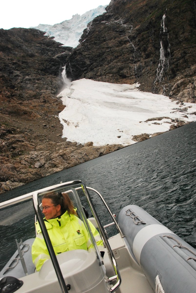
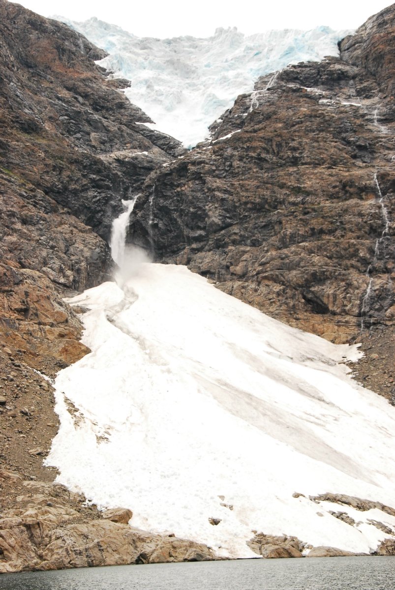
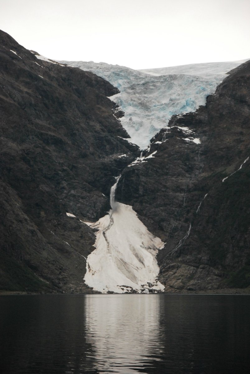
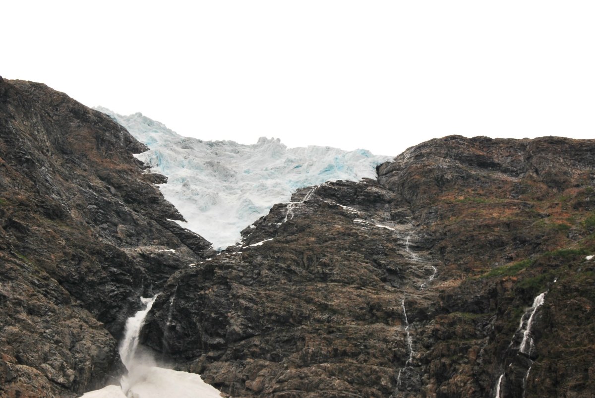
With a steady hand, Synnøve guides her RIB boat up the calm waters of the fjord. I keep getting glimpses of the glacier as we move along, but wonder to myself whether this glacier business isn’t maybe a bit overhyped. But when she turns off the outboard motor and lets us glide in towards the glacier, I can only gape in amazement. High up there I can see the blue ice with huge ice clumps destined to come crashing down at some point during the season. From the blue ice above, a waterfall cascades down to Nerisen, the part of the glacier which reaches almost right down to the sea. Nerisen is full of blue ice clumps from the main glacier, and has big holes with foaming glacier rivers beneath. The sound of rushing waterfalls fills the silence between the steep mountainsides; otherwise all we can hear are the terns on the great boulders in front of the glacier.
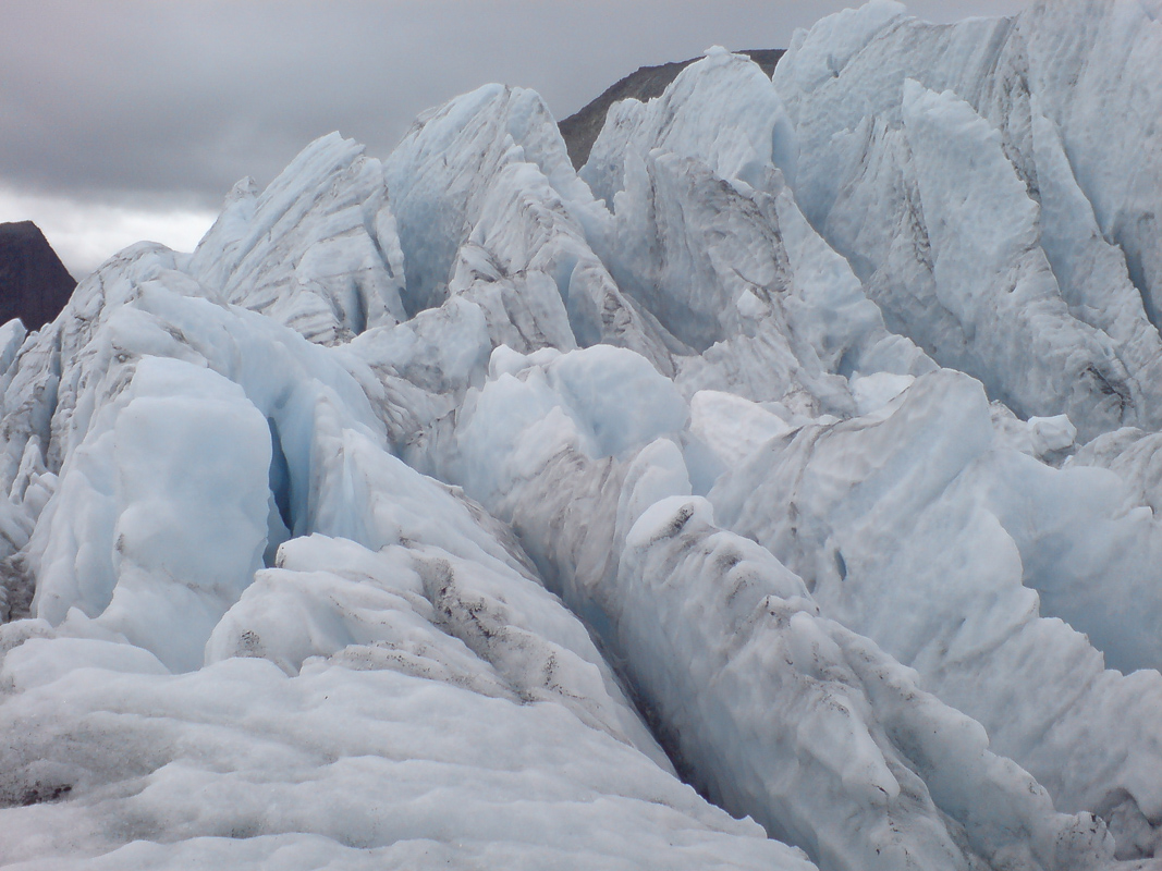
The looming blue ice is eye-catching
Synnøve points out, high above us, the next ice mountain due to hit the fjord; she talks of where the reindeer swim across the fjord in spring on the way to their summer grazing grounds, and she tells the story of the wartime evacuees in 1944. And yet it is the sight of the blue ice high above that catches the eye. Even when, with practised hand, she turns the boat round and sets off again slowly, I can’t manage to drag my eyes away from the glacier; it is every bit as breath-taking at a distance.
The glacier sheds into the sea
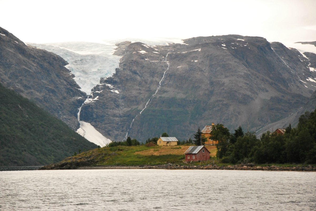
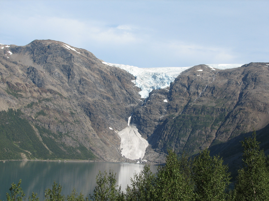
The Jøkelfjordbreen Glacier is the only glacier on the European mainland that calves down to the sea. This is because of the special topography in the area. At the head of the Jøkelfjord, the rock wall rises more or less vertically to a height of 8-900 metres (2,625-2,950 ft), right up to where the winter snow never has time to thaw during the summer. Now, when the glacier spreads outwards, clumps of ice of all sizes plummet over the edge and out into the sea. Some lie like great blue clumps on Nerisen, while others crash into the fjord and create tsunami waves that sweep away small boats on the land.
The glacier was once a giant in the fjord
From photographs taken at the end of the 19th century, we can see that the Jøkelfjordbreen Glacier is one consecutive tongue of ice that stretches right out into the fjord and forms a 10-15 metre-high glacier front. We also see large boulders sticking up from the fjord even further out, which stem from earlier terminal moraine. Now, however, the glacier has retreated a little, and the connection between the main glacier and the little glacier tongue that goes down to the fjord has been broken. Glaciers grow and shrink, and at the moment they are shrinking. The main glacier here, though, is one of the most stable in Norway.
Øksfjordjøkelen moves by 1cm a day
The Øksfjordjøkelen Glacier – in Sami called Ákšovunjiehkki – covers an area of 43 km2 (26 sq. miles), and is currently the eighth largest glacier in Norway. Barely half of it is in Kvænangen in Troms, while the rest is in Loppa in Finnmark. The highest point, 1,204 metres (3,950 ft) above sea level, is also the highest point in Finnmark. The glacier lies in a mountain mass between the fjord, Kvænangen, and the Øksfjord, and captures the rainclouds from over the sea. At a height of 1,000 metres (3,280 ft), the snow falls here in such huge quantities in winter that it never has time to thaw in summer. The glacier moves at a rate of about one centimetre a day, which is reckoned to be very fast.
The Ice industry relied upon Jøkelfjord ice
Before the advent of the modern freezer, the ice in the Jøkelfjord was a valuable resource. Three gangs of men worked 24 hours a day in summer extracting ice from the glacier. The ice was slid down a chute right on board the waiting boats, which supplied the entire fishing industry in Northern Norway with ice. It could be a dangerous business; one could quite literally get a mountain of ice on one’s head. This is why there was always someone standing watch to keep an eye on the ice. The industry lasted only until the mid-1950s, however, when freezer technology made ice from the Jøkelfjord redundant.
Evacuation from beneath the ice was for the best
In the autumn of 1944, Kvænangen, together with the rest of Northern Troms, was forcibly evacuated by the German occupying forces. However, the inhabitants of Jøkelfjord followed the encouragement of the Norwegian government in exile in London to escape from the evacuation. They sat up gammer (Sami turf huts) right beneath the glacier. The farm animals were kept further out in the fjord, so there was a very long way to get to the animals for milking. The people of Jøkelfjord thought the Allies were just round the corner, and that they would be able to return home in a week or two. Instead, they were discovered quite by chance, and forcibly evacuated southwards via Tromsø. This may have been all to the best, as only a few days after they were forced to leave their hiding place a gigantic block of ice fell into the water, which would probably have killed all the fugitives.
Join a tour to the Øksfjordjøkelen
Synatur in Jøkelfjorden runs guided boat trips by appointment every day throughout the summer. The programme is a flexible one: when guests come, they organise a trip. It all takes no more than an hour. During the trip, you will hear about the more recent history of the glacier with the transport of ice for the fishing industry, and about the place where the people hid from the Germans during the war-time evacuation.
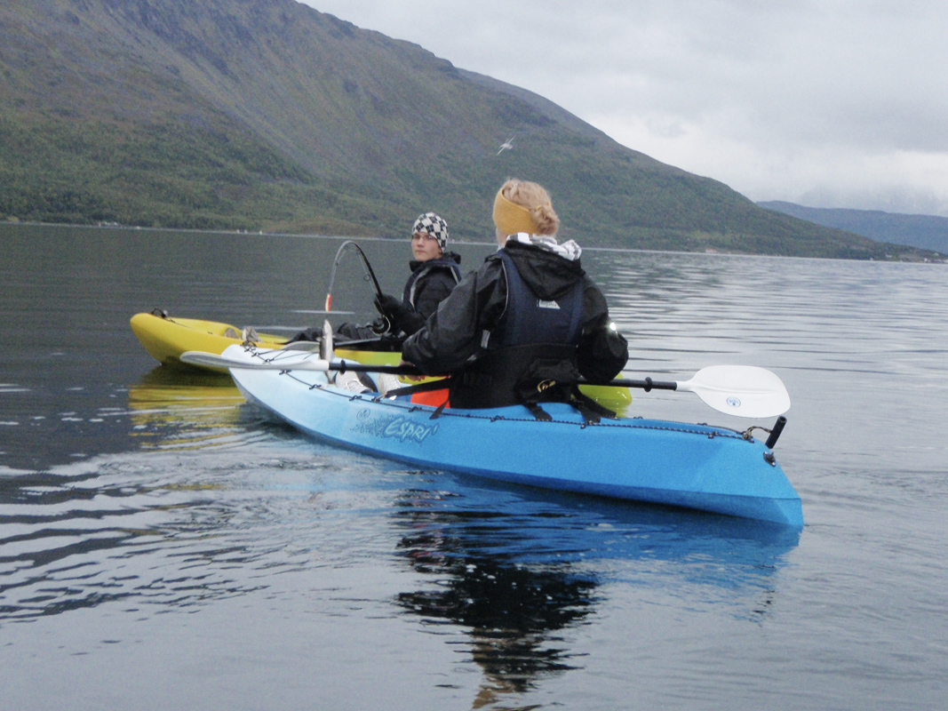
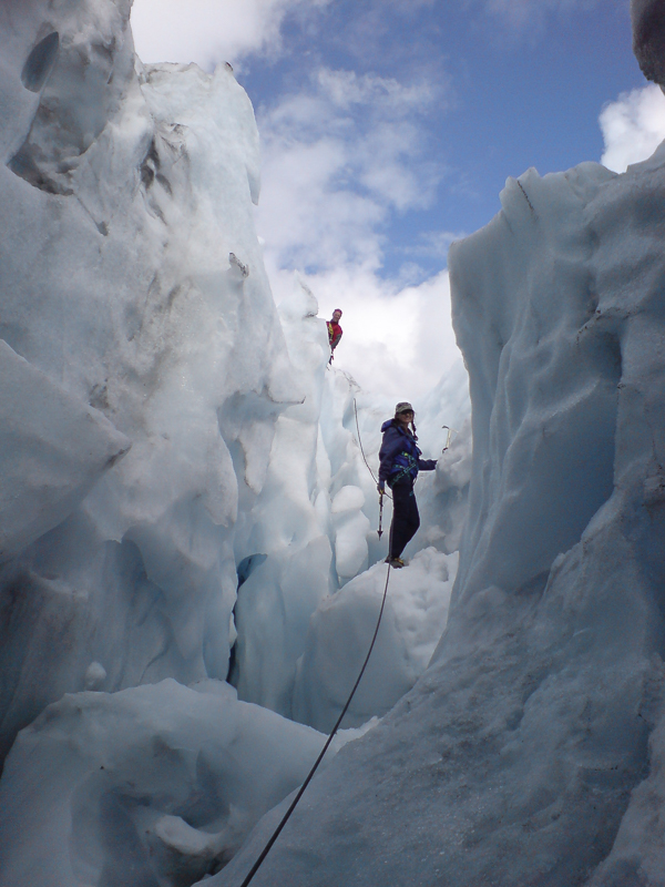
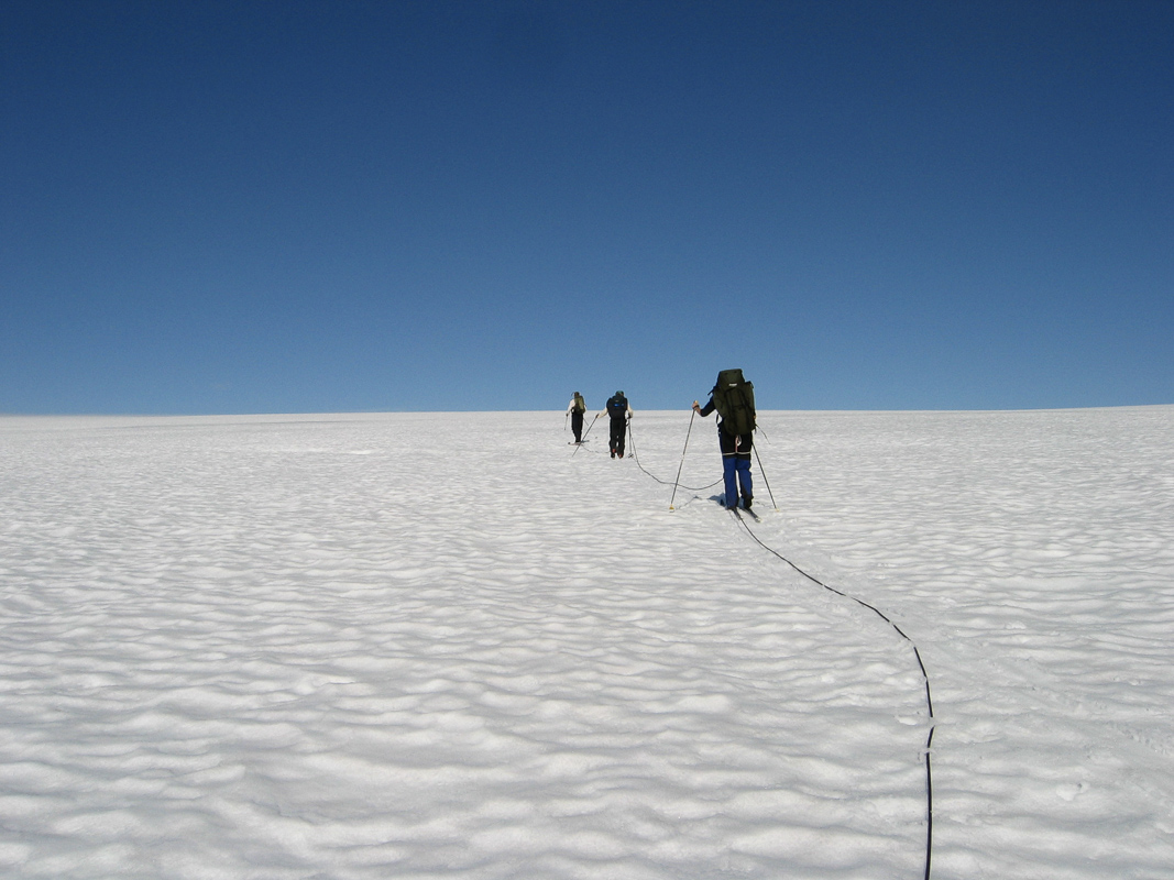
There is also the option of hiring a kayak and paddling in to the glacier, or joining a photo safari tour of Jøkelfjord. The kayaks used are of the “sit-on-top” type, which can be used safely by everyone. Synatur and Bre og vandring also offer glacier hikes. Here you get to climb in glacier crevasses and see the fantastic fjord landscape from more than a thousand metres above the sea. These hikes need to be booked in advance. There is also a marked trail that goes into the Jøkelfjord almost to the glacier. The last part is through rugged terrain full of scree, and is at your own risk. From the end of the marked trail there are fine views, however, and the whole hike takes 4-5 hours there and back.

Visit Alta
For all the information you need about visiting the Alta region simply check out the Visit Alta webpage.