At 1262 m (4140 ft) above sea level, the summit of Møysalen on the island of Hinnøya is the highest point in Vesterålen, and Norway’s second highest island mountain. Visible from across most of the archipelago, it towers over Sortlandssundet and Raftsundet, flanked by Møyene, two column-shaped cliffs. The walk up the mountain is challenging, but it is not an extreme trip and offers views out across much of the Cap of the North.
From the bottom it seems impossible to reach the top
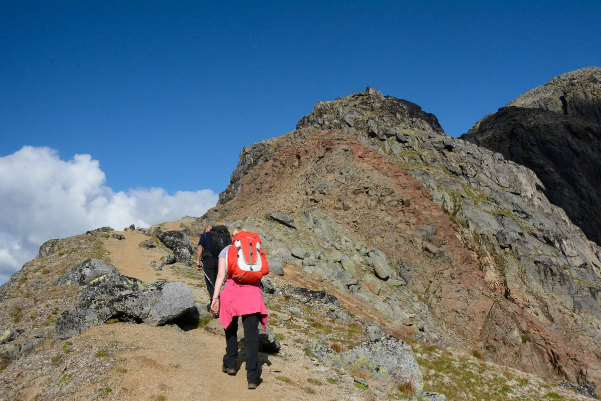
Møysalen is situated in the heart of Møysalen National Park and organised walks start on Hennes, on the Hinnøy side of Hadsel in Vesterålen. www.nordnorge.com was a little apprehensive before the trip, but the nerves quickly disappeared when our guide, who had 125 Møysalen trips behind him, briefed us at the centre. The first part of the walk is a 30-minute boat trip across the Lonkanfjord, where Møysalen towers above the other wild, jagged and dark summits, flanked by Møyen, the two adjacent jagged mountain towers. The mountain looks so steep that is hard to believe that it is possible to climb it.
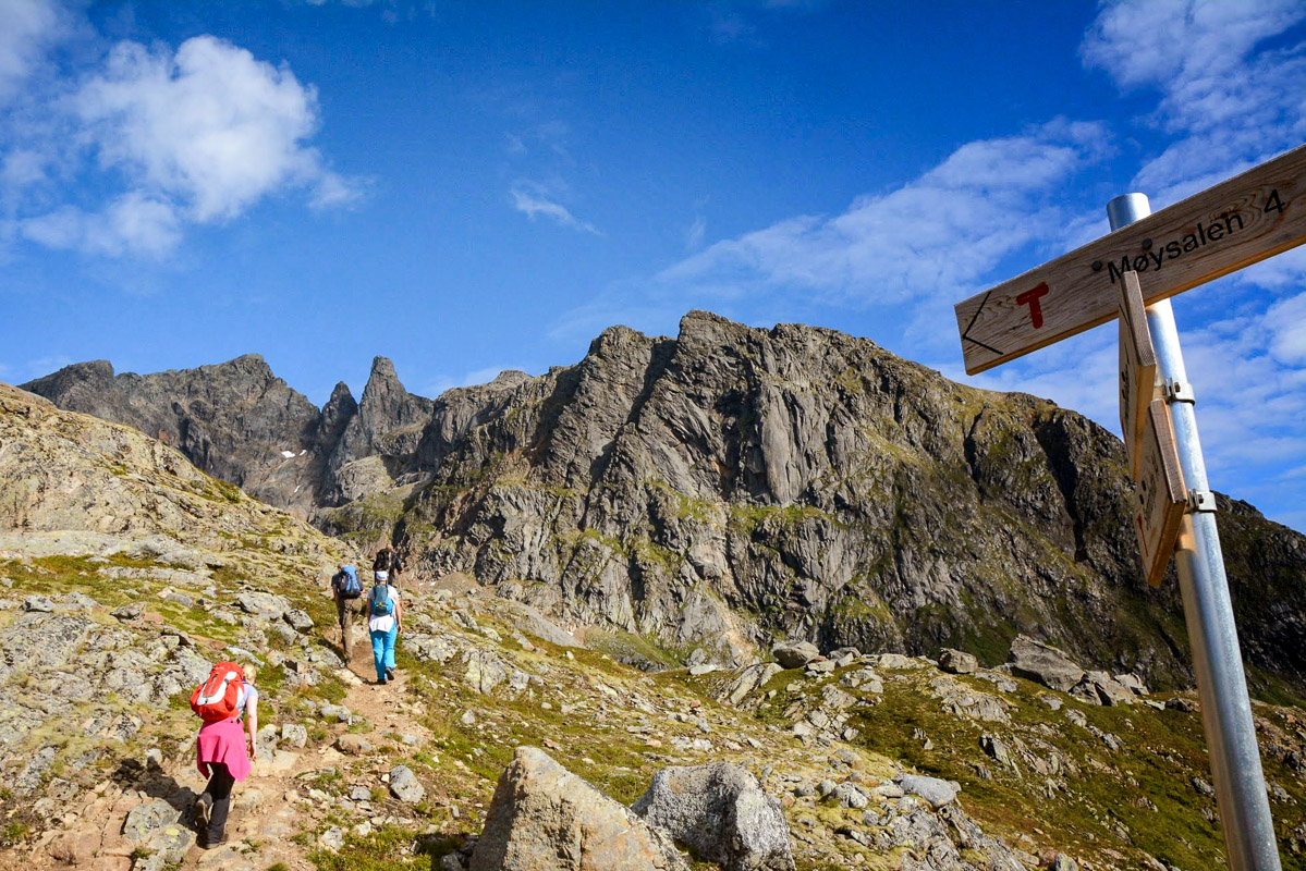
You follow an old railway line before the real climb begins
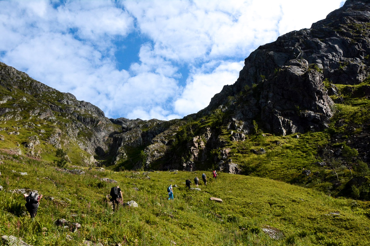
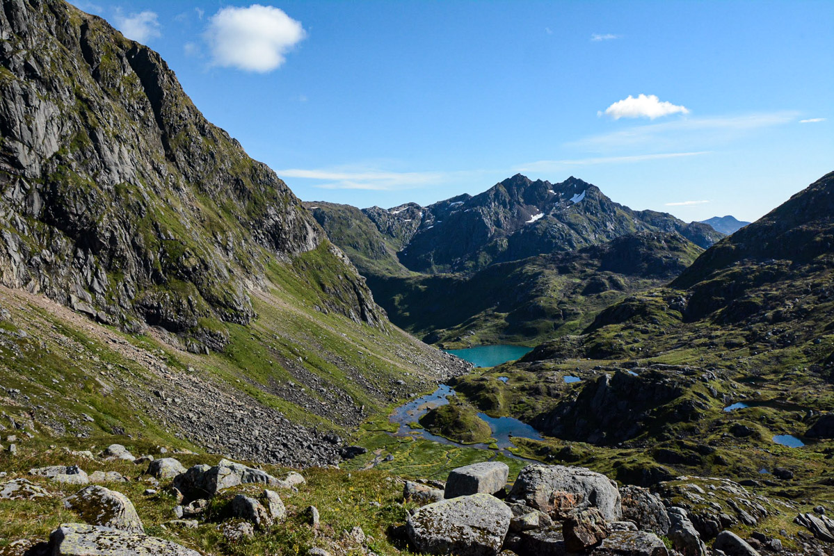
We first walked along the shore of the Lonkanfjord and up into a relatively flat, wooded valley. From here, we followed the track bed of an old narrow-gauge railway that was constructed to exploit the iron ore deposits in the area. However, the hard work began in the bottom of valley: jagged scree, loose gravel and steep mountainsides made the climb challenging. After climbing 400 m (1300 ft), however, we reached gentler terrain with a beautiful blue lake, moss cover and vivid mountain flowers. Here, we ate lunch and then, at 600 m (1960 ft) above sea level, we filled our water bottles for the last time.
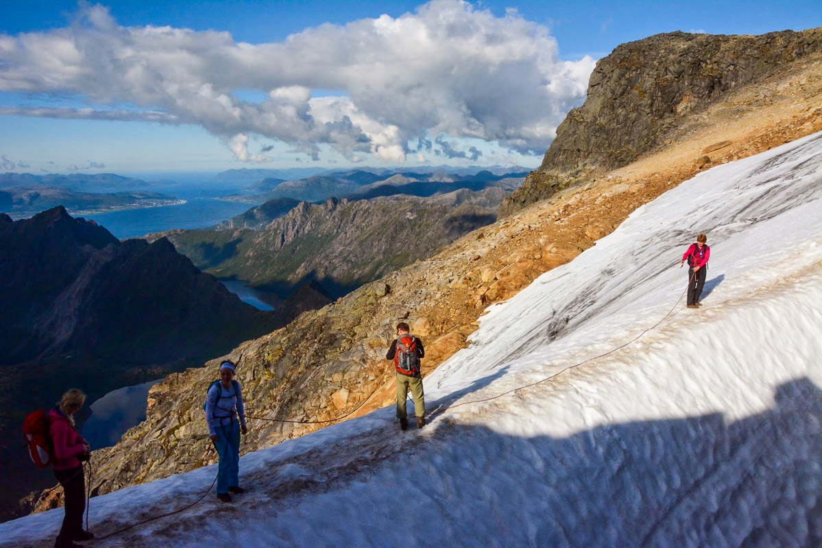
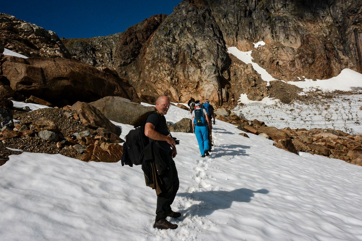
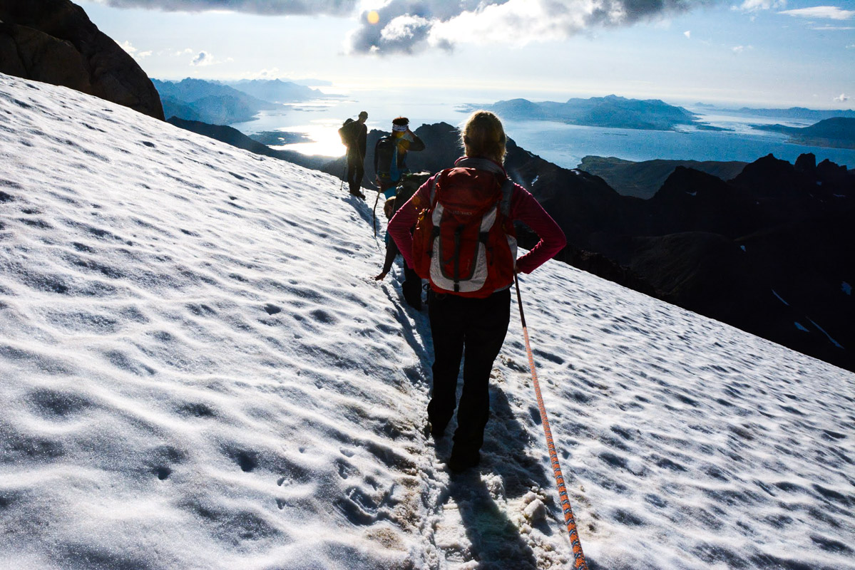
You cross two glaciers on the way to the top
You have to cross two glaciers to reach the summit. The lower glacier, around 700 m (2300 ft) above sea level, is situated on a shelf on the hillside. We walked alongside the glacier on a gentle rise, and there was no need for us to be tied together by rope. However, near the summit, there is a steep snowdrift where any slip would be fatal. We were therefore roped together over this stretch, but it was only for a few hundred metres.
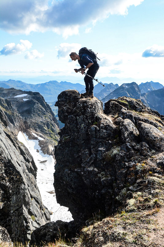
Hold on to the chains provided
Between the two glaciers, the route rises steadily over very varied terrain. There are some short scrambling sections and chains are also available to hold on to. There was also one exposed section on a shelf. Elsewhere, we strolled along wide paths that offered fantastic views out across the whole of Vesterålen. We also said hello to the troll, a rock formation at around 900 m (3000 ft) above sea level.
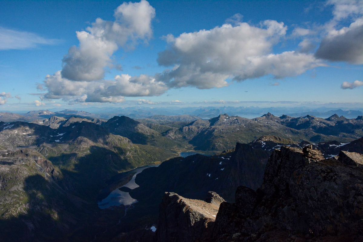
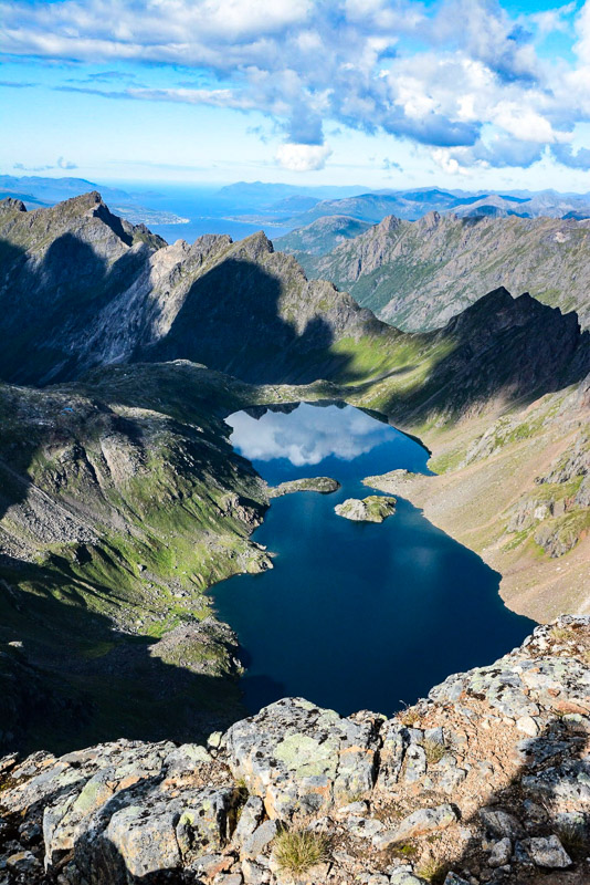
On a good day you can see to the horizon
Finally, we reached the summit. The view simply took our breath away. “Can you see that large white spot over there?” asked our guide. “That’s the Frostisen glacier. Next to it, you can just make out a remote mountain flecked with snow. That’s Kebnekaise, the highest mountain in Sweden”. Much closer lay Stetind, Norway’s national mountain. Towards the west lay the islands and mountains of Vesterålen stretched out like a deep blue map, with the Sortland bridge, the Hadsel bridge and Gaukværøy as prominent landmarks. The jagged summits of Lofoten extended towards the south-west. To the south, was Vestfjord with the remote, blue-tinged Steigartinder behind, and furthest away we could make out Sandhornøya south of Bodø. To the north, Senja’s seaboard coast peeked out between the summits, the mountain lakes and the fjords of Hinnøya.
Going down isn’t any easier
In the golden light of the evening, we began the walk down. It was certainly no easier than the walk up, as we had to lower ourselves down along chains, balance on scree and walk carefully across loose gravel. Fortunately, we had brought some extra food with us, so we were able to have a good break at the first stream. “Farewell, Møysalen” said one of the members of the party with sore feet and tender knees as she turned back towards the mountain from the boat; “I will never forget today”, she said.
The practical information on Møysalen
Møysalen is on the eastern border of Vesterålen, and is found south west of Hinnøya. The summit forms the border between Lødingen and Ofoten.
The starting point is at Hennes, an hour south-east of Sortland. Regular tours are organised by the National Park Centre
Møysalen is not for everyone. Hiking over 1000m on difficult terrain can be difficult for some. Because of the glacier on the top, it is recommended that anyone wishing to take the hike should do so with an experienced guide.
Reasonably fit people use 8-9 hours up and down. We used 12…
Møysalen is for the adventurer with a good fitness level
Møysalen is not a mountain for everyone. There is a lot of scrambling on the way up, and you will need a firm grip on stones and ledges. The terrain largely consists of scree, cliff faces and loose gravel. However, there is a short section that is exposed, and people with a fear of heights can avoid this shelf. However, if you are generally fit, regularly go on mountain walks with over 1000 m (3200 ft) of elevation gain, are not afraid to use your arms and legs and have sturdy walking boots, you will find Møysalen a surmountable challenge. www.nordnorge.com met both fit pensioners and older children aged 10-12.
For your own safety, join a tour
For your own safety, you should join an organised walk. This is because of the conditions on the upper glacier, where it is necessary to rope up. Only people who have completed a glacier walking course and who have the necessary equipment for glacier walking should do this walk without a guide. There is also no mobile phone coverage below 800 m (2600 ft) above sea level, so if anything should happen, you will be entirely on your own. The guides have their own means of communicating with the national park centre and will be able to summon help, if necessary. Trips depart from the national park centre daily during the summer season. You will need sturdy walking boots, a windproof jacket, thermal underwear in your rucksack, a hat, mittens and three packed lunches.
Visit Vesterålen
The Tourist organisation of the Vesterålen Islands helps you to book your trip