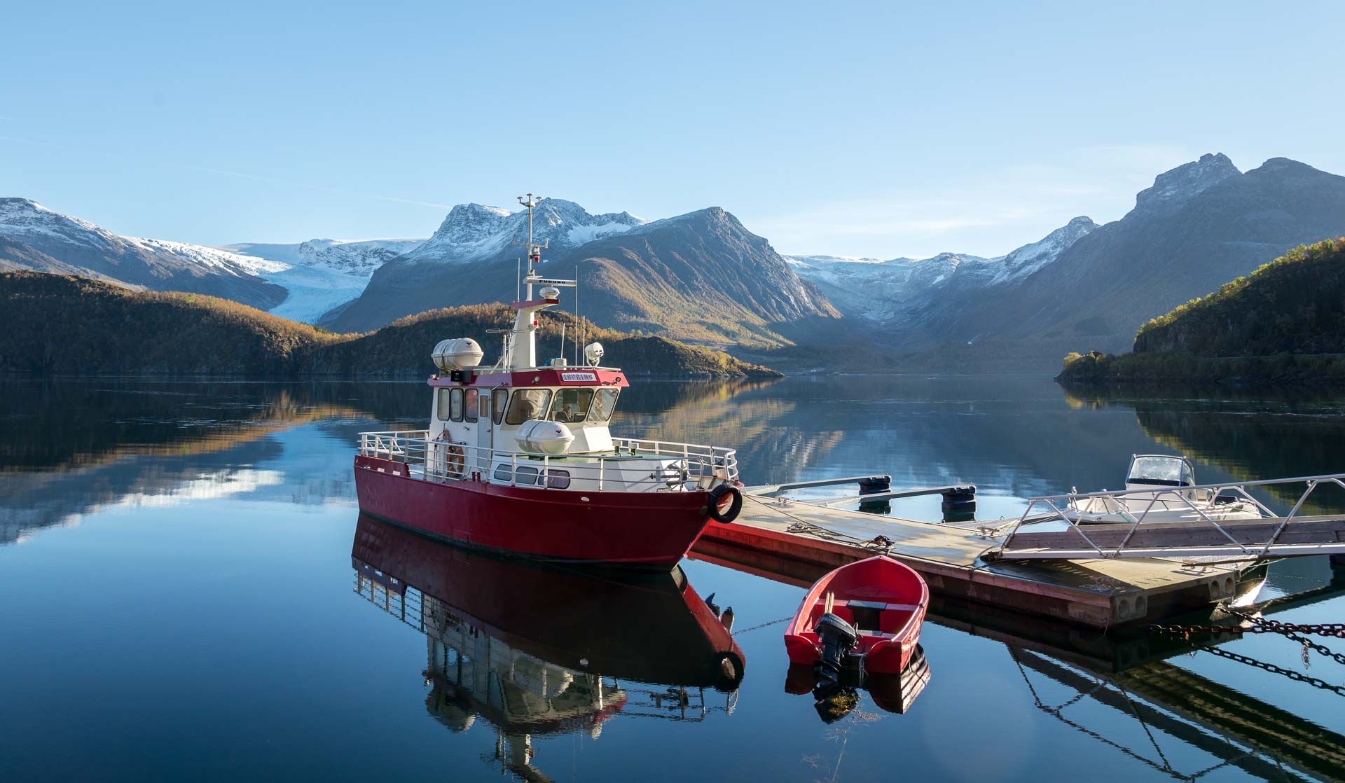
Engenbreen looks completely unnatural in the fertile, green landscape in the far north of Helgeland; a white mass with an almost baby-blue sheen. Surrounded by white mountaintops and fertile hillsides, the glacier is reflected in the opaque green meltwater of the Holandsfjord. If you round the headland by boat, the panorama comes upon you very suddenly and is guaranteed to make the hairs on the back of your neck stand out.
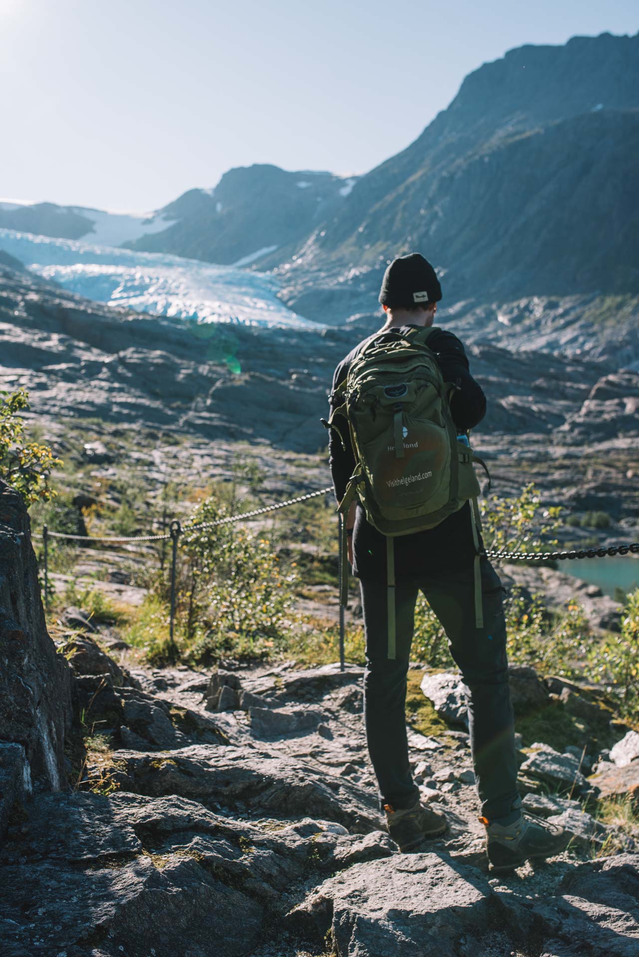
You can walk up to the ice edge
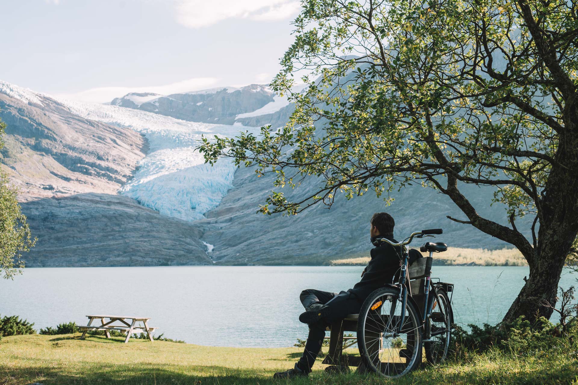
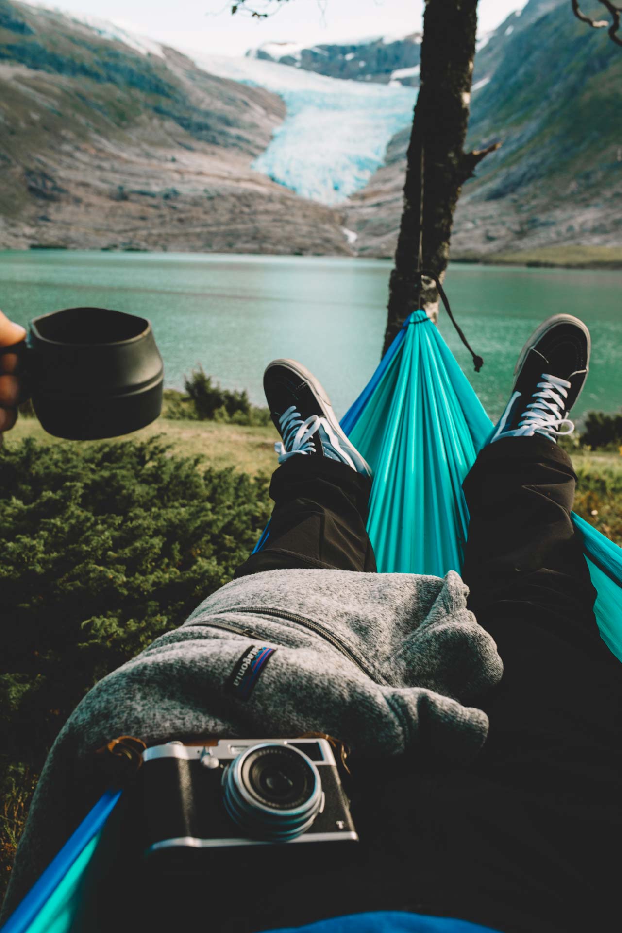
At a leisurely pace, it’s only a fifteen minute bike ride along Svartisvatnet lake to the end of the road. From here, a well-marked trail leads almost right up to the ice. As you get higher, you find that you are walking on smooth rock slopes from which the glacier has recently retreated. That’s why there is no vegetation or soil here at all, only bare rock scoured into undulations by the ice. There are some handrails on steep sections, but you should be careful, particularly in rainy weather, and wear good shoes.
Practical information about the glacier
Engabreen is located in the south of the Meløy district, close to the coastal road that takes you from Bodø to Namsos.
There is a ferry service during the summer months.

Keep your distance from the ice front
The atmosphere up beside the ice is still and strange. The glacier front is a shapeless mass, in some places almost white and in others a deep, translucent blue. The glacier has calved in places, sending huge chunks of ice down onto the rock in front of the glacier, and you understand why you have to keep your distance. At the bottom edge of the glacier, meltwater cascades out from a tunnel-shaped opening underneath the ice, and all you can hear is the roar of the water. Tiny shoots of rowan and willow peep out through the rubble not far from the chunks of ice, growing where only a few years ago there was ice.
Svartisen is an ice giant above the fjords
Engenbreen is part of Svartisen, the second biggest glacier in Norway. Most of Svartisen is at an altitude of 1,200–1,400 metres (4,000–4,500 ft). Up here, the mild, moist air masses from the Atlantic Ocean fall as snow most of the year, and the ice mass accumulates. Then the ice slowly slides down the valleys and forms glaciers. Engenbreen is the glacier ice tongue that has reached the lowest altitude – not only of the Svartisen ice tongues, but also of all the ice tongues in mainland Europe.

The glacier advanced and retreated in the past but only retreats today
Engenbreen is constantly in phases of advance or retreat. During the ‘Little Ice Age’ of the 1700s, we believe that the glacier front extended right out into Holandsfjord. Since then, the glacier has been slowly retreating, and around 1900, Svartisvatnet lake began to rise, until about 1940, when the whole lake was ice-free. In 1965, the glacier retreated well back up the mountainside, but there was then a new period of vigorous advance. However, since 1997, the ice has been retreating markedly, and now it takes half an hour to walk up to it from the lake.
How to visit Engenbreen
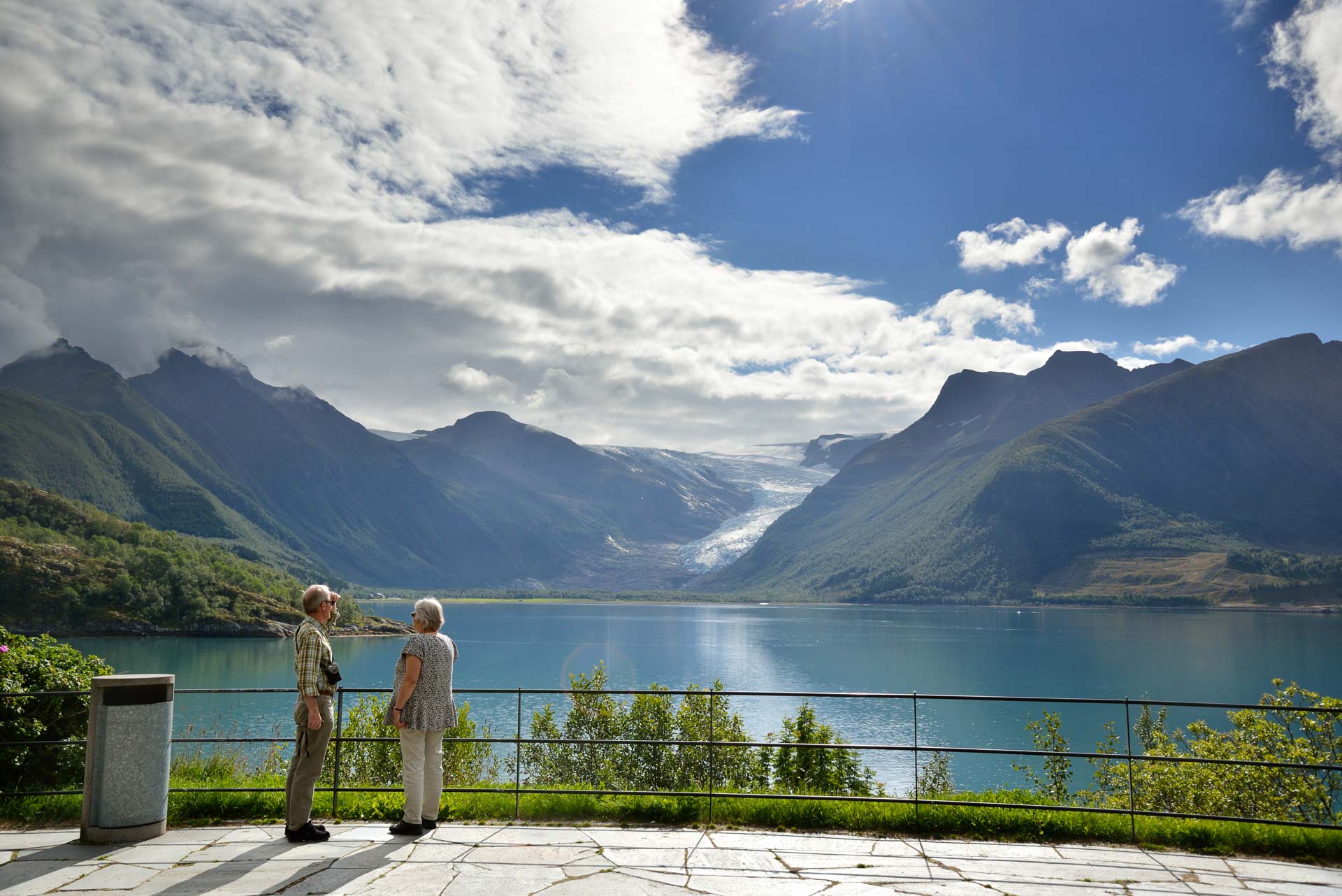
The easiest way is to stop on the Coastal Route (County Road 17) at the viewpoint of Braset. This provides a view over Holandsfjord to the glacier. However, it’s a much better experience if you cross the fjord and get up close. Just below the ice is the isolated hamlet of Svartisen Gård. Here you’ll find Svartispaviljongen, a lovely café with a view of the ice. You can hire bikes at the quay and get right up to the end of the lake, from where it is a half-hour climb up to the ice. You should allow about four hours for the trip.