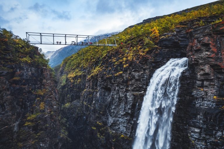
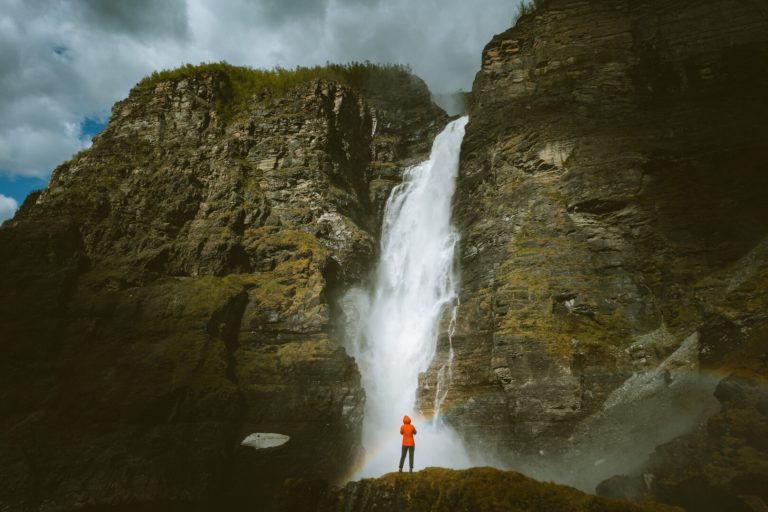
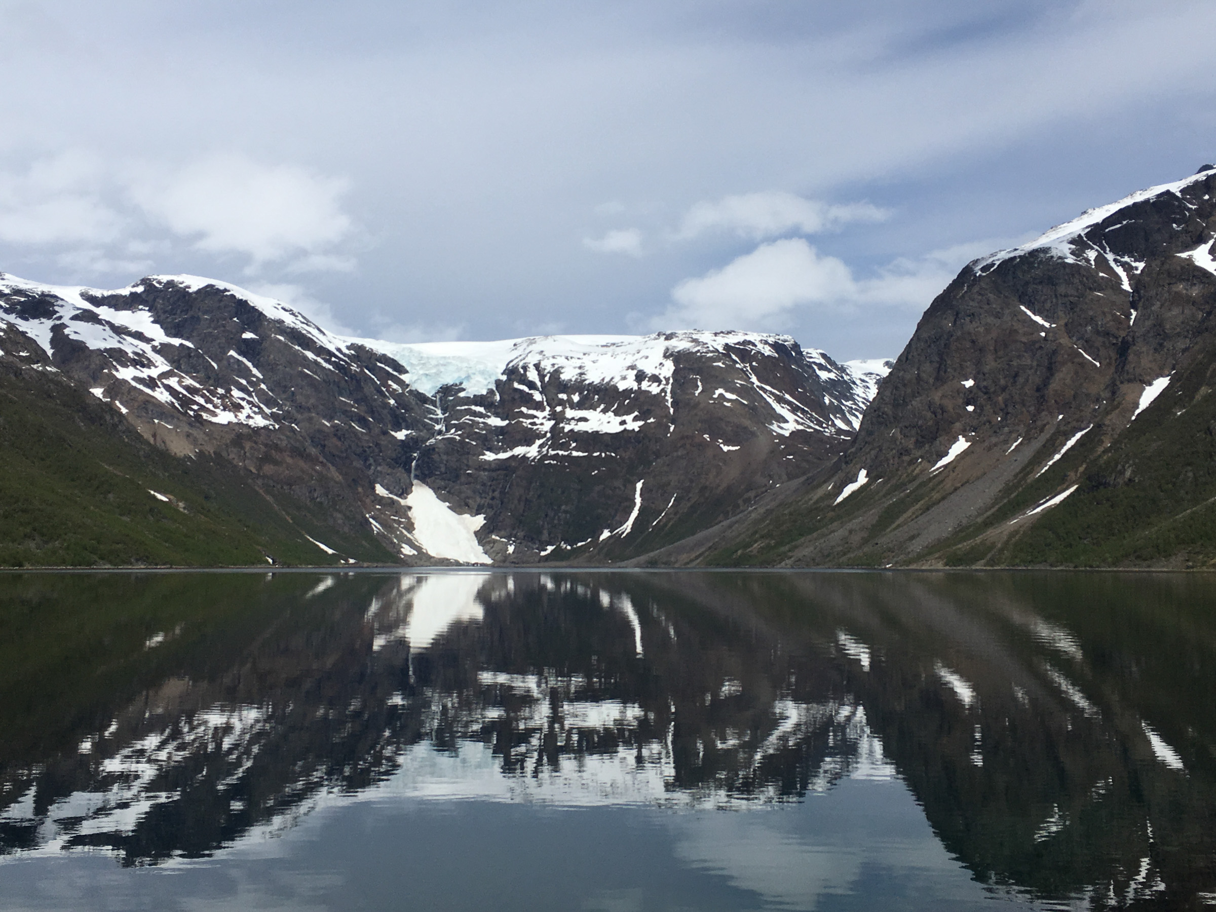
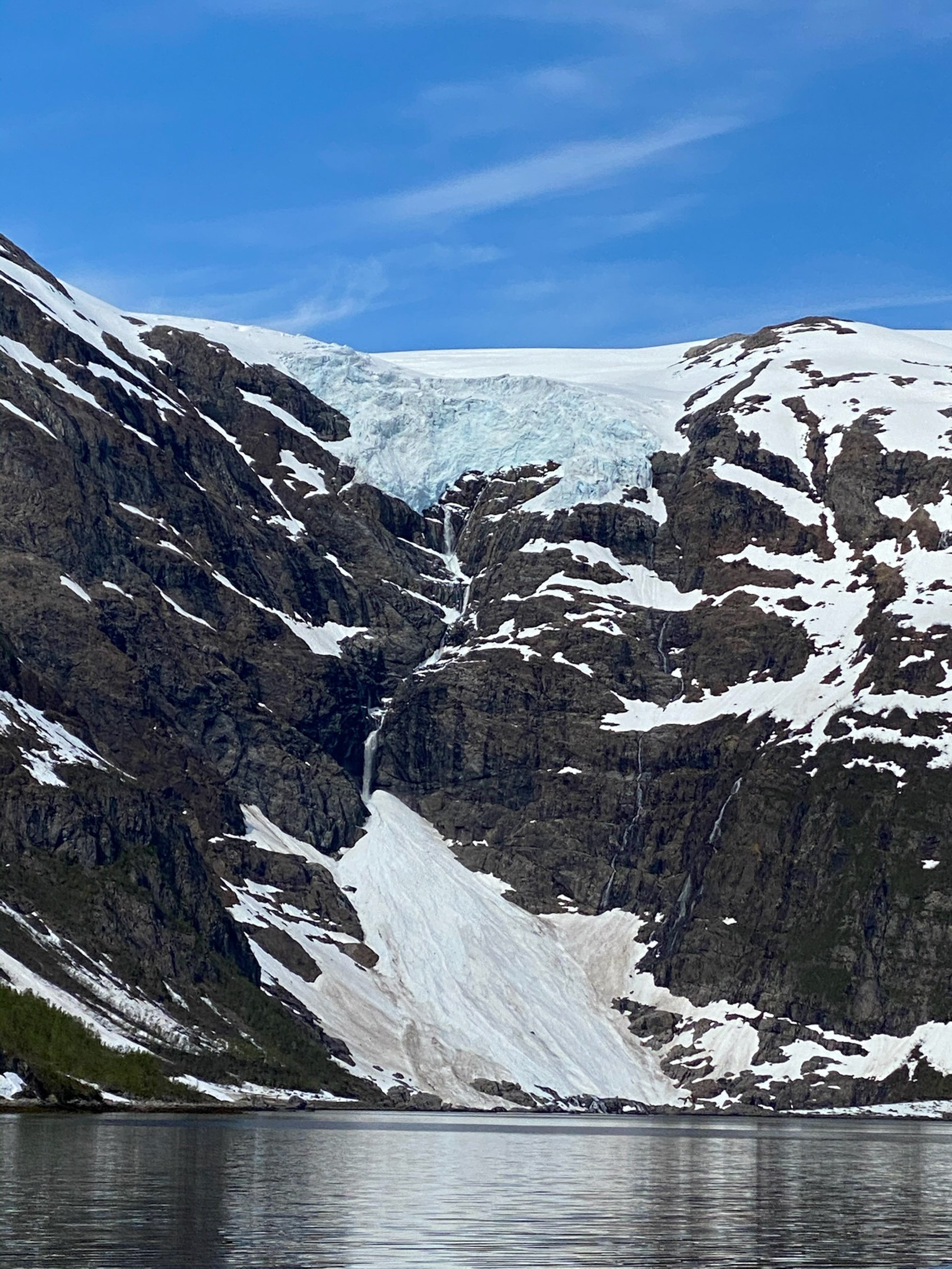
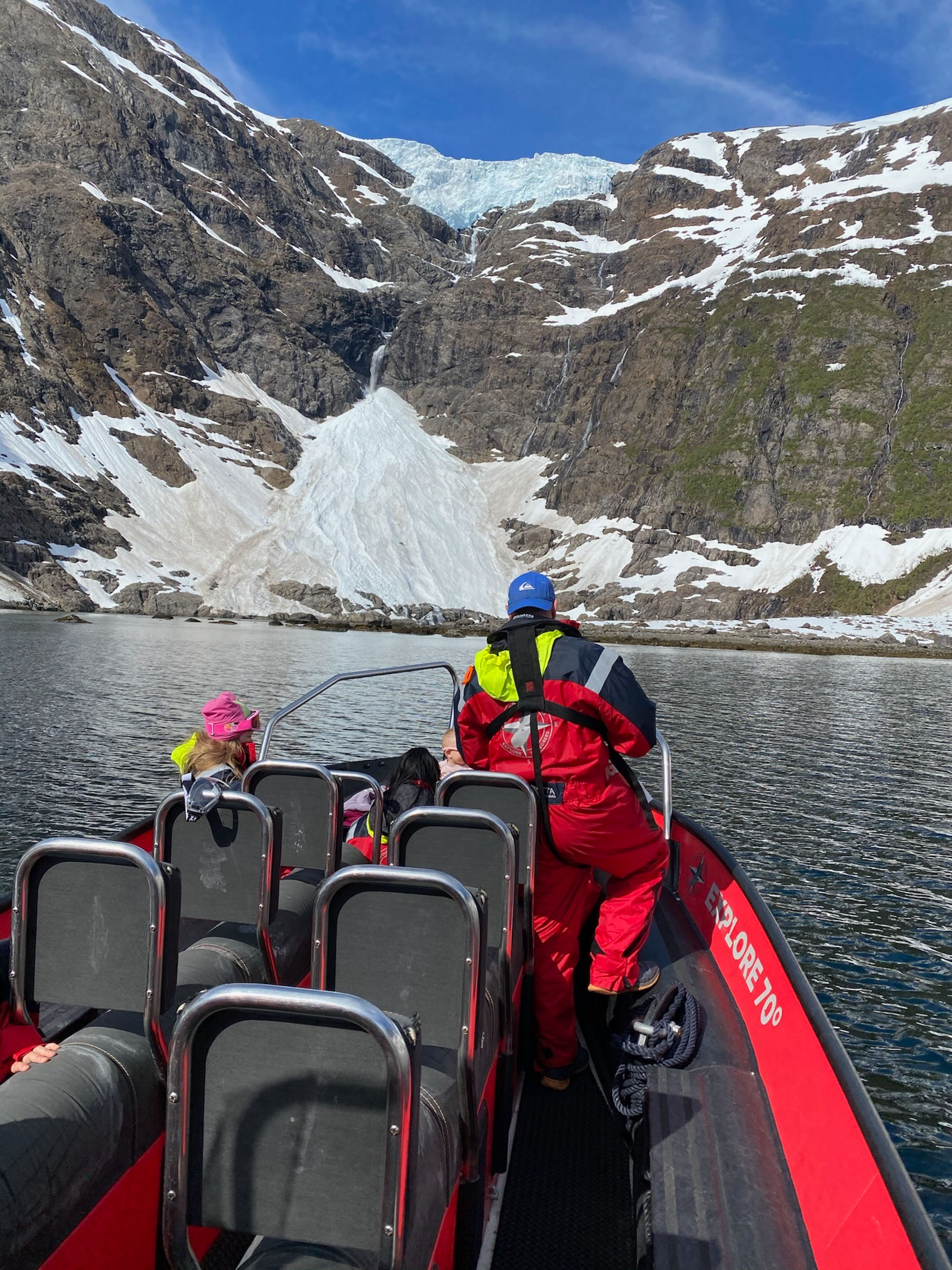
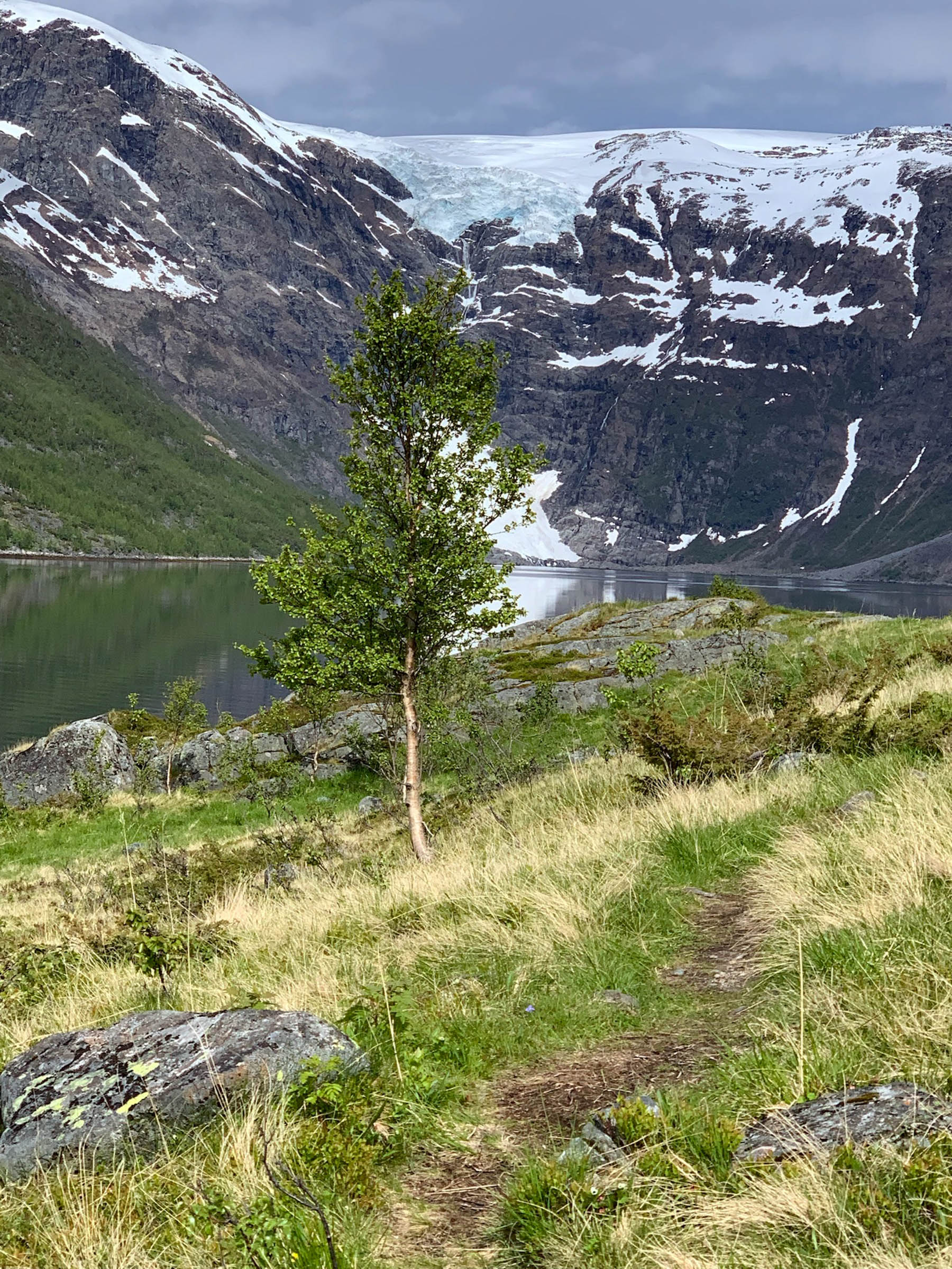
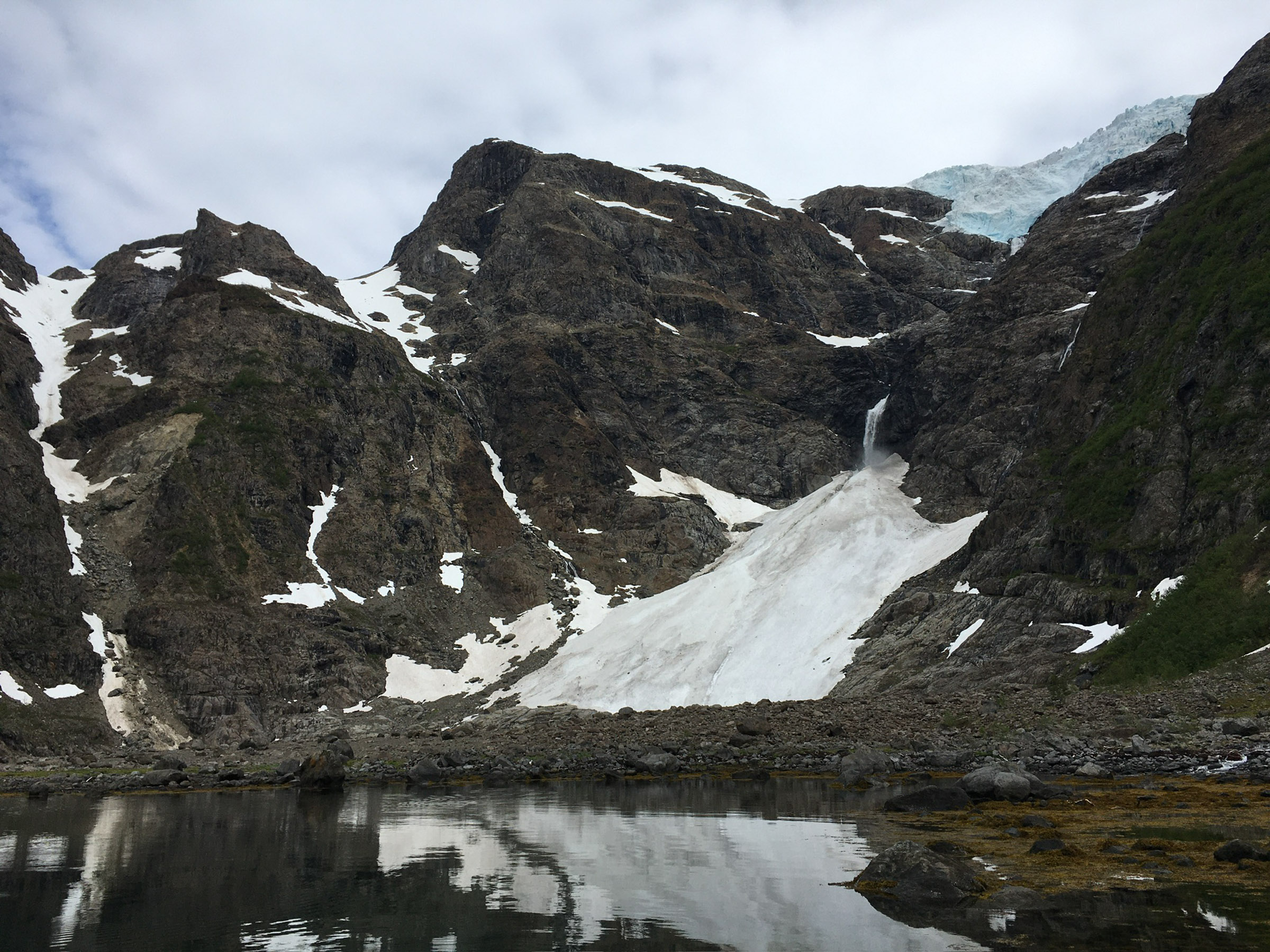
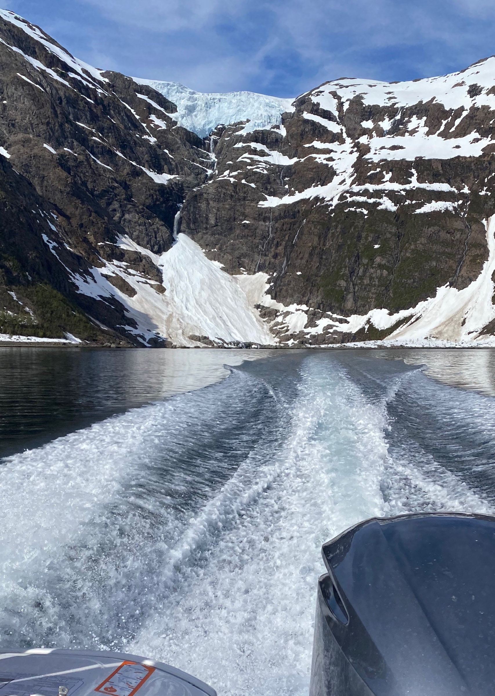
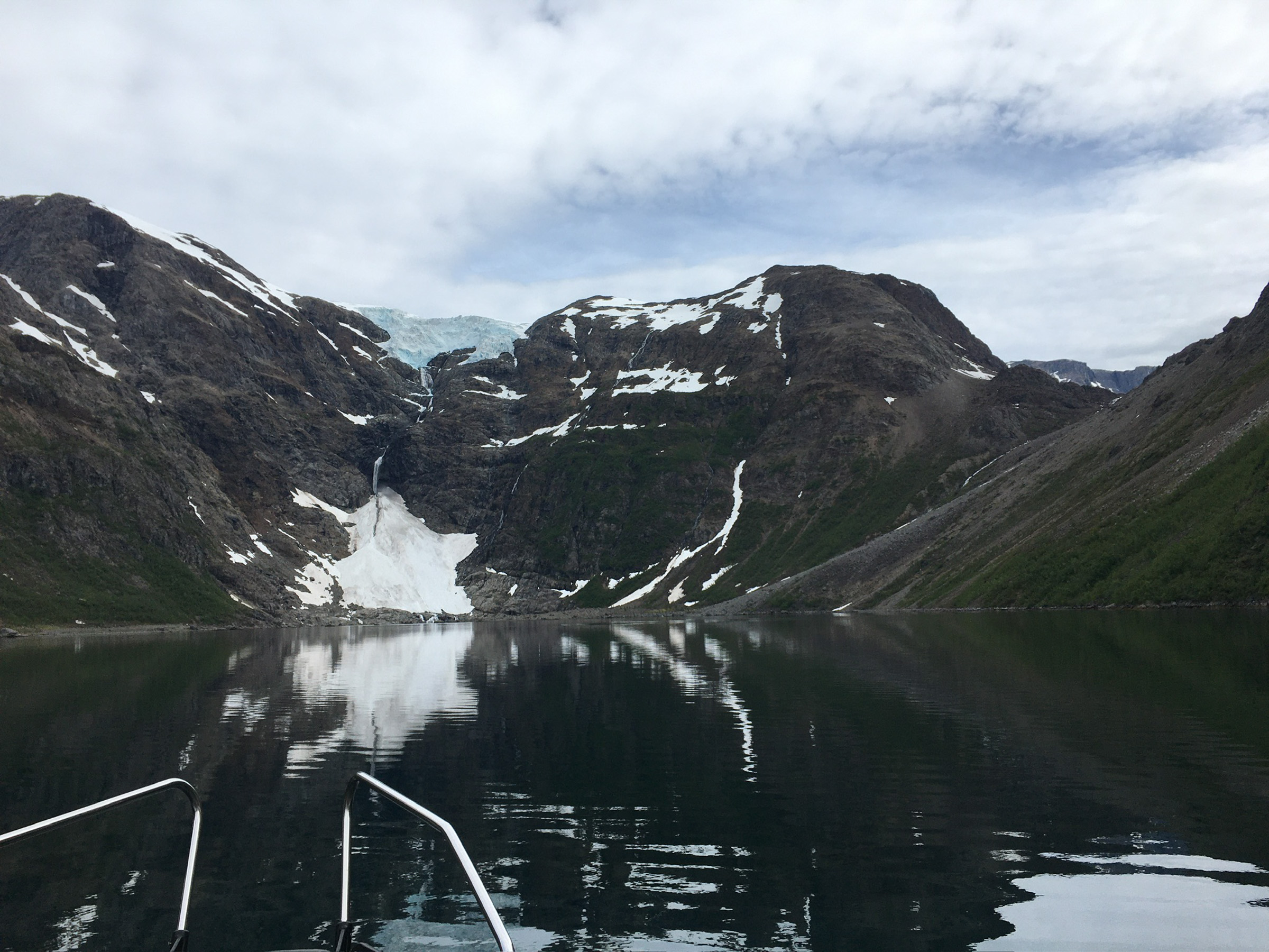
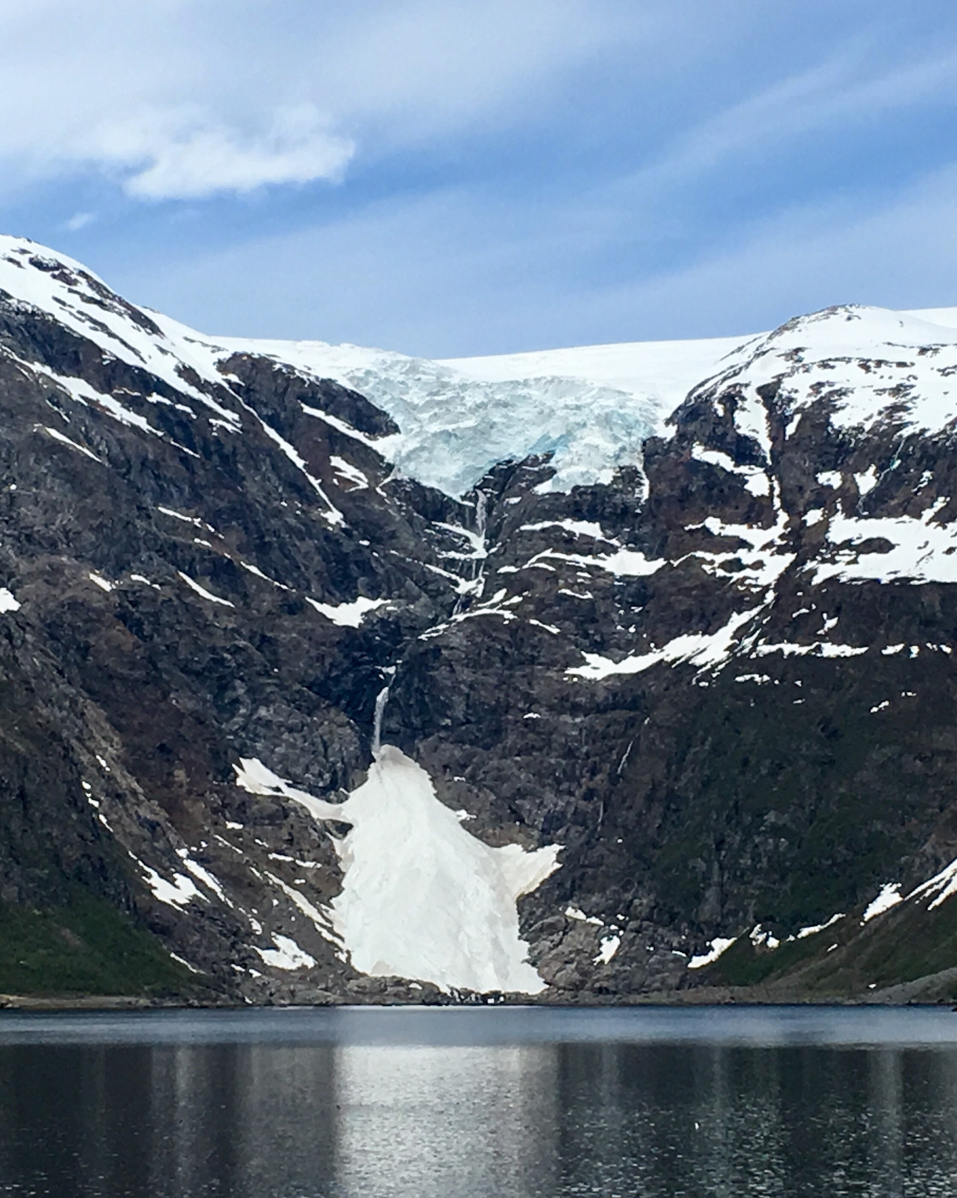
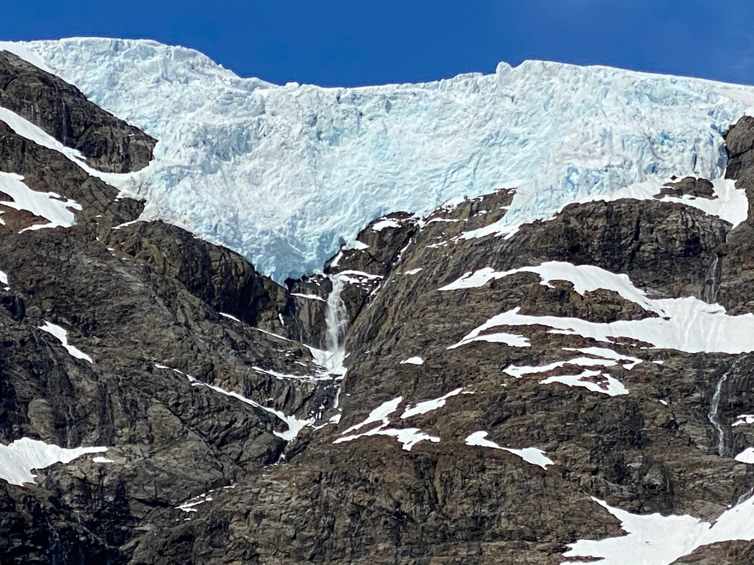
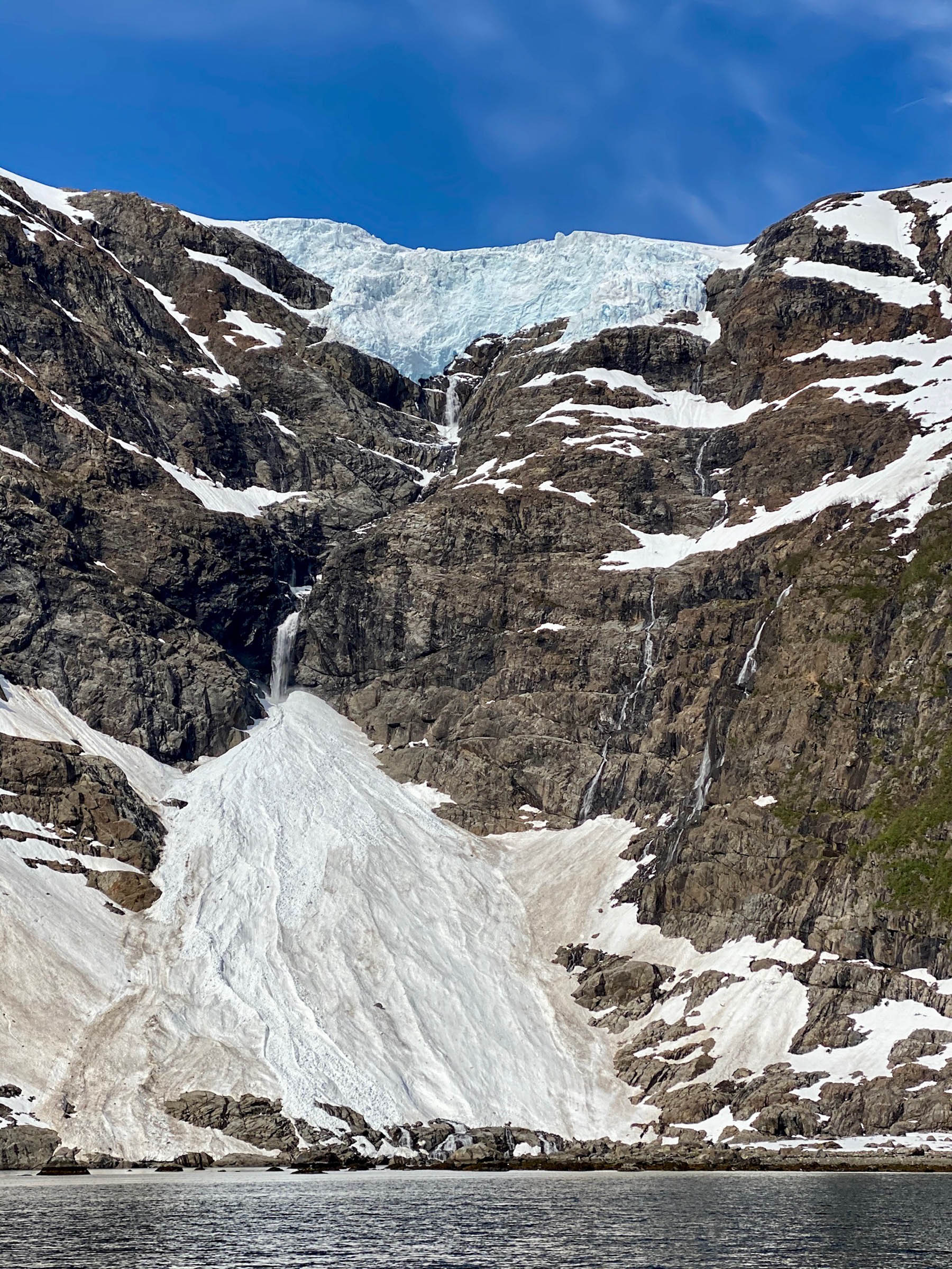
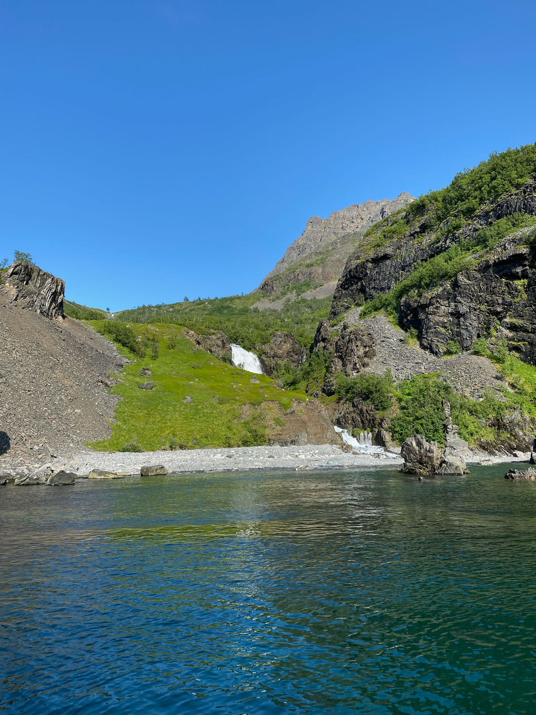
The boat slides quietly, engine turned off, making gentle waves on the calm water. Surrounding us are sharp, pointed mountains rising 1000 metres, and there are little chunks of ice floating in the fjord. Up there, the glacier Øksfjordjøkelen covers the mountainous landscape like a lid, sending a glacier snout down the slope. From the snout’s terminus, melting water cascades down the rocky ravine and into a vertical waterfall. The string of water then disappears behind another chunk of ice, covered with gravel and rocks transported by the glacier. Close to the sea, the water reappears, gushing into the fjord. It is a strange, beautiful, silent world.
Suddenly, the silence is broken
Occasionally, the deafening silence is interrupted as the glacier calves; it releases pieces of ice into the fjord. This is more likely to happen after a prolonged period of warm summer weather but can happen all through the summer. A recent calving is spotted by ice floating on the fjord and by intense blue spots on the ice front. The blue weakens as the ice surface oxidises, much like a fresh wound heals.
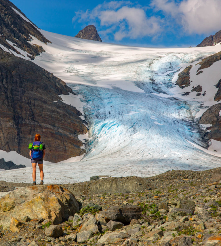
The Øksfjordjøkelen glacier presides over the landscape
Øksfjordjøkelen is Norway’s ninth biggest glacier, with a surface of 41 square kilometres. The top of the glacier is also the highest point in the county of Finnmark. Earlier, this point was 1204 metres high, but the glacier is currently reducing in volume, so these days the altitude is around 1190 metres. This is a plateau glacier, resting on the rugged, mountainous landscape like a flat roof. The glacier melt has had more consequences: Some decades ago, the glacier snout in Jøkelfjorden went uninterrupted from the main body of the glacier into the fjord. It was then the only glacier on Scandinavia’s mainland reaching the sea. As the world is warming, the Jøkelfjorden glacier arm is slowly disintegrating.
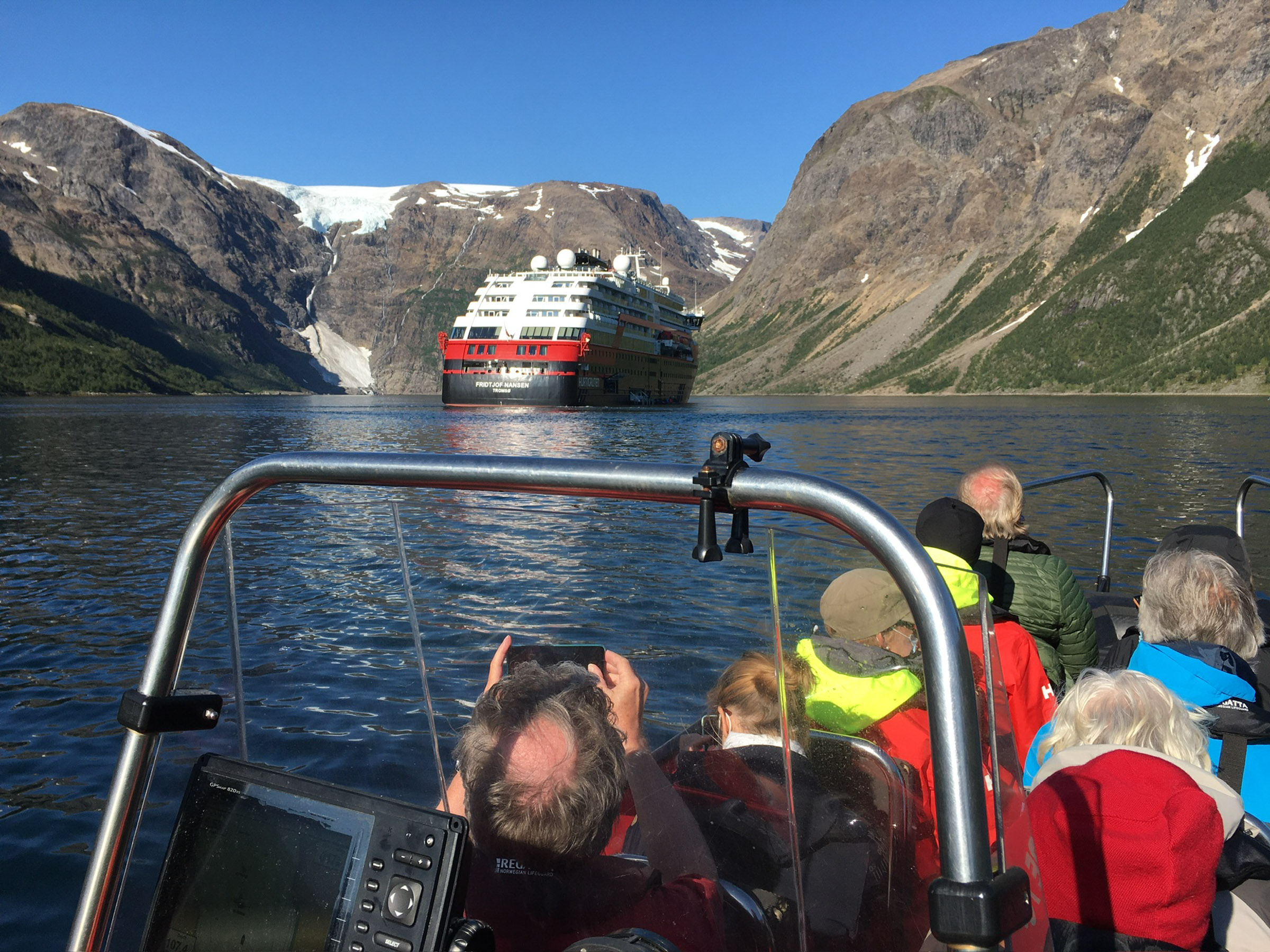
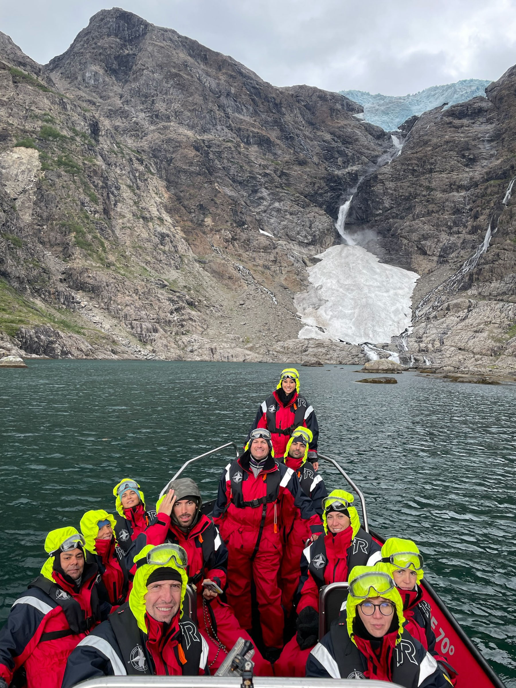
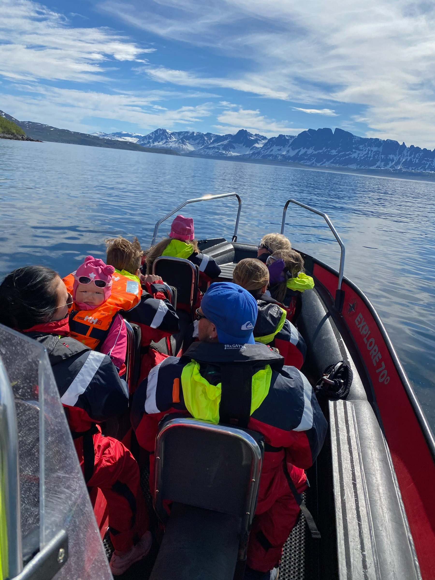
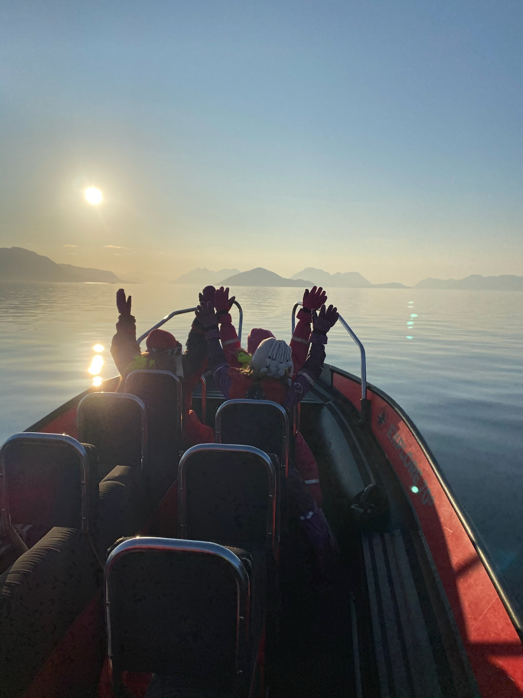
See the glacier on a RiB Tour
A RiB – Rigid Inflatable Boat – is like a zodiac, but is has a solid, sturdy keel. This kind of boat allows you to reach places that are difficult to visit for bigger boats. Going up to 40 knots, they can cover large distances, but more often, they sail on slow speed through the seascape, benefitting both the local wildlife and the guests’ desire to study the landscape. Explore 70 degrees is a small company based in Skjervøy, specialising in RiB tours all the year, and in summer and autumn, they organise a 3-4 hour RiB tour to Jøkelfjorden and the Øksfjord glacier. On the way, they pass wildlife, old history, interesting geology and glaciology at maximum 30 knots an hour. The Øksfjordjøkelen is thus only the icing on the cake.
The sailing goes through old history
If we’d been here 80-90 years ago, we would meet a landscape with a visible human imprint. Shores would be lined with smallholdings and people, and fishing boats would ply the waters. Following WWII devastations and the following modernisation, people moved to Skjervøy, Tromsø or even Oslo. The old houses are summer houses these days, and you see them dot the shore along the way.
Wildlife is part of the experience
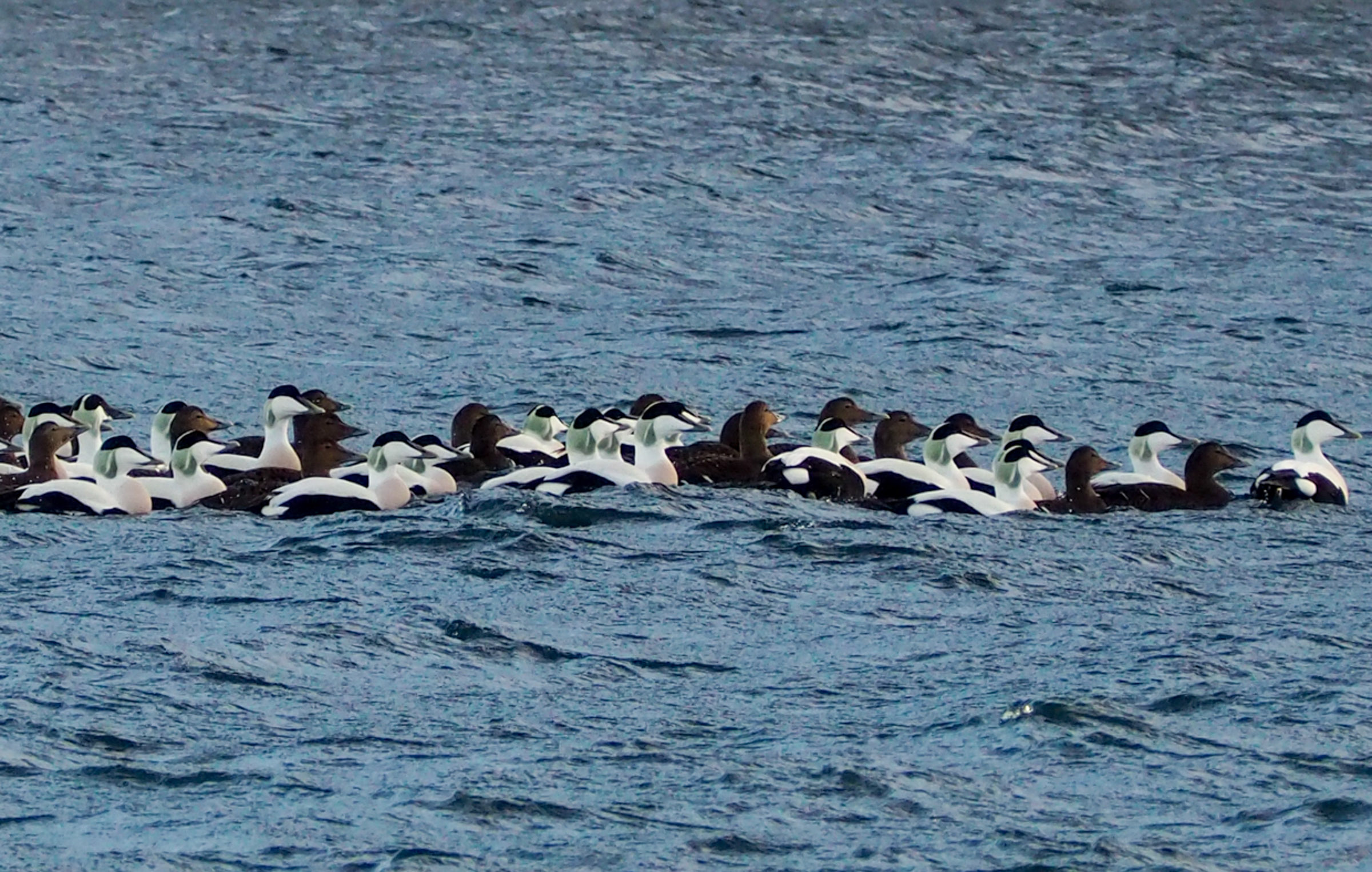
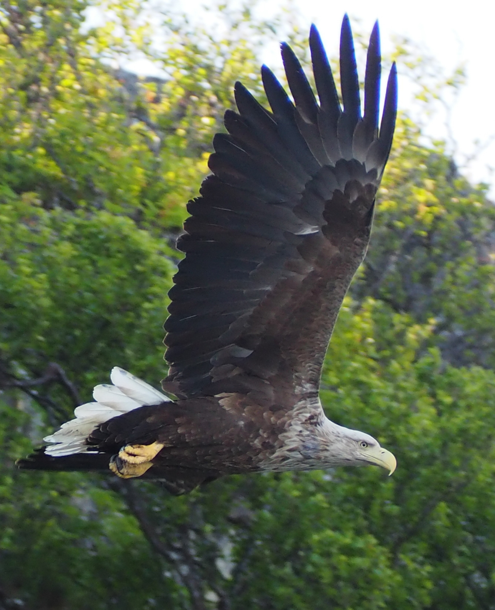
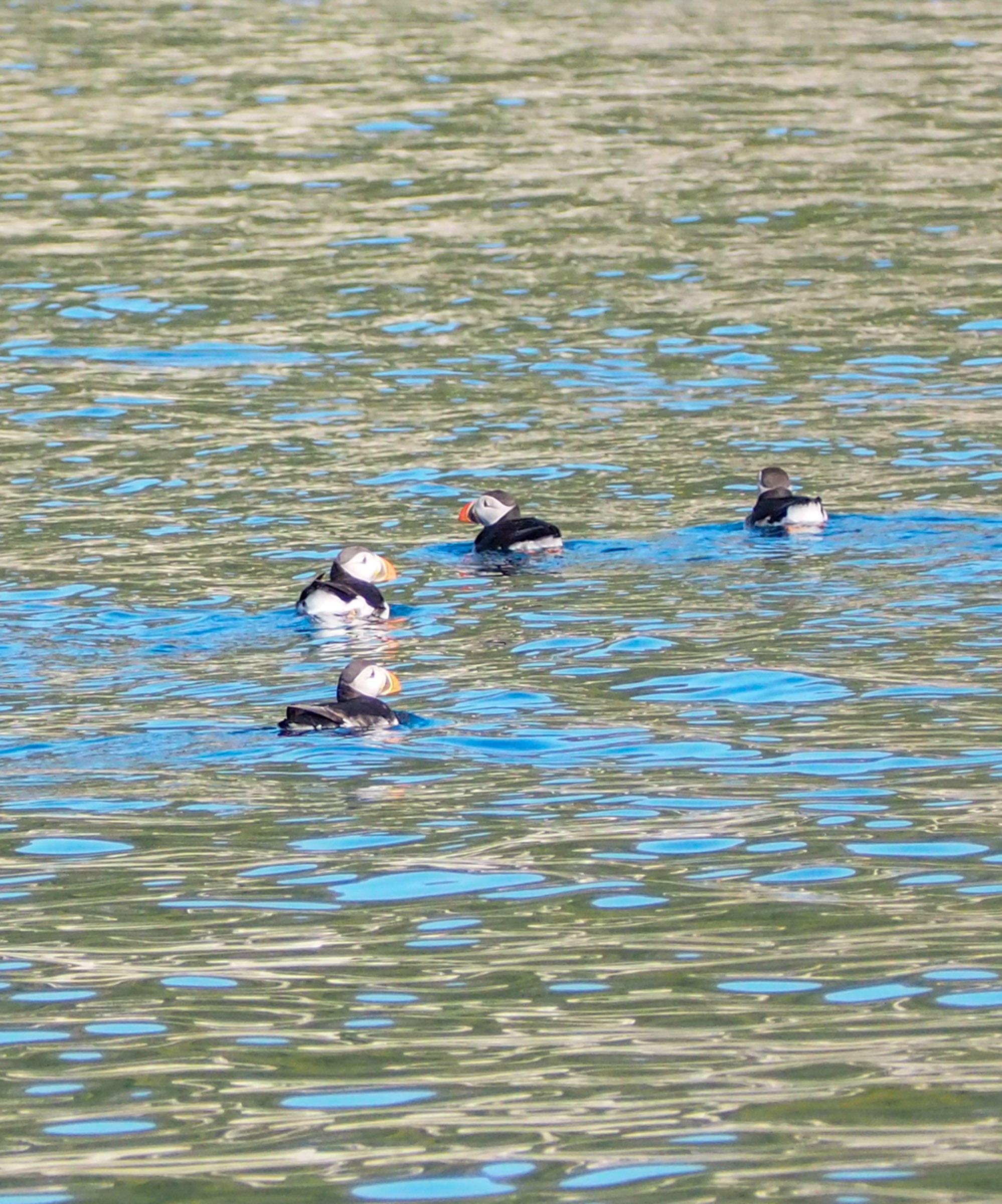
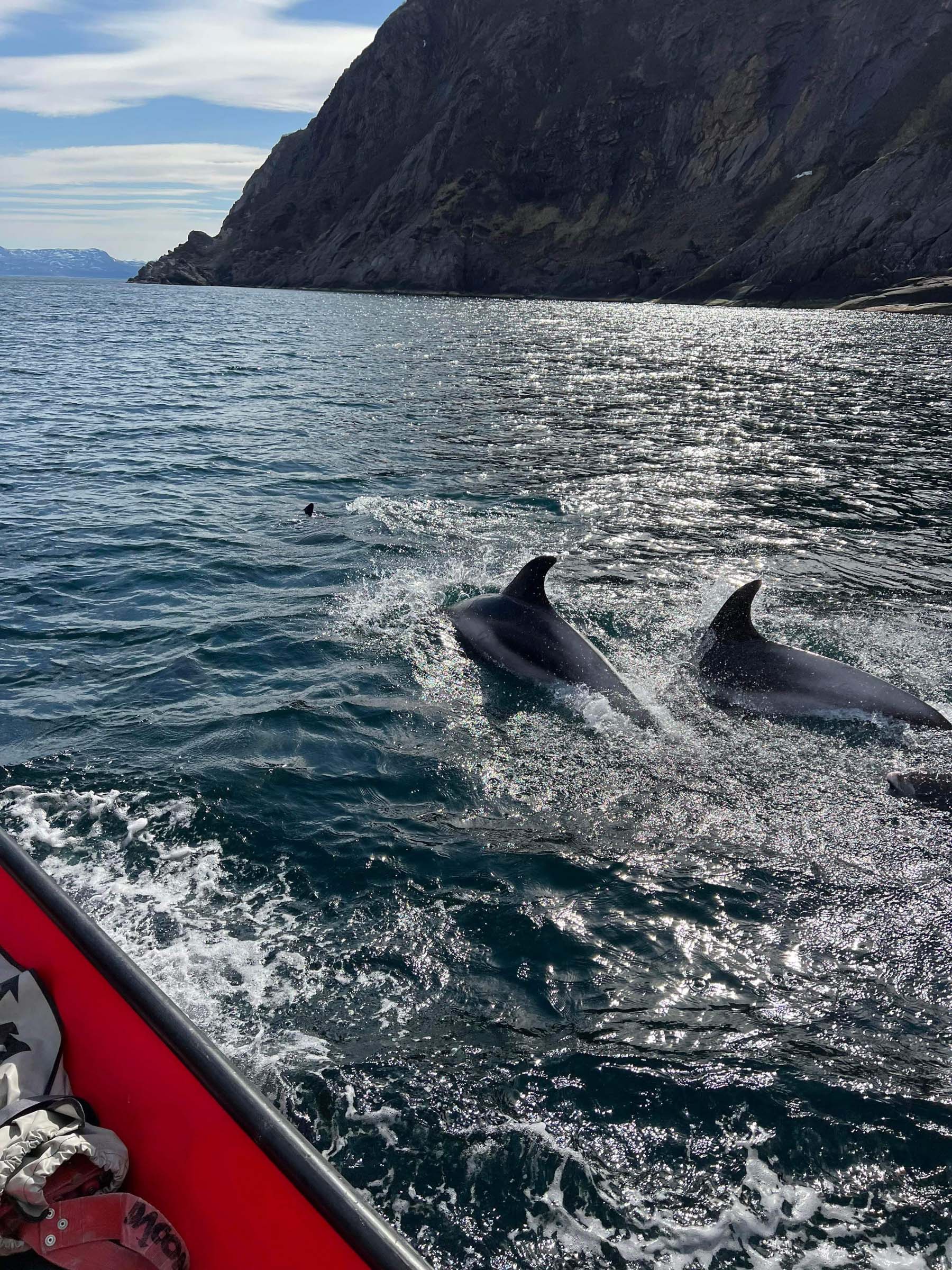
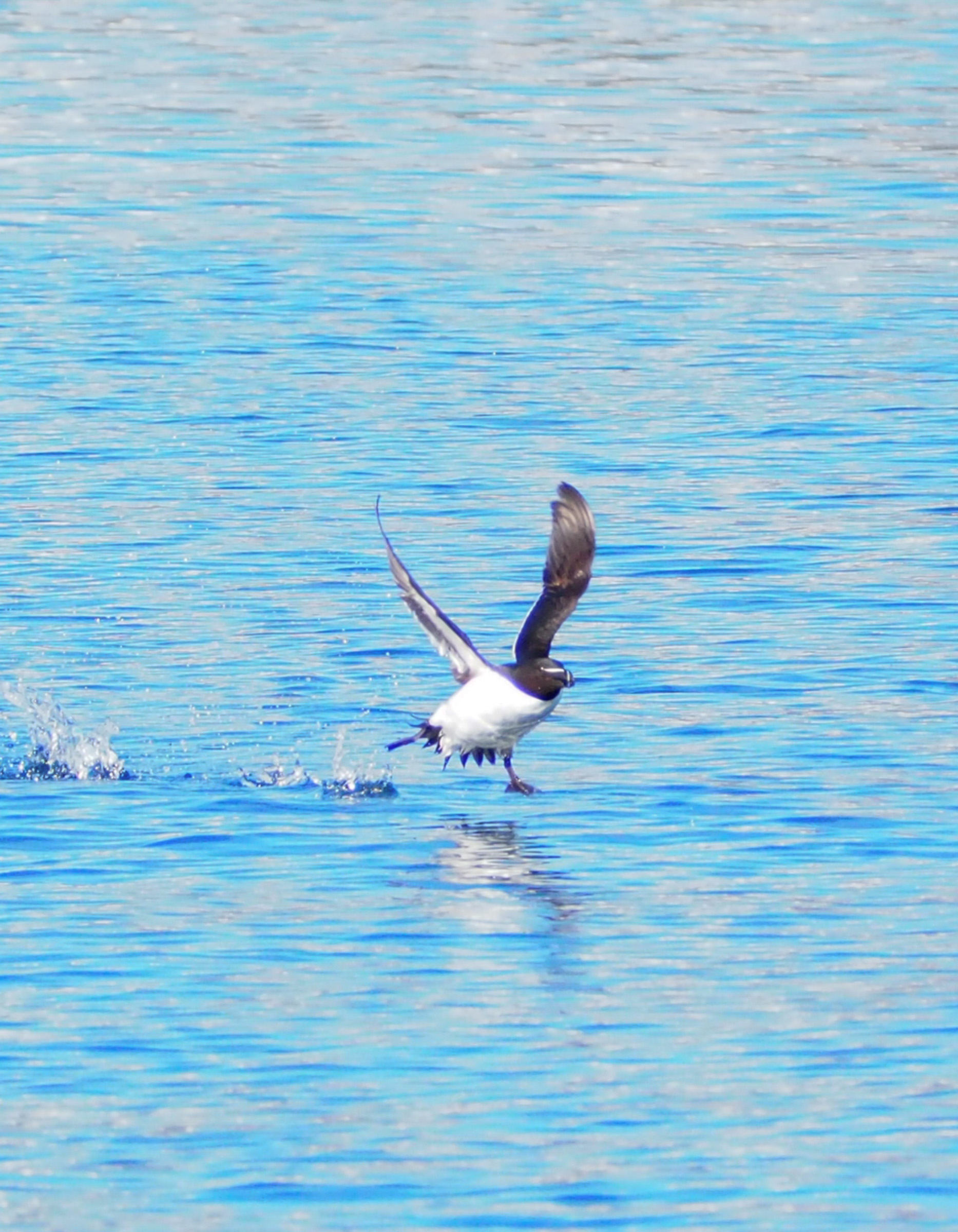
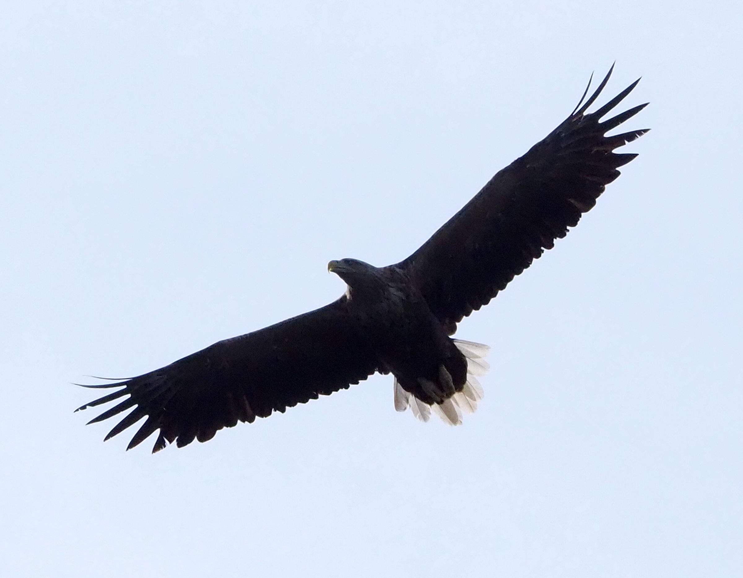
As the people have left, other beings have more room to live. The birdlife is thriving, with eider ducks, mallards and many other ducks plying the waters. From the boat, one can see the oystercatchers strutting along the shore on their thin, bright red legs. Angry terns dive-bomb down on our heads, seagulls are loud and talkative as usual and white-tailed eagles patrol from way up there. Puffins, razorbills and guillemots, those black and white colony birds, fly in the troughs of the waves. A pod of white-beaked dolphins lives and hunts in the area, and depending on their mood, they might entertain themselves with some human-watching. Hunting porpoises and bigger whales also turn up occasionally.
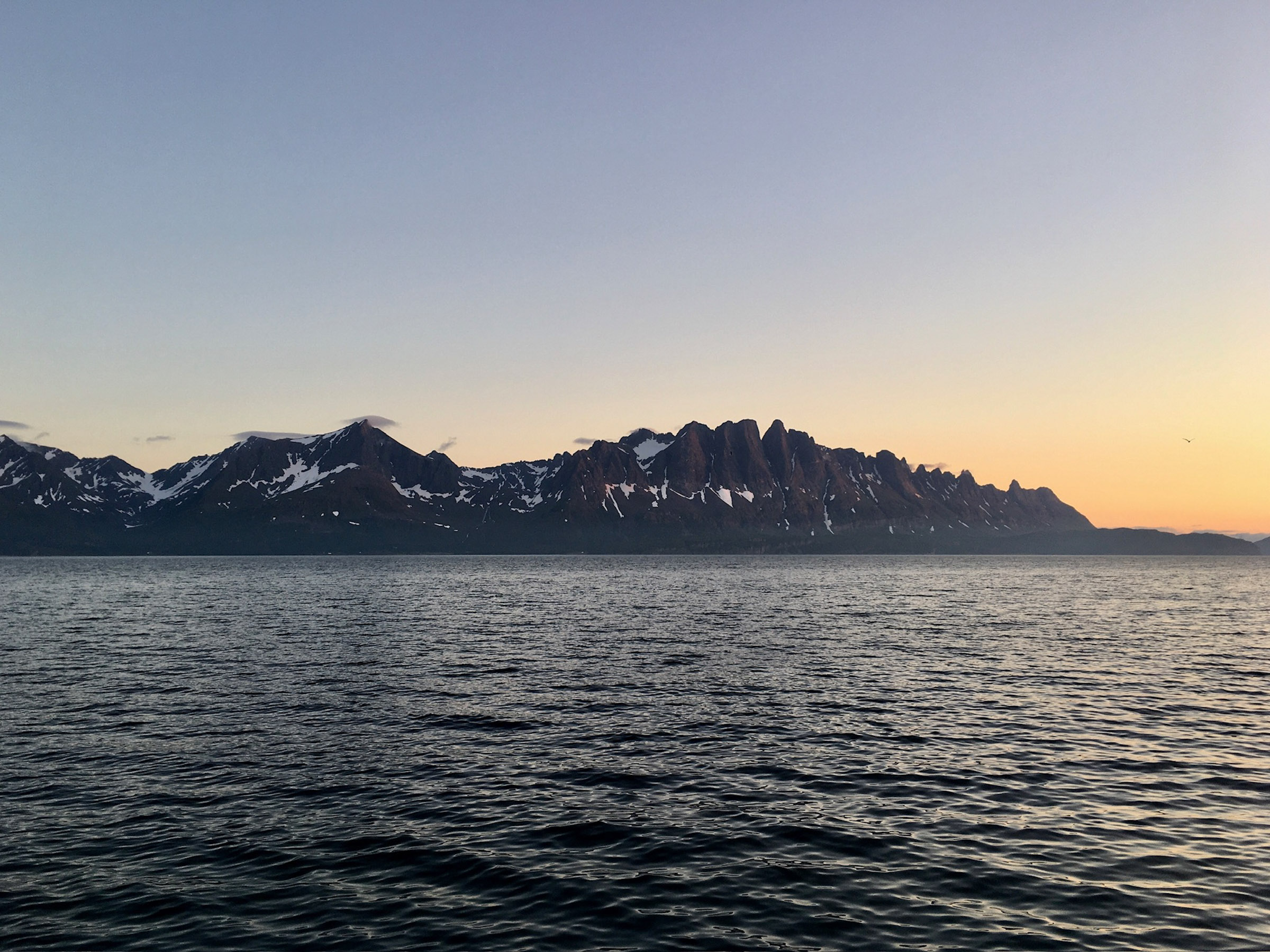
Kvænangstindan are the “Dragon’s Back”
One of the attractions along the route is the Kvænangstindan (Sami Návuongáissat) mountain range. From the sea, the pointed range looks like a prehistoric monster, having earned it the name “Dragon’s Back”. These mountains rise defiantly to an altitude of 1178 metres from the sea between two fjords. The abandoned settlement of Meiland appears minuscule under the impressive peaks.
Spildra Island is an old meeting point
The island of Spildra, Sami Spittá, has a deep-rooted Sami history. The island is full of graves, and not only of humans, but also bears. Bears were sacred animals in Sami mythology, and after having hunted down a bear, one needed to give the bones a proper funeral. Spildra was also a gathering point for siida’s, groups of nomadic Sami people during parts of the year. Today, some 20 people live here, making a living from the traditional fishing and farming combo, mixed in with community tourism.
Jøkelfjorden is geology in a big way
The Jøkelfjorden, Jiehkkervuonna in Sami, is long and narrow, surrounded by wild mountains carved out by glaciers in several ice ages. It is thus a classical fjord. But the geology reaches much further back, to the time some 565 million years ago when the Lyngen Alps, the Kvænangstindan and the area around Jøkelfjorden was chain of volcanoes, rising from the seabed. In the mountains north of the Jøkelfjord, one can wander among fossilised magma chambers from a supervulcano, one of only three locations on earth where this is can be seen. The mountains around the fjord also create a sheltered, warm microclimate, so the vegetation is surprisingly lush and green.
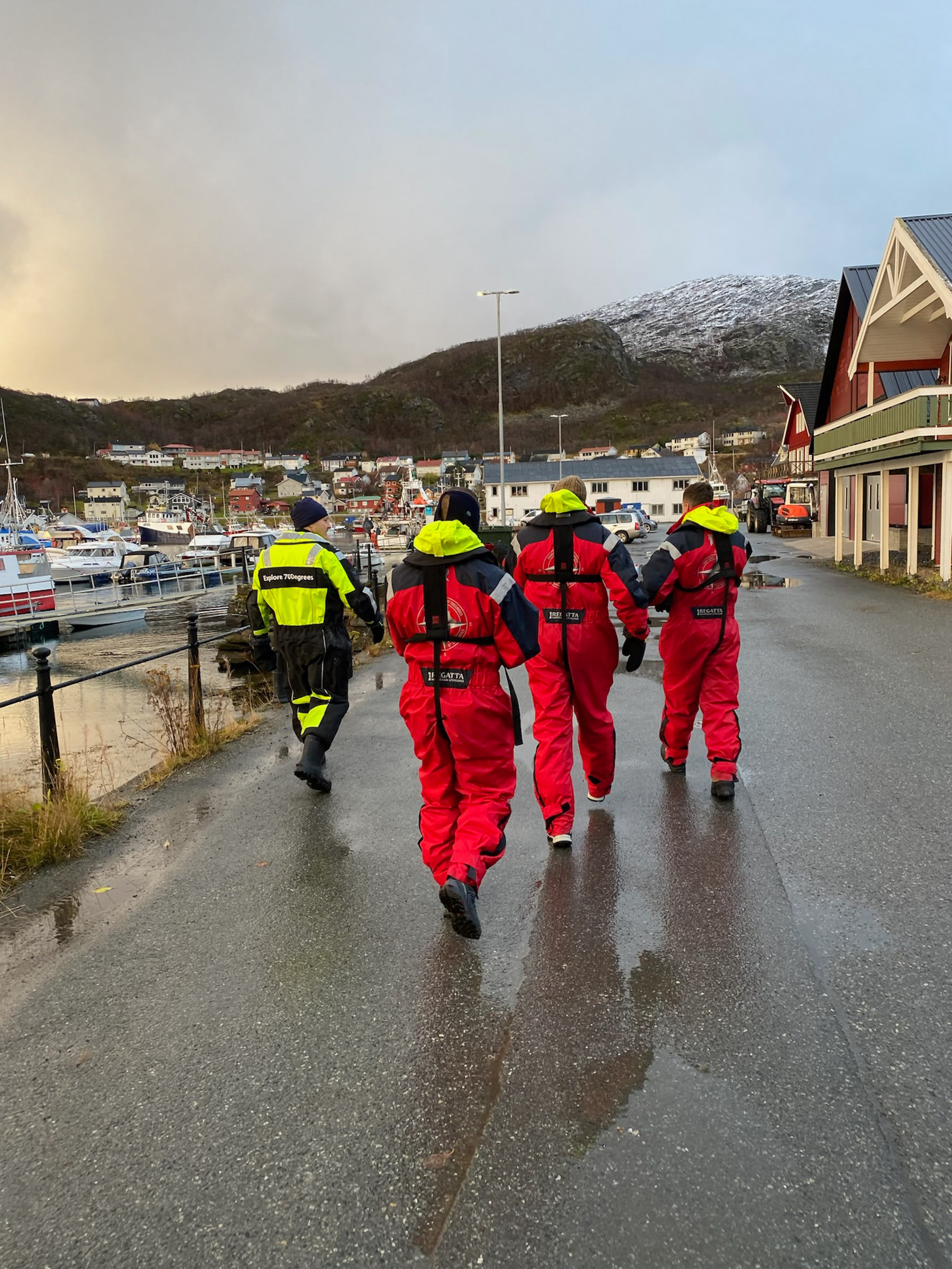
Skjervøy is the starting point of the tour
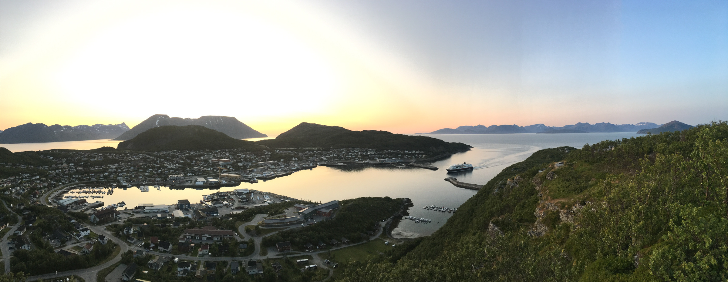
A fishing village of some 2500 inhabitants, Skjervøy is a tiny speck of urban life in a grand landscape. Here you can dine, enjoy good coffee, and have a glass of your favourite drink while studying the colourful reconstruction-era houses organised in terraces around the protected port.
For info about Skjervøy …
and the whole Lyngenfjord area, Visit Lyngenfjord is the most informed.
Good to know about the RiB tour to Jøkelfjord
A RiB tour is not tough, and does not require physical strenght or stamina. However, to counteract the waves, you flex your legs slightly. If you have major problems with your back or knees, maybe a RiB tour isn’t for you.
No worries! Explore 70 Degrees welcomes rookies every day. You get a thorough instruction before going on board.
Bring casual wear, along the lines of a t-shirt, a sweater and jeans. On a cool summer’s day, Explore 70 Degrees will fit you out with a floating thermal suit. If the summer’s day is unbearably hot, shorts and t-shirts are not unheard of. No discussion about the life jacket, though, that Explore 70 Degrees hands out, it should be worn all the time.
In early June, there will still be a fair bit of this year’s snow left, so the glacier is less visible. As the summer progresses, the glacier stands more and more out. However, fresh snow at 1000 metres altitude is a possibility all summer.
Jøkelfjord (“Glacier fjord”) is a short fjord cutting into the mountain range between the fjord Kvænangen and the Altafjord. The range divides the counties Troms and Finnmark, and Jøkelfjorden is on the peninsula’s western side.
Skjervøy is a fishing village and community centre in Northern Troms, midway between Tromsø and Alta.
You can easily drive to Skjervøy. The driving from Tromsø takes around 4 hours, and usually involves two ferry crossings. It is a little shorter to Alta in the east, about 3 hours. There is a daily bus from both Tromsø and Alta. From Tromsø, you can take the Hurtigruten, a 4 hour sailing, or a catamaran.