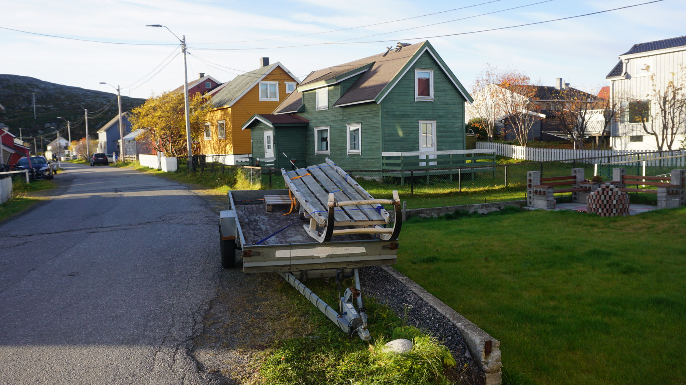
Kirkenes and the municipality of Sør-Varanger form a sliver between Russia and Finland, right on the Varanger fjord. This is a borderland both geographically and culturally, and everything here has a hint of east.
Kirkenes is the centre of Sør-Varanger
Sør-Varanger is the name of the huge municipality were Kirkenes is the centre. The northern coast is barren, with hardly any population, except the King Crab village of Bugøynes. Once you leave the wind-swept coast, however, the scenery changes. Deep forest, birch closest to the coast, pine inland, grow unobstructed from here to the Bering Strait and beyond. This is the landscape the Russians call taiga, deep conifer forests with lakes, bogs and rivers interspersed.
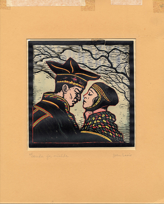
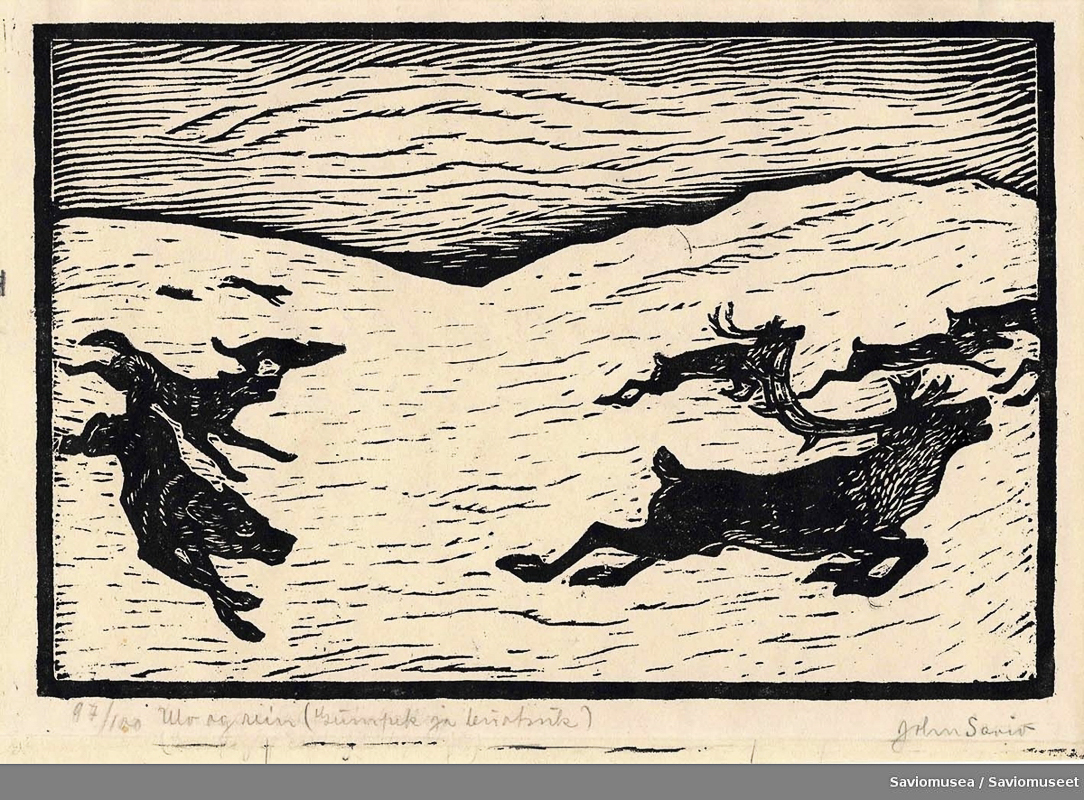
For 2000 years, this was the area of the Eastern Sami
The Eastern Sami, sometimes called the Skolt Sami, speak their own Sami language. In the centuries before the birth of Christ, their culture emerged in this area. They lived in siidas, small groups, that moved up and down the Neiden or Pasvik River, depending on fishing and reindeer hunting seasons.
The area became a borderland
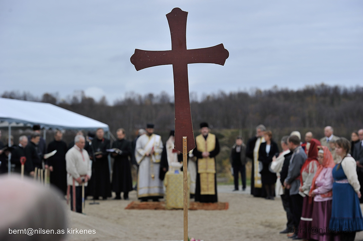
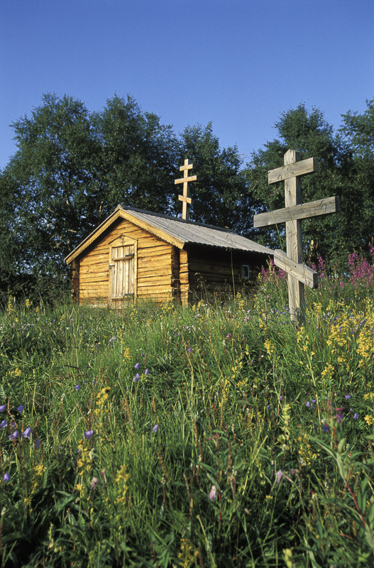
In 1307, Norway establishes itself with a fortress in nearby Vardø. The Norwegian king claimed the whole of the Kola peninsula, or Russian . The Russian approach was more subtle, they sent missionaries. The monk Trifon converted the Eastern Sami to Russian Orthodoxy in the 16th c., and the St. George chapel in Neiden dates from 1565.
Kirkenes was the last part of Norway to become Norwegian
The Eastern Sami were squeezed between Norway, Sweden-Finland and Russia, and had to pay taxes to all. However, in 1826, the border was drawn between Russia proper, the Grand Duchy of Finland and the Kingdom of Sweden-Norway. The border cut right through the annual migration routes of the Eastern Sami siidas, and caused considerable problems for them. The Eastern Sami continued to be visited by Orthodox priests until 1914, but thereafter they had to turn to the Lutherans for baptisms and weddings. Today, the Finnish Orthodox church celebrates liturgy in Neiden, and Orthodoxy has been modestly revived.
The Kirkenes area became little America
During the 19th c., Norwegian settlers arrived. Those that couldn’t afford to go all the way to America, moved from overpopulated inland valleys in the south to the deep forests of Sør-Varanger, where they found a similar climate as back home. Forest was cleared, and the earth was tilled, and log houses in typical southern Norwegian style were built.

The Kven arrived in the 19th c.
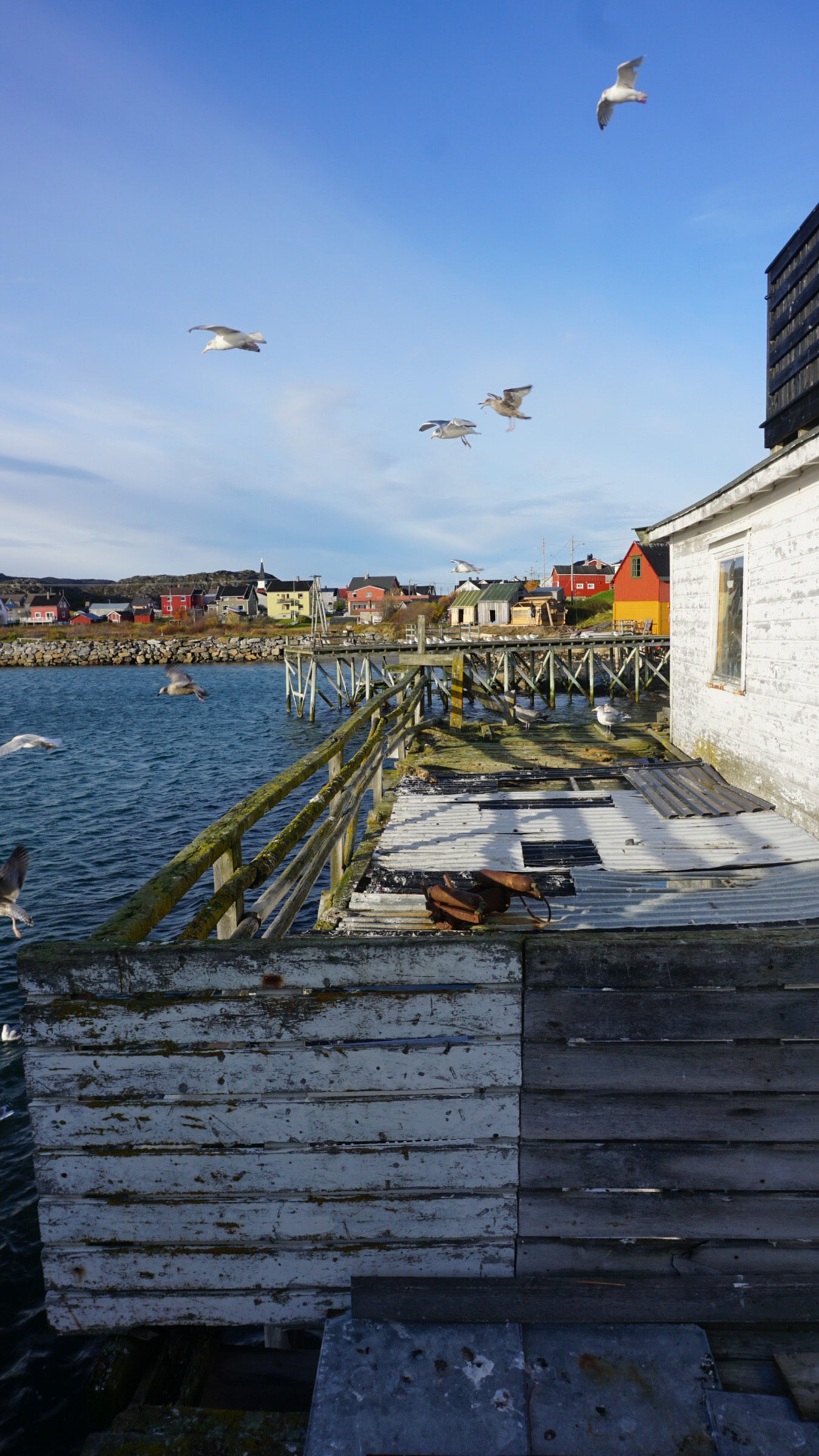
In the 1860ies, Finland´was stricken by a famine, and hungry people started to arrive at the shores of the Varanger fjord. They quickly learned to fish, and created fishing villages along the coast and farmsteads in the valleys all over Sør-Varanger. Today, Finnish is spoken in the community of Bugøynes, and even taught to the younger generation.
The mines in Kirkenes were opened in 1906
Kirkenes, which originally had only been the location of the church, was turned into a mining community as iron ore was found in nearby Bjørnevatn. A new town grew up, and people moved in from all over Northern Norway. The very multi-ethnic society got a more distinct Norwegian character, and Kirkenes became one of the wealthiest communities in Norway.
Norway imposed Norwegian culture on the minorities
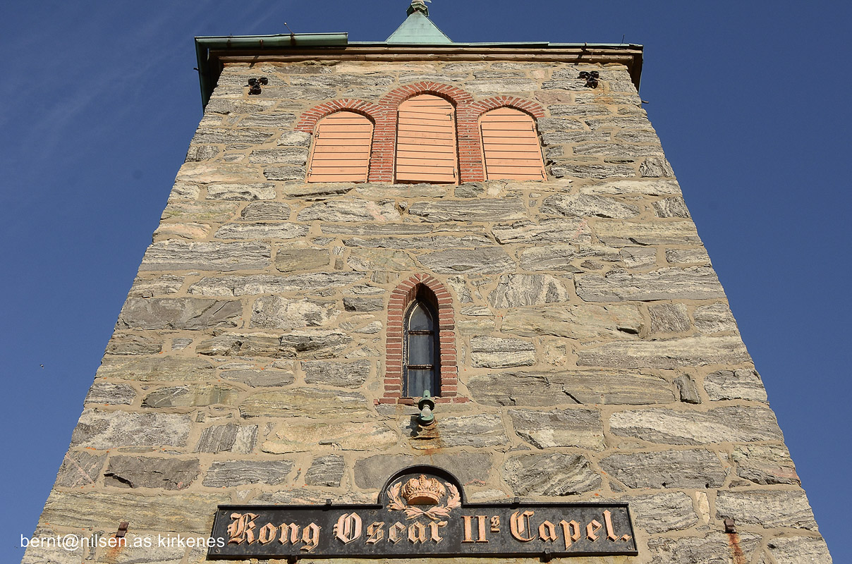
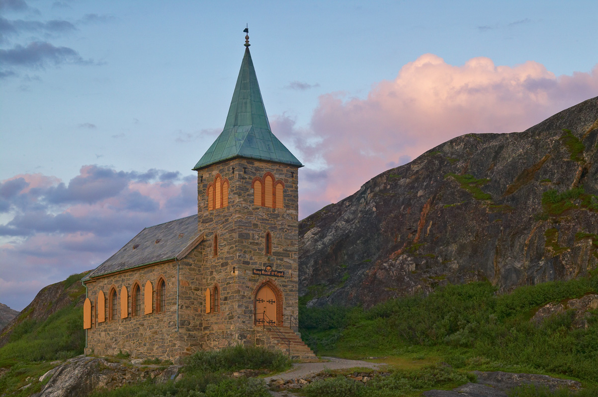
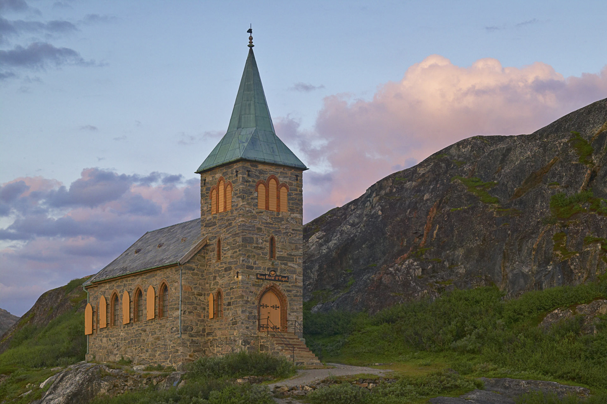
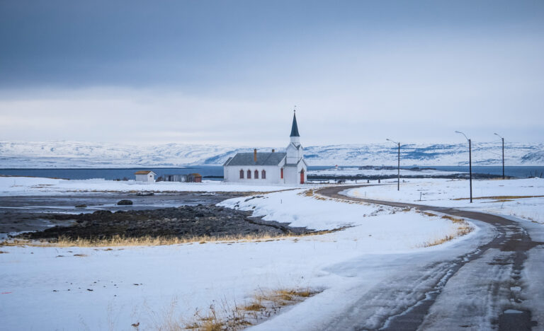
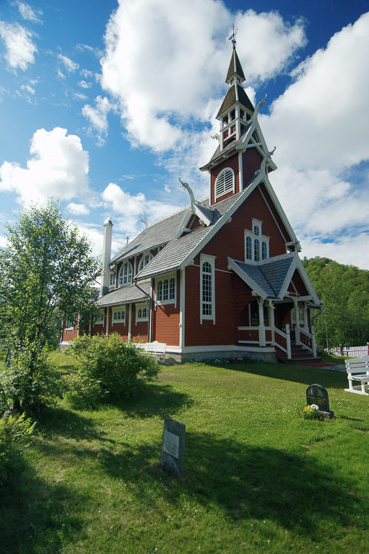
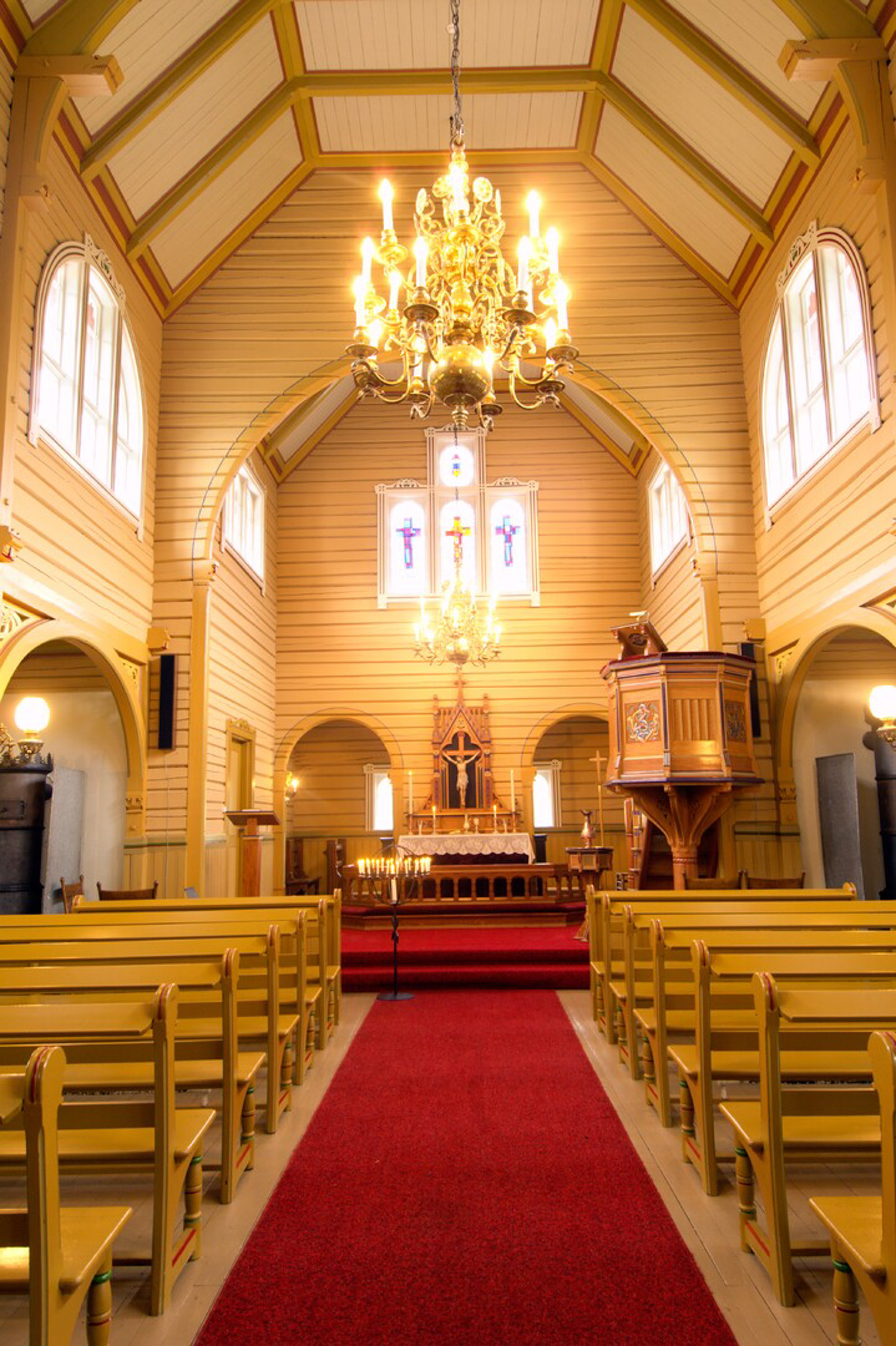
With Norwegian independence in 1905, growing nationalism in Finland around its independence in 1917 and the communist takeover in Northern Russia in 1920, Norway feared for its grip over this multi-ethnic borderland. Norwegian language was the only one allowed in school and old Sami names were replaced with Norwegian ones. This period is visible in the architecture; the churches of Neiden and Svanhovd are built in traditional, southern Norwegian wooden style, ressembling the old stave churches. The stone chapel at Grense Jakobselv could very well have adorned a village in the south.
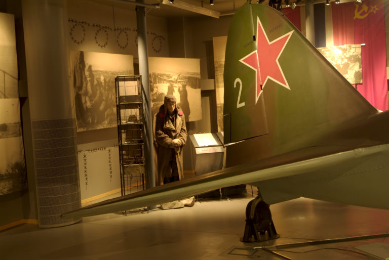
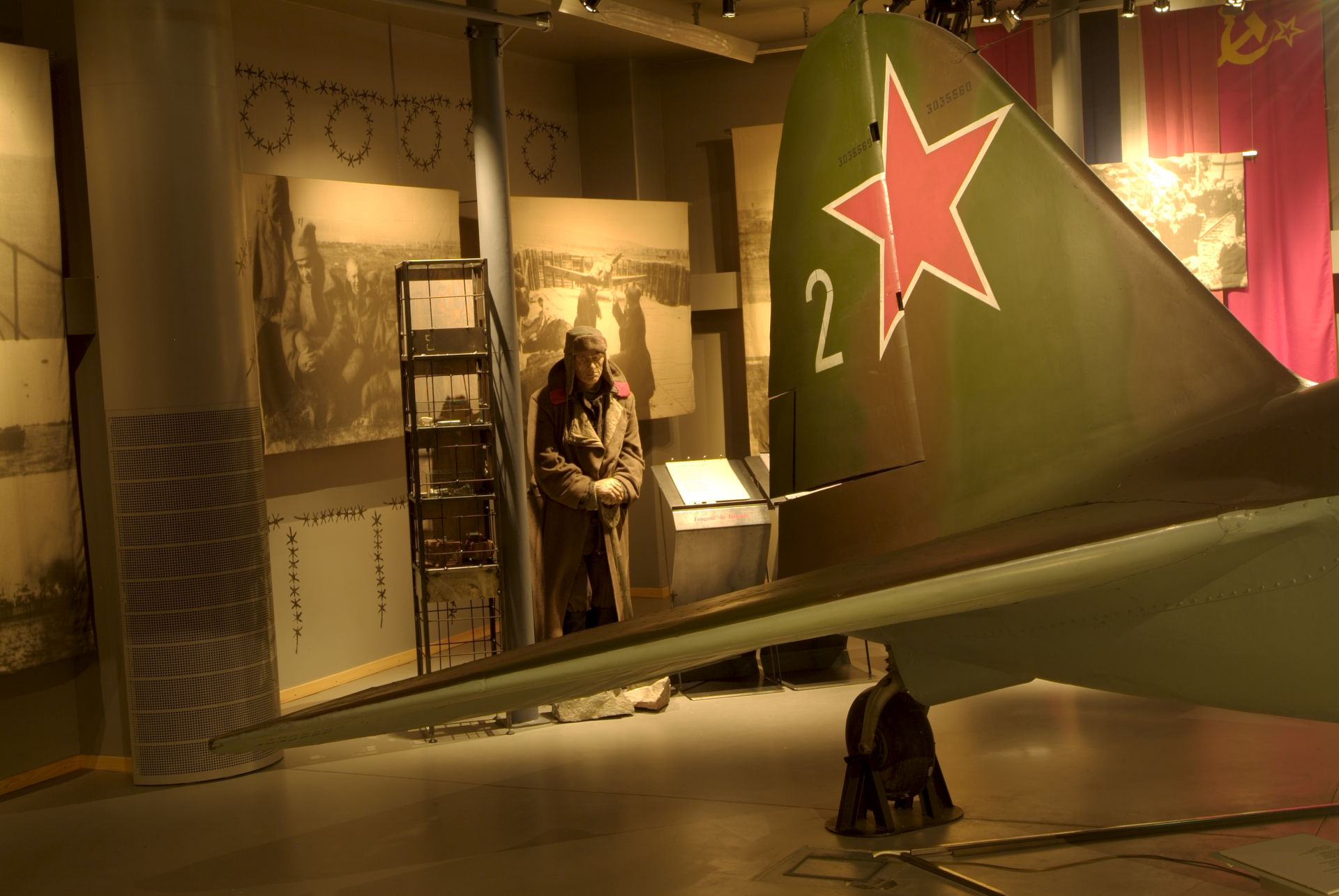
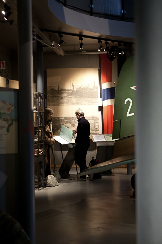
Kirkenes was at the frontline in WWII
In 1940, Kirkenes was occupied as the rest of Norway, but war was undramatic at first, as Kirkenes was so far away from the theatre of war. However, in June 1941, the Germans launched Operation Barbarossa, in which they attacked the Soviet Union. All of a sudden, Kirkenes was at the frontline. The German Wehrmacht tried over a period of three years to conquer the strategically important port city of Murmansk, without success. The number of German soldiers present at any time around Kirkenes outnumbered the locals many times over, and prisoners of war from the Soviet Union were brought in to build fortifications, the new airfield at Høybuktmoen and roads everywhere. All this happened under the most atrocious working conditions.
Kirkenes was the most bombed city on Europe’s mainland
One of the frightening aspects of the war were the constant air raids. The soviet airplanes were only minutes away by air in Murmansk, and the locals had little time to run into the air raid shelter in the middle of town. More than 1000 times the air raid sirens sounded, and 323 times the town was bombed. In July 1944, a particularly ferocious attack created a firestorm, and 170 houses burned. The air raid shelter of Andersgrotta is today possible to visit for guided tours.
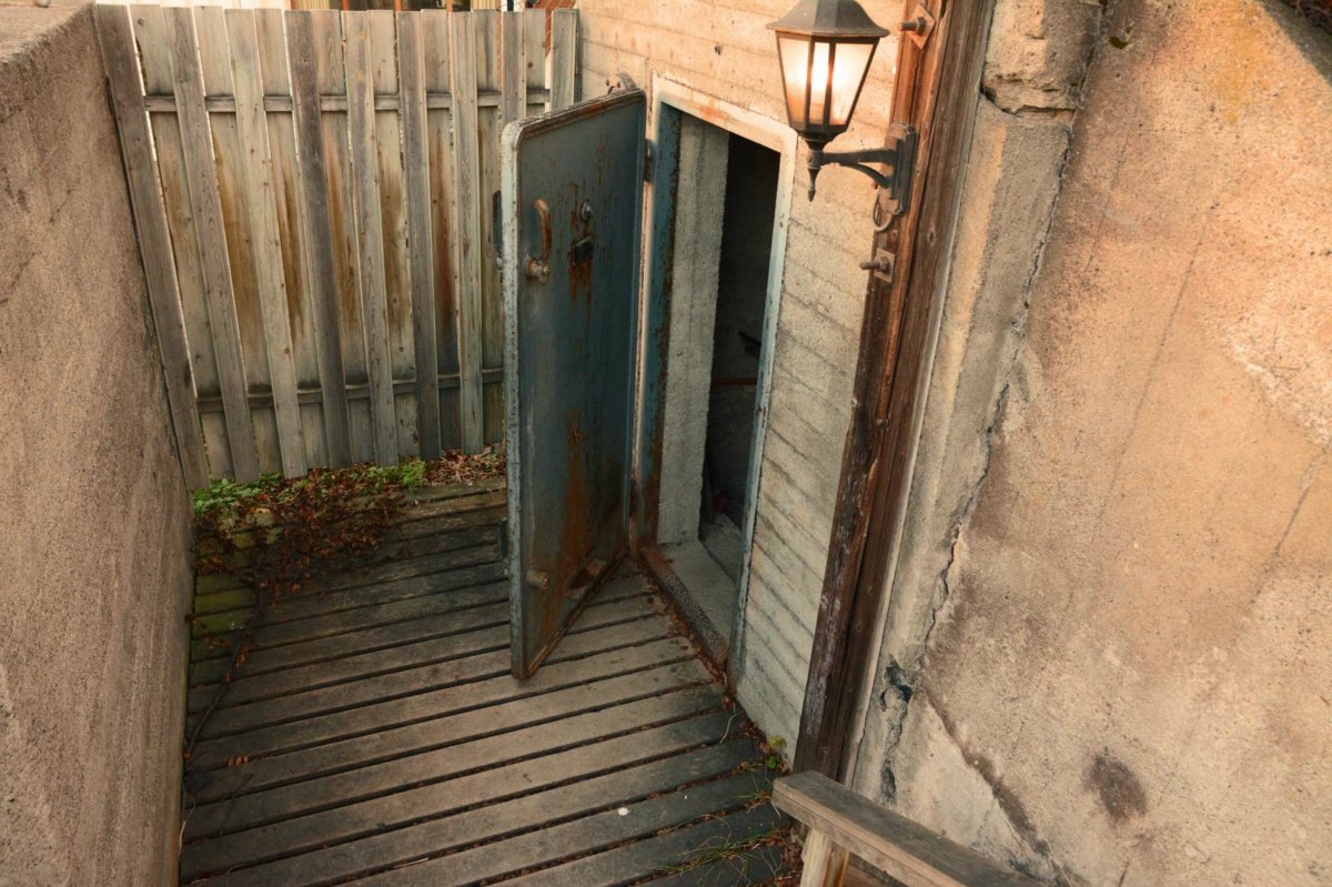
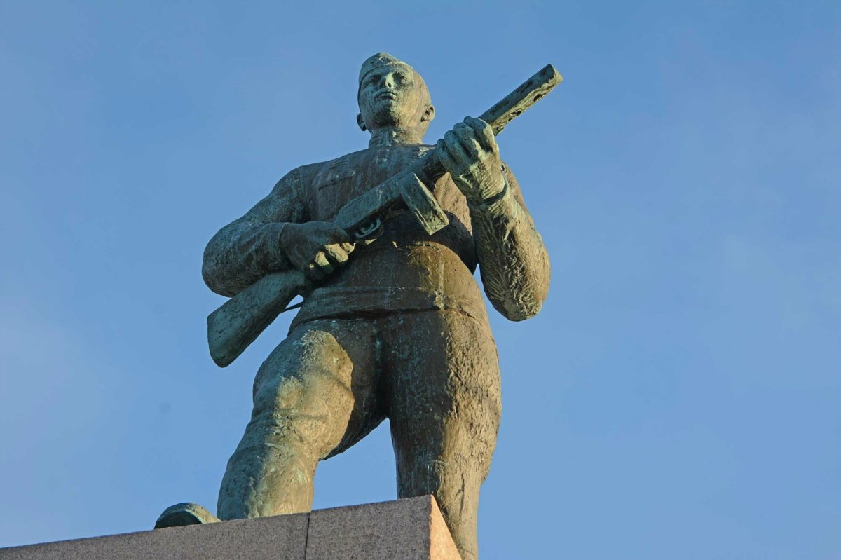
Kirkenes was liberated as the first in Norway
The German positions became precarious as the Soviet advance forced Finland to change sides from the Axis to the Allied. As the air raids got more frequent and the frontline got closer, the civilians in Kirkenes moved into the mines. Here they lived for 2-3 months in relative safety, and children were born. On the 24th of October, the Red Army marched into Kirkenes and was received as liberators by the population.
The Post-war period was a time of explansion for Kirkenes
The world needed steel to reconstruct, and the mines in Kirkenes were source of wealth for the country. The town was rebuilt after the war destructions, and Sør-Varanger increased in population and prosperity. However, with the economic troubles of the 1970’ies, the mines turned unprofitable. They were closed down in 1996.
The Fall of the Berlin Wall meant an opening to Russia
The ups and downs in the east-west relationship was easily felt in Kirkenes after WWII. However, there was precious little cross-border contact for 40 years. The fall of the Berlin wall, however, was easily spotted in Kirkenes, with the Russian market a colourful part of the city centre. The co-operation with Russia has since become more stable, both on the economical and cultural level.
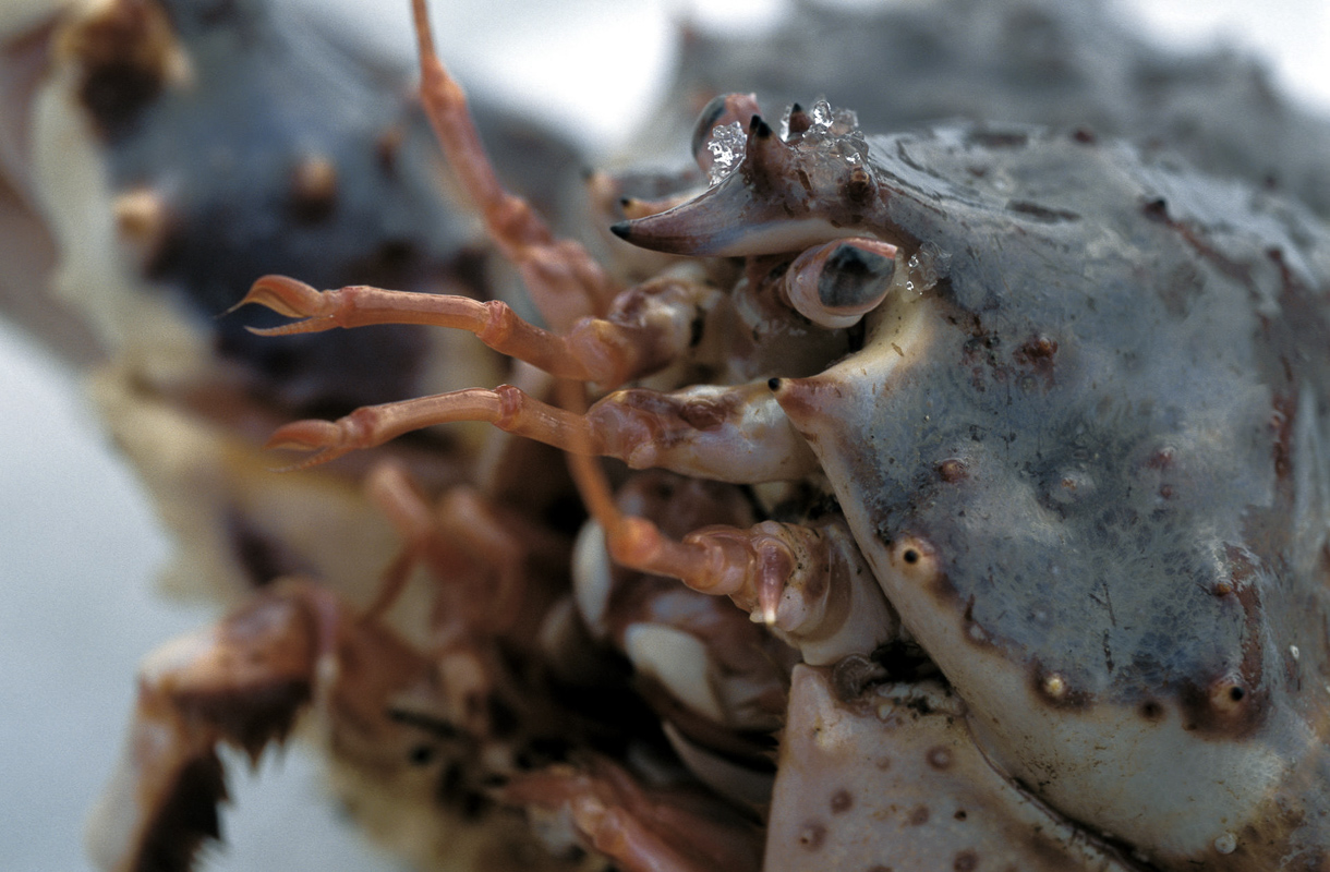
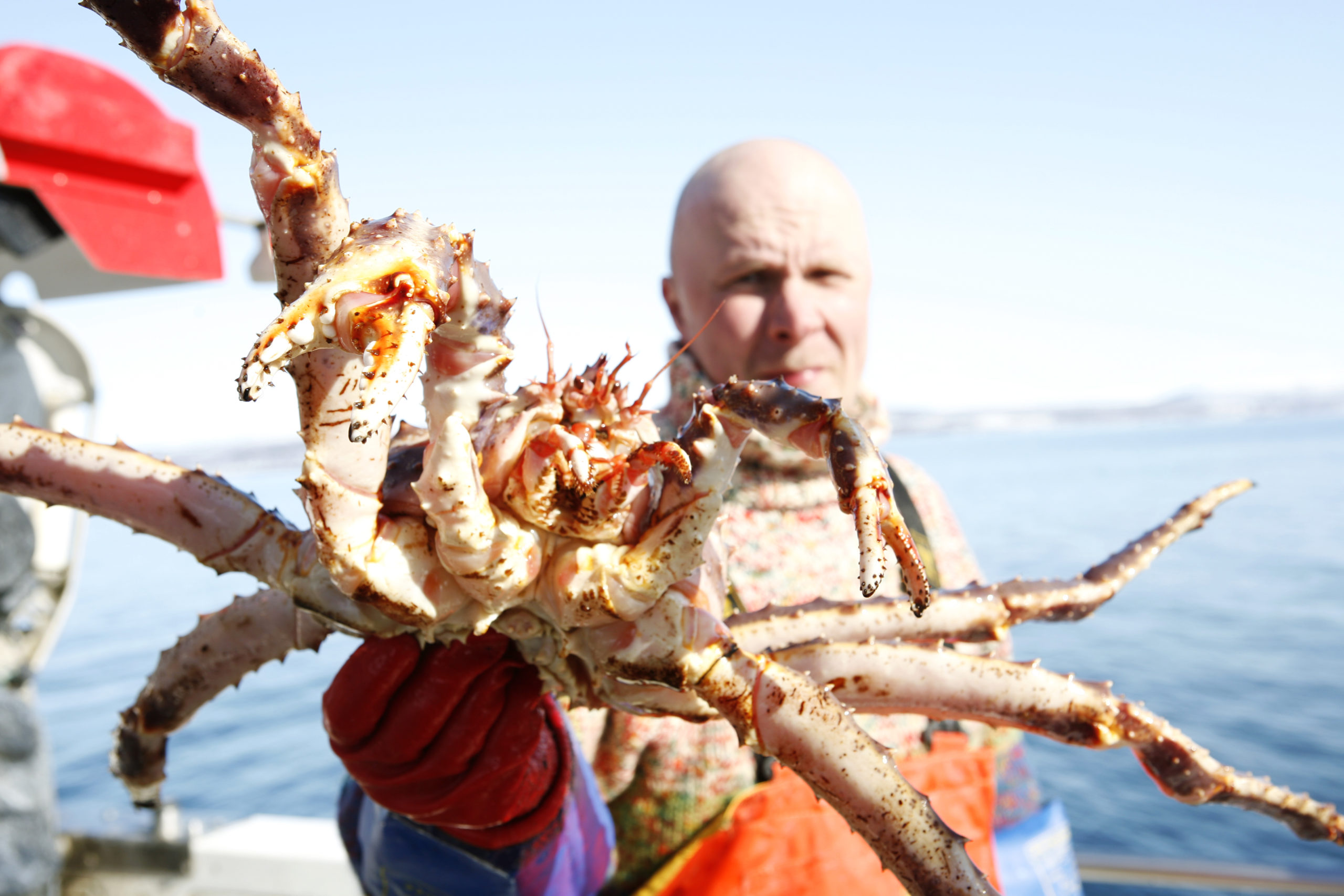
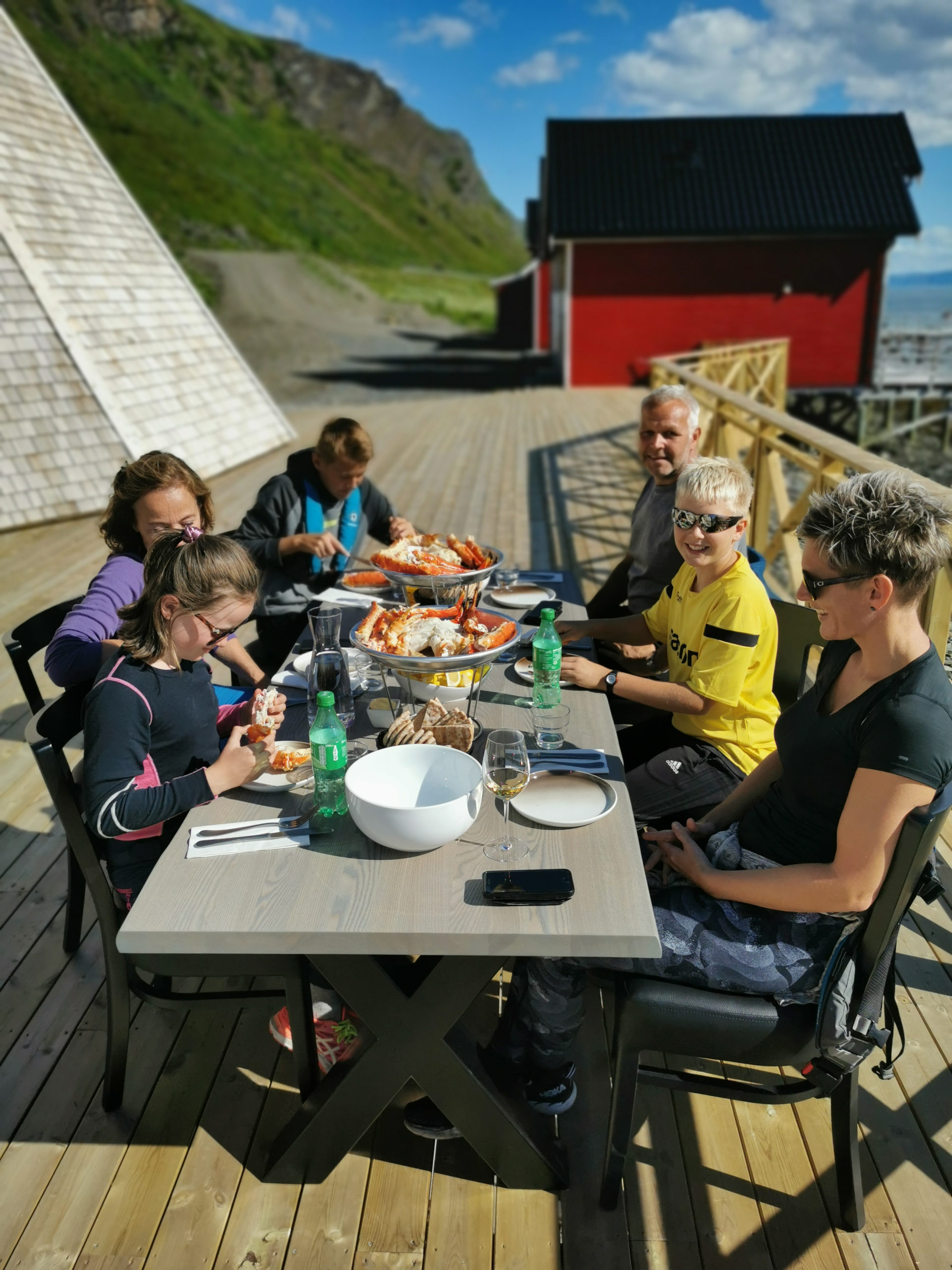
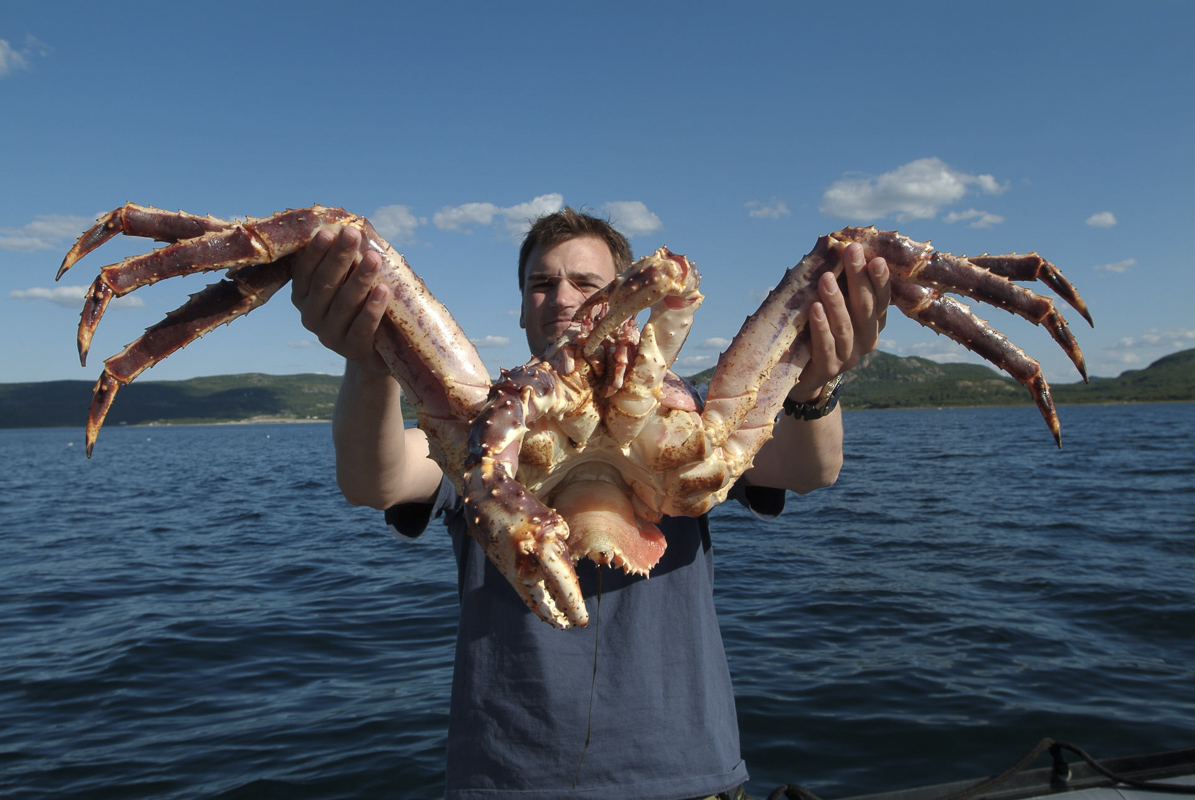
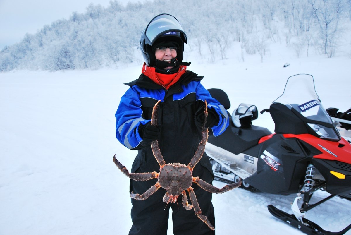
King Crabs are a tasty newcomer in Kirkenes
Sometimes in the 1960ies, the giant crab species originating in the Kamtchatka peninsula in the Russian far east were released by accident in the Murmansk fjord. It started to spread. In 1978, a fisherman from Bugøynes near Kirkenes got a specimen in his net. First seen as a bothersome net destroyer, the crabs have now become a sought-after delicacy. The centre of crab fishing remains Bugøynes, but tourists are taken out of Kirkenes to try their luck at fishing, both in the sea in summer and on the frozen fjord in winter.
Kirkenes Snow Hotel is built anew every winter
Inside a snow hotel, the rooms have a temperature of -4, even if it is -30 outside. Wrapped in a comfy sleeping bag, you may have the best sleep in your life. The Kirkenes Snow Hotel is adorned with ice sculptures, with a new theme every winter.

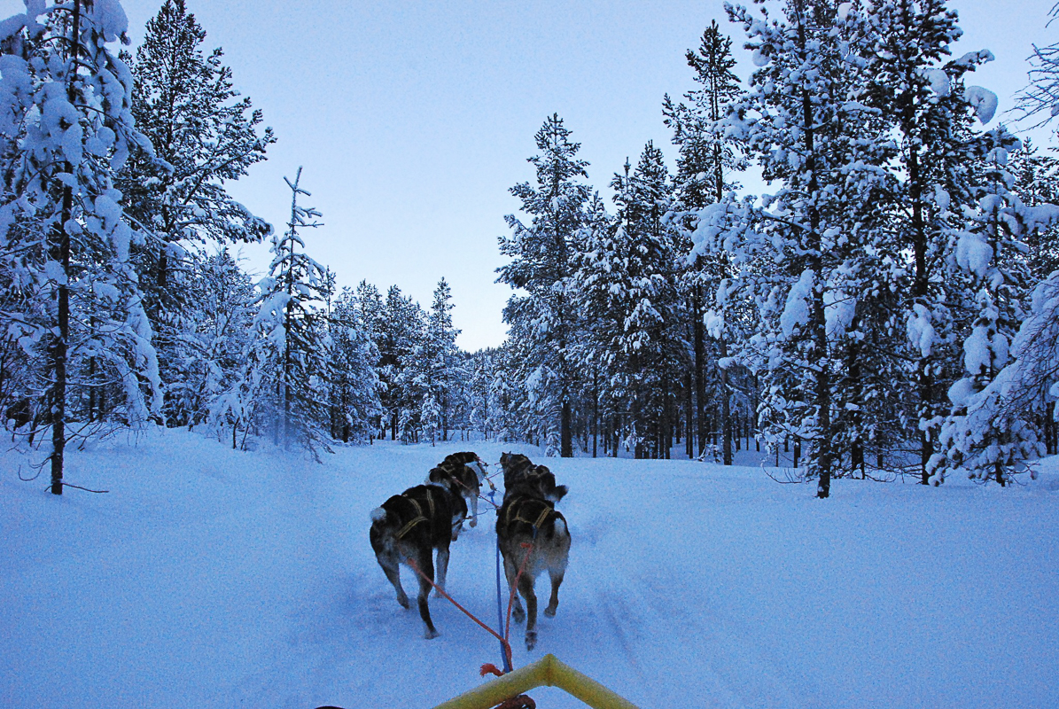
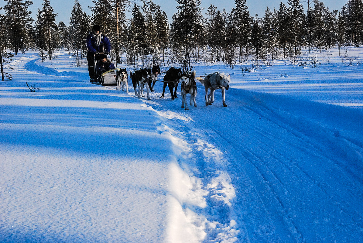
You can explore the taiga in the winter
The Taiga, the deep forests, frozen solid in winter, is filled with powdery snow. The locals use the age-old technology of skiing, and there are marked trails all over. Dog sledding is another eco-friendly option, and the dogs can penetrate deep into the forests. Snowmobiles can take you even further, and there are designated snowmobile trails. However, we do recommend going on an organised trip if you have scant snowmobile experience.
The Midnight Sun shines for two months in Kirkenes
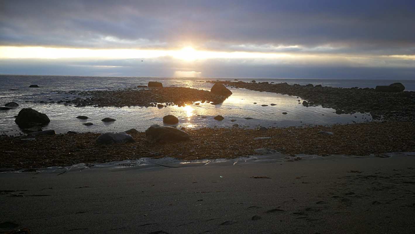
Well north of the Arctic Circle, Kirkenes enjoys the Midnight Sun for more than 2 months. In fact, the municipality of Sør-Varanger is so geographically extended from north to south that the exact period of the Midnight Sun is not the same all over. In Kirkenes, one sees the Midnight Sun from the 17th of May to the 24th of July. In Nyrud, at the southern end of the valley, the period is a few days shorter, from the 21st of May to the 22nd of July. In this flat landscape, mountains blocking the Midnight Sun view is not a big problem. However, going to a high point in the landscape is always more rewarding. Prestfjellet in Kirkenes offers views over the town. The hill named after its altitude, Høyde 96, allows you to see up and down the Pasvik valley and across the border. The excursion to Grense Jakobselv allows you to see the sun over the open ocean.
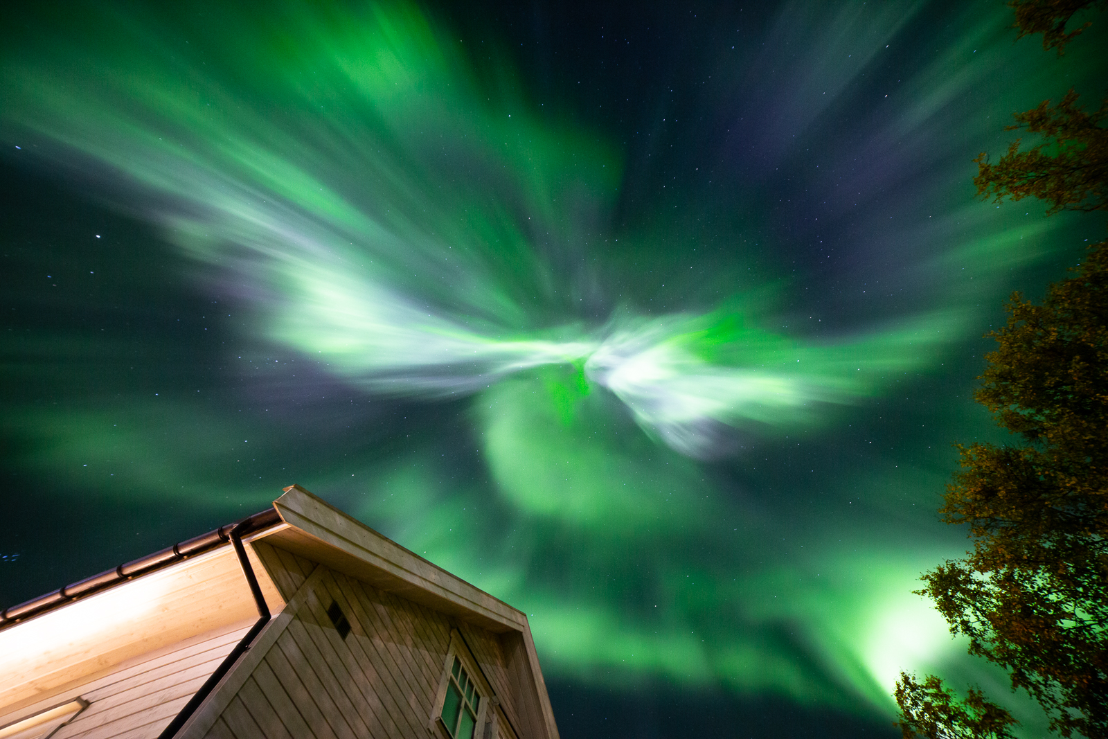
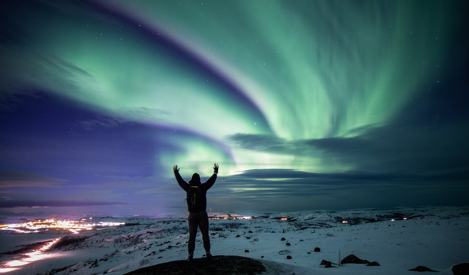
See Northern Lights in stable winter climate in Kirkenes
The green rays of the Northern Lights are often visible above Kirkenes. The winter climate is dry and stable, and frequent clear skies give excellent chances of spotting the illusive Aurora Borealis. You can go looking by snowmobile or by dogsledding, there are tour organised specifically to see them, and you can hire skis and go on marked trails around the population centres. The Kirkenes Snow Hotel is of course on the lookout, and alert you if you’ve checked in there.

Walk to the three-nation-cairn through bear country
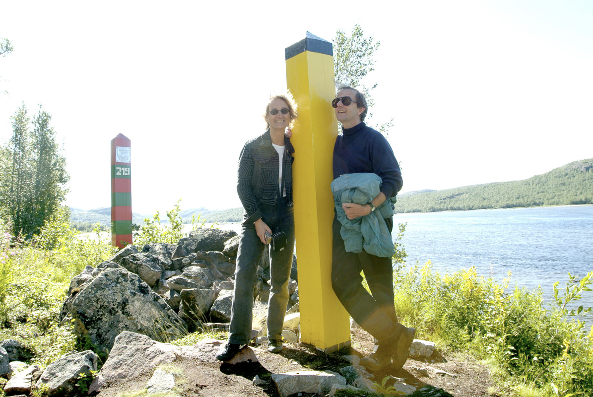
The deep forest of the Pasvik panhandle have precious few inhabitants, all living along the road following the border river. This is prime bear territory, and the bear population is shared with Russia and Finland, bears are genereally uninformed about delicate border issues. A well-marked trail takes you to the border cairn where the Russian Federation, the Republic of Finland and the Kingdom of Norway meet. You can walk on the Norwegian and Finnish side, but don’t step over on the Russian side.
The border follows the Pasvik river, mostly
The border between Norway and Russia is a 700 year old epic dividing line between the Orthodox east and Western Europe. Being undefined and fluctuant for centuries, it was finally settled in 1826. The Pasvik River, Russian Патсойоки or Patsojoki, Eastern Sami Paččjokk and Finnish Paatsjoki, was agreed as the border. However, the old Orthodox church at Boris Gleb would then end of on the Norwegian side. Thus an exclave was made around the chapel and monastery, and instead Norway was compensated with much more extensive areas east of the river mouth. This explains the curious bends and curves the border takes near the river mouth.
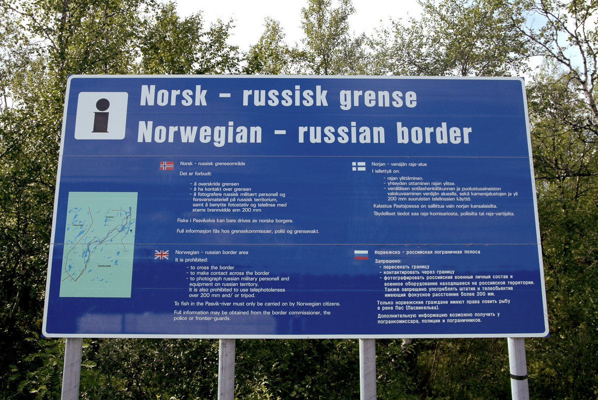

“I want to take a step into Russia” – forget it
One does not cross the border with the same ease as between Scandinavian and EU countries. A visa is required to cross the border for Norwegians, EU citizens and most other countries. The only place to cross the border is at Storskog, a short drive east of Kirkenes, and after quite a bit of waiting, the ones with the paperwork sorted, are let in. The border remains open, but tourist visits are not recommended at the moment.
Instead, we stay on the Norwegian side and look across at numerous viewpoints. There are restrictions on photography, and taking even one step across the border will give you a hefty fine.
The locals are used to living on the border
Locals can apply for what they call a “multi visa”, which allows them access to the nearest towns across the border. This means they can drive to nearby Nikel and tank up their car with cheap Russian petrol. Russian is a popular option in school, and Russians come to Kirkenes to shop for things like nappies and marmalade. Some streets in Kirkenes are even signposted with Cyrillic letters in addition to the Latin ones. All this is every day life for the locals, and a hint of the exotic for the western visitor.
Practical about Kirkenes and Sør-Varanger
Kirkenes is found close to the point where the Norwegian-Russian borders meet. As the crow flies, the distance is some 1400 km to Oslo, Norway’s capital.
There are direct flights from Oslo with SAS and Norwegian to Kirkenes Airport at Høybuktmoen. The legendary shipping line, Hurtigruten, also sails to Kirkenes. The sailing time from Bergen is five and a half days. There is also a bus to Karasjok with onward connections to Alta, Tromsø and the train in Narvik, but this takes several days and requires in-depth reading of bus tables.
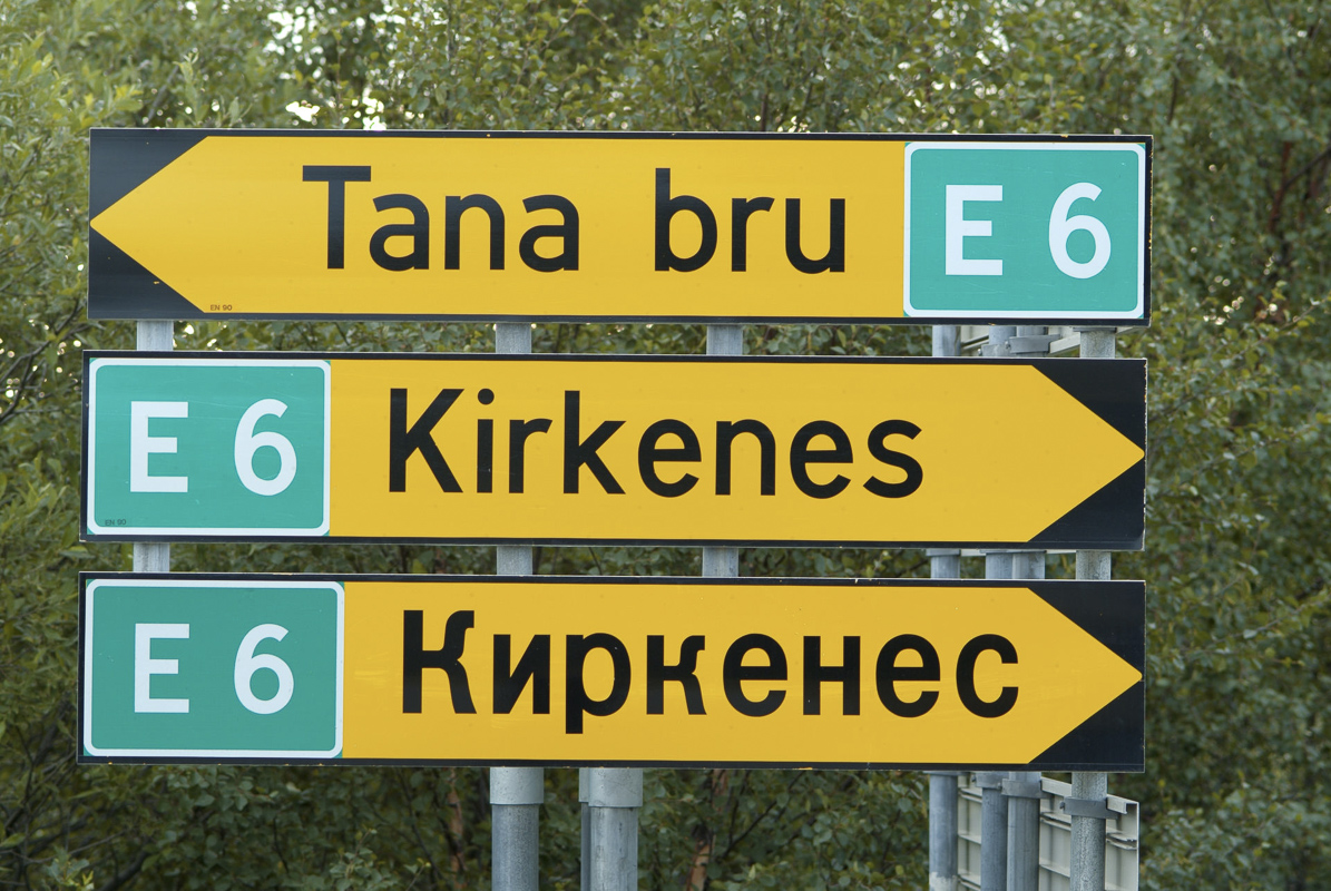
The E6 ends in Kirkenes, and you can certainly drive up all year. If you choose to drive up from Oslo entirely through Norway, the voyage is a whopping 34 hours, and 2380 km drive. Much faster is the short cut through Finland and Sweden, following the E4 along the western side of the Gulf of Bothnia, The 1844 km can be done in about 24 hours, breaks not counted in.
Kirkenes downtown has two first class hotels, a mid range one, and a few budget options.

Visit Kirkenes
Your guide to all activities in Kirkenes