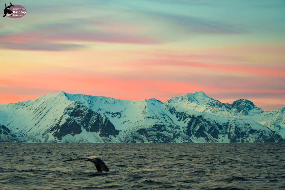
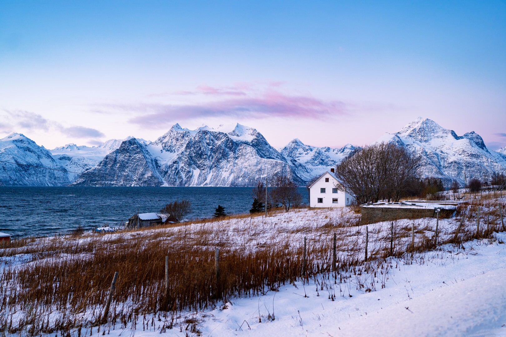
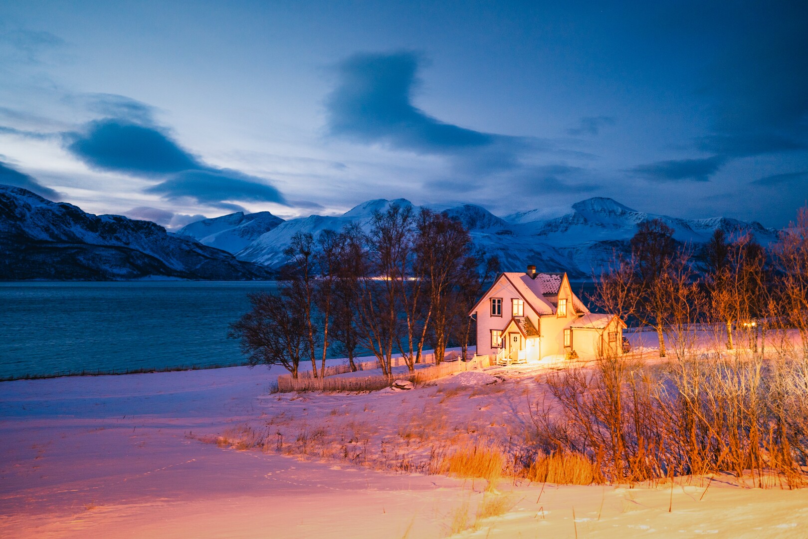
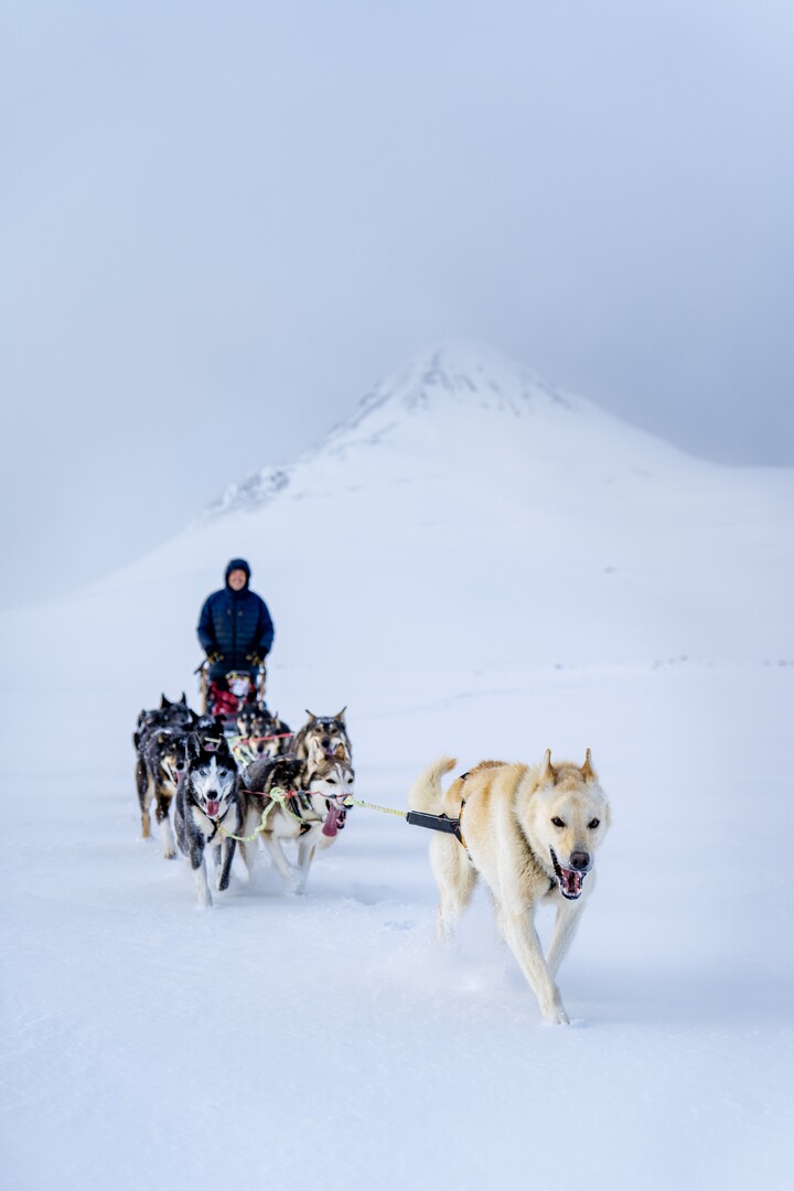
The giant Lyngen Alps, the wide and deep Lyngenfjord and the border mountains and valleys towards Finland form an impressive and endlessly varied landscape. Come here for the lovely views, to maximise your Northern Lights chances, for exhilarating skiing and cycling and for the multi-cultural heritage.
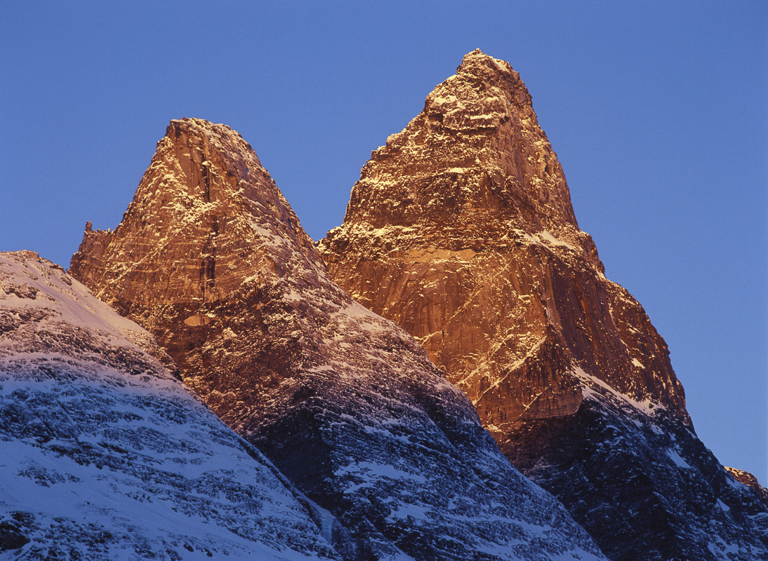
The mountains in Lyngenfjord impress the most blasé
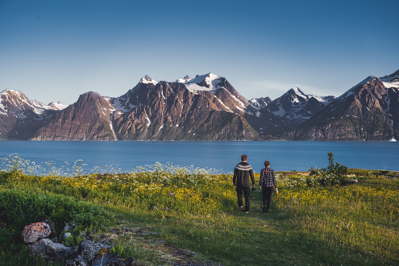
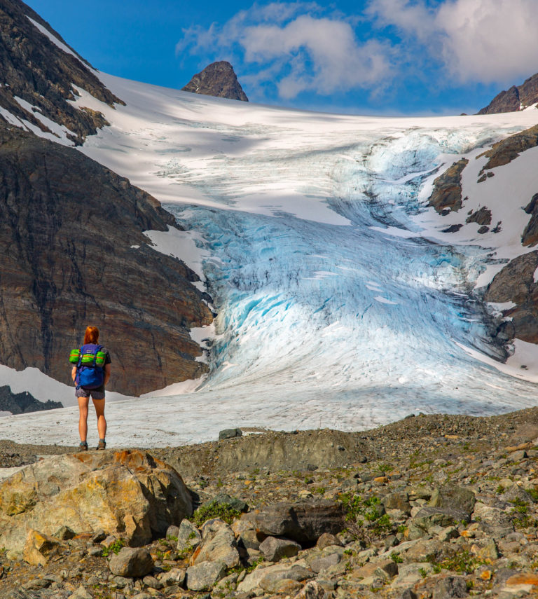
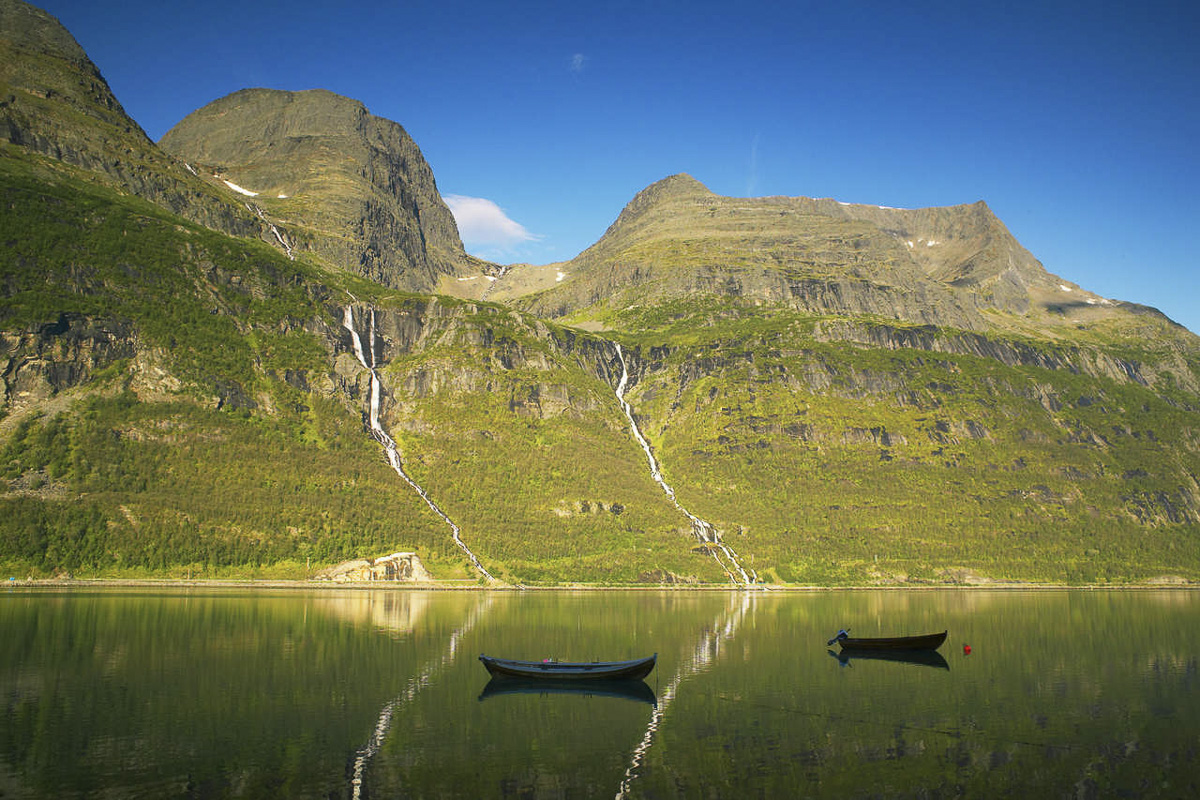
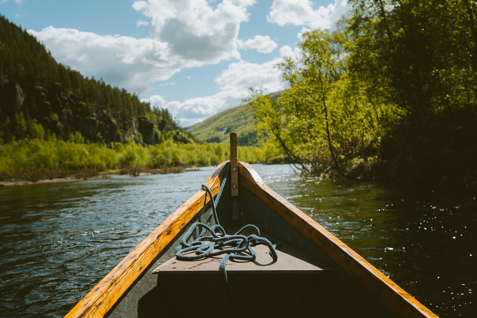
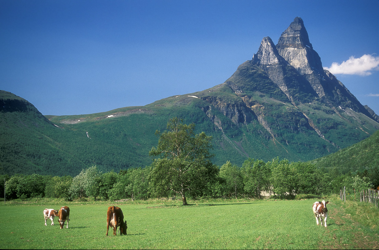
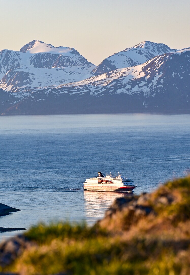
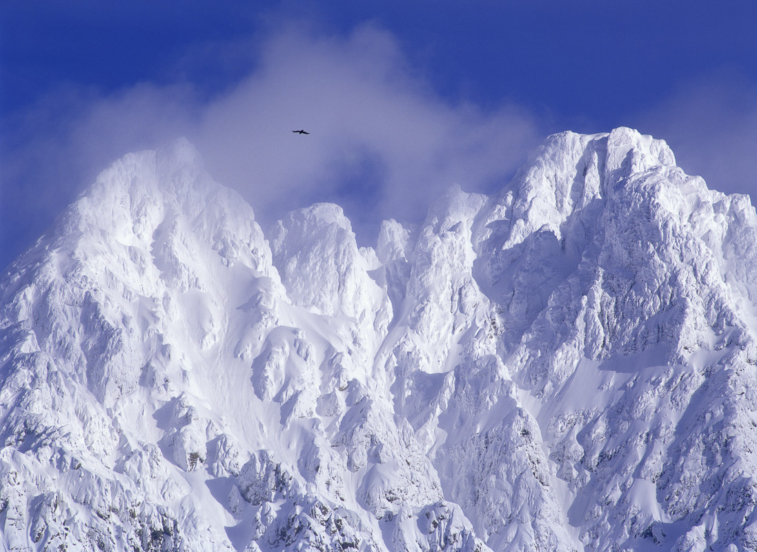
The Lyngen Alps are the spine of the Lyngenfjord area, found on the Lyngen Peninsula. They rise up to 1833 metres directly from the fjord. This landscape of towering peaks, glaciers, impenetrable scree and gushing rivers looks impressive from the fjord ferries and view points along on the opposite fjord banks. In summer, mountain hikers penetrate deep into this secret world, and in winter, ski enthusiasts criss-cross the peninsula. Yet most of the area hardly sees any humans at all.
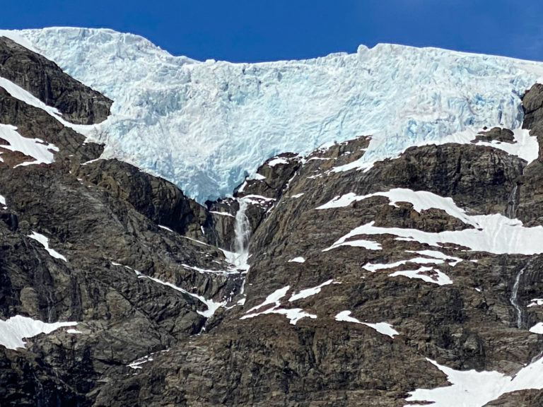
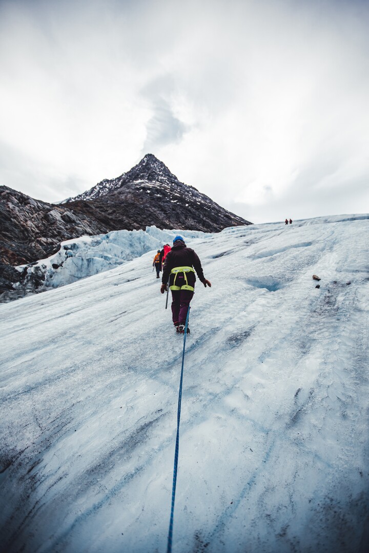
The Lyngen Alps are dotted with glaciers
A great number of small glaciers are found in deep ravines between the peaks of the Lyngen Alps. In late summer, they look like balconies between the peaks from afar. However, one can walk up to several of them without too much hassle. Glacier hiking should only be done with a guide, a fun activity done in Summer and Autumn.

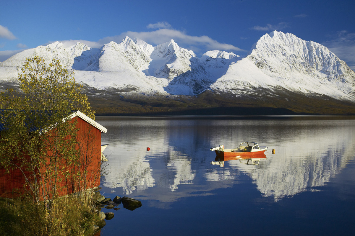
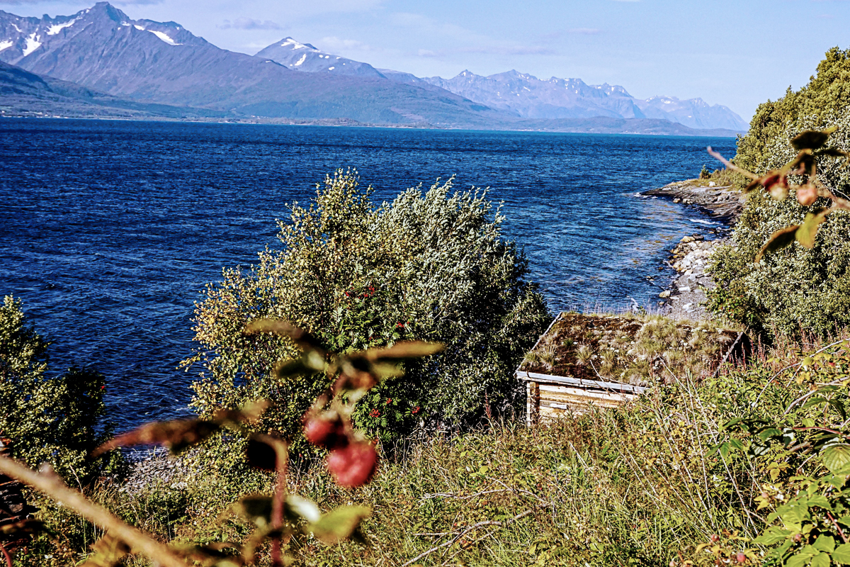
Lyngenfjord is the land of the big fjords
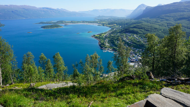
The Lyngenfjord, Sami Ivgovuotna and Kven Ykeänvouno, goes 120 km from the open sea straight south, splitting into two fjords midway, the Kåfjord going south east, and the Storfjord southwest. As fjords go, it’s rather wide. The landscape around the Reisafjord, further east, is less mountainous and give a taste of the forest and high plateau landscape that is found. The western entrance to the Lyngenfjord area goes across the Ullsfjord, from where you see the peaks of the Lyngen Alps rise dramatically.
The big islands meet the Atlantic
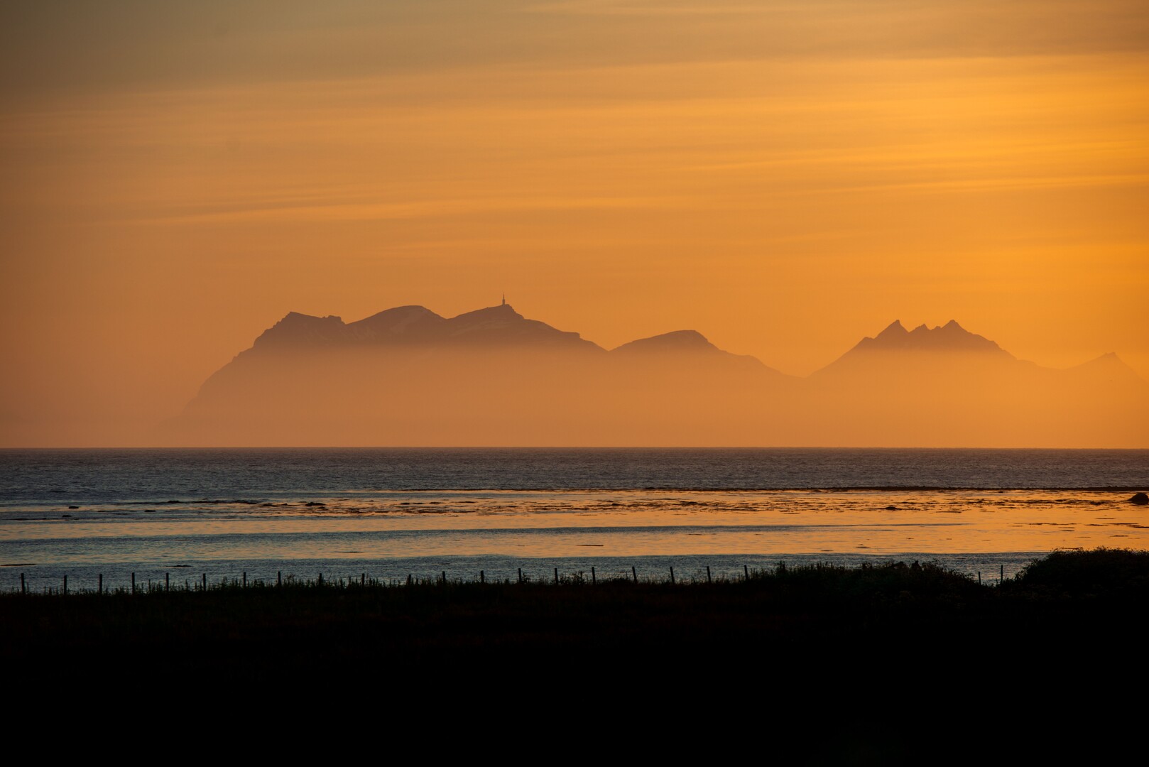
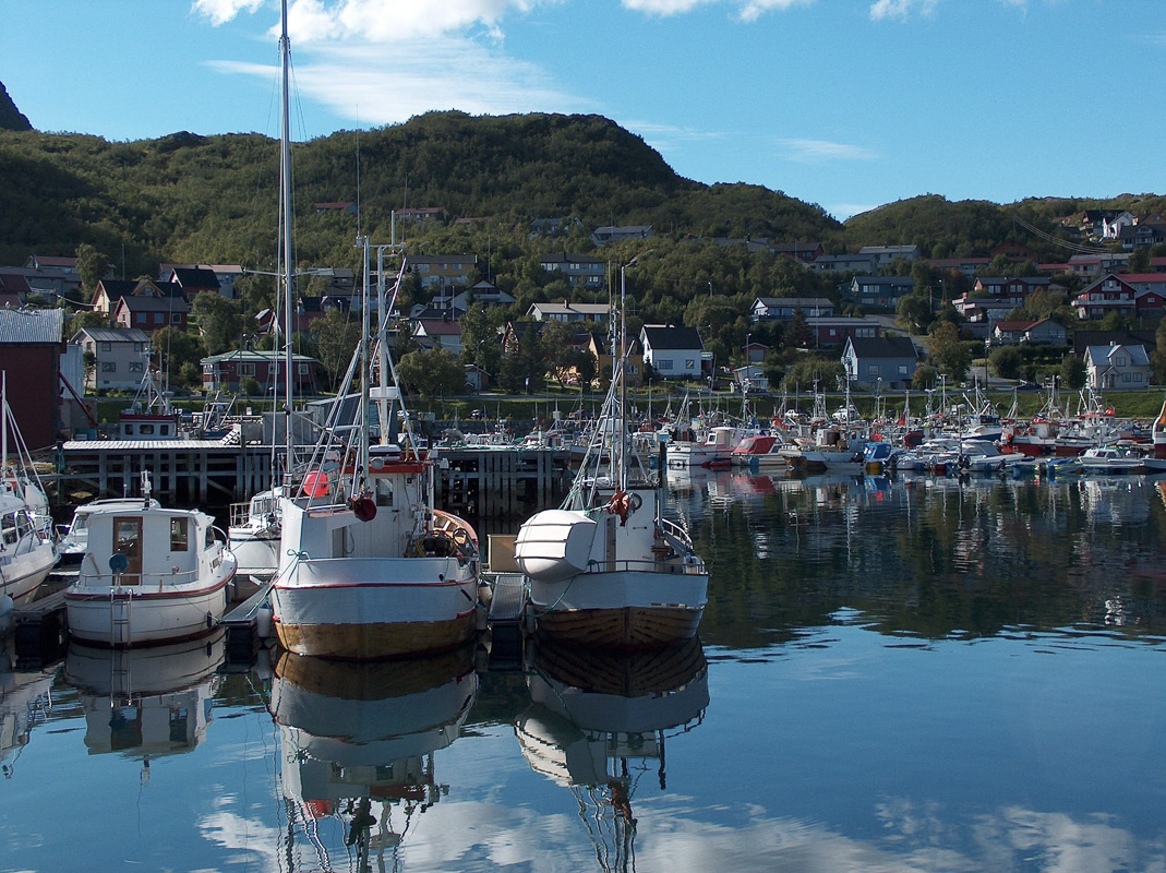
An archipelago of big, mountainous islands lies north of the fjords. Here little fishing villages are found under steep mountains. The old trading post of Havnnes survived WWII by a miracle, and sits on the fjord with fabulous views to the Lyngen Alps. The centre of the islands is the little town of Skjervøy, where fish boats float in the sheltered little port. Few people make it out to the mountain island of Arnøya, where small hamlets face the fury of the open Atlantic.

The deep forests are the hidden secret
A very different Lyngenfjord is found inland. Here large tracts of silent pine forests are found, high and impressive in the river valleys, crooked and tweeked in the hillsides. The river valleys cut deep into the mountains, and inland they give way to the vast plains in the east, with rounded hills, lakes, bogs, few people and many reindeer.
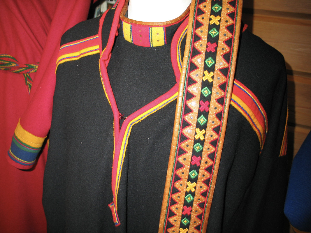
The Sami culture is the oldest culture present along the Fjords
The oldest culture of the area that is still present, is the Sami culture. It emerges out of the darkness of history some 2000 years ago. Back then, the Sami had a nomadic lifestyle, following the migration of the wild reindeer. Along the way, they hunted for seals, birds and smaller game and fished in the fjords and lakes.

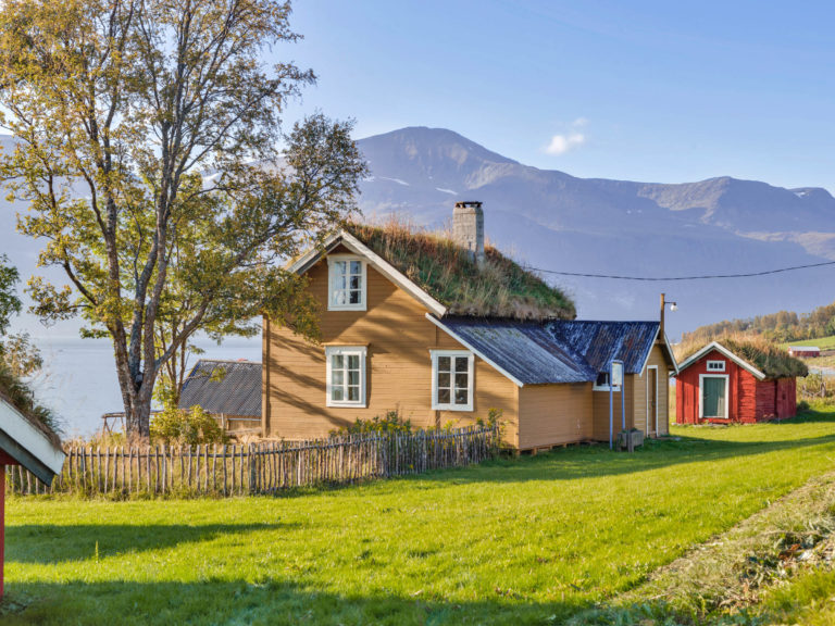
The Sea Sami culture is found along the fjords
In the 17th and 18th C., most Sami settled along the fjords, took up cattle raising and a bit of agriculture and combined it with fishing. This lifestyle is what we call the Sea Sami culture. Traditionally, they lived in turf huts, but from the 19th c. onwards they started to build Norwegian-style timber houses. The prestige of the Norwegian language and the outspoken assimilation policies of the authorities lead people to adopt the Norwegian language. Today, this process is about to be reversed, with increased interest for the Lyngenfjord dialect of the Northern Sami language, of old handicraft techniques, traditional music and the traditional costumes. For a glance into traditional Sea Sami life, stop at the Holmenes Sea Sami Farm in Kåfjord.
Lyngenfjord is the summer area for the Kautokeino reindeer
Every summer, the reindeer migrate from the Finnmark plain northwest to the summer grazing along the Lyngen Fjord. Families from the Sami parish of Kautokeino have long-established rights to use the are for their reindeer, and are an integral part of the cultural fabric of the Lyngenfjord area. It is thus no surprise to meet reindeer on the road, on a mountain hike or when tanning on the beach in summer.
Norwegians settled on the outer coast
In the 14th c., Norwegians settled along the outer coasts of the Lyngenfjord area. They fished, dried the fish and sent it down to Bergen for exports. They were thus part of an international trade network. Since Norwegian later got to be the language of prestige and education, it has spread all along the Lyngenfjord area, and is today the everyday language of almost everyone. In the latter part of the 19th c and the first half of the 20th c, the Norwegian authorities lead an
The Kven culture was established in the 18th c.
There were always trade connections criss-crossing Northern Scandinavia. In the 18th C, the area experienced an immigration wave from Finland and the Finnish-speaking parts of Northern Sweden, who were traditionally called Kven. They brought a farming culture with them, and cleared new farms in the inner valley and the inner fjords, where the climate and nature looked the most like Finland. The Northern Finnish dialects, influenced by Norwegian and cut off from contact with modernising Finland, evolved into the distinct, but mutually intelligible Kven language. Today, this language is spoken by the older generation only, although it experiences increased interest, and is taught in some schools in the area.
The Lyngen Line was supposed to stop the Russians
The Lyngenfjord was a hotspot at the end of the second world war. As the Red Army moved into Nazi-occupied Finnmark and Finland joined forces with them, Hitler ordered a new frontline through the Lyngenfjord area. “The Lyngen Line” was established with strongholds between the Lyngenfjord and the Finnish border, using Soviet POWs. These suffered horrendously, building in the middle of winter in the mountains with little food and clothing. The areas north and east were burned and the population forcibly evacuated. You can see the fortifications if you follow the Lavka trail, and the Spåkenes fort is a gigantic, crumbling concrete ruin at the mouth of the Lyngen Fjord.
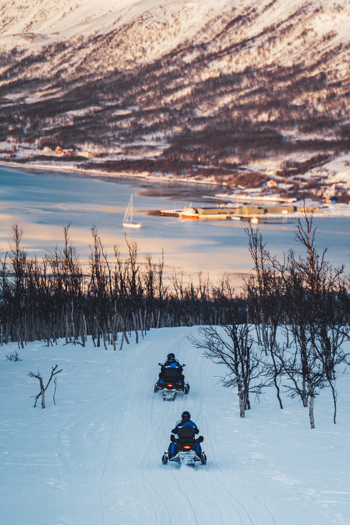
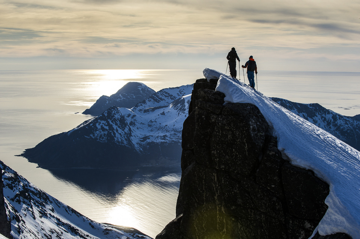
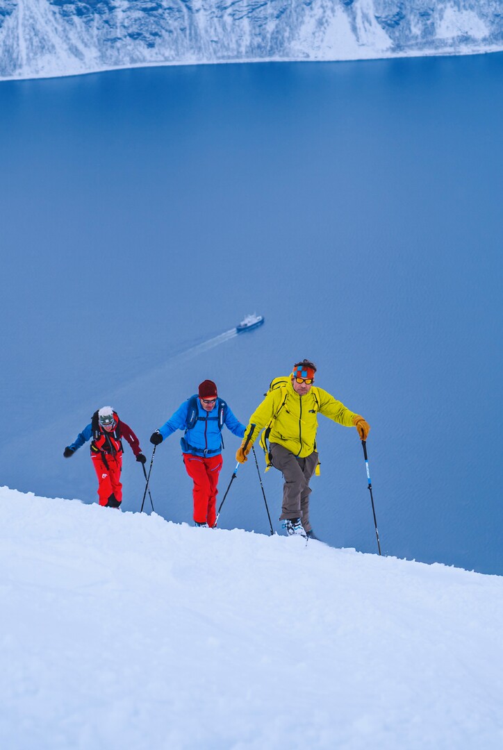
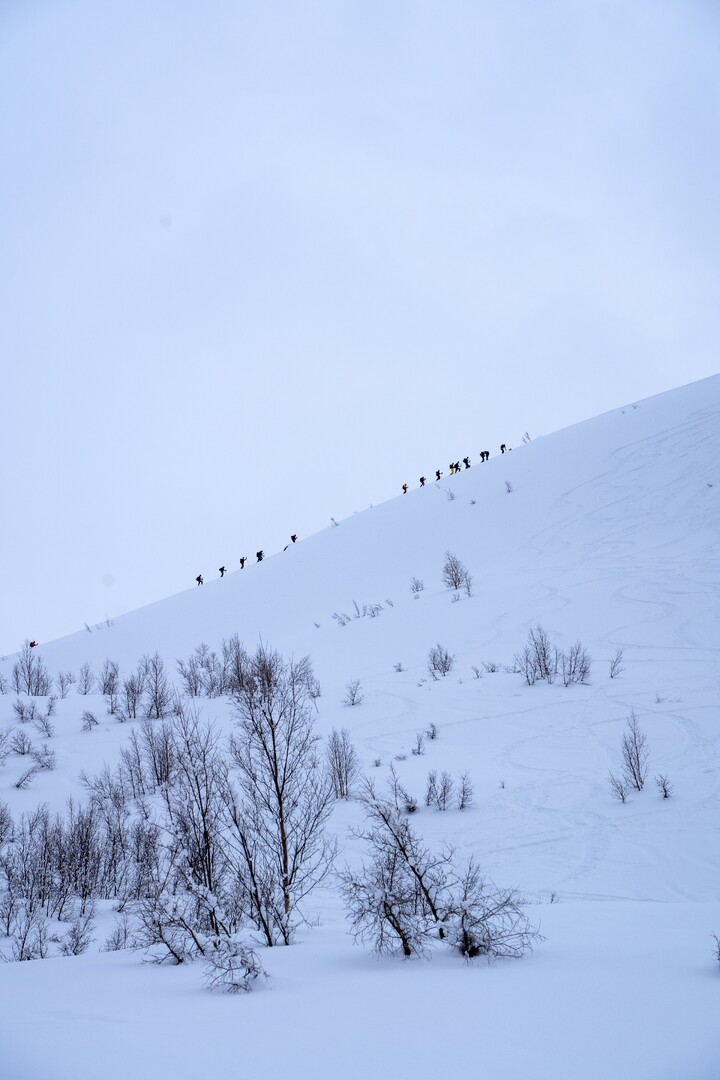
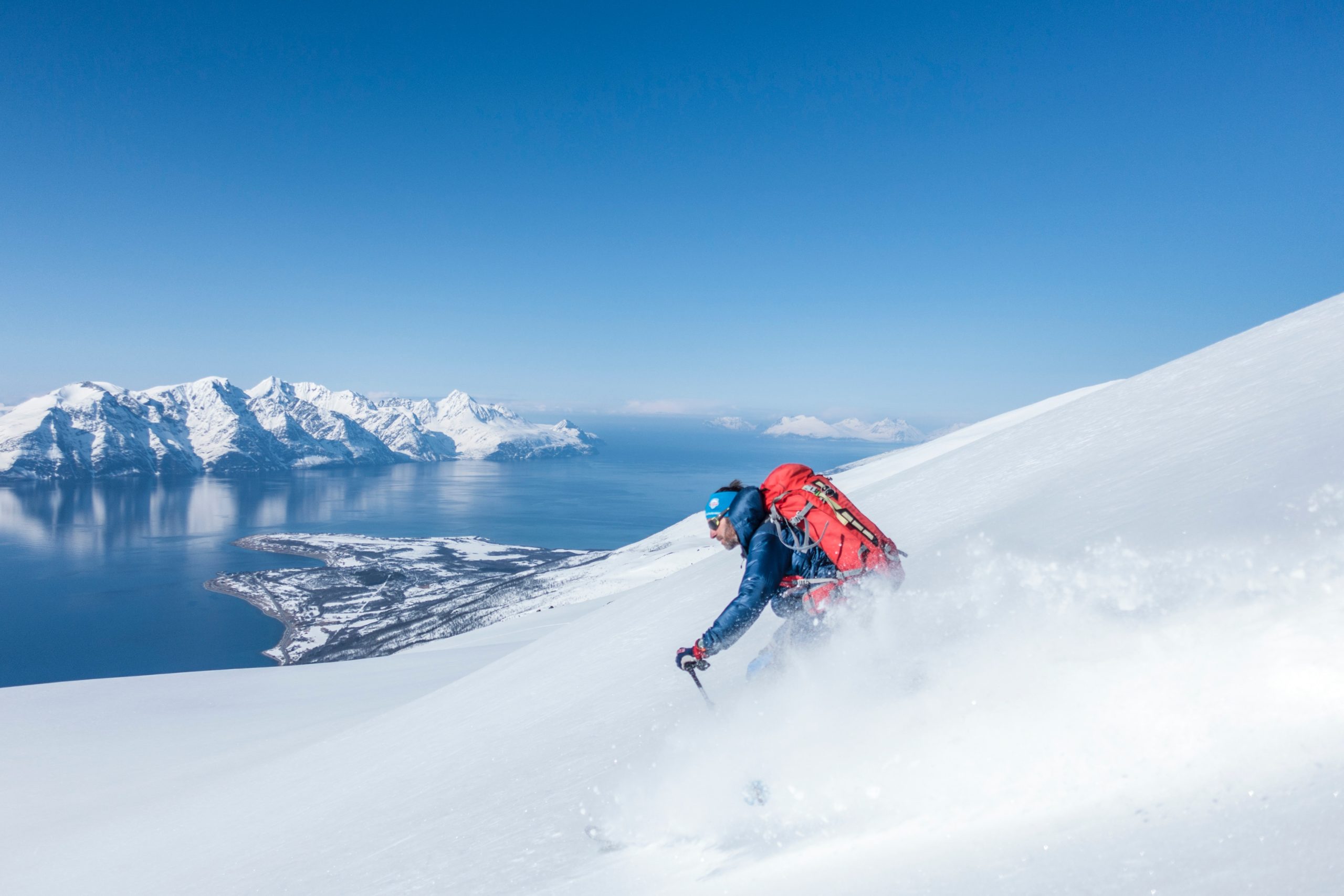
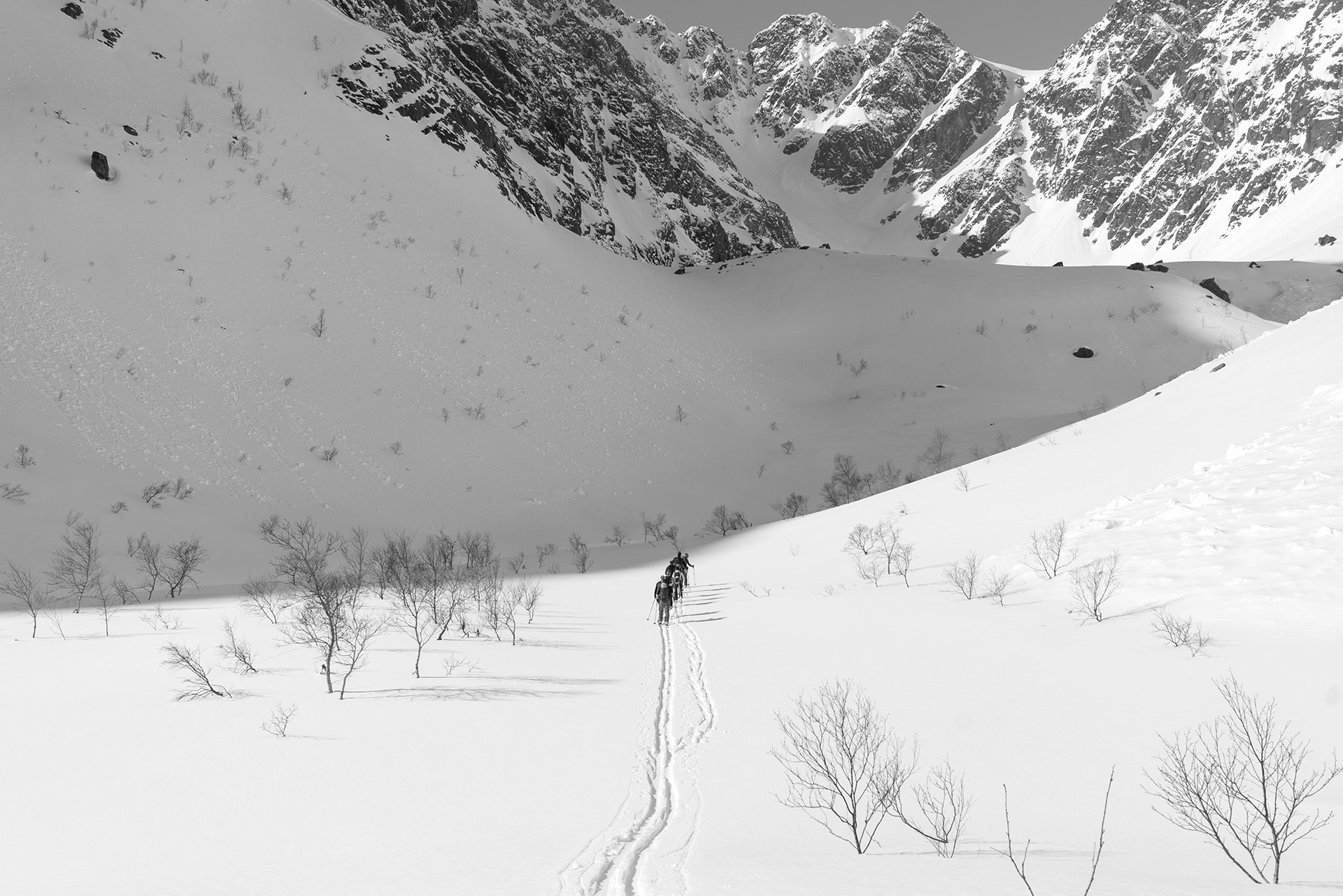
Skiing in the Lyngen Alps means no ski lift
Imagine spending all day going up the mountains on skis, and then spending some 15-20 minutes driving down. This is Randonnée skiing, and sometimes in the 80ies and 90ies, the Lyngen Alps got discovered by the ski élite. The playground was soon extended from the Lyngen Alps themselves to the somewhat easier mountains on the other side as well as on the steep climbs on the big islands in the north. Today, March, April and well into May is all about skiing in the Lyngenfjord area, and the sport is cultivated by locals and travellers alike.

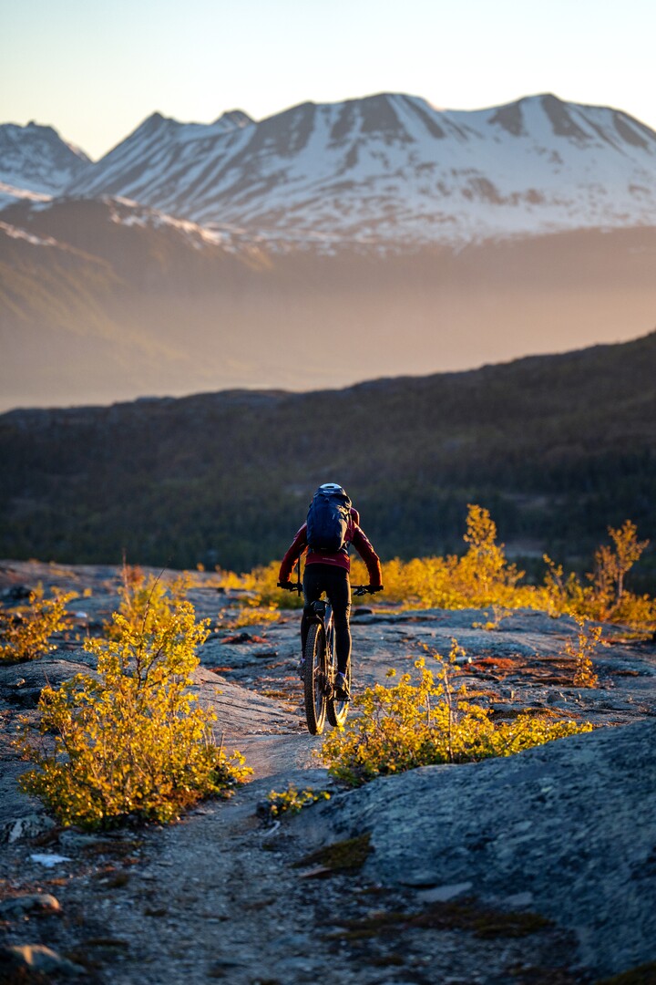
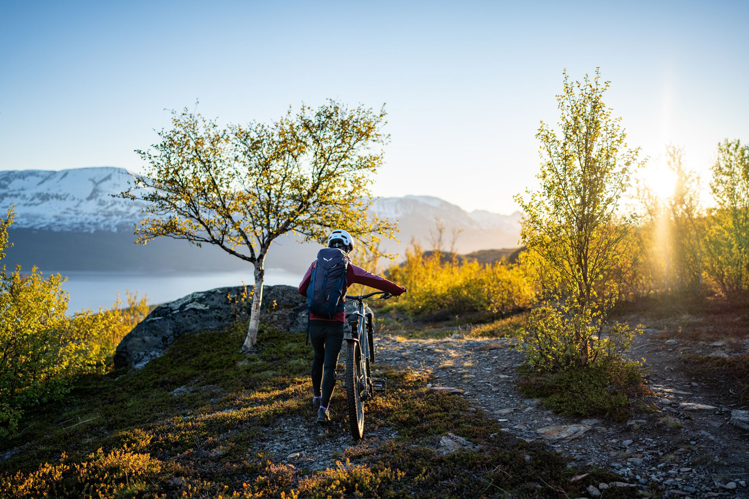
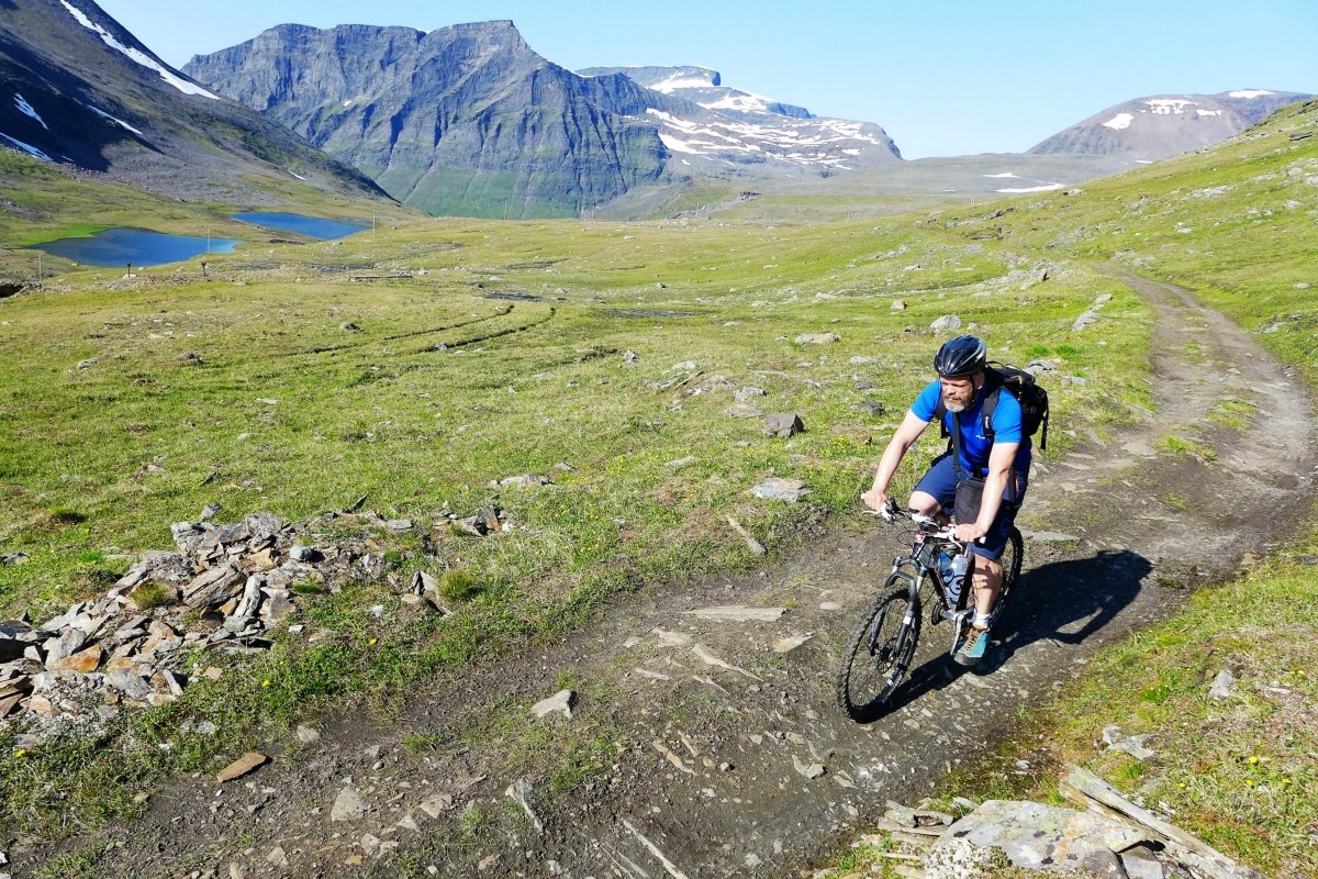
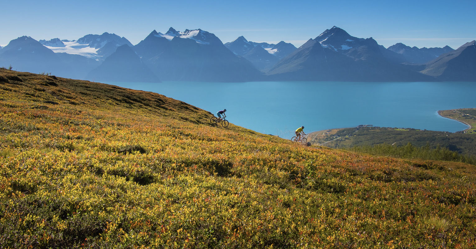
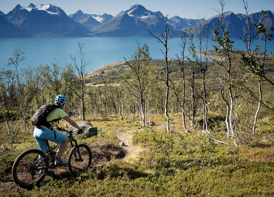
Lyngen has exhilarating bike trails
The summer equivalent is mountain biking. Lyngenfjord has it all; a dry, sunny climate, a network of paths and lovely views everywhere. Many of the paths are for well-seasoned mountain bikers, and you can run all the way from way above the treeline to the fjord. However, the Lavka Trail, where the annual Lavka Race takes place, runs 68 km and goes 800 metres up, and is doable for any skill level, as long as you have some stamina.
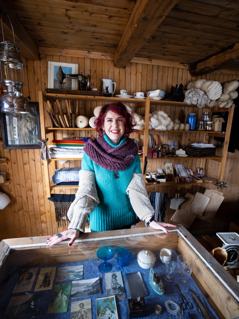
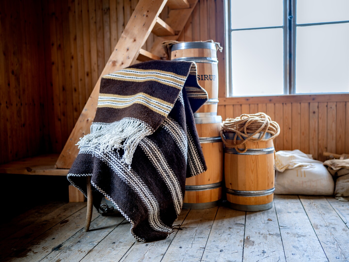
Manndalen is the handicraft village
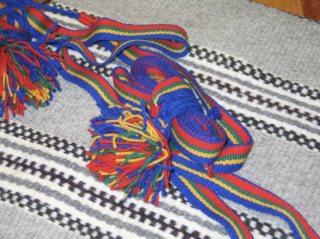
In the village of Olmmaivaggi, Norwegian Manndalen, the Sami language was the everyday language up to the 1960ies. Women in this village traditionally did handicraft to have some extra income. The rátnu, the old type of loom, goes thousands of years back all over Europe, but has survived in Manndalen only. Knitting with home-spun wool is another speciality, and the colourful patterns look streetsmart in the most fashion-conscious big city circles in winter. The little handicraft store, Grenebua, in Manndalen is a treasure trove for age-old handicraft skills.
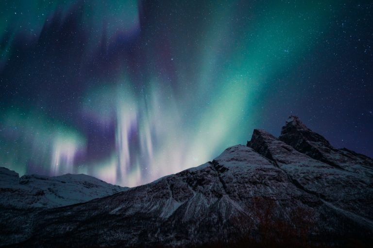
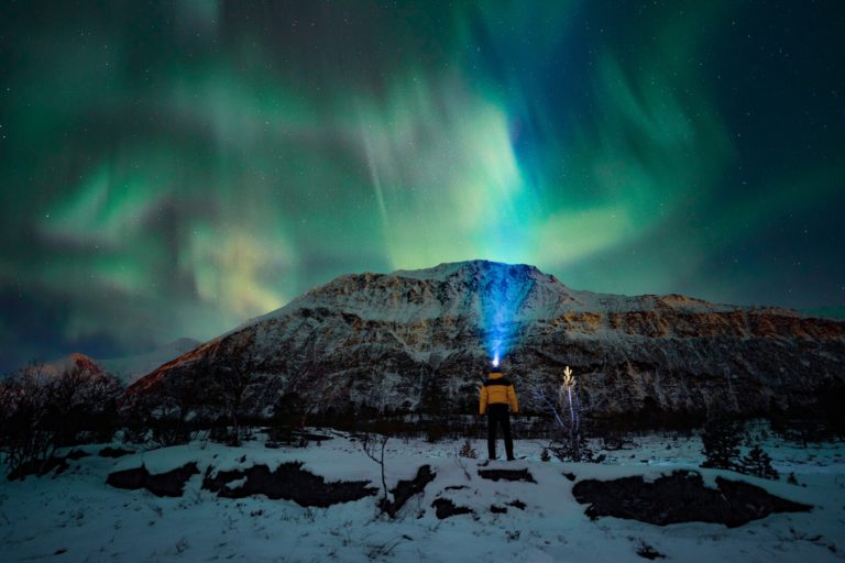
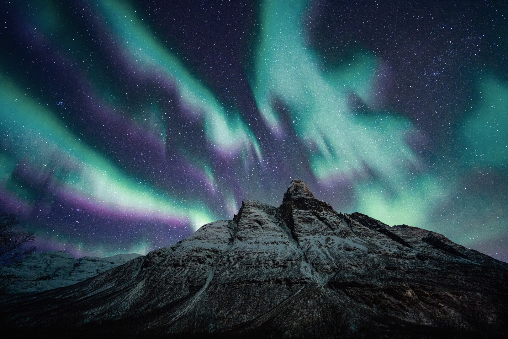
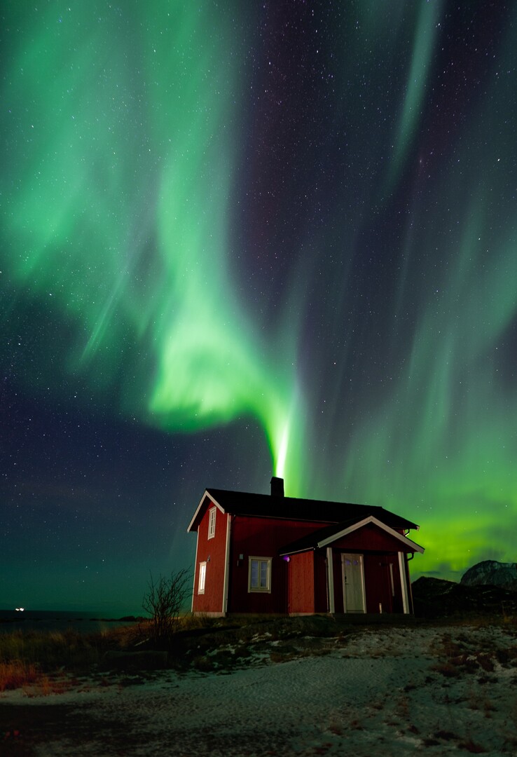
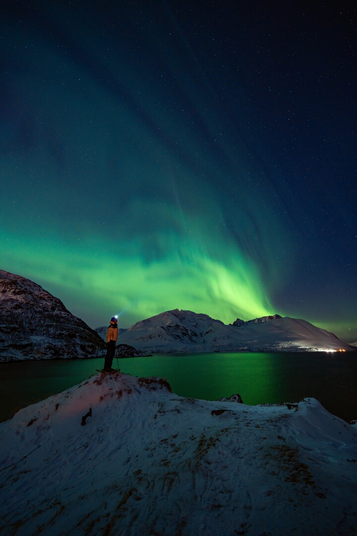
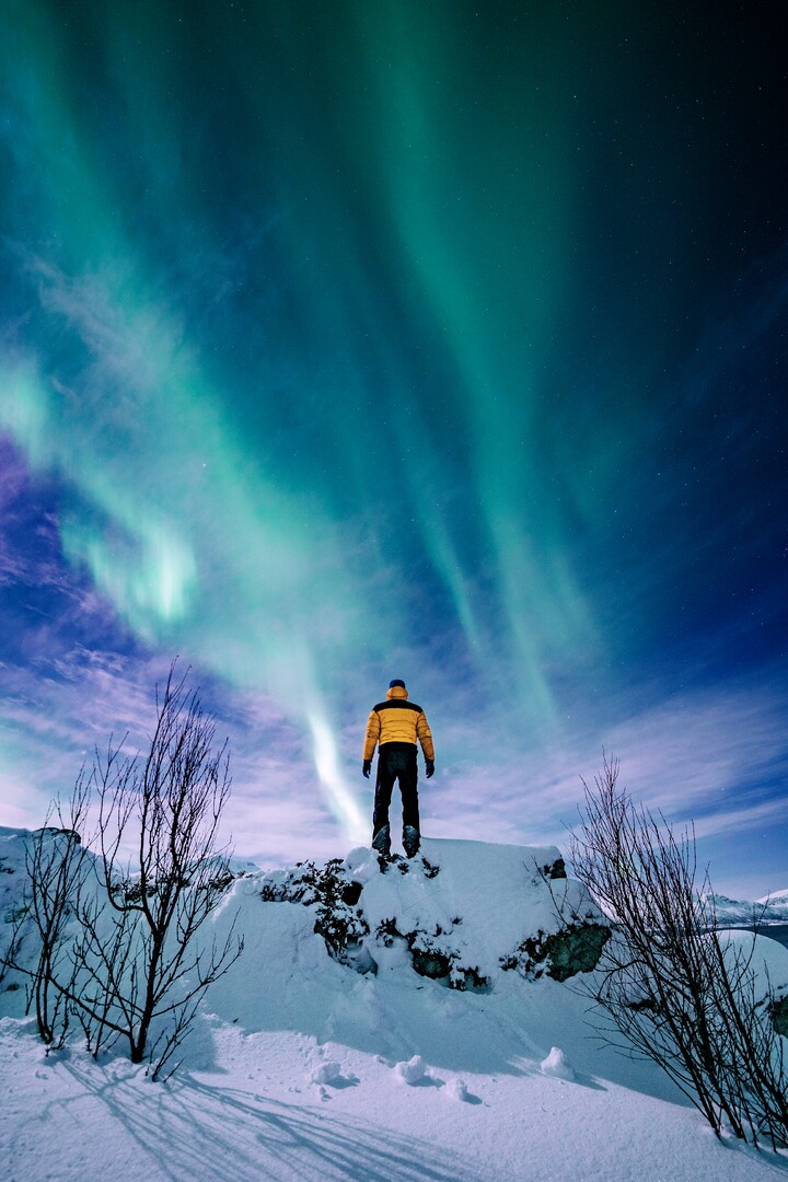
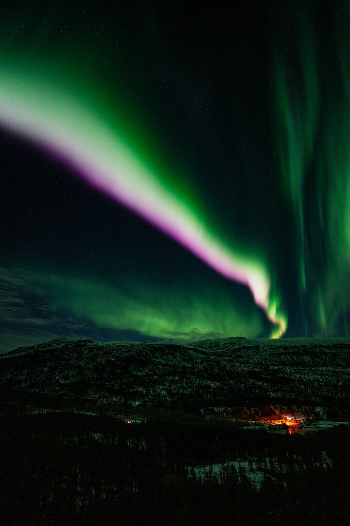
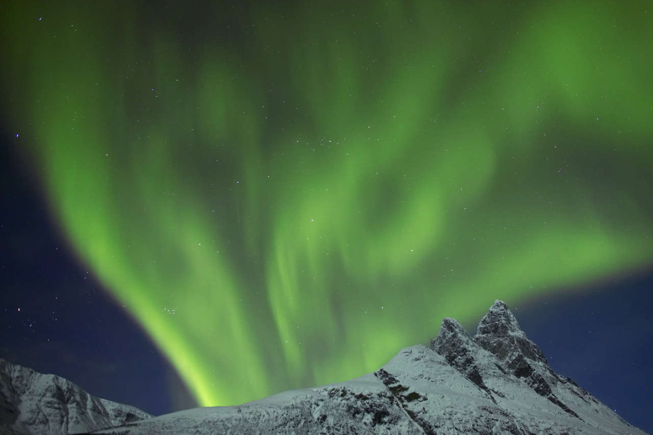
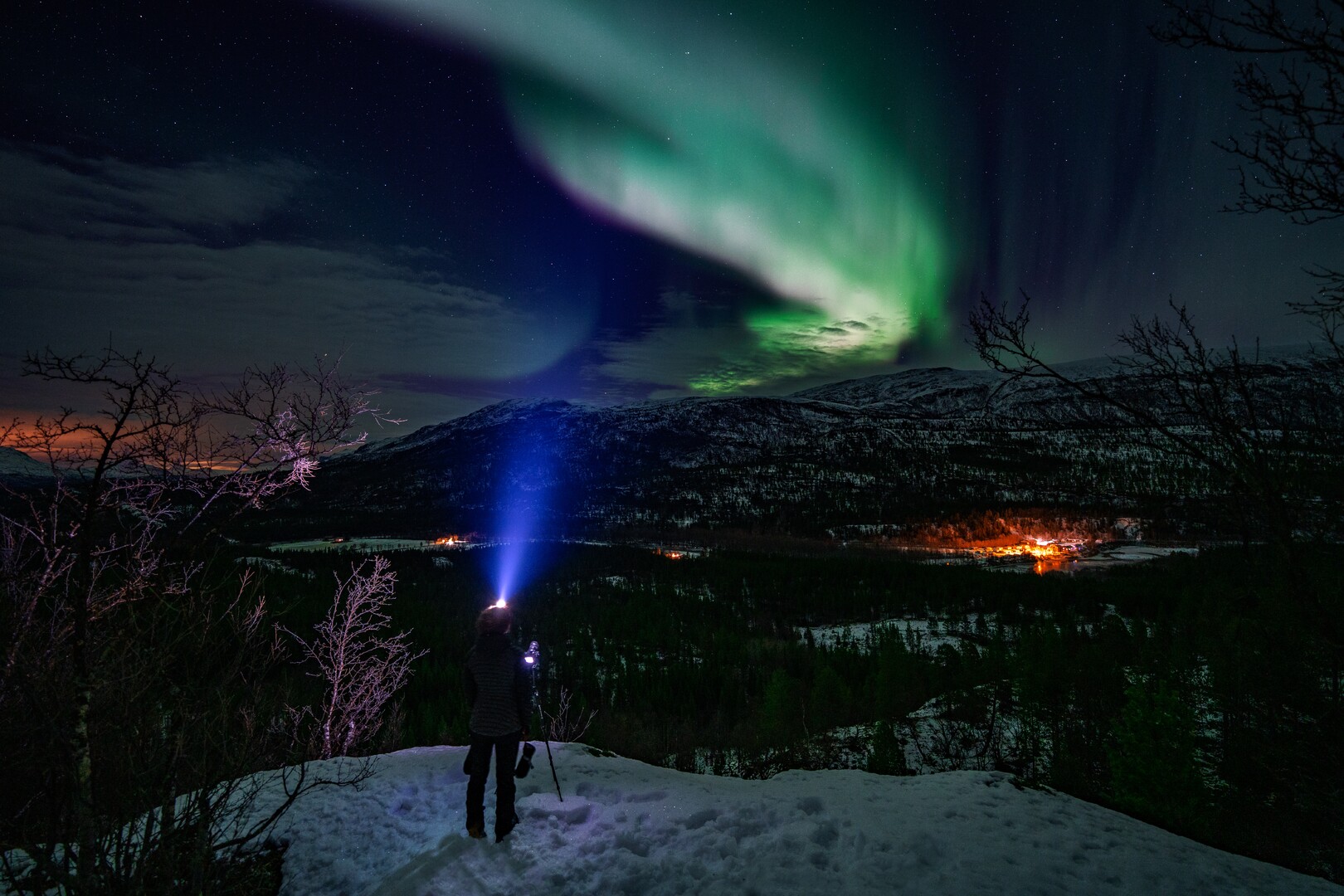
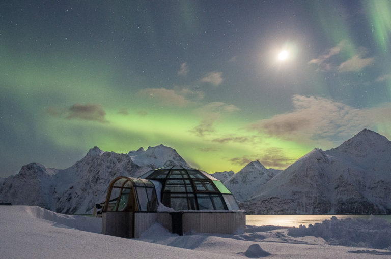
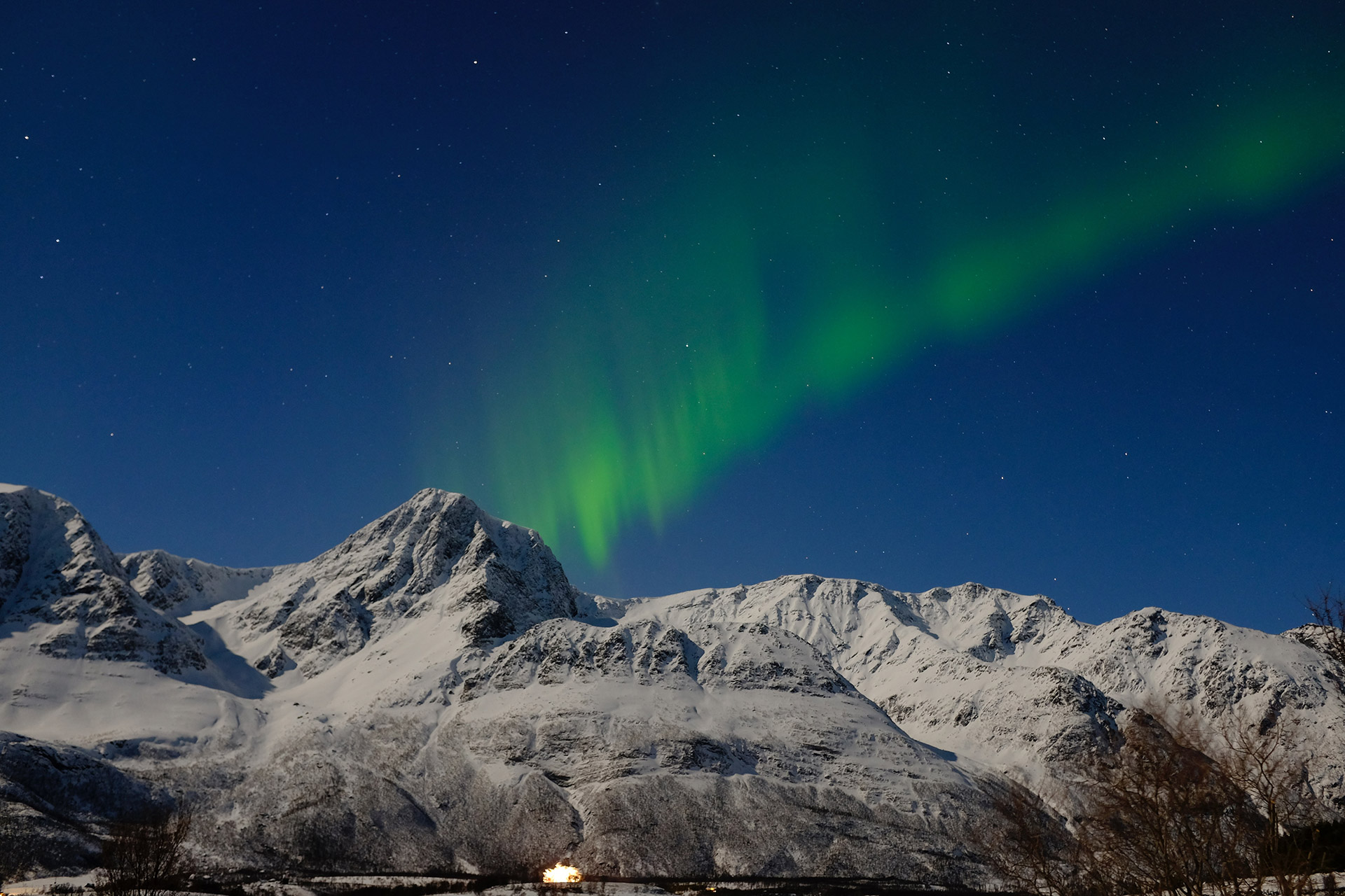
Lyngenfjorden has excellent weather to watch the Northern Lights
Lyngenfjord is directly under the Northern Lights oval, and no place on earth can you see more of this phenomenon that here. The climate is also very suited for Northern Lights watching; some pockets in the inner parts have so little precipitation that they border on desert climate. They are among the absolute driest places in Scandinavia. However, sometimes, when the cold draft from the east freezes in, clouds gather around the border mountains. Then the islands and the fjord mouths are the places to be. Studying the topography and varied microclimates around Lyngenfjord is the key to maximising your chances of spotting the Northern Lights, along with being mobile. Many guests hire a car and stay in a cabin in the area, exploring the beautiful landscape at daytime and watching out for the lights at night.
Lyngenfjord has Midnight Sun for more than two months
Some 350 km north of the Arctic Circle, the Lyngenfjord area enjoys the Midnight Sun for a good two months. At Signaldalen, a valley in the far south of the area, the period is from the 20th of May to the 23rd of July. The small fishing village of Årviksand, in the far north, actually sees the sun from the 16th of May to the 27th of July. Now, however, the Lyngenfjord topography demands a bit of planning. If you are south of a 1500 alpine mountain, you’re definitely in the shadows. Ask the locals where the best places are nearby, be it on a fjord promontory or the nearest mountain top. If you go to the sandspit of Spåkenes or to Lyngstuva, the northern end of the Lyngen Peninsula, you have free, unobstructed views toward the north, only the cliff island of Nord-Fugløy punctuate the horizon.

Jan Baalsrud fled the Nazis through Lyngenfjord
The story of Jan Baalsrud is a fascinating WWII drama. A group of saboteurs from the Norwegian forces in exile in the UK approached German-occupied Norway north of Tromsø. Their vessel was sunk and all onboard shot or captured. Except Jan Baalsrud. With the help of locals, he made it from the outer coast into the Lyngen Alps, across the Lyngenfjord and into Sweden. On the way, he had to cut off toes because of gangrene. This drama has been filmed twice, base on the book “We die alone”. You can follow the tracks of Jan Baalsfrud across the area.
Finland’s highest mountain is reached from Lyngenfjord
Halti at 1323 metres is Finlands highest mountain. However, to get there it is better to pass through Norway. Drive up the Kåfjord Valley on an ok dirt track, park at the end of the road, hike for some 2-3 hours uphill on a well-marked trail to the Norwegian mountain of Ráisduottarháldi at 1361 metres. From here you actually walk downhill slightly to Haltiatunturi (Halde in Sami), which is Finland’s highest point, on the actual border.
The area around
Lyngstuva Point
Blåisvatnet – u0022The Blue Lakeu0022
Lyngseidet
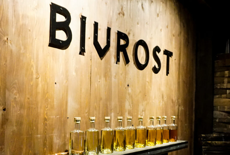
Aurora Spirits
Steindalsbreen glacier
Skibotn
Manndalen
Gorsabrua
Spåkenes
Storslett
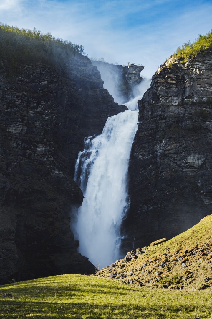
Mollisfossen Waterfall
Skjervøy
The three-country cairn is Sweden’s northermost point
Another iconic hike goes to the Three County Cairn (Norwegian Treriksrøysa, Swedish Treriksröset, Finnish Kolmen valtakunnan rajapyykki and Northern Sami Golmma riikka urna). This is Sweden’s northernmost point, and the westernmost point of mainland Finland. The point itself is a concrete lump placed in the middle of the little lake Golddajávri, The easiest way to get here is to take a boat from Kilpisjärvi in Finland and hike 3 km. An 11 km hike through the Malla nature reserve is another option. The point involves a long hike from the Swedish side, but from the Goulas cabin on the Norwegian side it’s only a short hike.
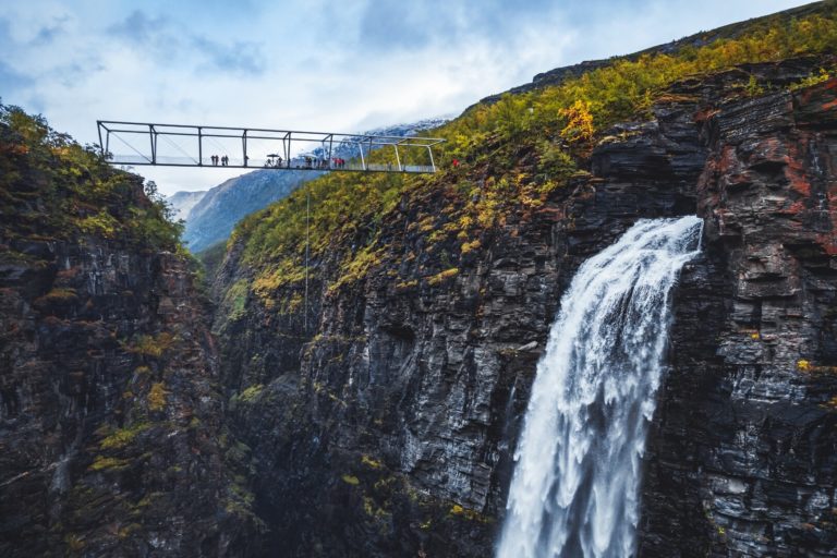
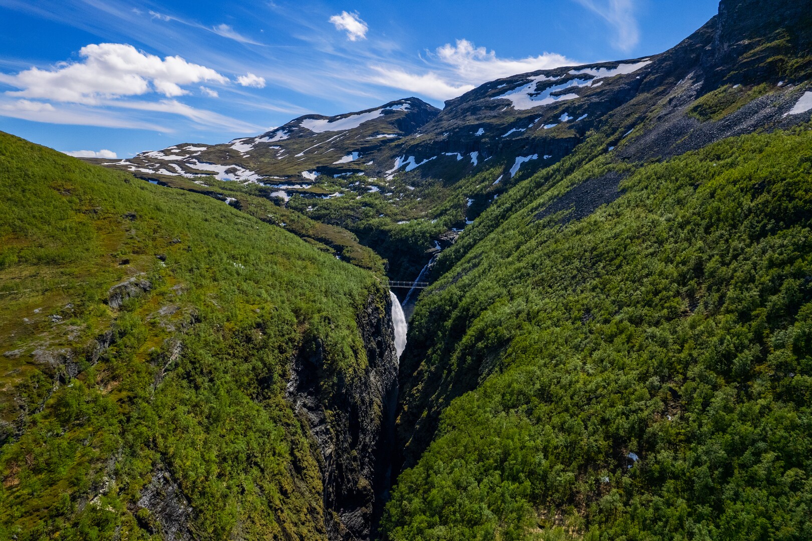
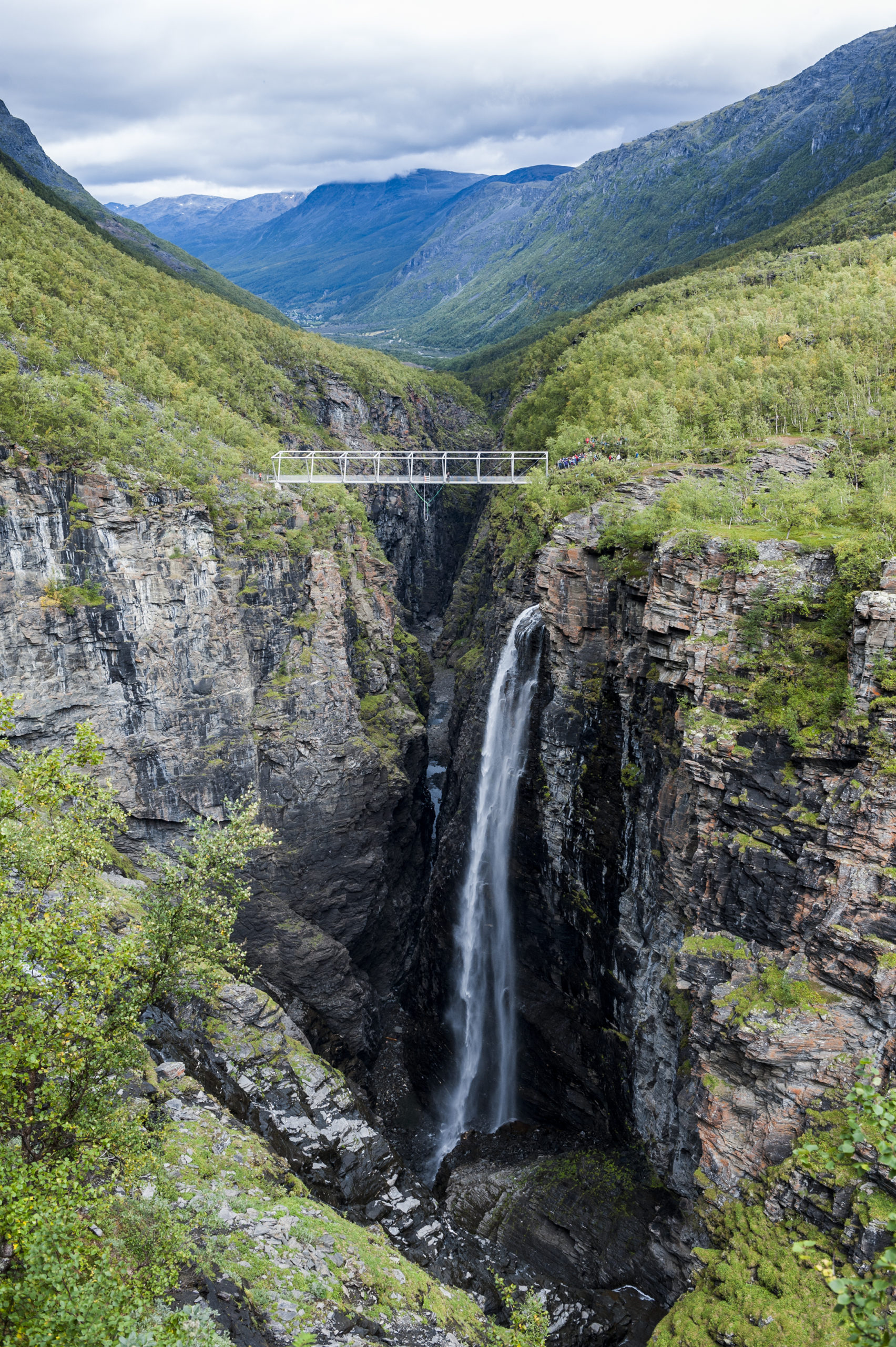
Walk the Gorsa Bridge over the Sabetjohk canyon, or plunge into it
The Kåfjorddalen Valley is dry and sunny in summer, perfect for a relatively easy hike to the Sabetjohk canyon, one of the deepest in Scandinavia. Here an architecturally designed steel bridge takes you across the canyon over the Gorsa Waterfall. The brave might want to try bungee

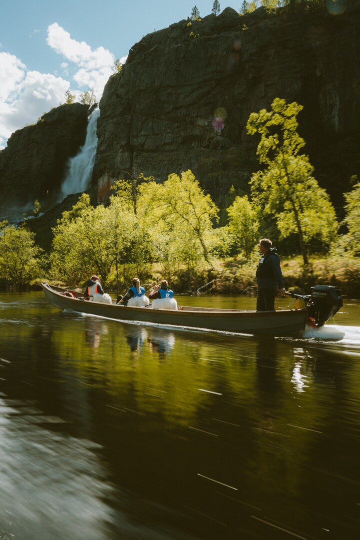
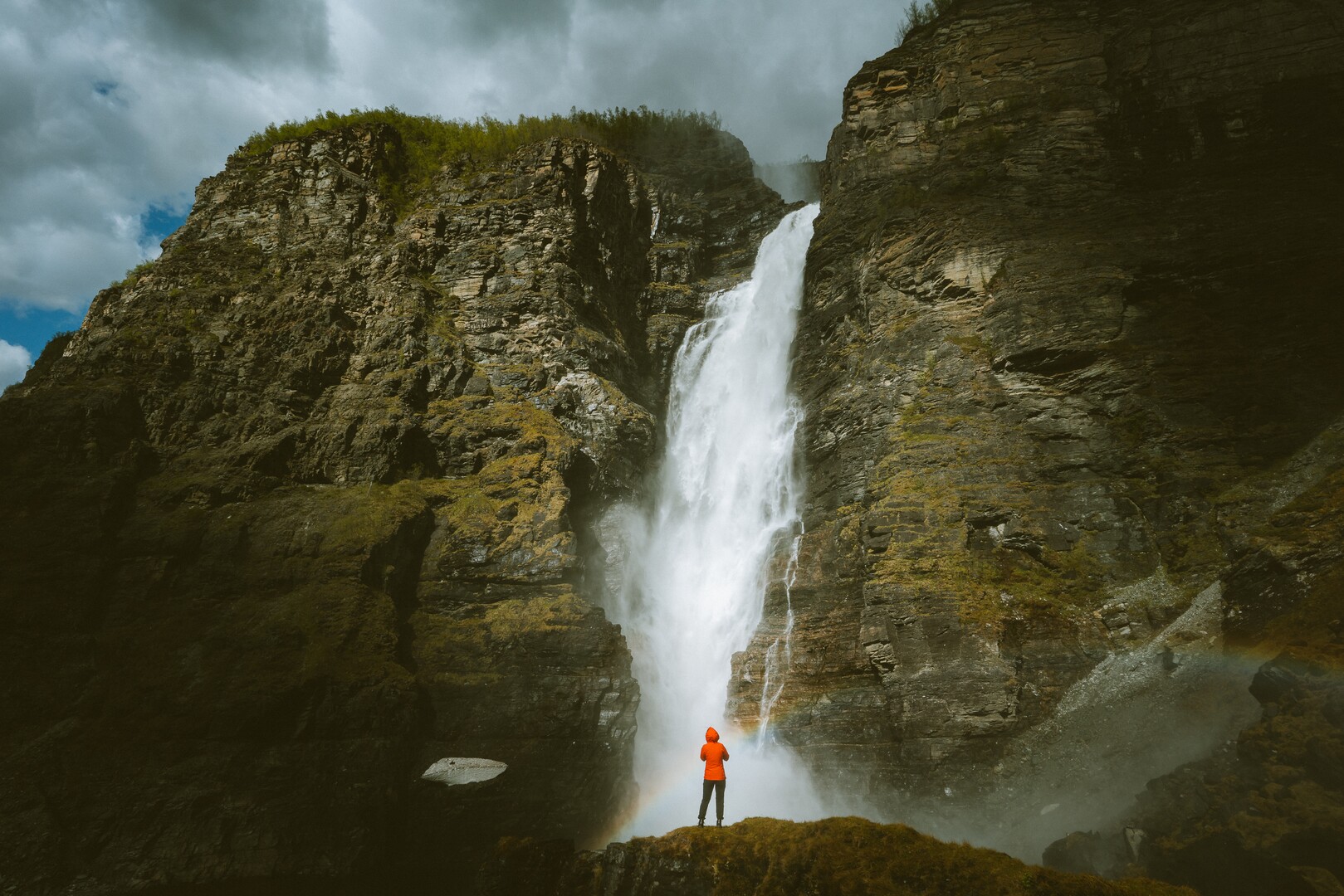
Mollisfossen Waterfall is reached by riverboat only
On its way from the Finnmark Plateau, the Mollešjohka river takes a sudden deep dive into the Reisa Valley by falling 269 metres before it joins the Reisa River. This you see clearly from the riverboat on the Reisa River, and you can walk two-three minutes to the waterfall, feel thousands of tiny droplets towards your face and see the rainbow created by the mist. To get there, go by a slender riverboat from the upper most settlements in the Reisa Valley.
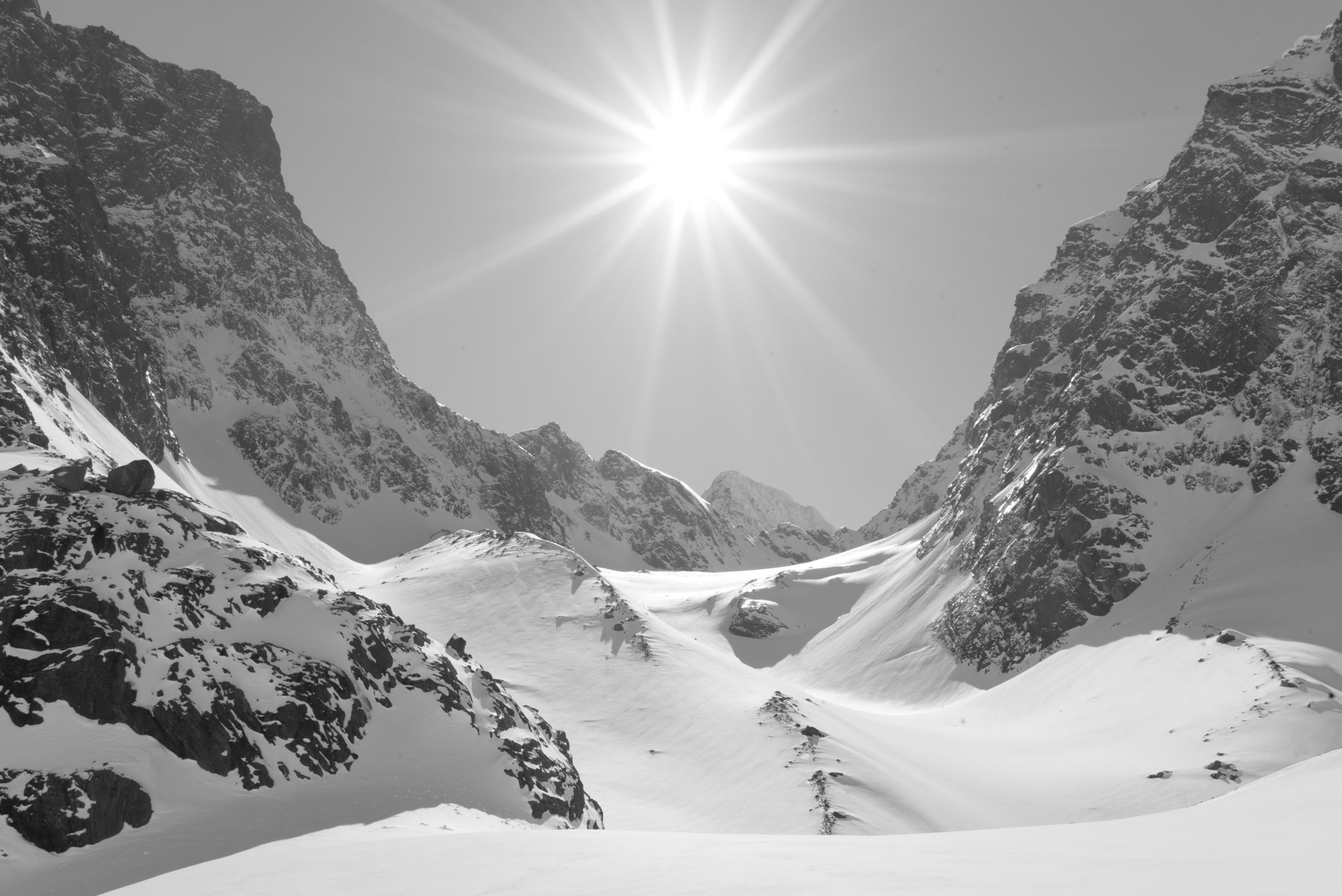
The blue lake is a hidden secret between the peaks
Blåisvatnet (“The Blue Lake”), or Blåisvatnet, is a lake between some of the highest peaks of the Lyngen Alps. The lake being rather low, receives melting water gushing down from the surrounding glaciers. This is filled with rock flour, making the water milky. The light reflections make the water look deep blue, which is also enhanced by the extreme depth of the lake. The walk here takes a couple of hours, and can be tiresome because of the rocky terrain. It is, however, not much of an ascent.

Small treasures of history dot the magnificent landscape
One comes to Lyngenfjord for the majestic landscape, for the northern lights, the fun skiing and cycling. However, the careful observer also stops at the small museums and historic points. The church of Skjervøy from 1721 and the one in Lyngen from about 1785 are modest buildings with charming interiors. The old trading post of Havnnes survived the war by sheer luck, and the old houses enjoy a magnificent setting between fjords and peaks. Tørfos Kven farm is a memory of 18th c. Kven settlement. In Skibotn, the old houses remind of the Skibotn market, where traders from three countries gathered for centuries. The Holmenes Sami Farm shows the Sea Sami lifestyle from the 19th c. “Skithælveteskåken” (“the @%& shack”) tells a tragi-comical story from the post-war reconstruction era.
Practical about Lyngenfjord
Lyngenfjord is a big fjord system east of Tromsø, at around 70 degrees north. It consists of the municipalities Lyngen, Storfjord, Kåfjord, Skjervøy and Nordreisa. Skjervøy and Storslett are small towns in the area, and Lyngseidet, Olderdalen, Skibotn and Hatteng are larger villages.
There is an airport in Sørkjosen (SOJ), near Storslett. This is frequented by the smaller propeller planes of the Widerøe Airline. The nearest larger airport is found in Tromsø (TOS). From here, buses go to various locations in the Lyngenfjord area. Some people also use the Alta Airport (ALF), this is particularly true for travellers to Nordreisa/Storslett. Hurtigruten, the legendary shipping line, calls at Skjervøy. The outer coastal areas, most notably Skjervøy, also have a catamaran connection with Tromsø. For the best tips, consult the Visit Lyngenfjord website.
Lyngenfjord has small hotels, small resorts, campsites and simpler accommodation. Visit Lyngenfjord lists it all at their complehensive website.
That all depends on your tastes. The fabulous Midnight Sun period is good for hiking and sightseeing in a wonderful landscape. In the Autumn, the Autumn colours invite to lovely hikes, and the Northern Lights are back with a bang from around mid-September (can be spotted from mid-August). The months around Mid-Winter are prime Northern Lights season, in combination with excursion in the snow. The bright end of Winter is perfect for both sightseeing, skiing and other outdoor activities.

Visit Lyngenfjord
For culture and activities around the Lyngenfjord area, go no further than Visit Lyngenfjord