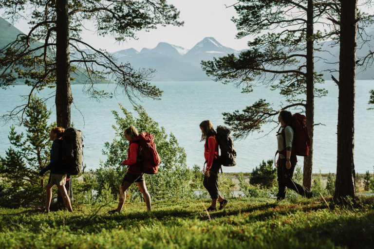
Norway’s second island is a mikro-continent, with endless landscape variations. Wild and utamed as it can be, Senja is also easy to explore on foot. Here we have a selection of hikes in the easy to medium plus category, suited for daytrips across this fairytale island.
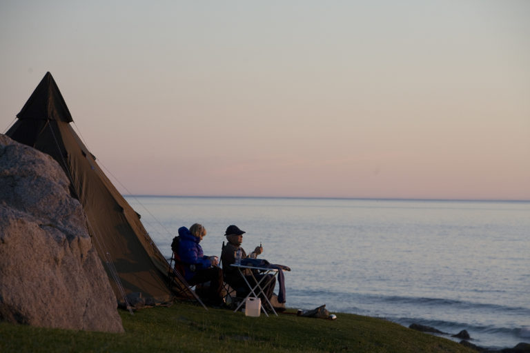
Hamn i Senja is old industrial history
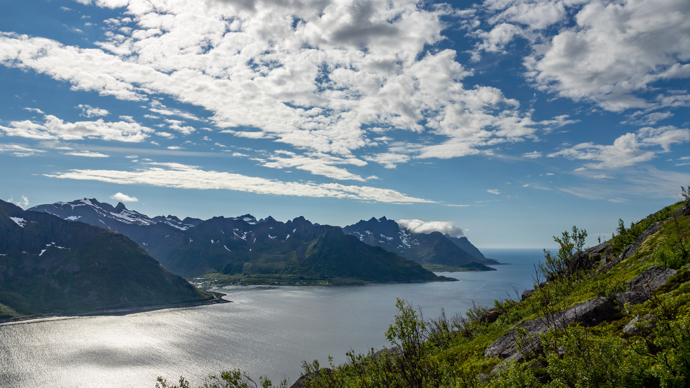
The old mining town and trading post of Hamn i Senja is now a small resort. There are also other accommodations available in the area. This region offers excellent opportunities for hiking. Parking is available at Hellandsneset point, where the old mining town of Hamn was situated. Established in 1872, it employed 350 people, and amenities like a school, church, shops, and a bakery served a population of 650. However, in 1886, everything closed down. Today, the picturesque location invites exploration of the remnants of the town.
Lake Storvatnet and Utsikten overlook 98 islands
While parked at Hellandsneset, you can also explore more history and do easy hikes. Storvatnet is an artificial lake created in 1882 to supply water for Europe’s first hydroelectric power station. The path follows the old penstock as you ascend. As you climb, the view unfolds, revealing the 98 islands in the Bergfjord. A promontory nearby is called Utsikten (“The view”). Some adventurous individuals continue up to Sukkertoppen (456m), but this is a steep ascent and should only be attempted by those who are physically fit and surefooted.
Where the road ends in Mefjordvær, the adventure begins
Mefjordvær, a picturesque fishing village, offers a pleasing blend of old and new houses, complemented by stunning views of the fjord and the ocean. To enhance your experience, explore the hiking opportunities in the area. Most tours are relatively easy:
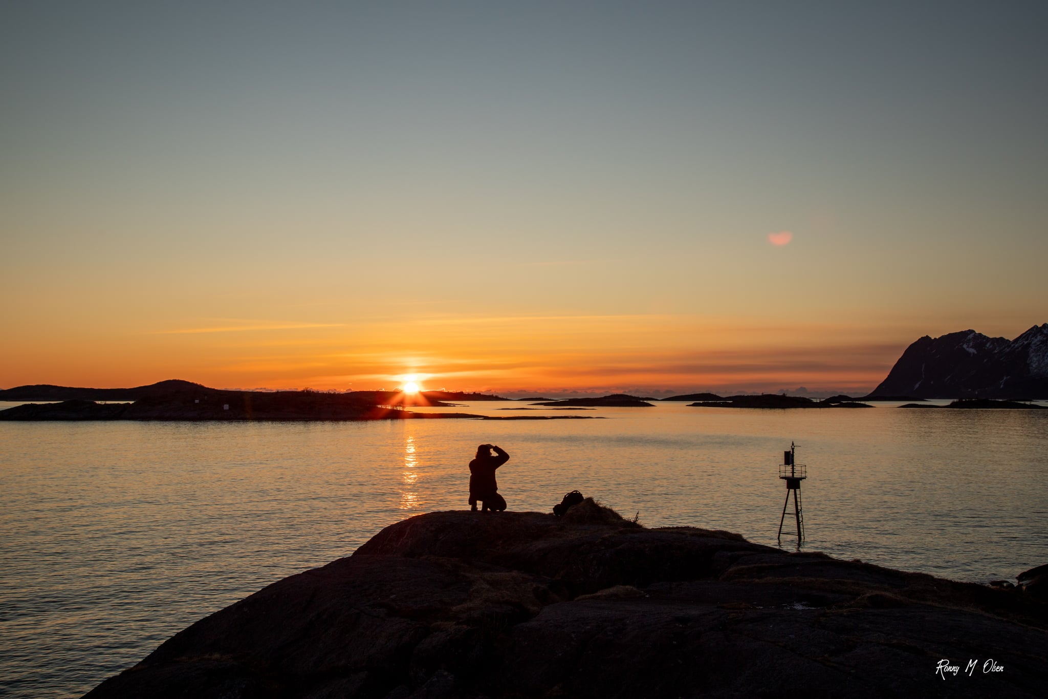
- Knuten: An effortless hike taking approximately 1 hour round trip, Knuten offers an excellent vantage point to witness the midnight sun during summer or the ocean’s sunset in autumn. The trail is clearly marked, starting from the village football ground.
- Skøyteneset: This promontory extends into the ocean, providing unobstructed views of the open Atlantic
- Kyle: A short yet challenging ascent reaching an altitude of 503 meters. From the summit, you can gaze upon Mefjordvær on one side and the larger village of Senjahopen on the other, along with the entire Senja coastline and the western horizon. This mountain is recommended for experienced hikers only, as some sections can be steep and demanding.
Hikes in Senja
An overview of the places mentioned in the article. The numbers refer to the approximate location of the parkings. This info has to be taken with a little salt, as we have often had to put the marker on the nearest address.
Hamn i Senja
Historic mining town and ascent to Storvatnet and Utsikten, even to Sukkertoppen for the extra sporty. Marker slightly misplaced.
Mefjordvær
Picturesque village, hikes to Knuten hill and Skøyteneset point, parking near the marker. Mount Kyle is has a parking ahead of Mefjordvær village.
Torsken
Klubban and Ravnfløy are easy hikes above the village, Midtertinden a bit more challenging. Parking on various locations in the village.
Hofsøy bygdemuseum – Dronningstien
Parking for the Queen’s Route – Dronningruta – along the beach to the southern tip of Senja Island.
Leirpollfjellet
Easy hill hike with wide views. Parking ahead of the little road to Viklund, where there is also an info board.
Sjursviktinden
Demanding and endlessly rewarding hike. Parking marker slightly misplaced, advance a little bit and find small parking on the left.
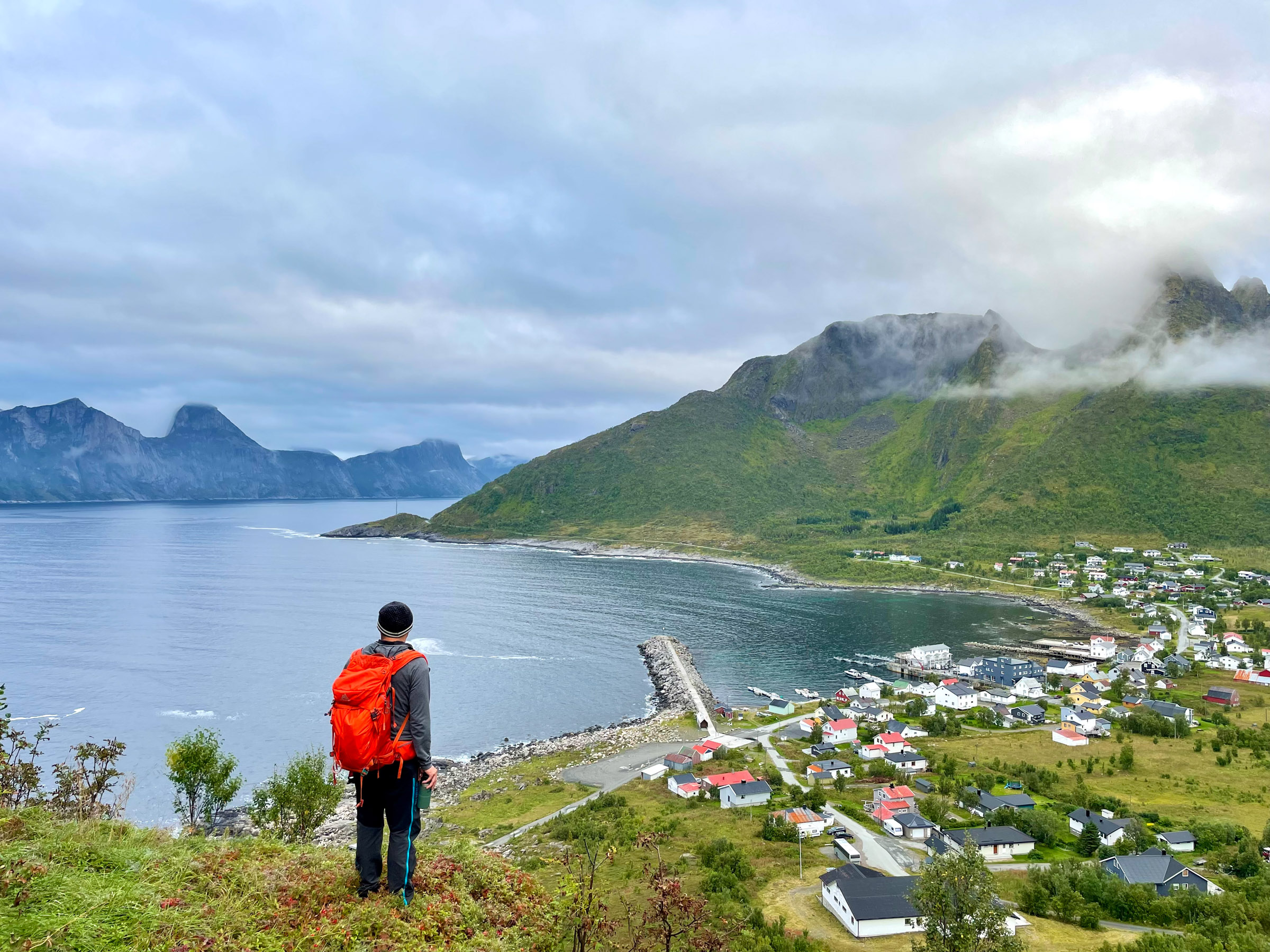
Fjordgård
Ascent to Hesten for instagram favourite. Parking in the village.
Hyttekroa – Ånderdalen nasjonalpark
Loop into the pine forests along Lake Åndervatn in the National Park. Park across the road from the marker at Hyttekroa café in Tranøybotn.
Skaland – Husfjellet/Sommardalen
Husfjellet is another iconic viewpoint. Various parking around the shop in Skaland
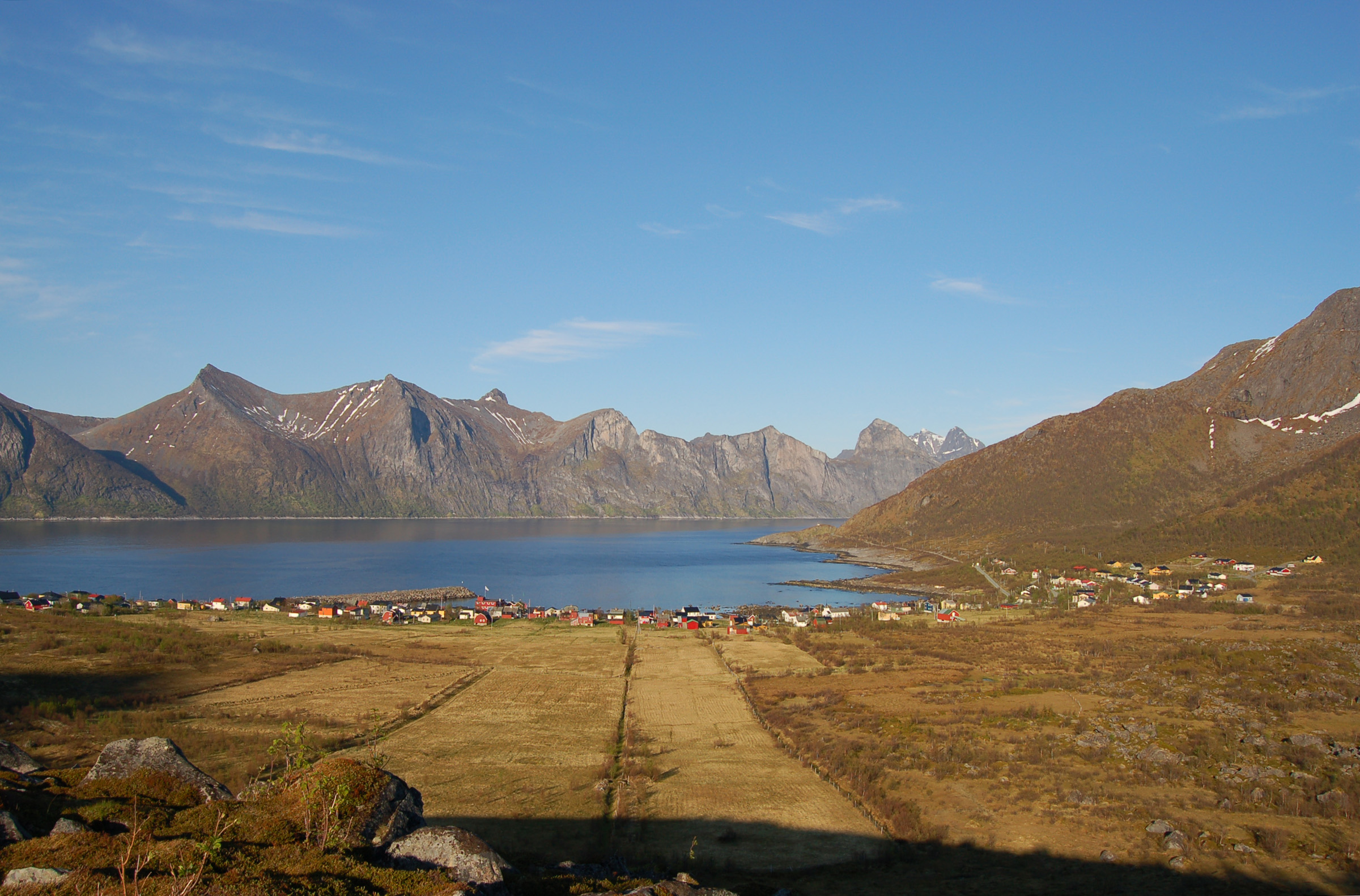
Torsken is a Village with a Fjord and Ocean Ambiance
Torsken is a charming fishing village located on a serene fjord near the vast Atlantic Ocean. Its highlight is the picturesque 18th-century church. The village also offers good hiking opportunities:
- Klubban: Situated amidst pointed mountains and rocks, Klubban is a rounded hill with an elevation of 195 meters. The climb is a steady ascent that most people can accomplish, rewarding hikers with stunning landscape views. Park your vehicle at Øvre Ferånna, the village entrance, and expect a return hike of approximately one hour.
- Midtertinden: This hike involves a climb of 623 meters and typically takes around 3-4 hours for a round trip. While the majority of the ascent is steady, some sections may be more challenging. From the summit, you can see the mountains around Tromsø in the north and Harstad in the south. If you find the full climb too demanding, you can opt to stop at Ravnfløya, which still offers rewarding views across Andfjord to Andøya Island.
The South Coast is Senja’s friendly side
Sometimes The South Coast, particularly around Stonglandseidet, can occasionally feel like a real costa with its beaches and calm waters. However, such conditions are not guaranteed. We recommend three routes in this area: one flat and coastal, one easy hill hike, and a full-day excursion for experienced hikers.
Stay safe and minimise your footprint
The most frequent accidents in summer and autumn are caused by wiggling your ankle and by hypotermia. The risk of both is reduced by the right shoes, good clothes and checking the weather forecast.
The easiest tours on this list can be done safely with regular trainers and a wind-proof jacket. The tours where you are out over several hours, and especially those ascending several hundred metres require good hiking shoes, wind and rainproof jackets and trousers and a backpack with an extra sweater, gloves and a good hat. A flask with hot drinks is also a good idea, as some extra food.
Around mid-June, the snow has melted in most places, and you can start hiking. June-July are good for midnight sun hikes. August and y September are the most popular months for the locals. Occasionally, there might be snow on the mountain tops in September, forcing you to cut your hike short. In October, days are short, but a mid-day hike is still a good idea, as long as the weather is reasonable.
Try to stick as much as possible to the marked trail. Trails tend to widen when many people use them, and they become water canals in the spring snow melting. Do not leave any litter behind, take it all with you. This also goes for orange and banana peel. Although it does rot, it takes time, and makes it unpleasant for other hikers.
Parking at odd places can cause irritation, and maybe a fine for you. Use designated parking lots. Try to use public toilets as much as possible. If you need to go in the nature, make sure you go a fair bit away from the path. If you go through a gate, make sure to close it after you. This stops sheep for going astray.
Almost all of Senja is hiking terrain, open to the public. We have asked the municipality of Senja to recommend some tours that are both beautiful and can take the extra wear and tear that an article like this could cause. You are in no way obligated to stick to these trails, but if you do, you minimise your footprint.
The website www.ut.no is a website with numerous trails. They have good maps and come up with parking info and warnings. They are simply good. Use google translate, as there is nothing similar available in English.
You are. Norway’s nature comes without a safety guarantee. We, the website ut.no, the landowner, Senja municipality or anyone else can be held responsible by Norwegian law. Use your good senses, and don’t over-estimate yourself.
Dronningstien – The Queen’s Route – takes you to the southern tip
This easy trek takes you through coastal forests on the tip of the Stonglandet peninsula, including its southernmost point. The terrain is gentle, making it suitable for almost everyone. Along the route, you will encounter a nature reserve with rare coastal pines, bog landscapes, fields, grazing areas for livestock, and various historic structures like boathouses, food storages, barns, and mills. For those in good shape, there is an option to climb the 301-meter-high hill, Stangnesfjellet. The loop trail spans approximately 9 km and should take around 3 hours to complete. Park your vehicle at Hofsøy Bygdemuseum (local museum). Our intrepid Queen Sonja has done the route, thus the name Dronningstien , the Queen’s Path.
From Leirpollfjellet, you see all the islands
A relatively easy hike to Leirpollfjellet hill on the Stonglandet peninsula awaits. Suited for most hikers, with an altitude of only around 250 meters, the main highlight is the panoramic view. From the summit, you can admire Senja, the mountainous Andørja Island, Harstad to the south, and significant portions of the Vesterålen islands to the west. This quick hike takes up to 2 hours, covering a mere 3 km. With an elevation difference of 240 meters, there is a designated parking lot available.

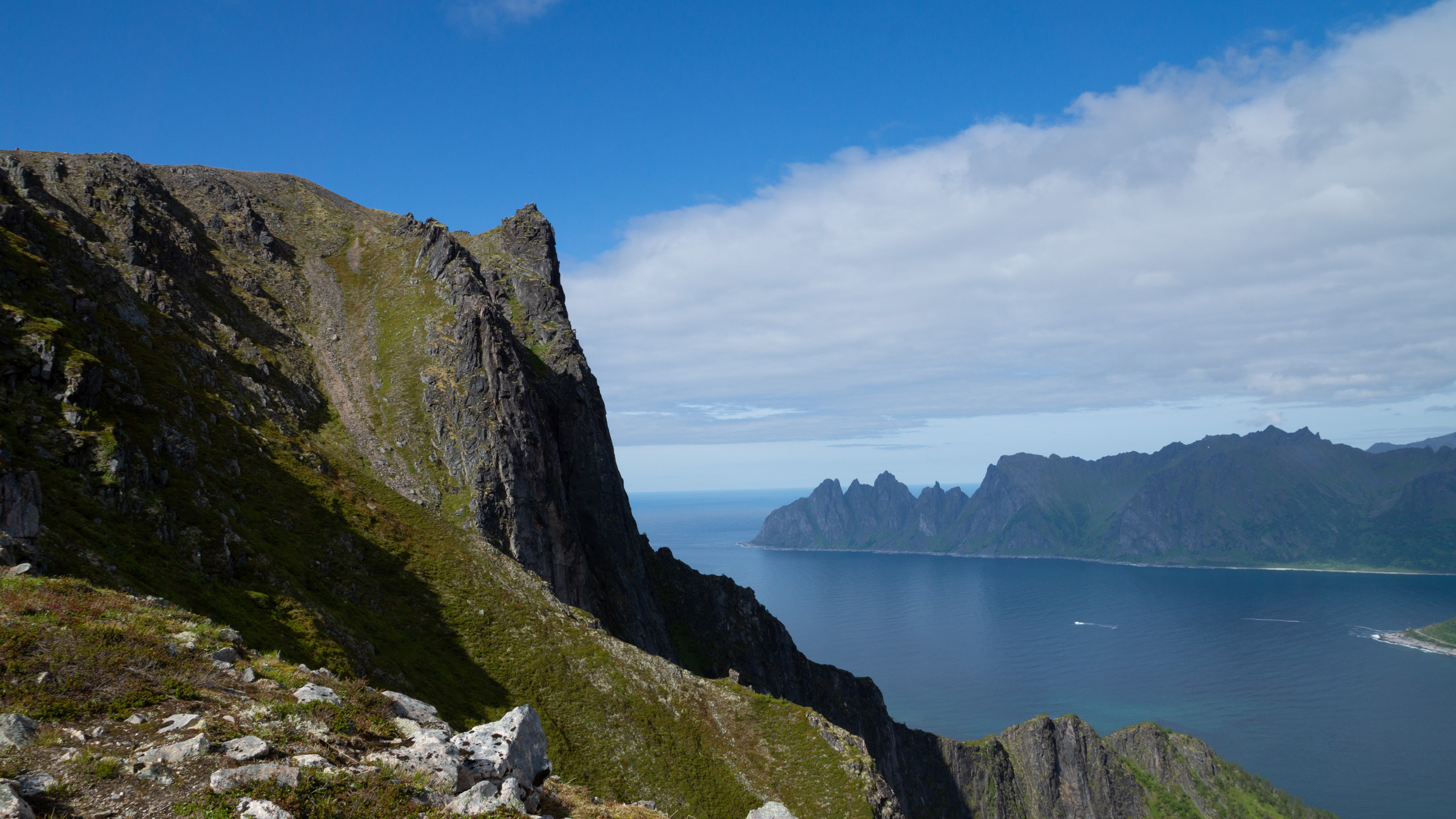
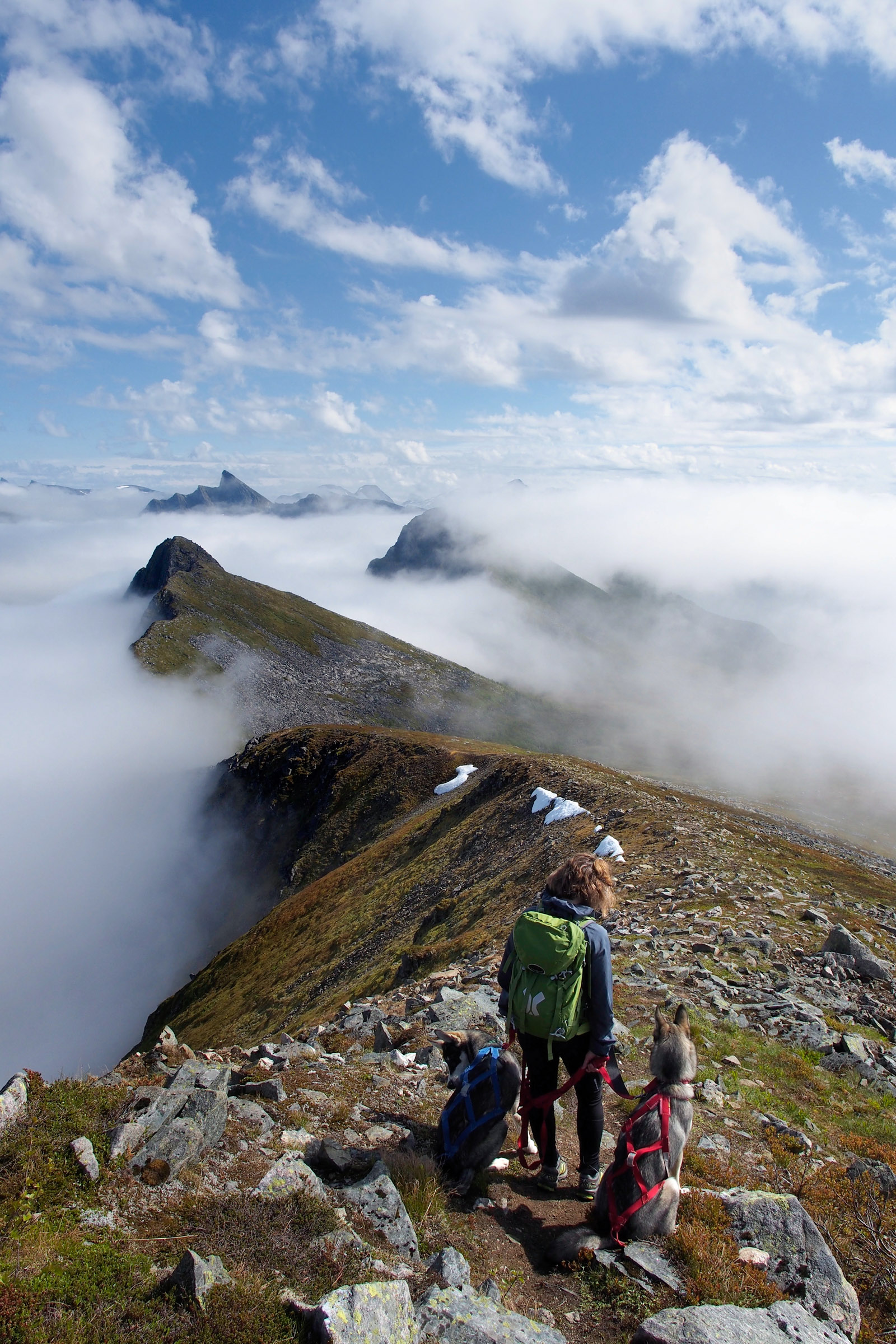
Sjursviktinden is the big challenge
Located on Senja’s southwestern tip, Sjursviktinden offers a challenging but not extreme tour. The primary attraction is the breathtaking view that encompasses the Vesterålen Islands and the surrounding islands of Vågsfjord. Equally impressive is the view north along the outer Senja coast. There is also an intriguing hole in the mountain near the summit. This day trip requires sturdy hiking shoes, provisions, and extra clothing. It is not recommended for first-time hikers. Expect a 5-6 hour hike covering 7 km with an ascent of 791 meters. A designated parking area is available.
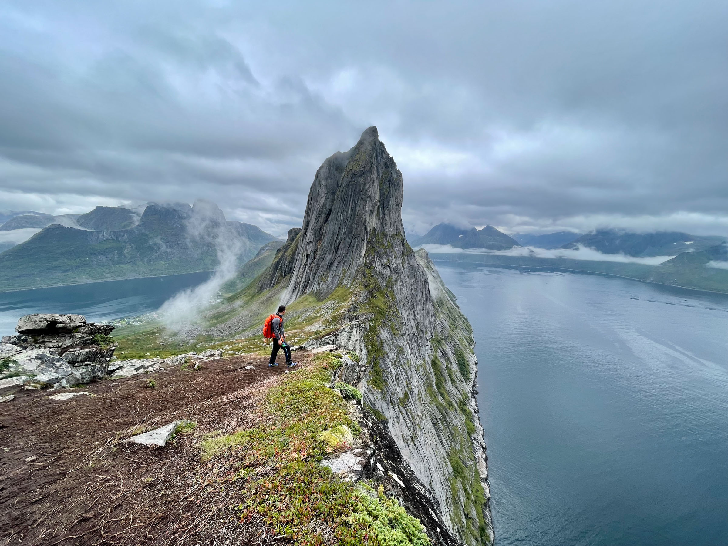
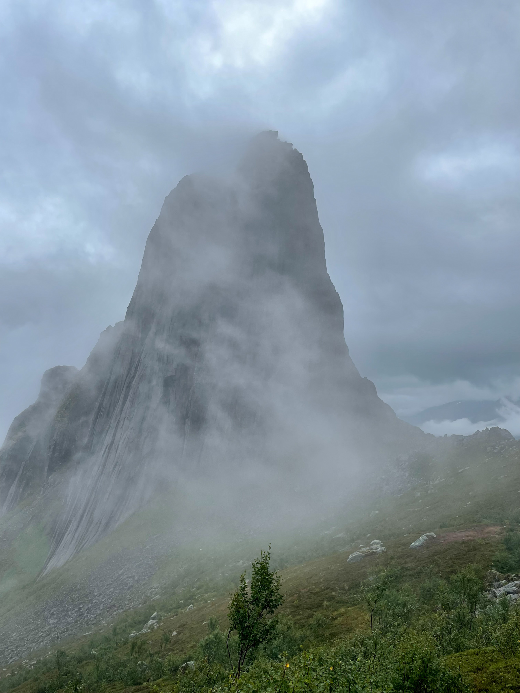
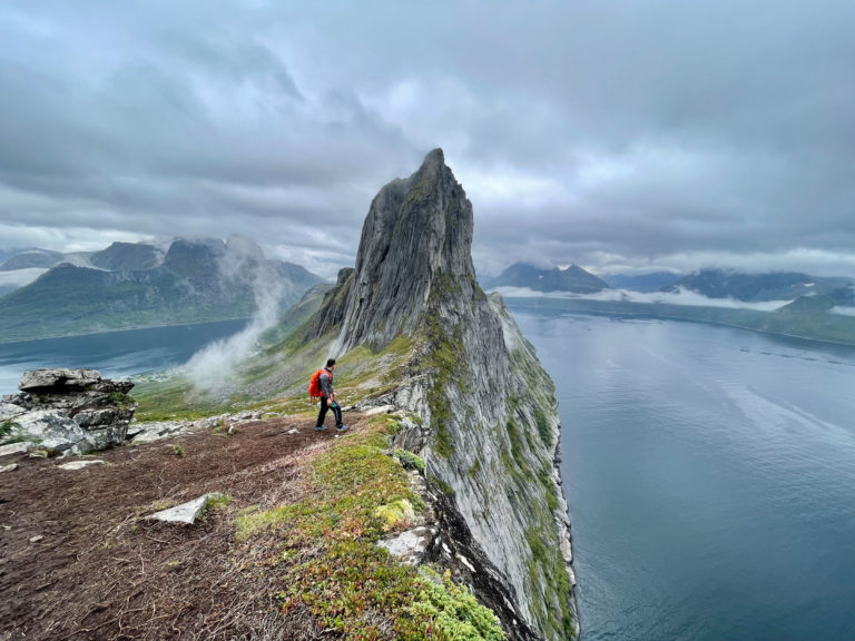
Hesten is between the fjords
The hike to the popular Instagram spot, Hesten, is short yet demanding. With an ascent of 670 meters, you only need to cover a mile to reach the top. The view of the iconic rock formation Segla, along with the panoramic views of Øyfjorden to the northeast and Mefjord to the southwest, is breathtaking. The round trip takes about two hours to complete over a distance of 4 km. Designated parking is available in Fjordgård village.
Ånderdalen National Park offers instant wilderness
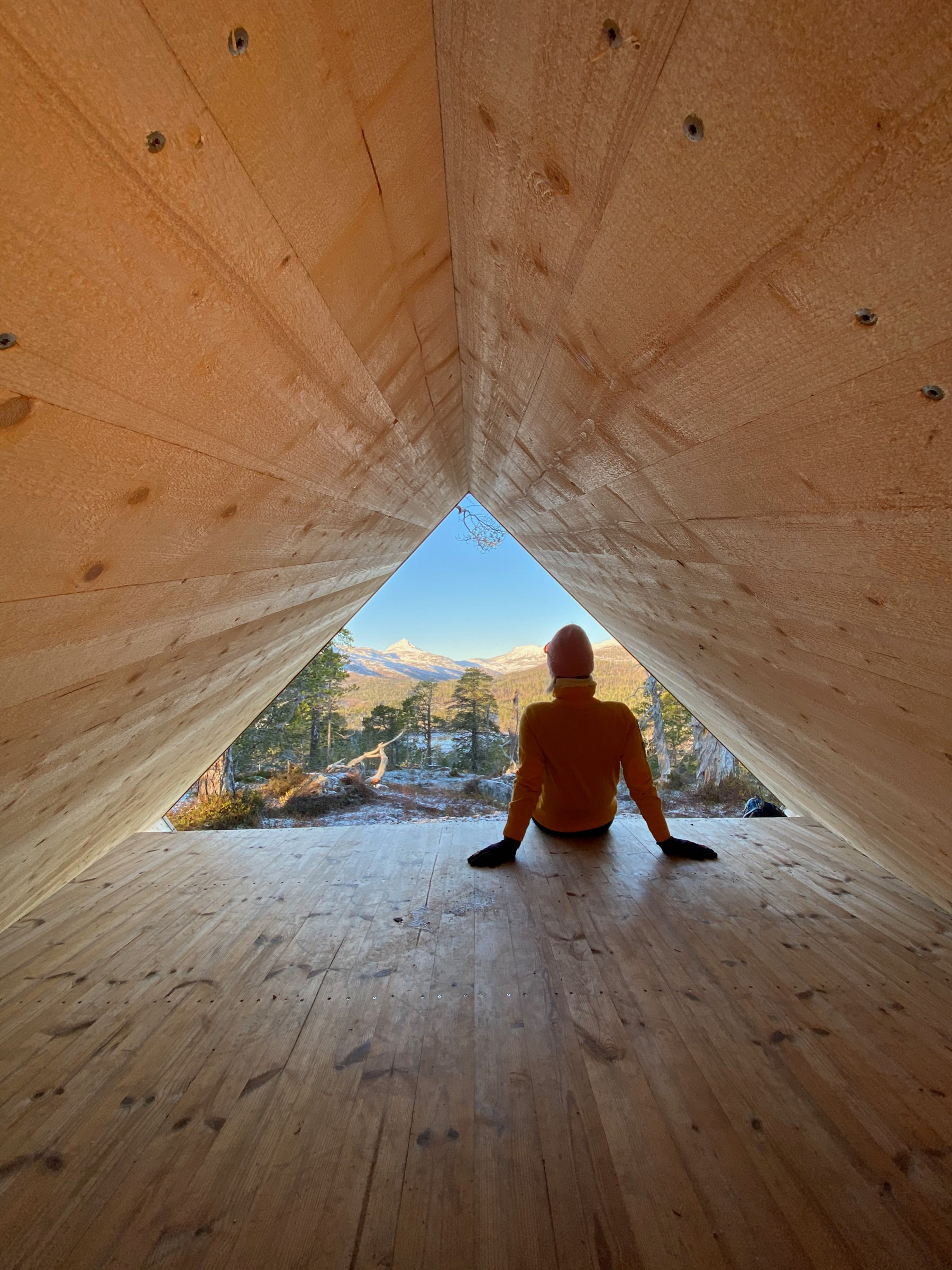
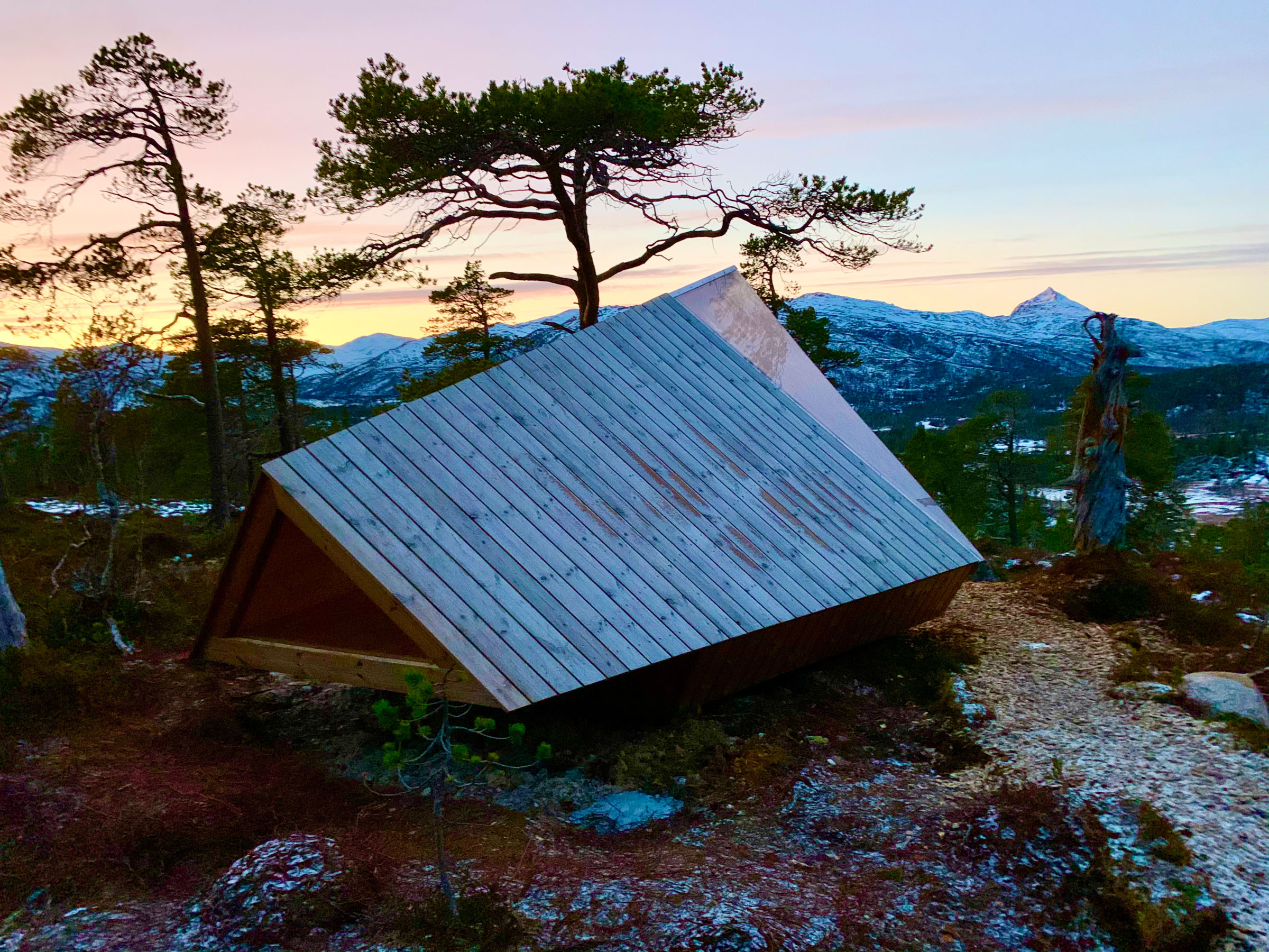
Ånderdalen National Park boasts a rare coastal pine forest, diverse flora, and a varied landscape of lakes, forests, mountains, and fjords. While reaching the park’s remote areas requires lengthy hikes and camping, some parts are wonderfully accessible. A suggested loop around the southern entrance takes you through gently rolling terrain, offering delightful views of Åndervatnet Lake and the distant mountains. Take a coffee break at the architecturally designed shelter. The loop covers approximately 4 km of varied terrain, including some gentle hills, and should take 2-3 hours to complete. Park opposite the Hyttekroa tavern in Tranøybotn.
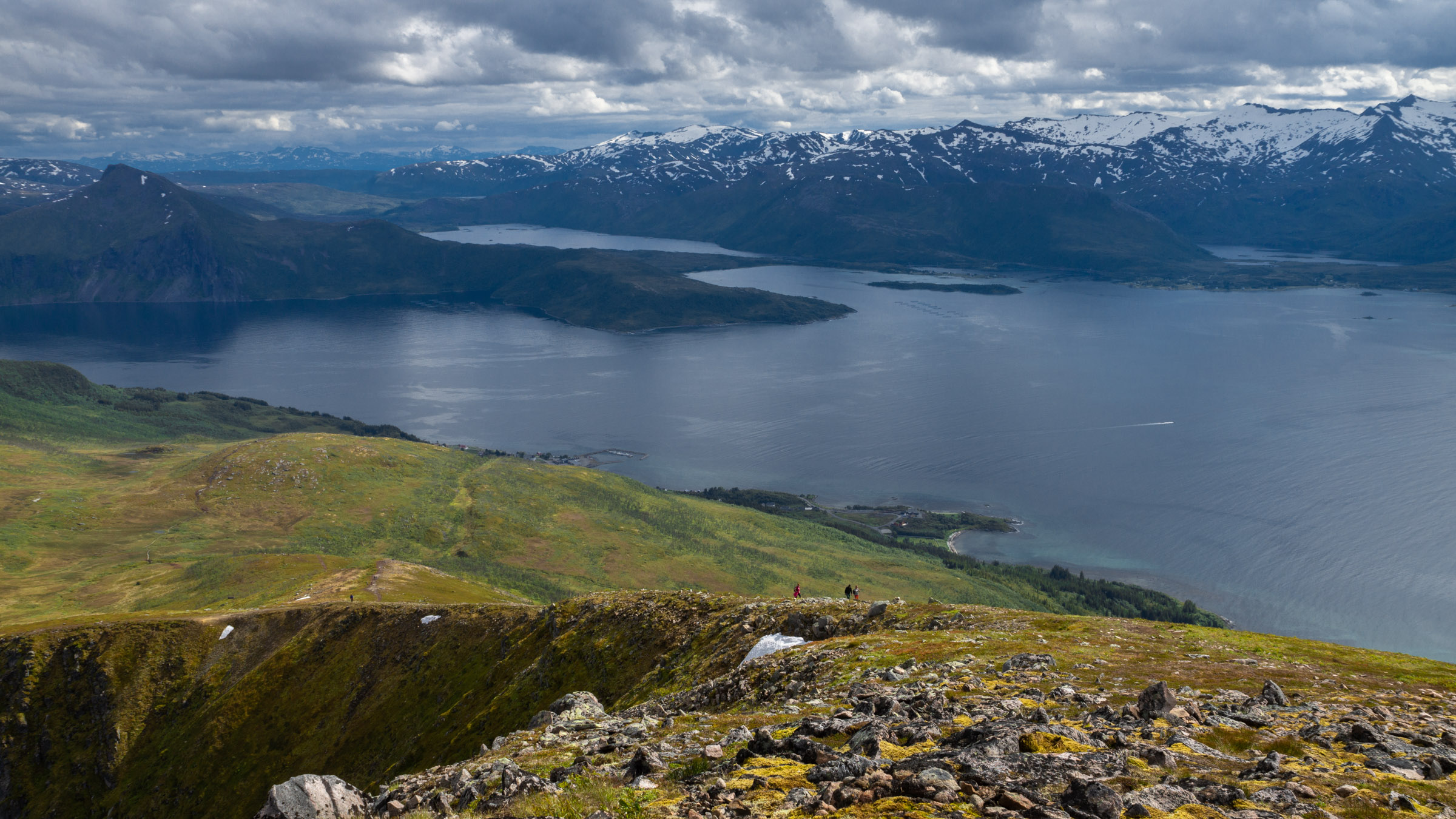
Husfjellet offers the big view
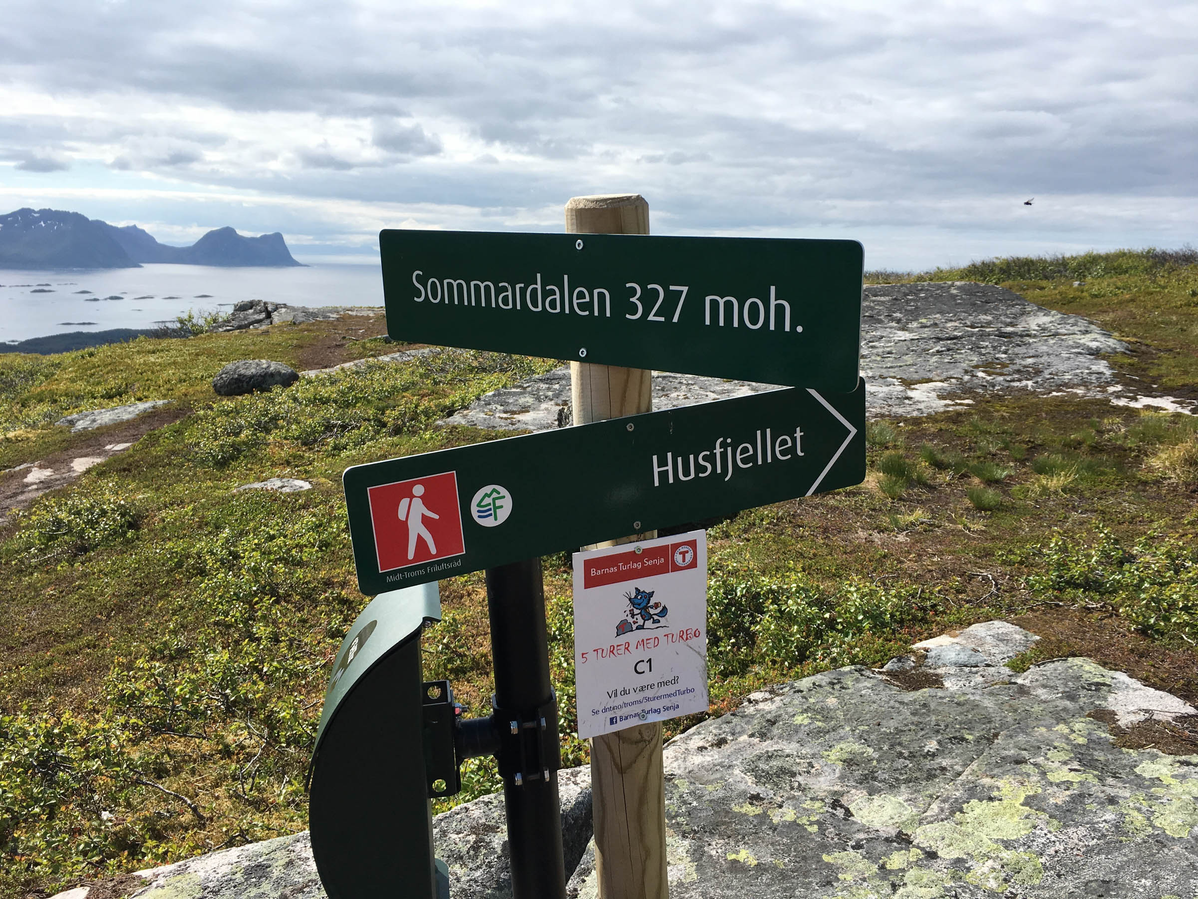
Mount Husfjellet, standing at 632 meters, is well-known from Instagram and offers views of the iconic Okshornan cliffs and the Atlantic to the west. The hike is of the short and demanding variety, although the terrain is not overly difficult. In Sommardalen, located at 327 meters altitude, shelters are available for a coffee break while enjoying the view of the 98 islands of Bergsfjorden. If you cut the ascent short in Sommardalen, you will be forgiven. It takes some 4 hours return to Husfjellet, and 2 if you turn around at Sommardalen. It all takes off from Skaland, a village with a cafe and and shop on the outer side.
Practical about Senja
Senja is an island on 69 degrees north in Northern Norway, some 300 km inside the Arctic Circle.
Senja can be reached by car, rather easily across the bridge from Finnsnes on the mainland. There are catamaran boats from Tromsø and Harstad to Finnsnes on Senja’s mainland side. There is also a quick connection from Tromsø to Lysnes on Senja’s north-eastern coast, and another from Harstad to Skrollsvika on the southwestern side.
Senja has a number of nice places to stay, in various categories. Have a look at the website of Visit Senja for a closer look
Senja has a number of small eateries, often connected with accommodation, that offer local food. Check Visit Senja for an overview.
Visit Senja is the local tourist board, and they inform in detail about everything in Senja.