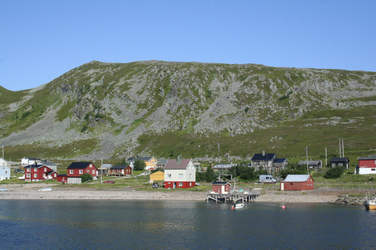
Some of the most unique characteristics of the cities, towns and fishing villages in Finnmark are the way they look. All of the buildings look as if they were built at the same time, all at once. They are more square than rectangular, and they have bold colours and clean, modern lines. That is because they were all built after the war, after almost all buildings were destroyed in 1944. Only Kongsfjord and a few other communities in Eastern Finnmark were spared. This is an opportunity to see what Finnmark looked like before the war.

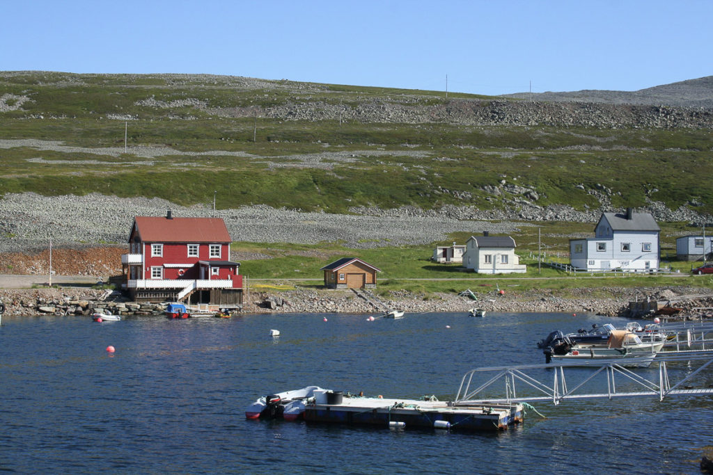
Slow down to look around in Kongsfjord
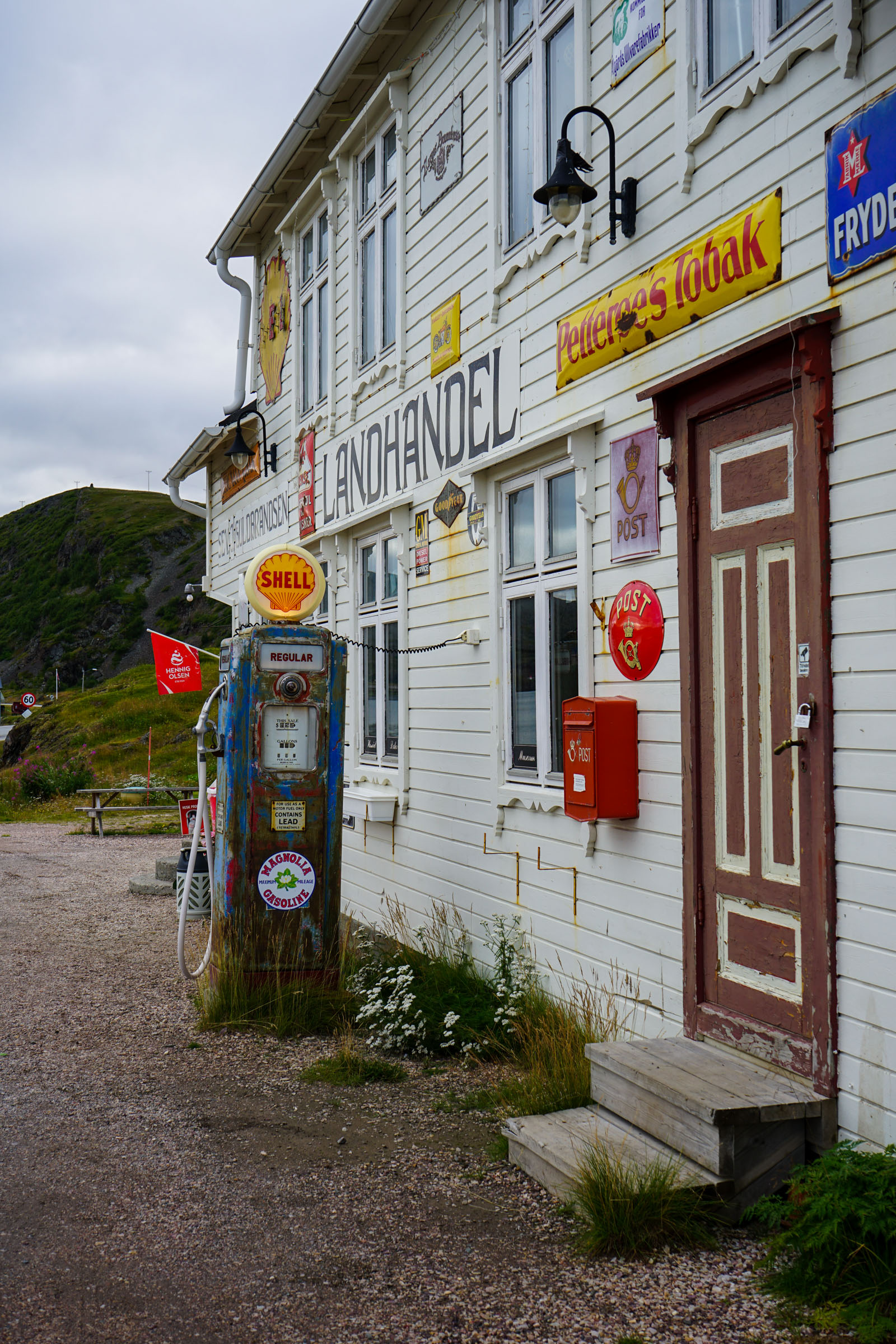
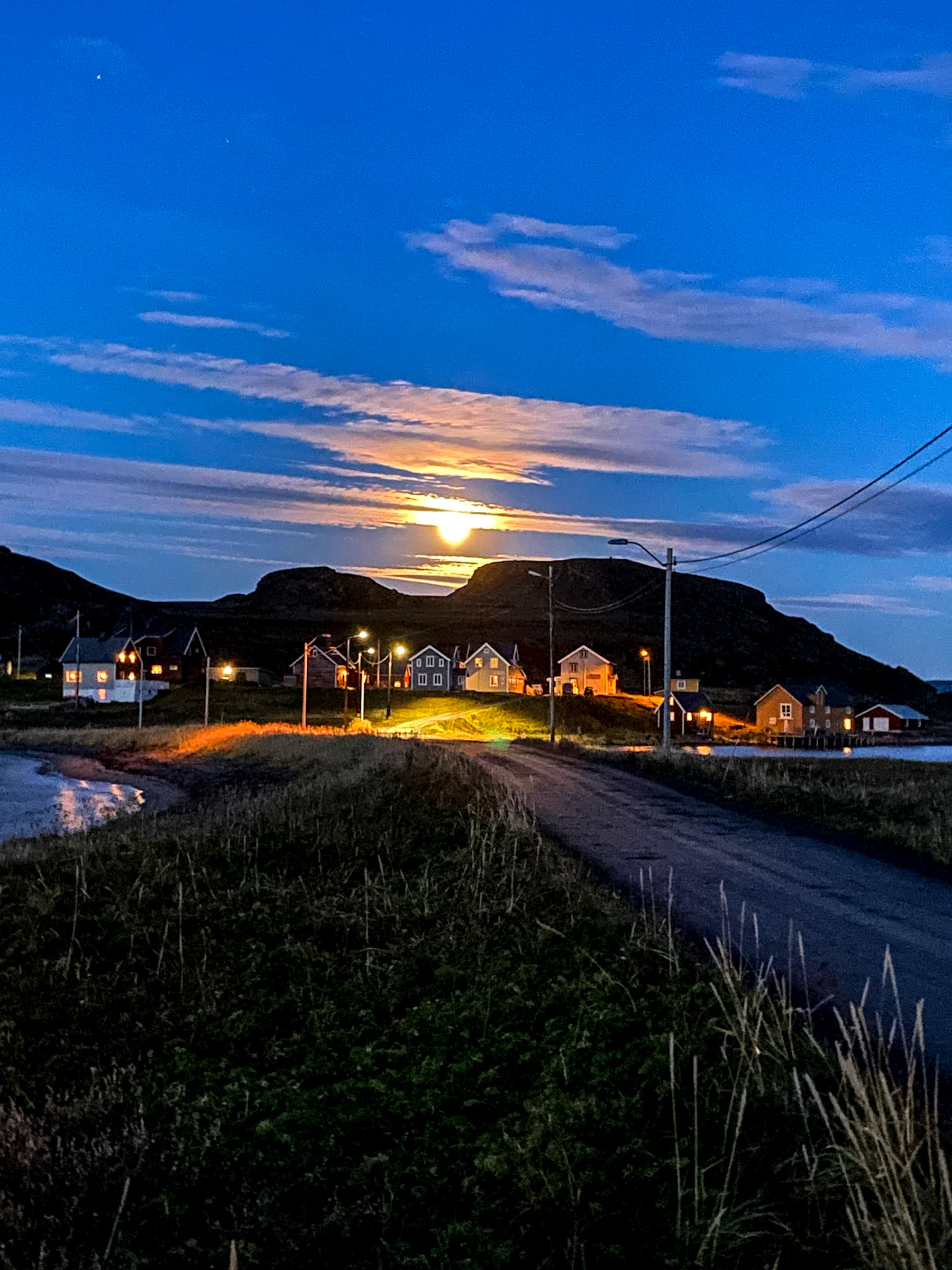
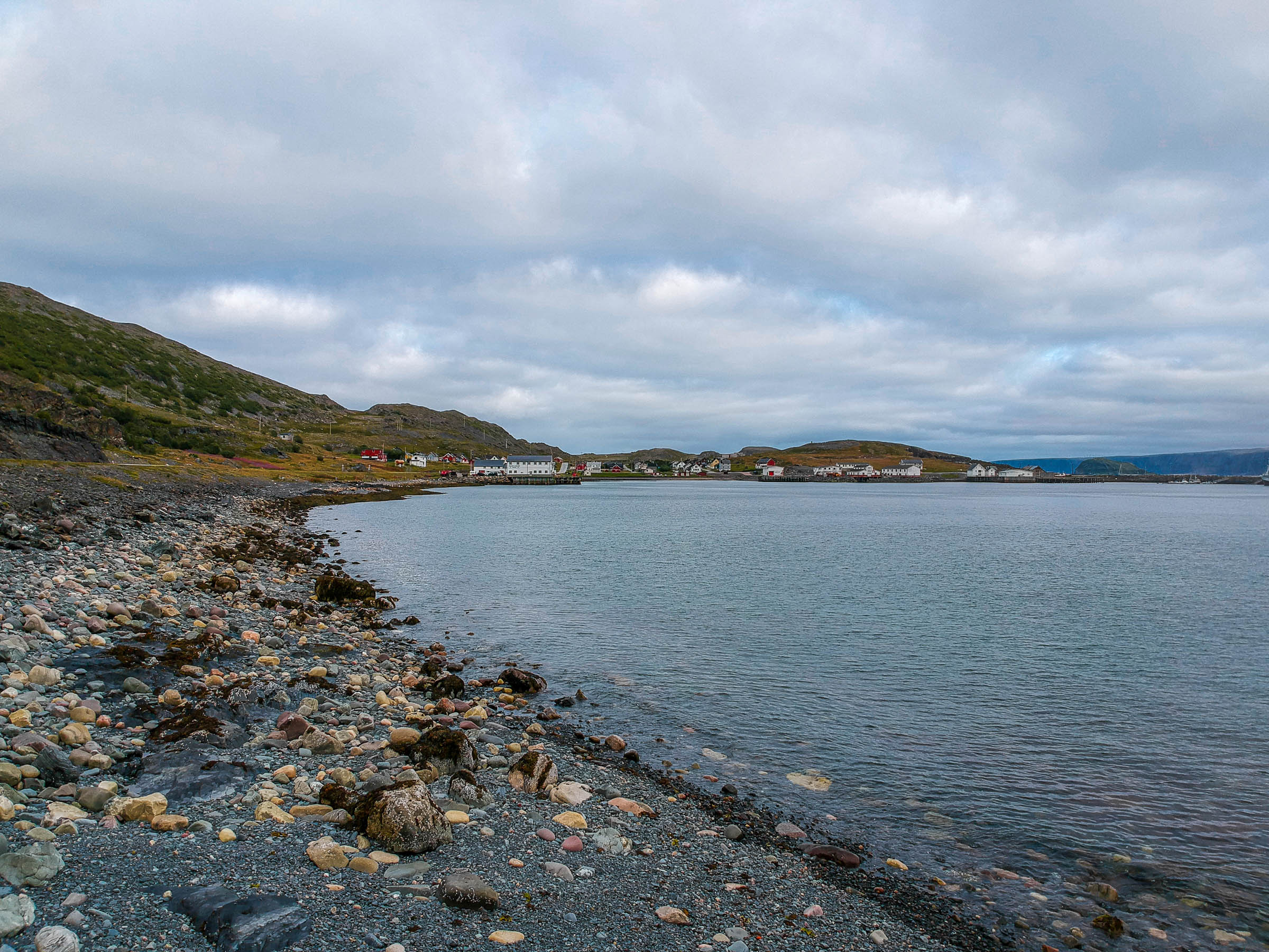
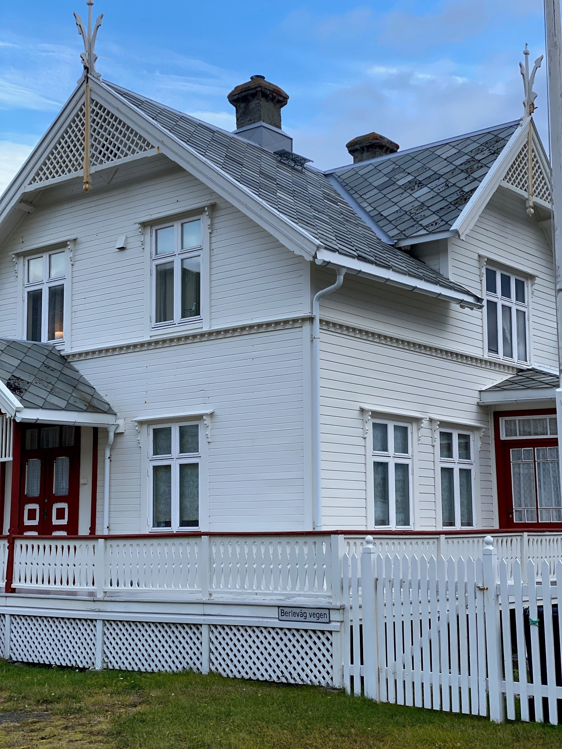
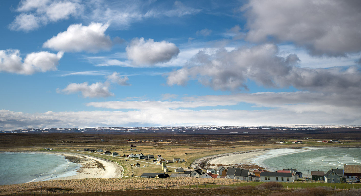
Slow down when you get to Kongsfjord. On your left, if you come up from the south, is the old shop. It was undergoing restaurations when we last visited. Across the road are boathouses, piers and a stately, Swiss-style building surrounded by a picket fence. The flat promontory has more modern buildings, and everything is within walking distance.
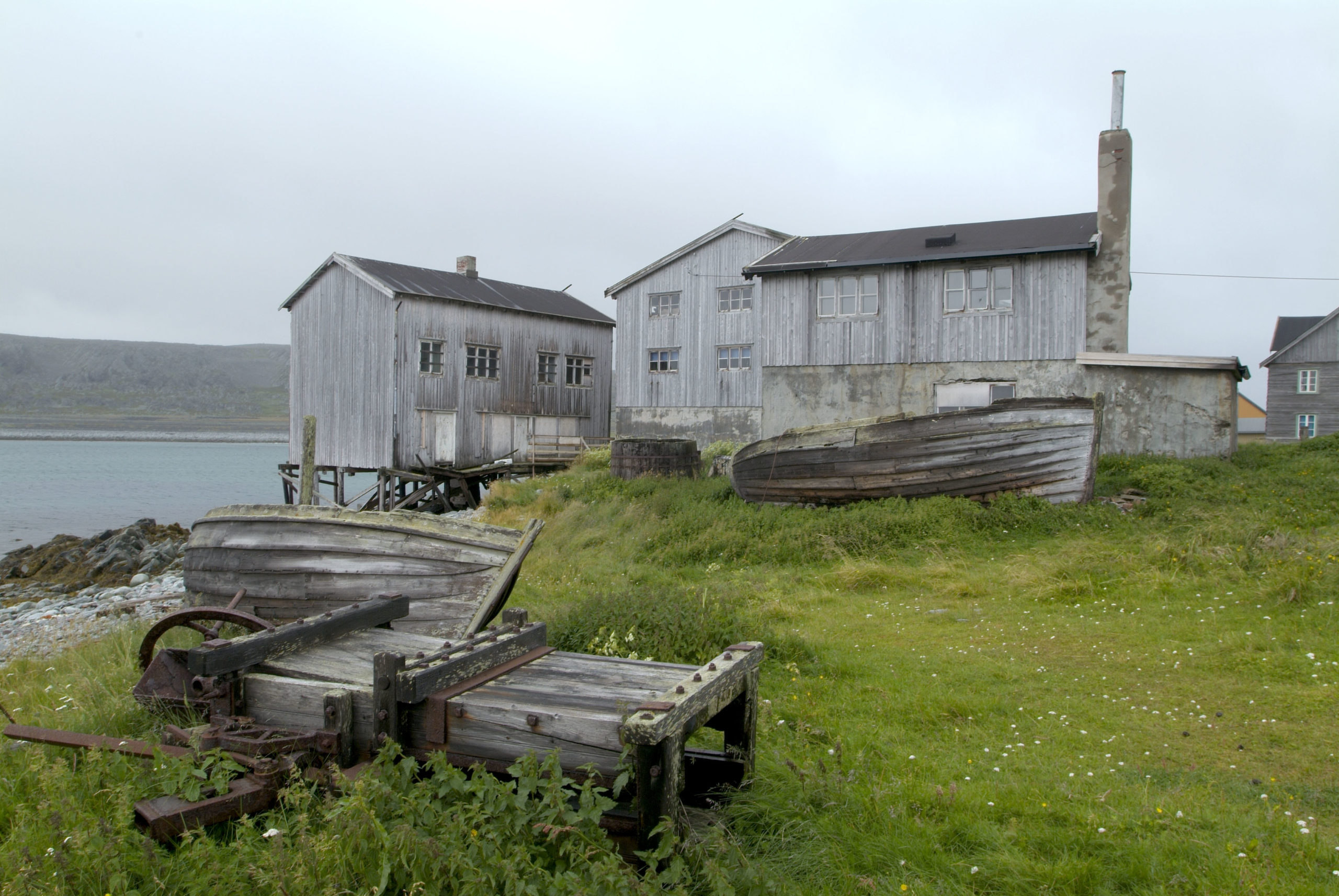
Veines is a unique cluster of buildings
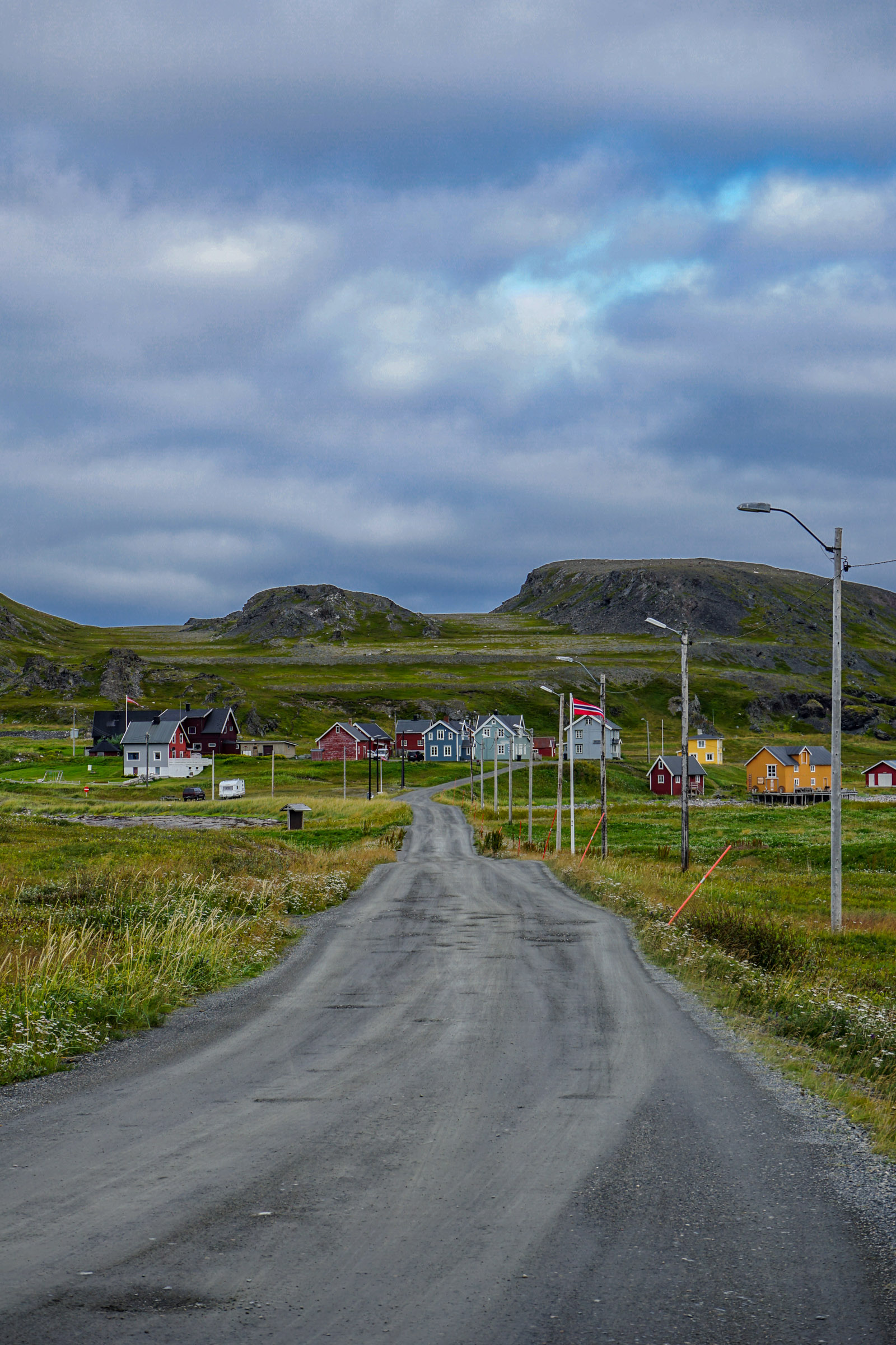
A lovely walk away, or just a few minutes by car, you’ll find Veines (sometimes spelled Veidnes). This is a very well-conserved cluster of buildings from around 1900. There is a pier at the water’s edge, close to the so-called “monthly men’s shack”. This is where the “monthly men” stayed – seasonal workers who needed to make some extra money. The single- and double-storey homes are further up, away from the water. At the very back are barns and sheds. This entire site is currently Kongsfjord Gjestehus – offering accommodation to visitors. There is also a café in the summer.
This is ancient land
People have been living in the Kongsfjord area since the Stone Age – archaeologists have found arrowheads and foundations for dwellings. In the Sami Iron Age, which covers the period from 0–1600 AD, the Sami people were nomadic and stayed in the fjords around Kongsfjord for part of the year to hunt seal and birds on the small islands nearby. In the late Middle Ages, they encountered the first Norwegians, who fished the fjords and exported dried fish to Bergen. As early as the 17th century, there are records of the islands being under the Danish King’s protection, which indicates a considerable interest in the natural resources here. This is also when the area gets its regal name, Kongsfjord – the King’s Fjord.
Kongsfjord expanded from approx. 1875
Kongsfjord must have been a tiny community until the 19th century, but it started expanding rapidly from around 1875. Kongsfjord has a good harbour, and the fishing banks were bountiful. Fish paid well and with better transport options south, the settlement picked up pace. In 1892, the postal boat started stopping at Kongsfjord, and in 1900, telegraph poles went up. There were eight fish processing plants here before the war, and they produced fresh fish, dried fish, salt fish, cod liver oil and guano. The islands had tenants who harvested eggs, eider down and berries in the summer season. There was also a boarding school in Kongsfjord for children from the small coastal Sami settlements on the fjords. As the language spoken in Kongsfjord was Norwegian during this time, this contributed to the Norwegianization, alienating the school children from their Sami culture.
World War II changed the lives of people in Kongsfjord
In 1941, the German occupational forces built a large coastal fortress, with bunkers and trenches out on Veineset. The area was sectioned off with barbed wire, and there were restrictions on where people were allowed to go. This was true both on land and at sea. Allied forces sunk a Dutch river barge in the harbour in 1944, and it stayed there for many years after as a reminder.
Kongsfjord was the westernmost community to survive the war
For more than three years of war, the front lay between Kirkenes in occupied Norway and Murmansk in the Soviet Union. For most of this period, the front lay in Litsadalen immediately east of the border. The German forces were forced to withdraw in late 1944, and Kirkenes was liberated by the Red Army in late October. The German soldiers were suddenly in a hurry to move west, and the only land connection was the Tana bridge. This bridge was destroyed on 6 November, and after this date, everything east of the bridge, including Kongsfjord, was freed from German occupation. In short, Kongsfjord escaped destruction because the Germans didn’t have time to burn it down.
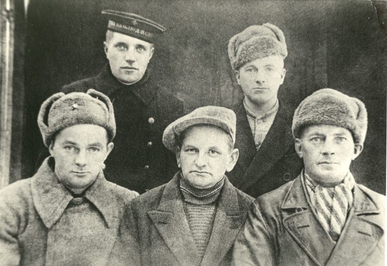
After the war, Kongsfjord was a thriving fishing village
For the first few years after the war, people were living in attics and basements all over Kongsfjord, because the nearby Berlevåg had been burned and completely destroyed. But the community soon thrived, with shops, bakeries, guesthouses and the postal boat from Tromsø stopping in. In 1947, the population counted 148 people from 42 households. In addition, many seasonal workers came in from the small coastal communities nearby. After a while, it also became common for young people from Finland to find summer jobs out here.
Downfall of Kongsfjord
The fisheries are a fickle industry. Larger boats required larger fish processing plants, and eventually, they started processing much of the catch on board. In the late 1980s, they built a nice, big, new school for 20 pupils, but in 1995, there were only 8 left. In 1998, the school was closed, and only a handful of students caught the bus to Berlevåd for school. Today, Kongsfjord is home to around 30 people. Fishing boats no longer land here – there are no fish processing plants left. Åse Winsents, from a good Kongsfjord family, is a prime mover when it comes to restoring the old buildings. A building in use is a building that is cared for. That is why they currently rent them out to tourists.
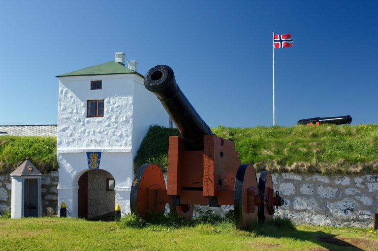
Veiness Fortress is visible on the promontory
Construction on the coastal fortress at Veineset started in early 1942. Coastal fortifications were built all along the coast, from Eastern Finnmark to the French-Spanish border. These fortifications were part of the Atlantic Wall The intention was to protect Germany and German-controlled territories against attack and landings from the Allied Forces. Once finished, the fortress had five cannons, and approx. 140 men were stationed here. In 1944, ammunition and cannons were disassembled and moved west, and the rest was blown up and destroyed. The crumbling concrete of the ruins are still quite prominent.
Veines bird hide offers great views
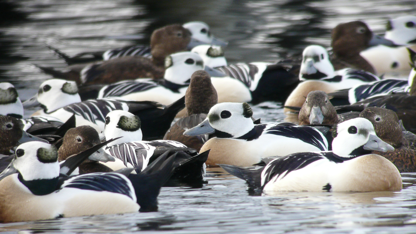
There is a bird hide out on the promontory of Veineset. Eastern Finnmark has a rich and varied bird population, and bird watchers come from all over the worlds to see Arctic birds they would otherwise have to travel to remote high Arctic places to see. That is why the architects at Biotope put up bird hides, where bird watchers can watch the bird without being seen by them. One of the better known of these hides sits at the top of Veineset, and it offers spectacular views. Be considerate of bird watchers if you go up there – they prefer quiet and good angles for photography.
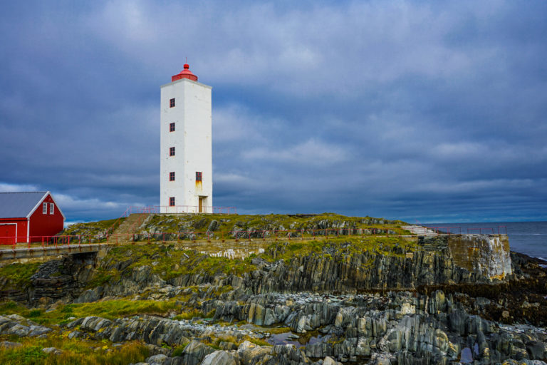
Make a detour to the lighthouse at Veinesodden
There is a marked trail from the buildings at Veineset, past the ruins of the German fortress and bird hide, to the very point of the promontory, Veinesodden. There is a lighthouse here. The hike out is just short of 3 km, and you should expect the hike there and back to take around three hours. Please do not disturb the birds during nesting season, from April to mid-July – we recommend sticking to the trail during this period. The terrain is easy, and there are hardly any hills.
What to do in Kongsfjord and Veines?
When driving from Tana or Båtsfjord to the beautiful Berlevåg, Kongsfjord is the obvious choice to stop for a break. Taking the time to go for a little hike and take pictures is compulsory in a place like this, where the landscape is so full of a melancholy beauty. Please remember, though: do not enter people’s gardens or look through windows. It can be easy to forget basic manners when you’re this far from home. If you have the time, the hike out to Veinesodden is a must. If you really want to immerse yourself, we recommend staying in Kongsfjord overnight.
Sources
- Leif Bjarne Hammer has written an historic overview (Norwegian)
- Tor Edgar Olsen has written about the German fortress at Veinesodden (Norwegian)
- The Architectural guide for Northern Norway and Svalbard is always a good sources for information on old houses
- Ut.no describes the route to the lighthouse at Veinesodden. Use autotranslate for a quick translation into English.

More about Kongsfjord and Veines
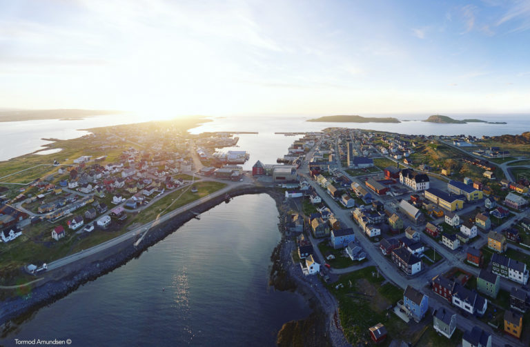
Kongsfjord is a small fishing village with some 30 inhabitants on the north-western side of the Varangerhalvøya peninsula, near the fishing village of Berlevåg. Veines is a cluster of houses a few minutes
Kongsfjord Gjestehus is a small guesthouse in the old houses at Veines. Pre booking is a requirement. Otherwise, there are a few options in Berlevåg half an hour away.
Sometimes, Kongsfjord Gjestehus has an open cafe. Otherwise one should call them ahead. In Berlevåg, half an hour away, there are more options.
Kongsfjord and Veines are found along the National Route 890, leading from Tana bru to Berlevåg. The road is open all year, but might close short term across the Båtsfjordfjellet mountain in winter due to bad weather.
There are a few buses a week from Kirkenes/Tana bru to Kongsfjord and Berlevåg. Check with the route planner at Snelandia.