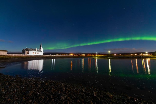
Before it is even 11 o’clock in Oslo, in Vardø and Kirkenes the sun is already at noon. The two cities are located at the same latitude as Istanbul and Alexandria. Culturally and historically, the binding between the east and south is strong. Bugøynes is called Pikku-Suomi – little Finland, in Neiden the orthodox religion has deep roots, Unjarga / Nesseby has a fun Sami market and Vardø has been Norway’s eastern border for over 700 years; together, this makes up a mosaic of cultures, languages, histories and stories.
Take a summer vacation in Norway’s Far East
This article is about ideas for traveling around in different and distinctive parts of the north east. We imagine that you fly to Kirkenes, and then you travel around the area on your own, in search of beautiful nature, history and encounters with the locals. The first section is about Kirkenes and Sør-Varanger, then we move across the fjord to the National Tourist Road in Varanger, and the third section is about Tana and the fishing villages Båtsfjord and Berlevåg north of the Varanger Peninsula. All this can be seen over some busy days or on a relaxed, thoughtful week. Finally, we have some practical advice.
Kirkenes is the start of the journey in the east
Kirkenes is set in beautiful surroundings where Bøkfjorden divides in two at the mouth of the Pasvik river. The houses are in the characteristic, cubic rebuilding style with the strong colours, and city is rimmed by birch and roe trees. On nice summer days, the main street and the small square are full of people, and it is buzzing with life. Kirkenes has a dramatic war history that should be explored, and the city ss the largest in East Finnmark, a good starting point for discovering the small and slightly larger in the east.

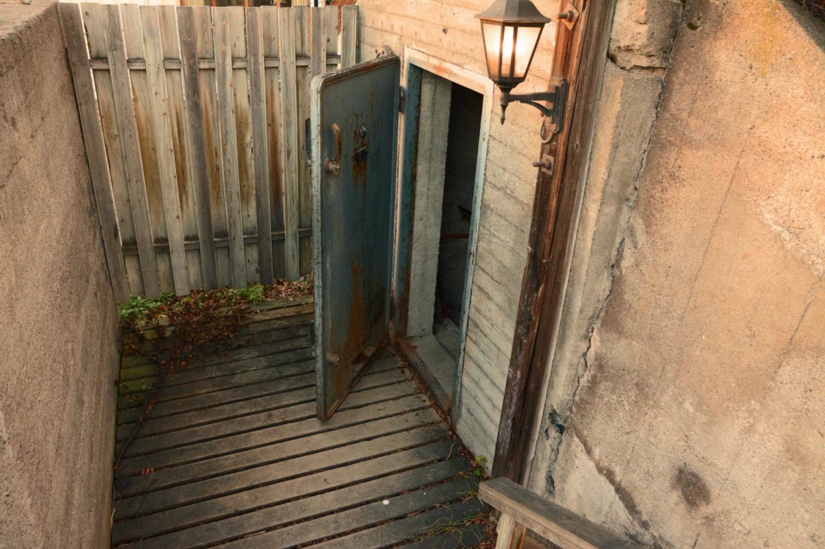
Andersgrotta was the refuge during 328 air strikes
Nowhere in Norway experienced so many acts of war as Kirkenes. In 1941, the German occupiers attacked the Soviet Union, and from Kirkenes the Germans advanced towards Murmansk. However, they were stopped in Litsadalen just east of the border. For three years, the front line ran through here, and Kirkenes was a battle zone. Thus, the city was a bomb target for the Soviets, and over a thousand times the air raid sirens sounded, and 328 times the city was bombed. Then the inhabitants ran into the refuge room named Andersgrotta, where they stayed for 10-12 minutes before the Russians had to return and refuel. Andergrotta is located in the center of town, and is open to groups in 2021.
The brave Soviet soldier guards the centre
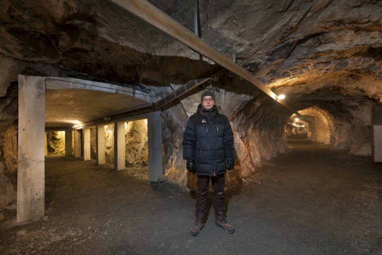
In the autumn of 1944, the Soviets gained the upper hand on the Lithuanian front, and were able to move across the Norwegian border. On October 25, Kirkenes was liberated, the first city in Norway. The population had then lived for 2-3 months in the underground mines in Bjørnevatn, and welcomed the Red Army as liberators. The brave Soviet soldier, a statue in classical Soviet style, still stands in the centre today as a memorial.
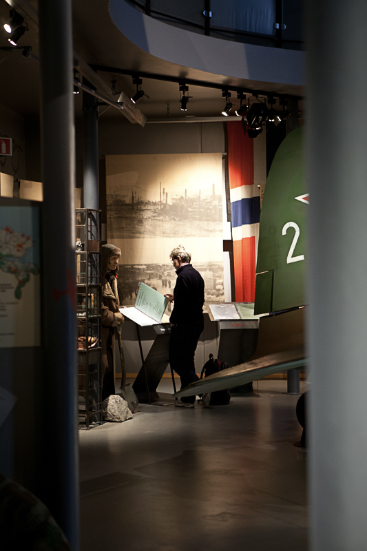
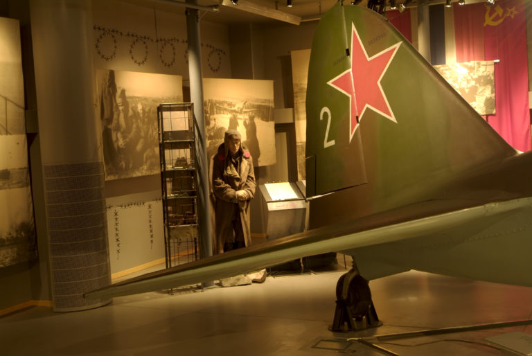
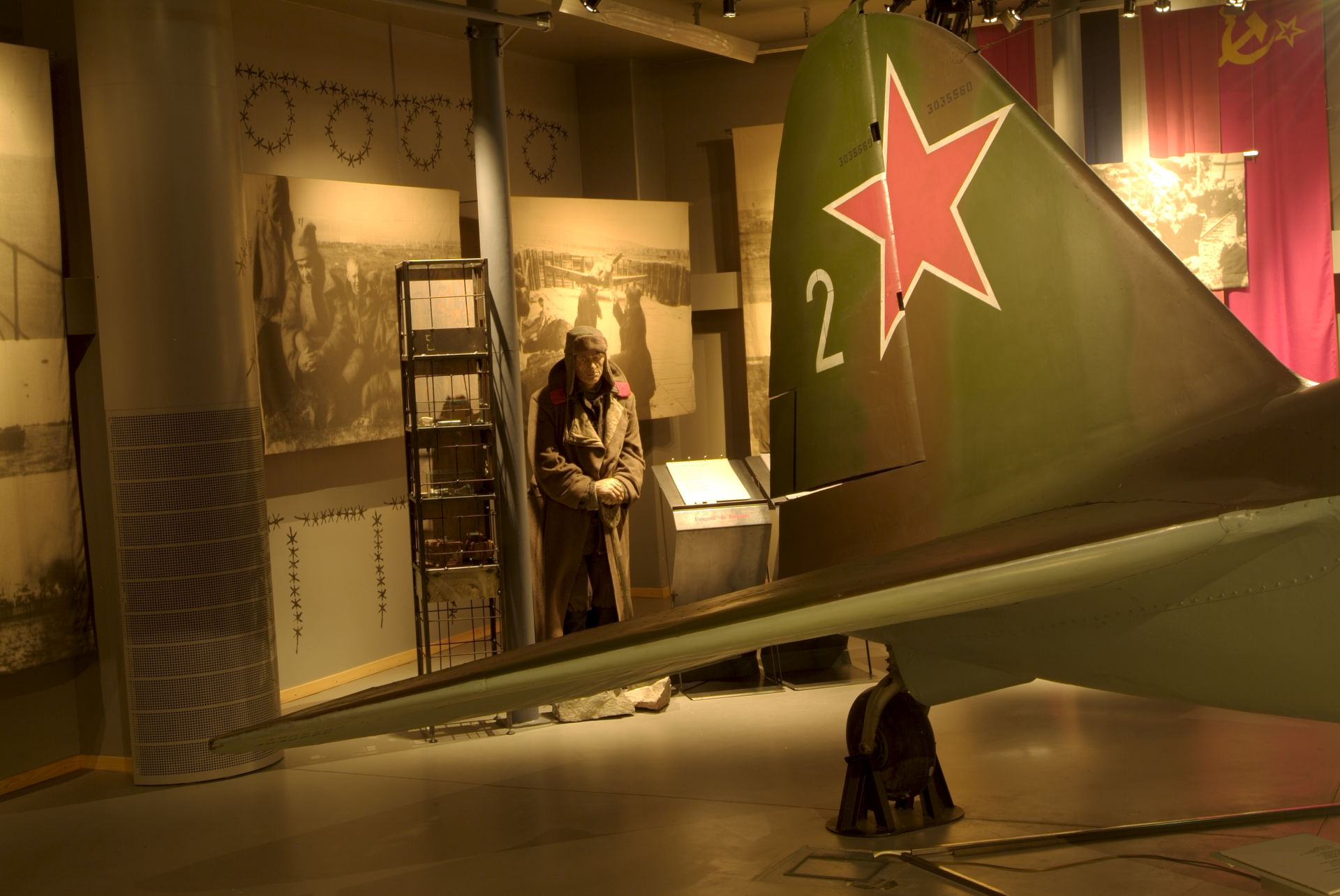
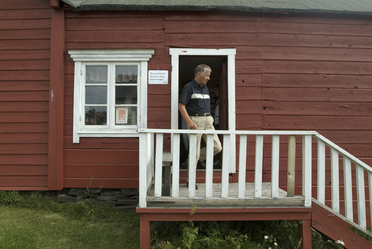
The Borderland Museum puts the war in perspective
A Soviet plane that made an emergency landing on a lake in October 1944 forms the centre of the exhibition at the Borderland Museum. All aspects of the war in the far north-east of Norway are discussed here, both the bombing of Kirkenes, the prisoners of war, the partisans who were educated in the Soviet Union, the Lithuanian front and the battles for Kirkenes in October 1944. It is all varied, accessible and in some places gripping, and well worth a small half hour walk from the centre to the ‘first Lake’.
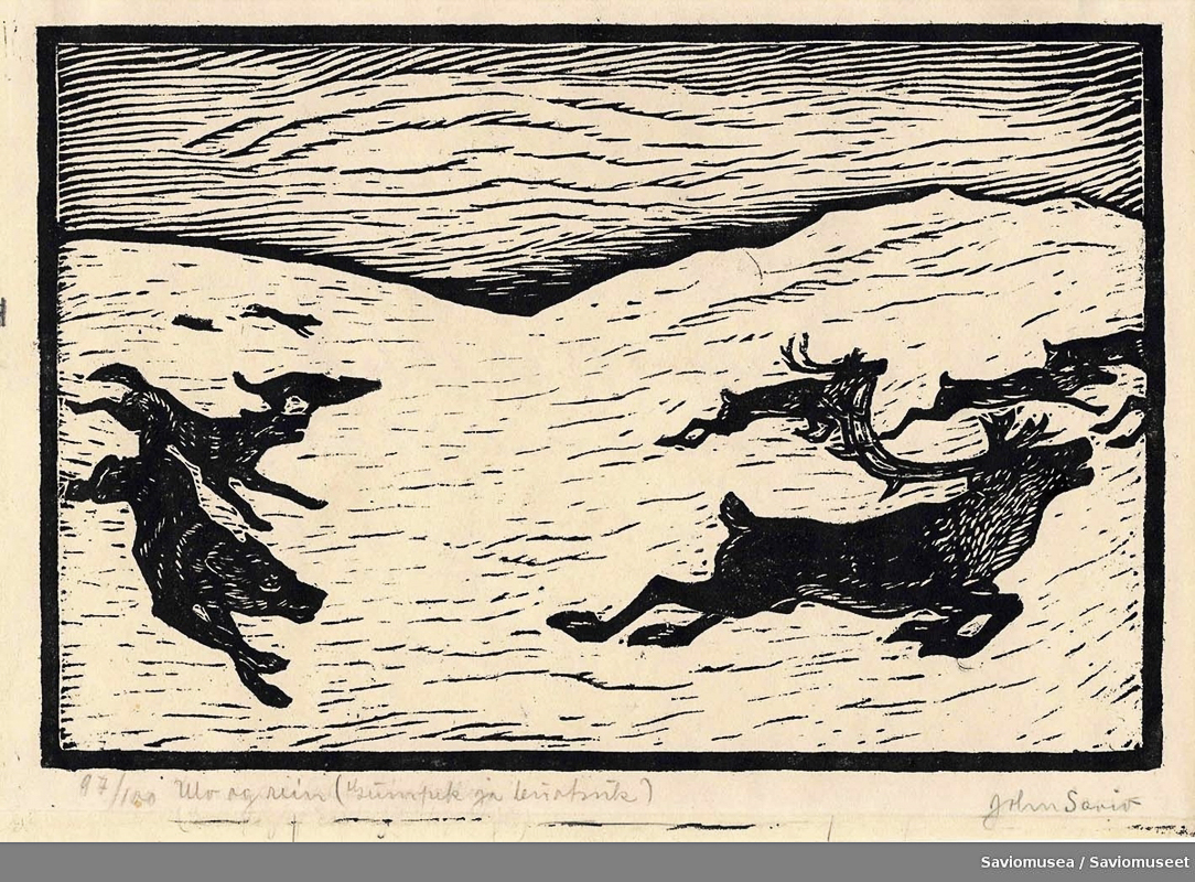
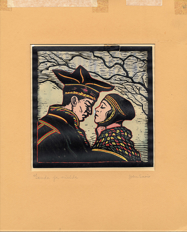
John Savio was Sápmi’s first artist
The woodcuts of John Savio tell with simple lines about life in East Finnmark. The motifs are taken from the daily life of the Sami in Varanger, with reindeer, skiing and wolves depicted. Savio was the first Sami artist in the modern sense, and has gradually gained great recognition. This collection is the largest Savio collection ever, and is a great opportunity to get to know this artist. The museum is located in the same building as the Borderland Museum.
Explore Sør-Varanger along the small roads
Sør-Varanger became Norwegian only in 1826, when the borders were regulated between Norway, the Russian Grand Duchy of Finland and the Russian Empire. At this time, the population here was almost exclusively Eastern Sami, also called Skolt Sami, who belonged to the Russian Orthodox Church. When the area became Norwegian, people from southern Norway moved in and founded small communities similar to those they came from. With the great famine in Finland in the 1860s, there was a great immigration from Finland. Finally came the development of the mines in Kirkenes around 1900, which made Norwegian culture the dominant one.
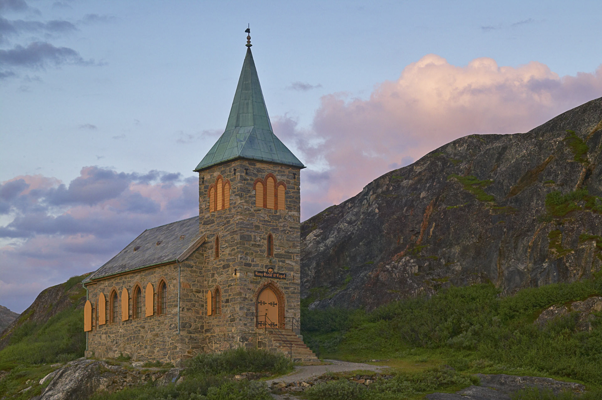
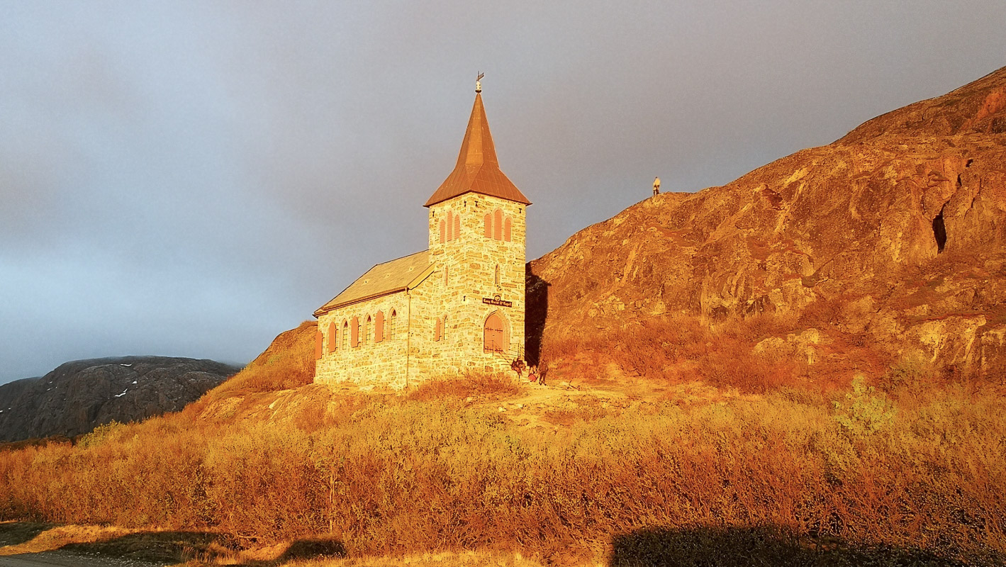
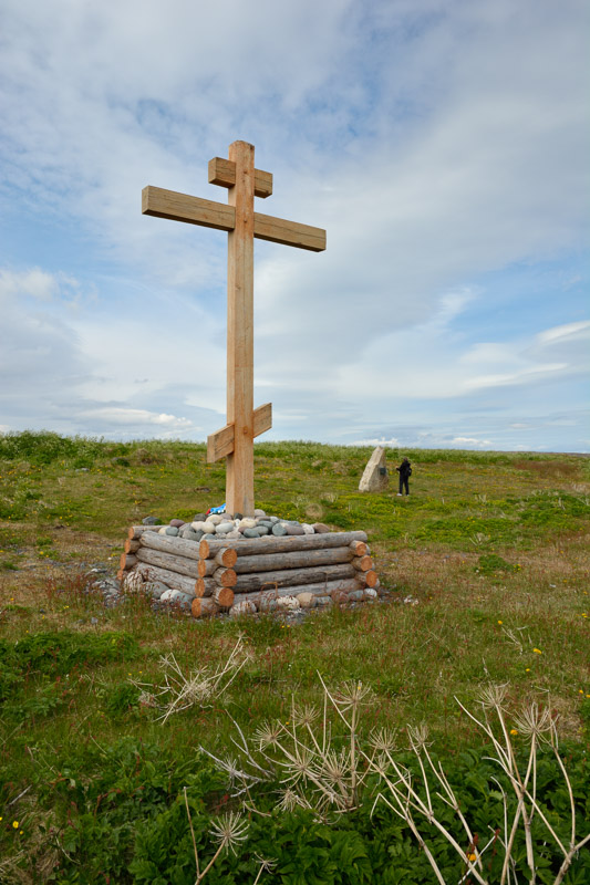
In Grense Jakobselv, the border meets the Arctic Ocean
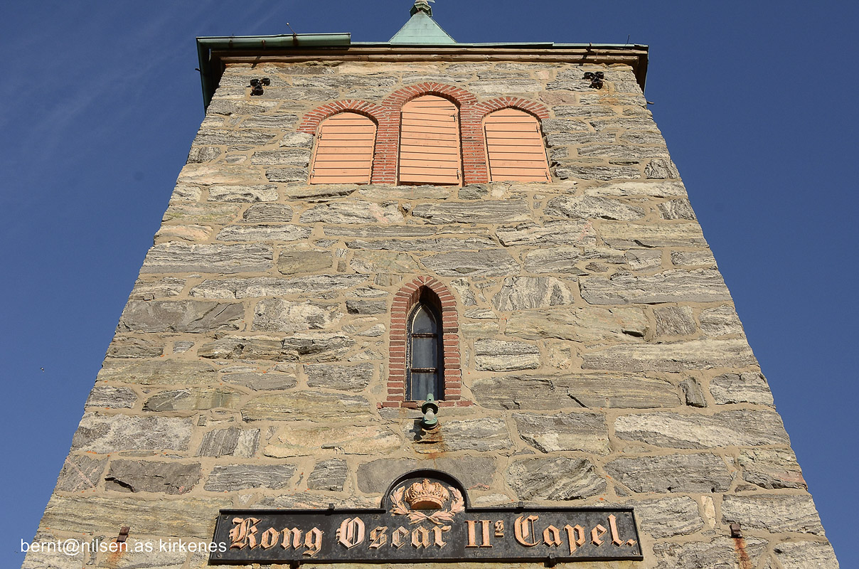
Until not long ago, a Norwegian community lived just inside the Russian border, in Grense Jakobselv. Since Russian fishermen tended to fish on the Norwegian side, a small chapel was built that was visible far out to sea in 1869. After a royal visit in 1873, it was named King Oscar II Chapel. Thus, the border was marked with a church tower in an otherwise roadless and sparsely populated area. The road here is a summer only route and can be quite bumpy in parts. You can also join organized tours with ATV here.
Sør-Varanger is the western offshoot of the Taiga
The great coniferous forest belt runs around the planet, both in North America, Siberia and northern Russia. Sør-Varanger is the western continuation, and the areas south of Kirkenes are characterized by deep pine forests. The population lives along the Pasvik River, and sees Russia through the kitchen window. From the lookout tower on high point 96 – the hills are not so high and there is a sweeping view of the Pasvik River, the deep forests and Russia on the other side of the river. Svanhovd chapel is built in the Norwegian village style, to mark Norway in a multi-ethnic area. Close by is the Visitor Centre for Øvre Pasvik National Park, with exhibitions about nature and culture in Pasvik.
You can get all the way to Treriksrøysa
Highway 885 through Pasvikdalen ends in Nyrud, right next to Russia and at the entrance to Øvre Pasvik National Park. From here you can drive even further south on a forest road to Grensefoss, and then take the three-hour trip to Treriksrøysa between Norway, Finland and Russia. A boundary violation, even in the form of a foot inside, quickly leads to large fines, so stay on the Norwegian side. The journey is ten miles on a very bumpy national road from Kirkenes, then 20 miles on a forest road before you walk for 7 kilometers. This can be an excursion with a lot of driving in one day, so it is a good idea to have an overnight stay at Svanhovd.
Travel west to Neiden
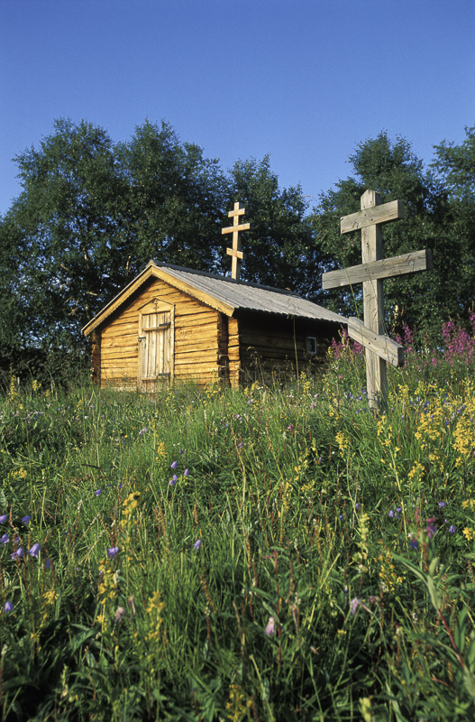
The road to the rest of Norway is route E6 which goes west. Neiden is the first village on the west side, and here there are only 3-4 kilometers between the fjord bottom to and the border with Finland to the south. The Neiden River comes runs northward from the Finnish forests into Norway, as did many of the inhabitants over a hundred and a half years ago. The church by the river, on the other hand, is in the Norwegian stave church style, it was important at the time to mark Norwegian territory in front of a congregation that spoke Finnish or East Sami.
Finnmark’s oldest building is ten square meters
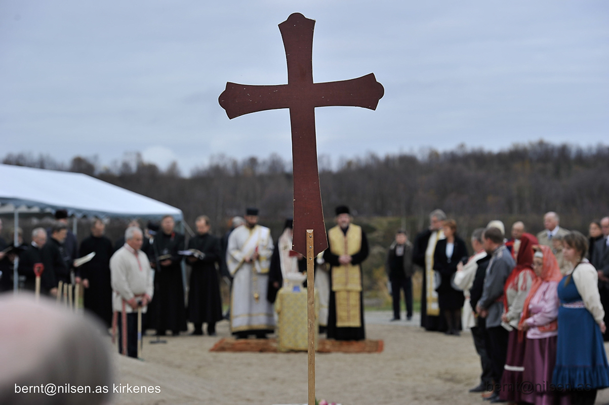
The tiny St. George’s chapel in Neiden is so small that you can not stand upright in it. Built in 1565, it is Finnmark’s oldest church building, and a reminder of the Russian influence on the Sami in Sør-Varanger. Until 1914, the Russian priests came here and baptized the children, since then the Sami have had to do this with the Lutherans. The orthodox faith, however, is on its way back, and in the summer an orthodox liturgy is held in front of the chapel.
The Skolt Sami Museum tells the story of a small community
Ävv Saa’mi Muzei, Skolt Sámi Museum, in Neiden, tells about how the Skolt Sámi migrated throughout the year to utilize the natural resources in the sea, along the rivers and in the mountains. Culture and social organization are also explained, as well as the fate of the Skolts as border residents between the east and the west.
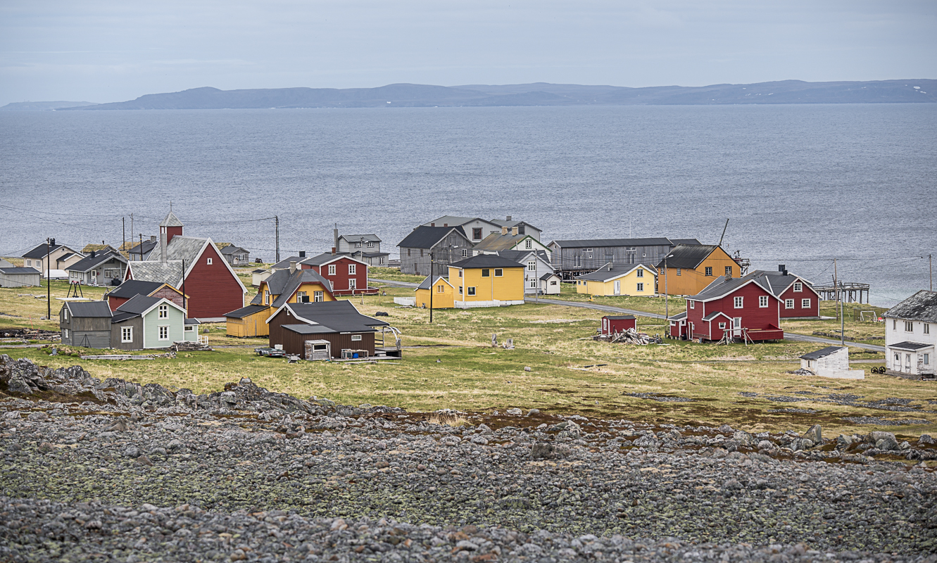
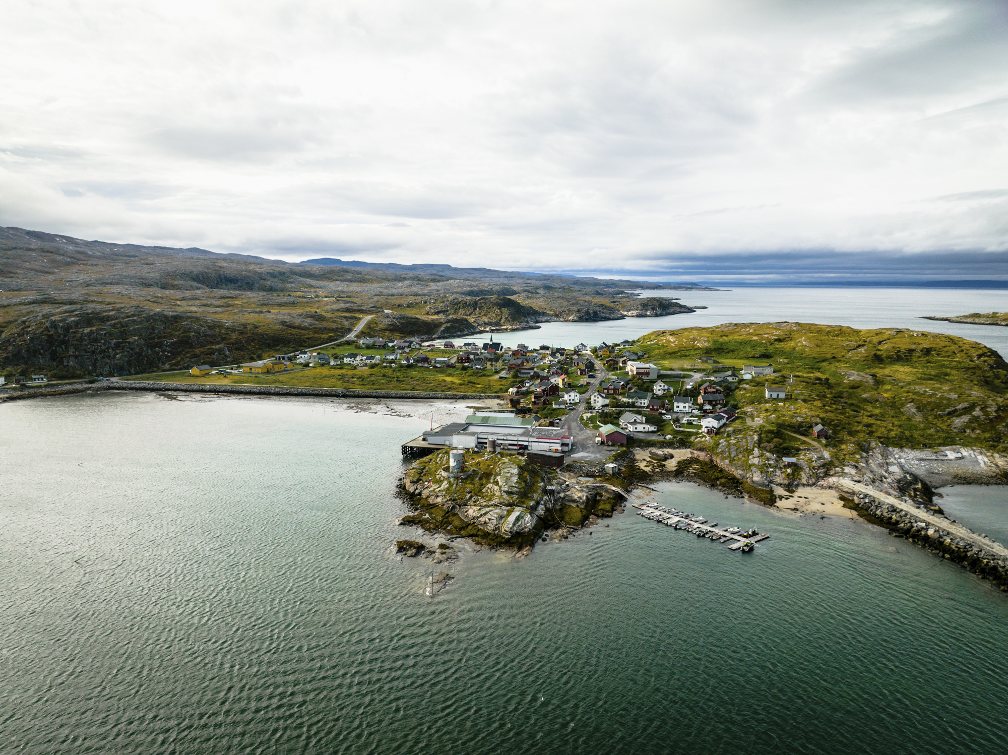
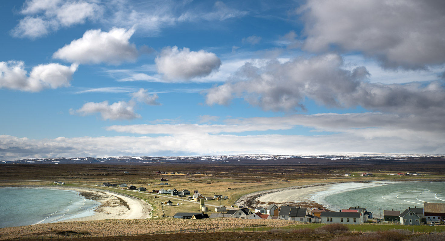
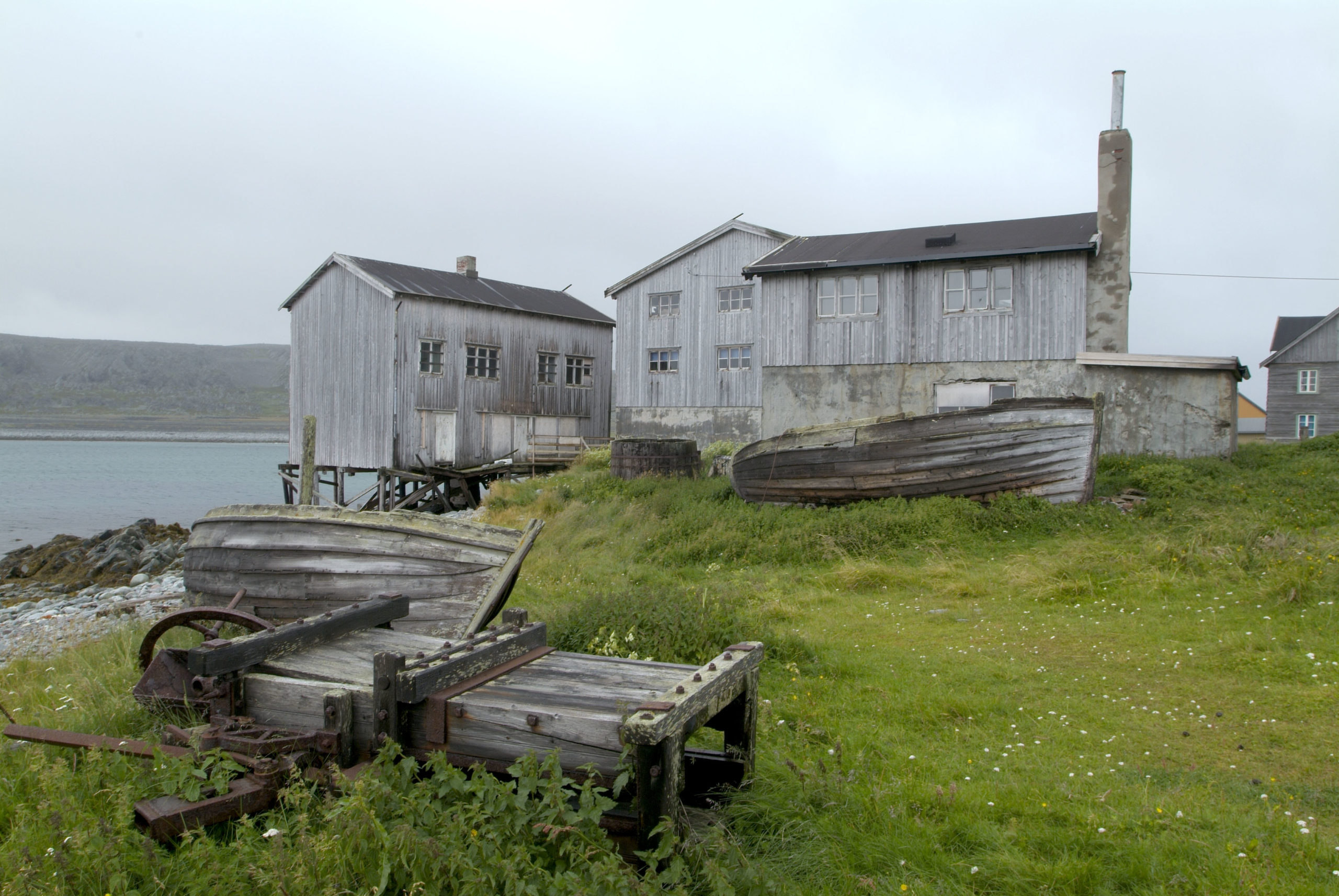
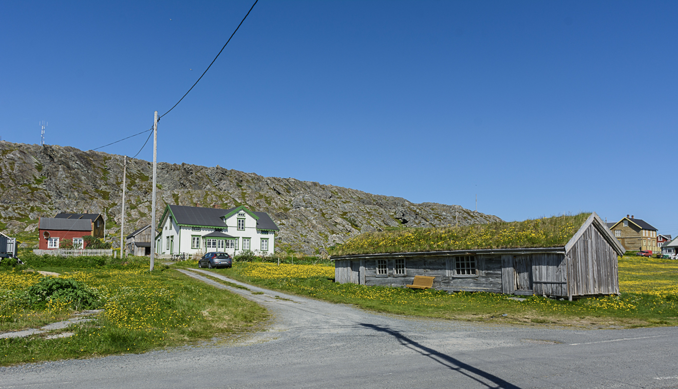
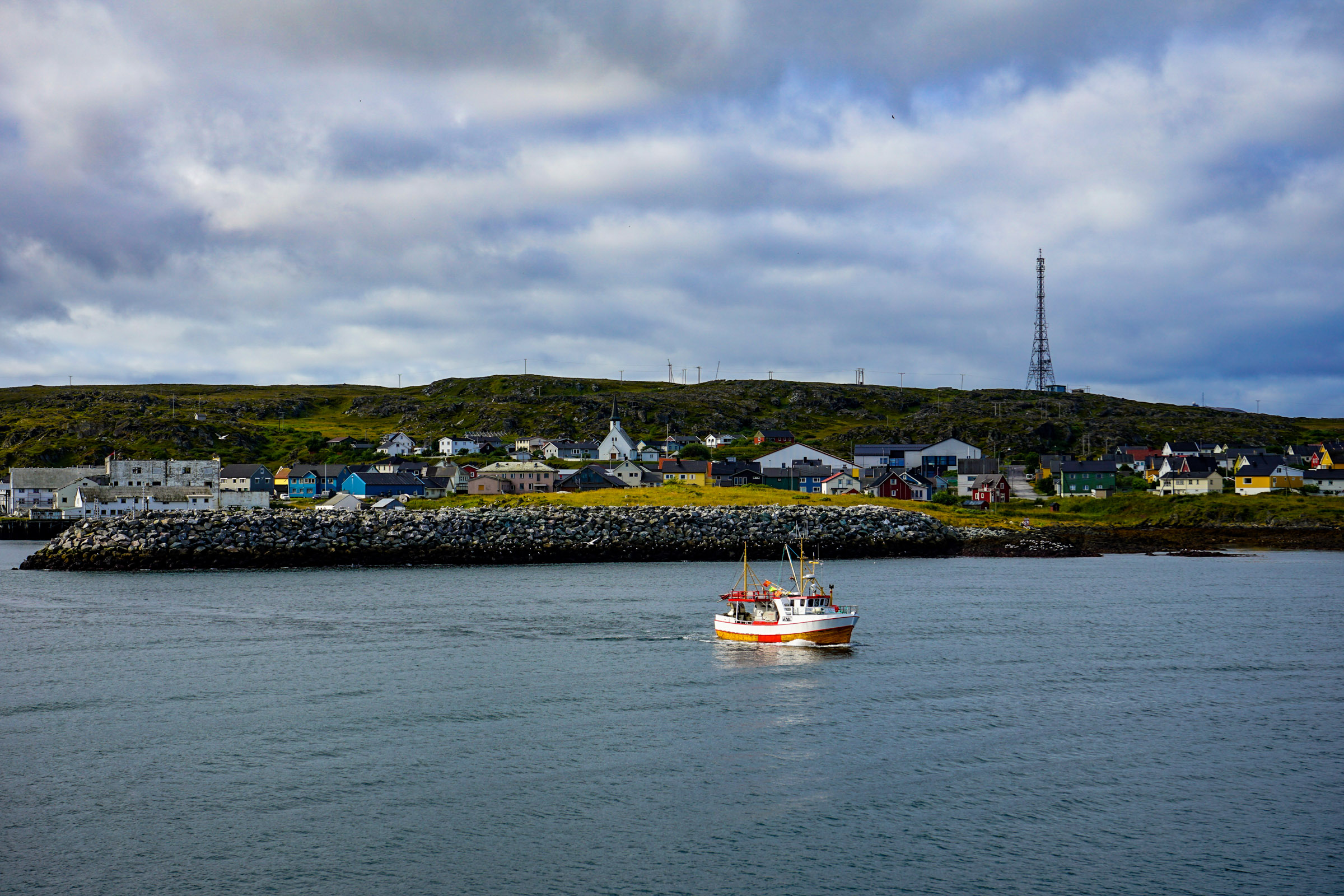
Pikku-Suomi – Little Finland – is located on the Arctic Ocean
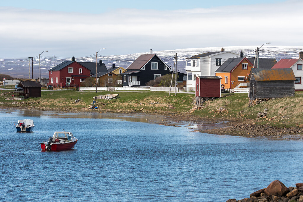
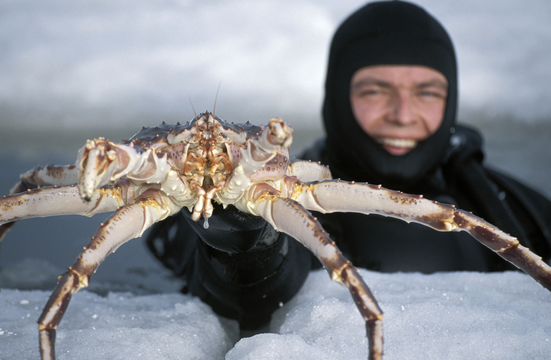
One of the few communities where the Finnish or Kven language is handed down to younger generations is Bugøynes on the south side of the Varangerfjord. This small village is a compact fishing village, and here, king crab is fished. This monster came into the net of a fisherman from Bugøynes in 1977, and has since become the way of life for the village by the fjord.
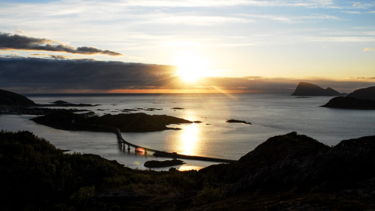
National tourist roads are especially beautiful
National tourist roads are part of a project in the Norwegian Public Roads Administration to promote particularly beautiful stretches of road. Varanger National Tourist Route is the easternmost of them all, and follows the north side of the Varangerfjord from Varangerbotn to Hamningberg. The Norwegian Public Roads Administration has built beautiful viewpoints, picnic areas and toilets that enrich the landscape. Toilets in Gornitak are built on a German ammunition depot from the war, and there are beautiful shelters where you can study bird life, ‘Arctic Viewpoint’ close to Vardø is the latest to be opened.
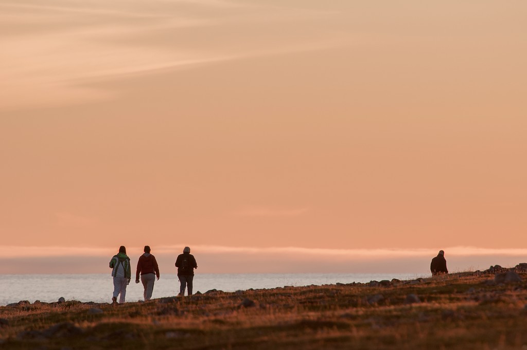
You see a high sky and wide horizons
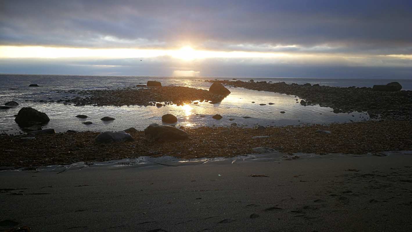
Here you are far away from Norwegian fjords and mountains. On one side you see the endless, low plateau of the Varanger Peninsula. Here is the only real tundra in Norway, because there is permafrost in the ground all year round in some places. On the other side is the shore; pebble beaches, sandy beaches and rocky shorelines. There are no islands, so you look towards the horizon to the east. At Vardø you can just about make out the Fiskar Peninsula in Russia in the far east. Inside the fjord, the birch forest grows lush, further out there is low shrub vegetation and heather moors.
People have lived here for 10,000 years
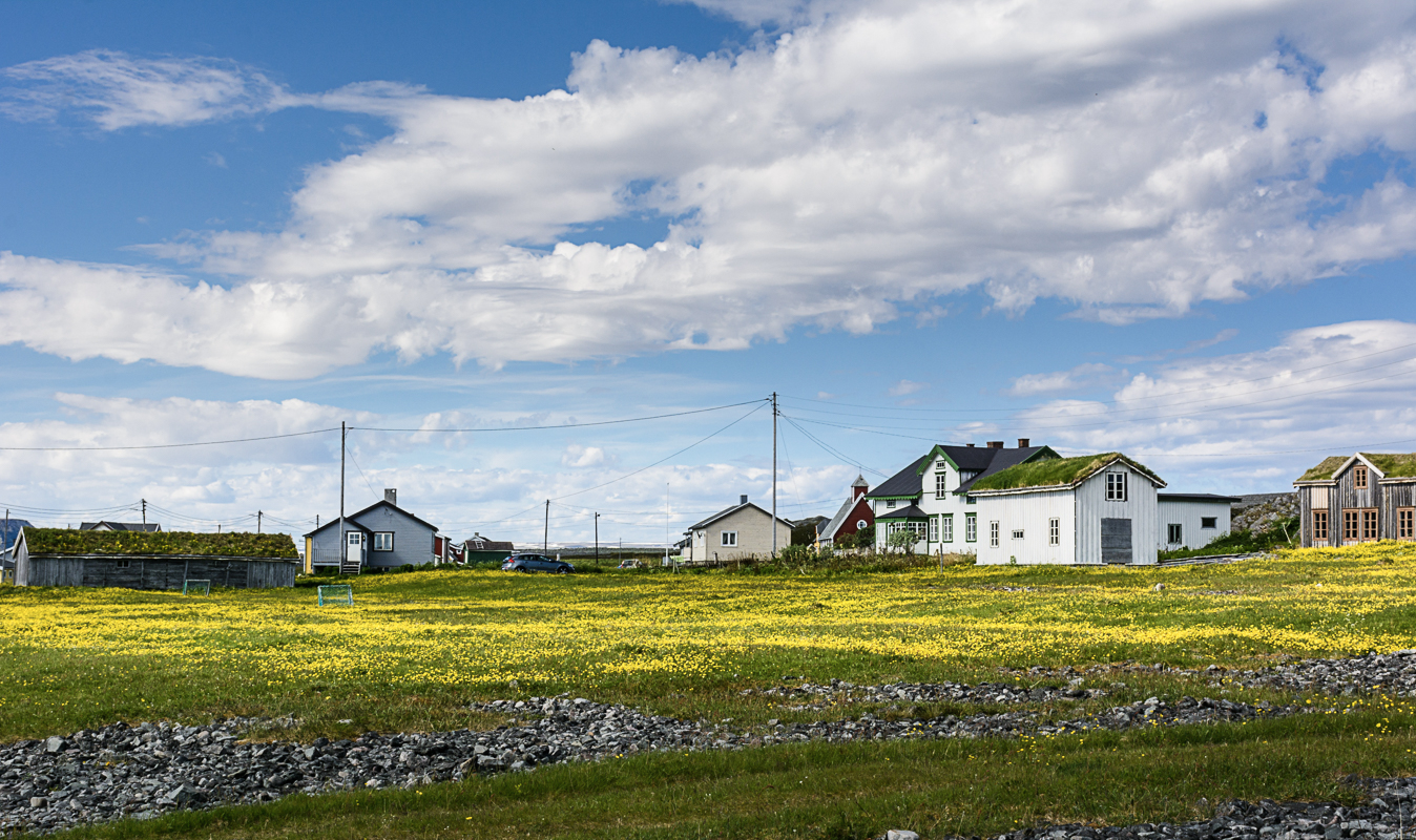
Just as distinctive as the landscapes so is the history of the people along the route. The archaeological traces at Mortensnes date back 10,000 years, while the fortress at Vardøhus dates from the 18th century. Unlike the rest of Finnmark, not everything was destroyed during World War II, so there is a visible history here. Finally, this is a multi-ethnic society, where Sami dominates deep into the fjord combined with the Finnish language around Vadsø. Some of the houses were bought as building kits by the Russian White Sea and set up in the fishing villages, others point to Finnish building customs.
The journey along the National Tourist Route starts in Varangerbotn
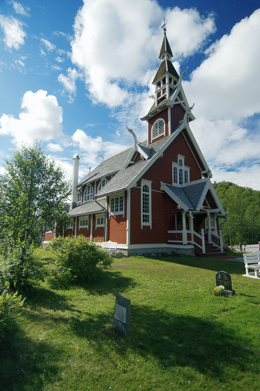
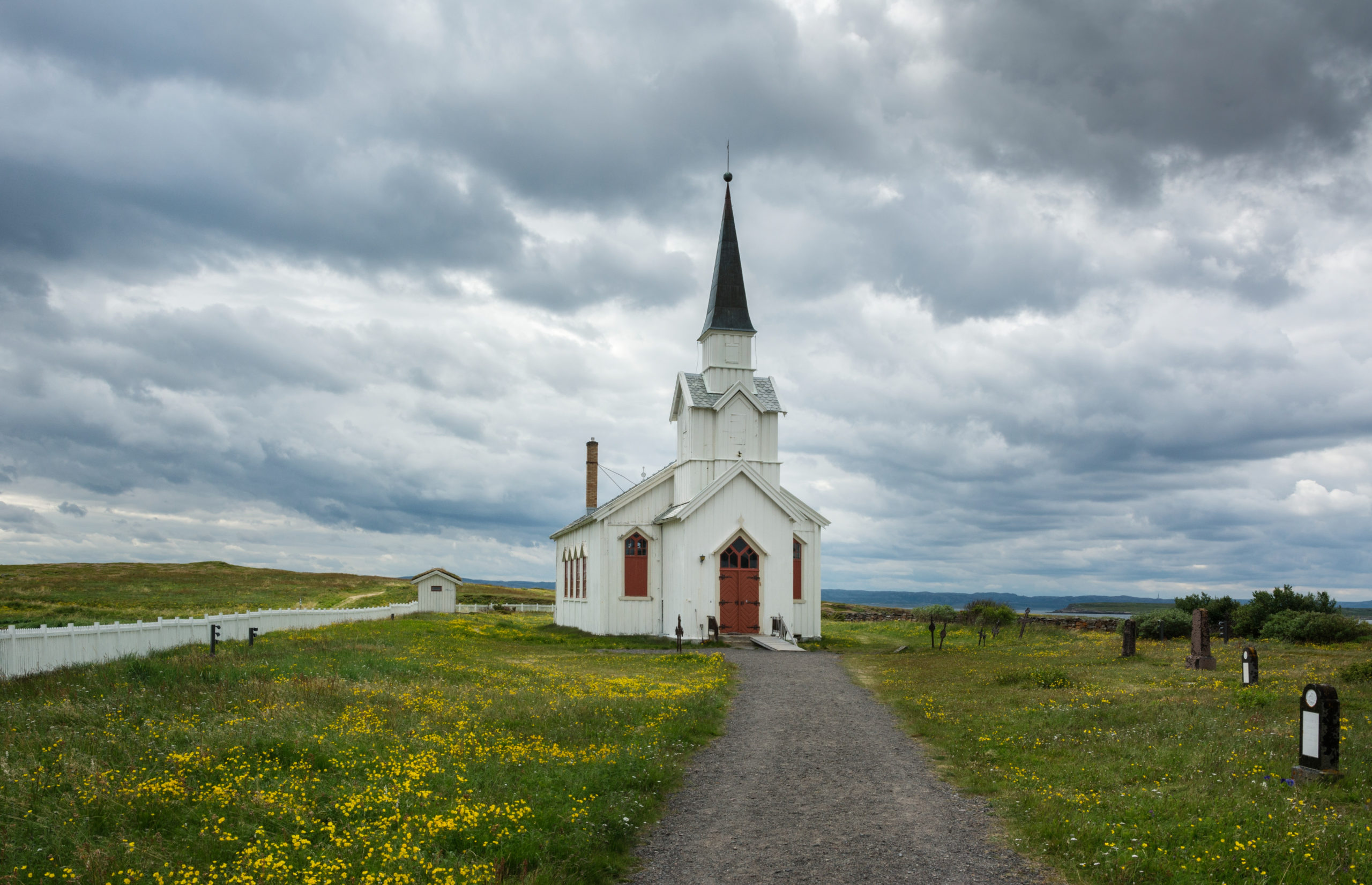
The tiny church in Nesseby from 1858 punctures the low horizon and is a favourite photo motif. Nesseby is a Sami municipality, and Varanger Sami Museum tells about the sea Sami, about duoddji – Sami crafts – and about costume history. At the end of the summer, Vuonnamarkanat is a fun Sami festival where you can taste and buy Sami food specialties. The small privately owned Sjøsamemuseet in Byluft has an impressive collection of old objects, feel free to ask the owner for a little tour.
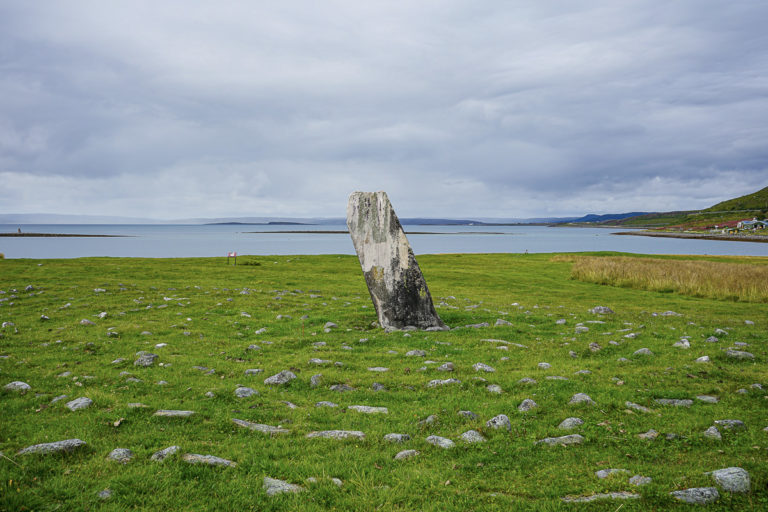
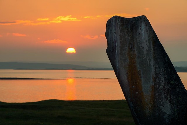
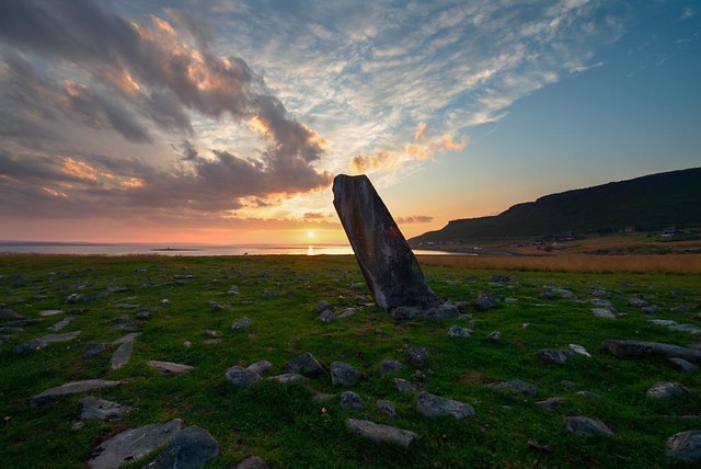
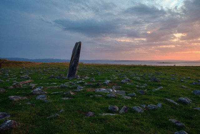
Mortensnes has been a meeting place for 10,000 years
Transteinen, which may have been a sacrificial stone, gamme tufts and graves for humans, bears and reindeer; Ceavccageađge, Mortensnes, has been inhabited for 10,000 years. Occasionally a seasonal residence, gathering place and permanent settlement, the area has a long history. This is one of the places in northern Scandinavia with the most archaeological finds. Follow the signs and walk around the flat landscape with a wide view of the fjord on a voyage of discovery.
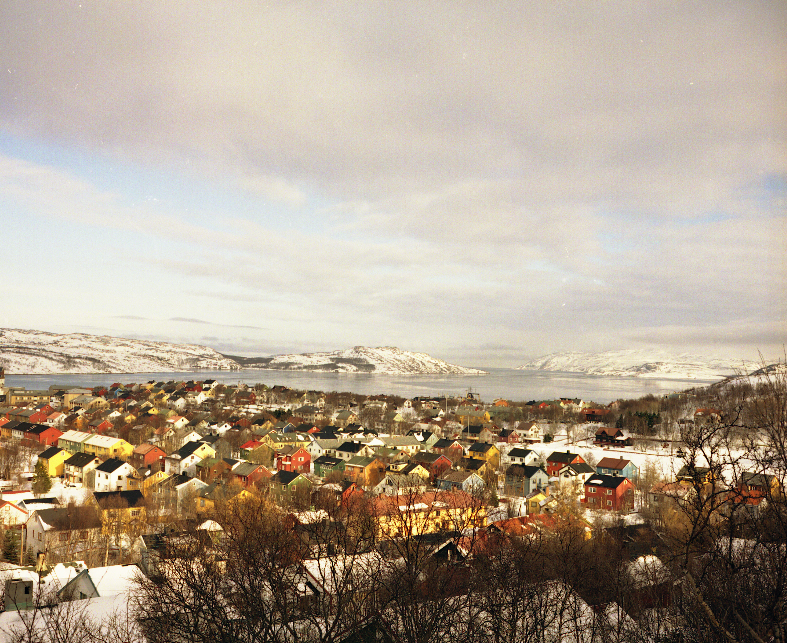
Vadsø is the Kven capital
Most people once spoke Finnish in Vadsø, as they had come from hunger and distress in Finland to the coast to become fishermen and farmers. This can still be seen in the surnames. In the Tuomainen farm there is a sauna, a Finnish bakery and old houses built according to the custom of Northern Finland and Tornedalen. Esbensengården nearby, on the other hand, is a Norwegian merchant’s farm. Despite the bombing of the city center in 1944, Vadsø has preserved a good number of older buildings, so a walk around the outskirts of town offers many photo motifs, and some of the houses can be visited because they are part of Vadsø museum. Also check out what they are exhibiting at the new City Gallery.

The airship mast was used for North Pole expeditions
Out on Vadsøya there is a mast that was used to moor airships. It has probably not been used that many times, but in 1926 the expedition “Norway” stopped with Italian Umberto Nobile as navigator and Roald Amundsen as acquaintance. They reached the North Pole a few days later, probably as the first. A new expedition in 1928 with the airship “Italia” also stopped by, but ended in a shipwreck north of Svalbard. The airships chose an eastern route inland up to the North Pole because they were sensitive to wind, and Vadsø was the last stop before Svalbard. A marked hiking trail of one and a half kilometres passes ancient monuments such as house foundations, old Sami hut foundations and war monuments. Vadsøya was an important fishing village around 1500, but then everyone moved to the mainland.
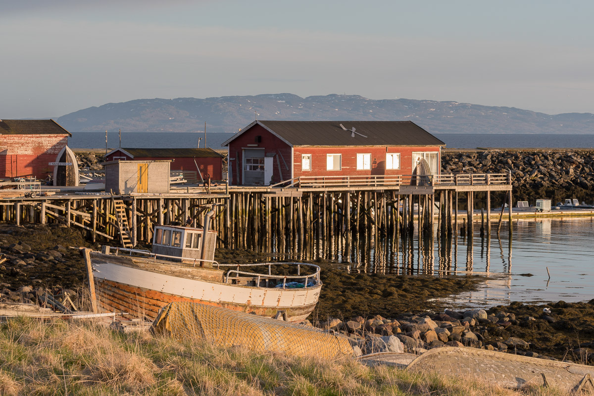
Ekkerøy is a peninsula with its own bird cliffs
Old piers on high pillars and small, colourful pre-war houses are located between two sandy beaches between Ekkerøya and the mainland. This fishing village was once busy, but today is a sleepy idyll with a small museum inside the fish farm and a fun little cafe where the waders go on an excursion. Here you park the car, walk along the beach and walk to the bird cliffs where tens of thousands of talkative seagulls nest.

Follow the hiking trail in Skallelv
Skallelv is a Kven village where historical architecture is well preserved. Here you find the characteristic Varanger houses, which have been built here with Finnish influence. Park the car and walk a marked hiking trail through the village and up into a distinctive, Arctic cultural landscape up the valley.
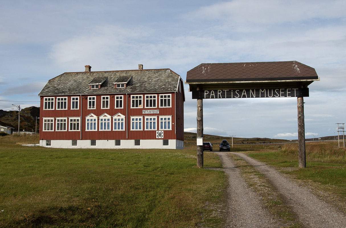
Kiberg has a partisan past
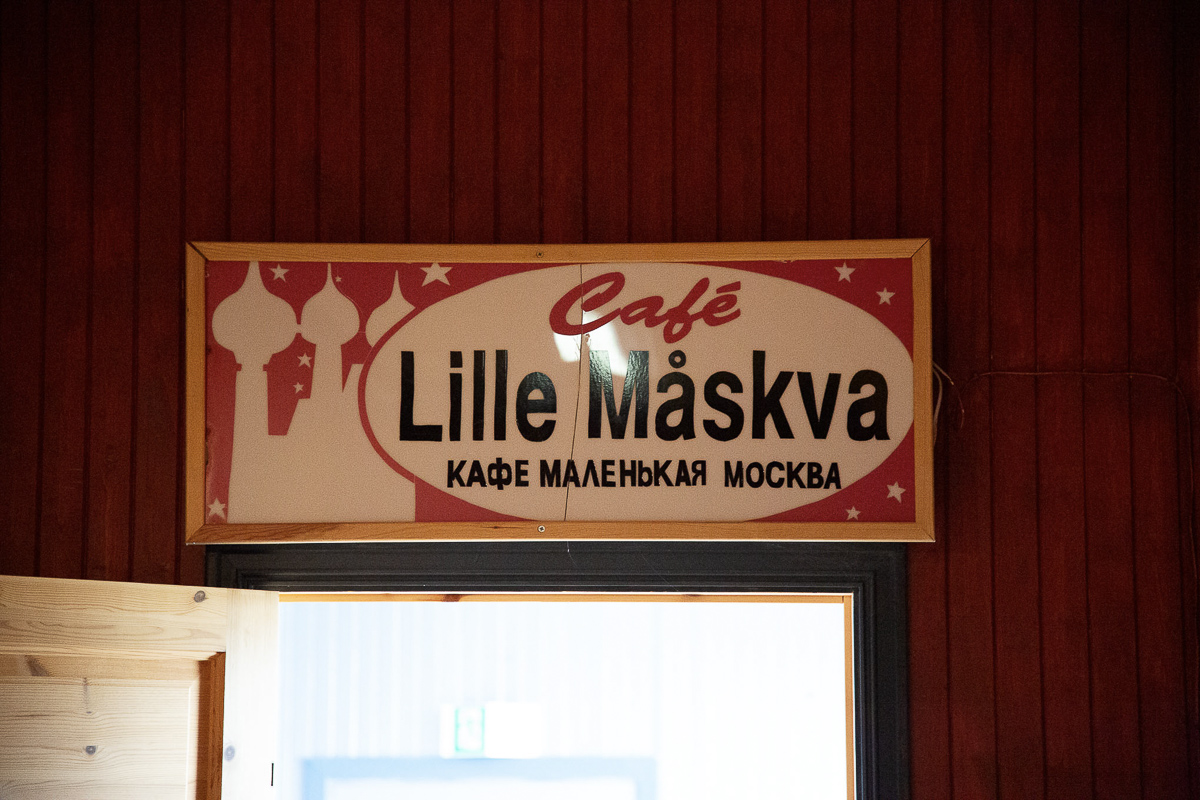
In front of the old boarding school are two monuments, one erected by the Norwegian state and one donated by Russia. Both honour the efforts young women and men made during World War II, when they moved from Kiberg to the Soviet Union to be trained in guerrilla activities. They returned as partisans who provided information on German troop movements to the Allies. This was an extremely dangerous activity, and the losses were great both among the partisans and among the locals who helped them. Everything is explained in detail and coherently inside the museum. After the exhibits, you can drink coffee at the café Lille Måskva, a nod to Kiberg’s nickname.
The mainland ends at Kibergneset
Kibergneset, locally pronounced Kibergnesset, is the easternmost point on the Norwegian mainland. The entire area was turned into a giant coastal fortress during the war. Take a look at the map inside the Partisan Museum and take a walk among crumbling concrete and cannon positions, but avoid going into cavities and into impassable caves. It is never known whether the de-miners got everything out after the war. From here you can see Russia on a clear day.
At Domen, the witches met on Christmas Eve
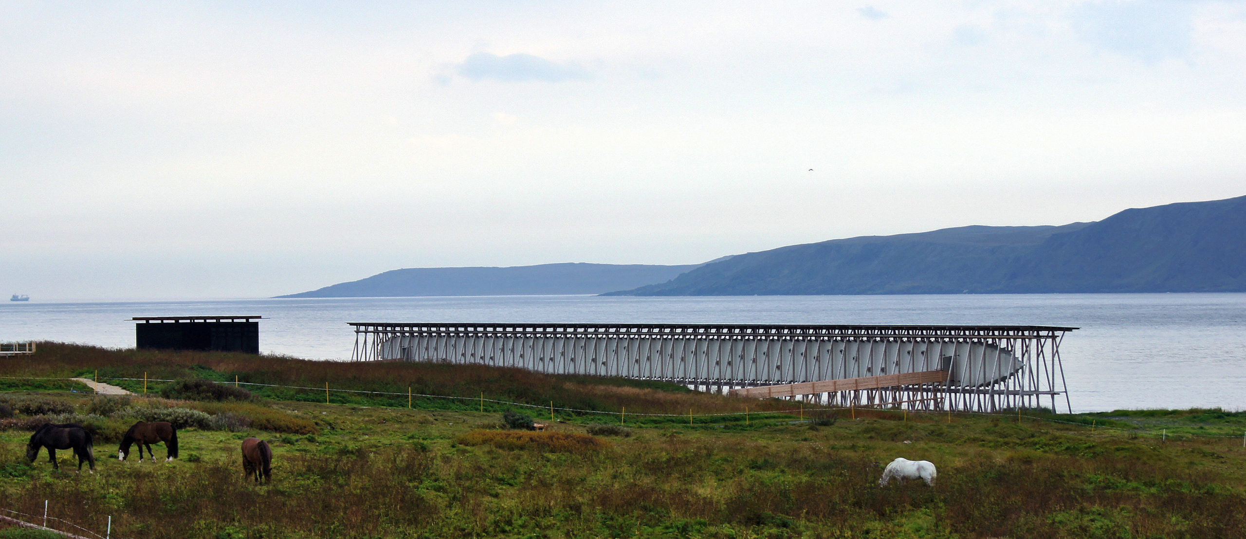
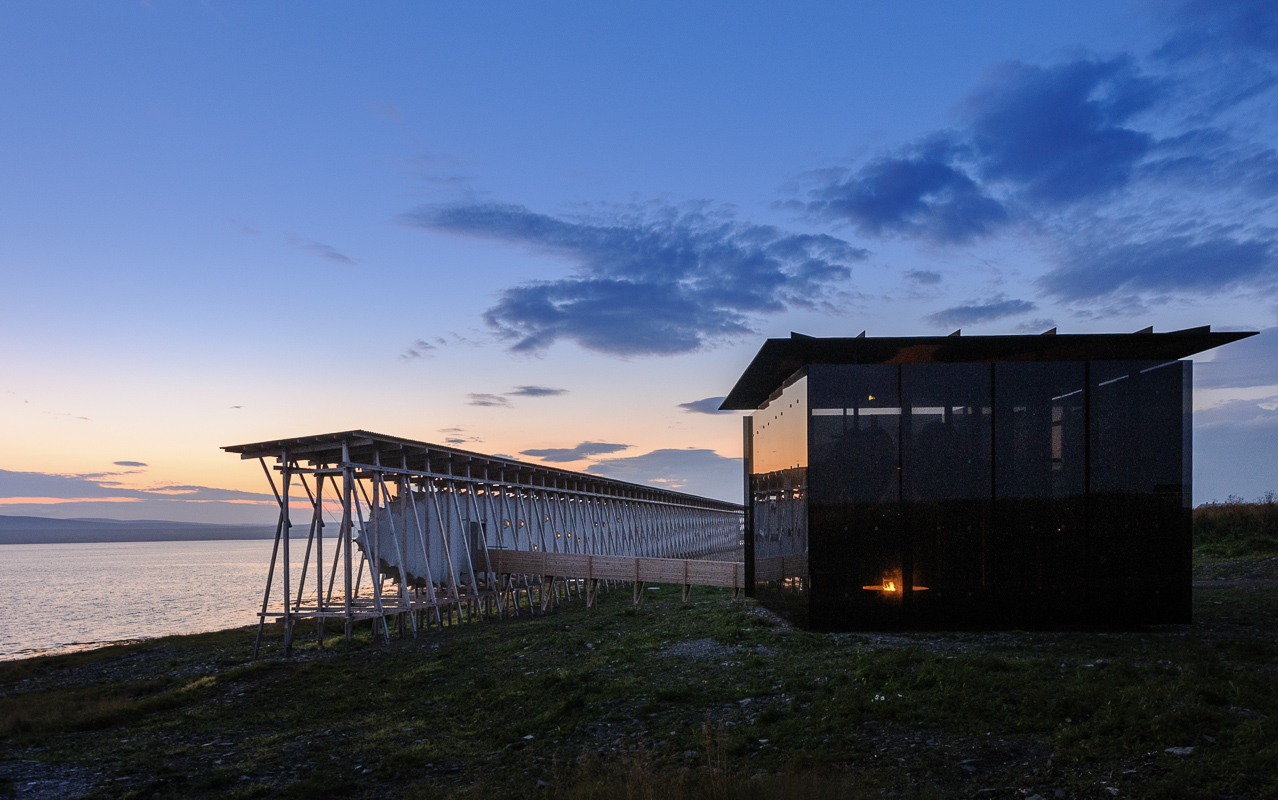
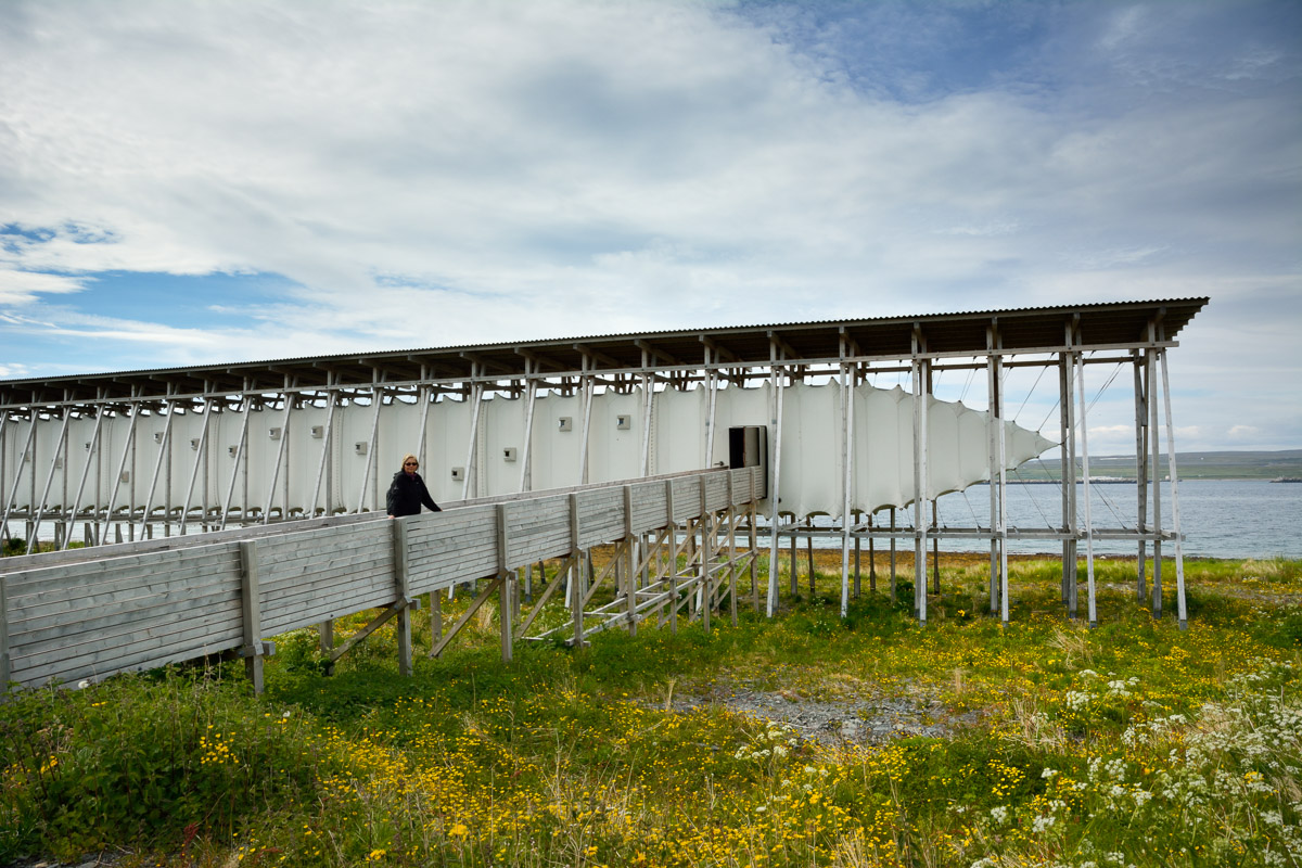
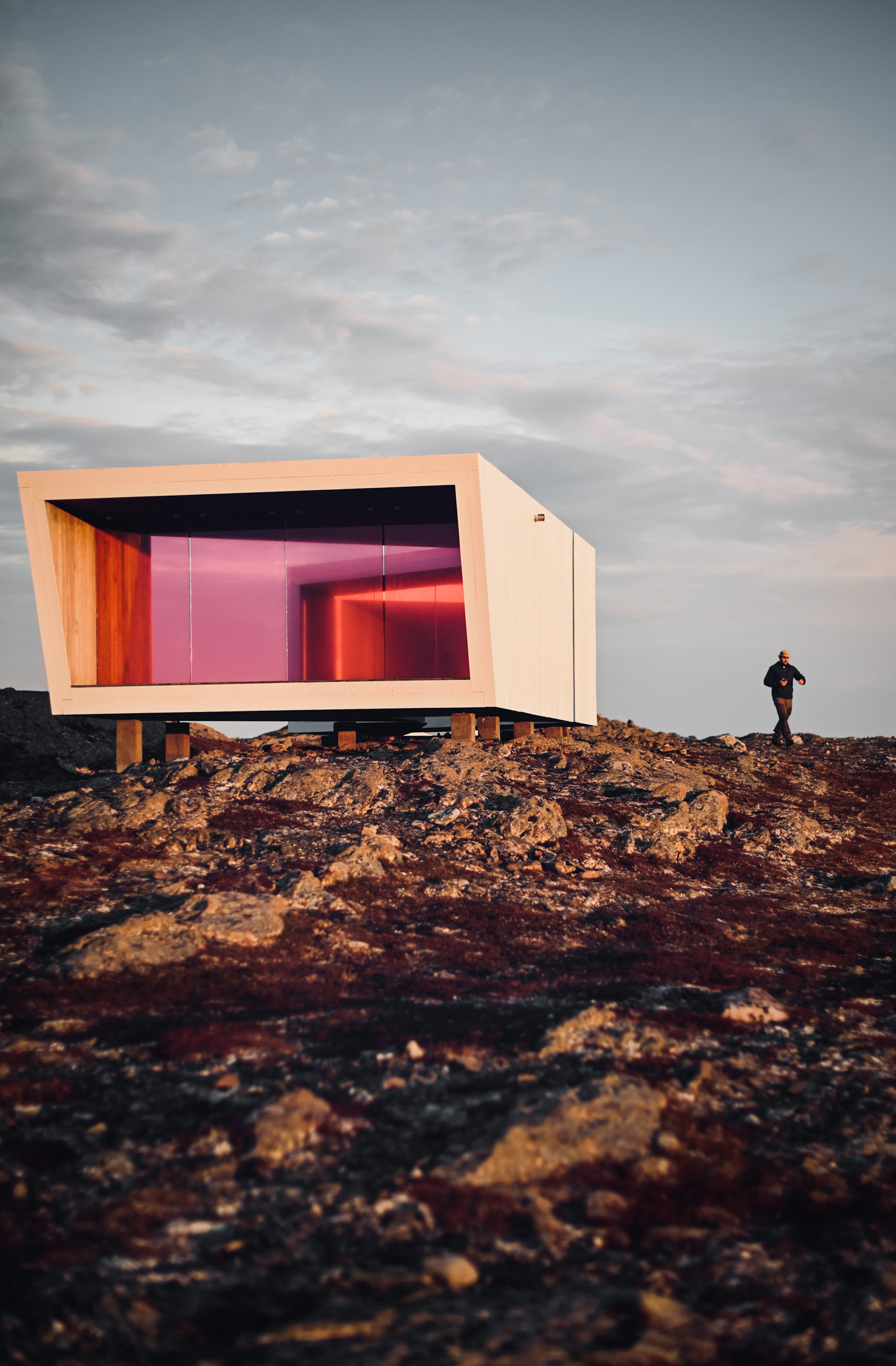
The dome is a mountain pass between Kiberg and Svartnes just outside of Vardø. The witches who were burned in Vardø in the 17th century, were often convicted of having participated in the celebration of Sankthans with Satan on the mountain Domen. The architect’s office Biotope in Vardø has designed a bird sanctuary and vantage point at Domen that both enriches the vast nature, and invites you to see it from new angles.
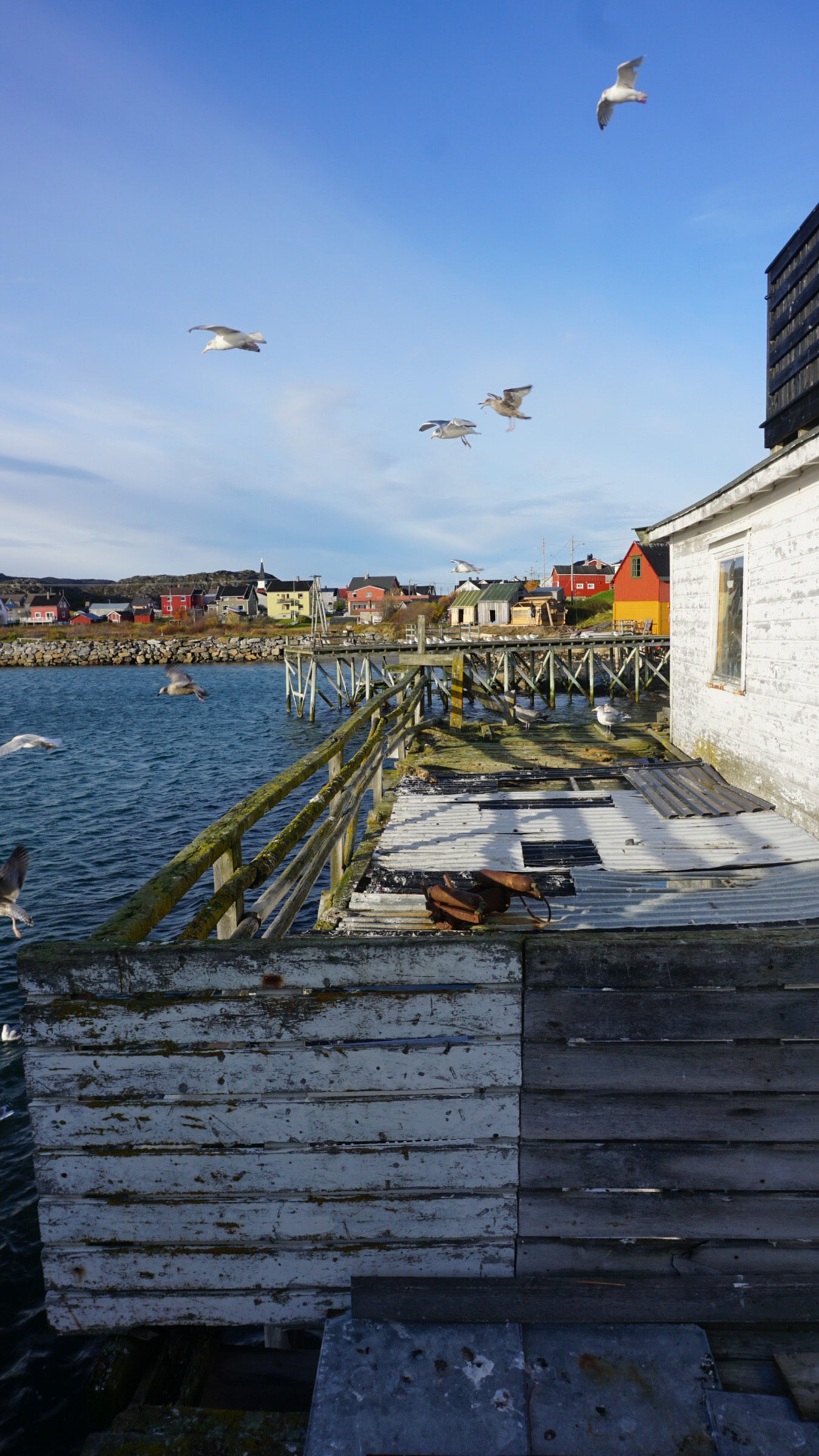
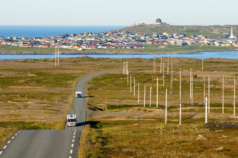
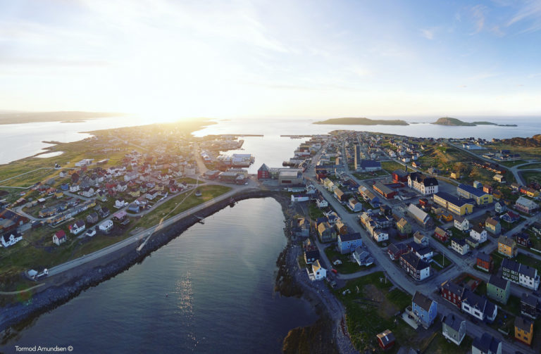
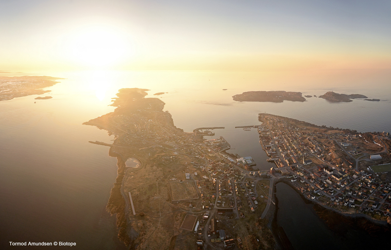
Vardø is Norway’s easternmost town
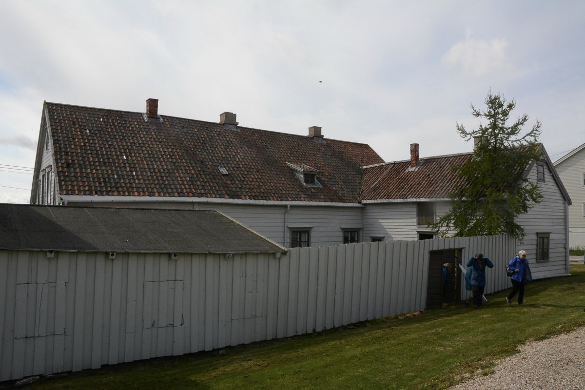
In 1307, King Håkon Magnusson (probably with a little help) built both a church and the first fortress on Vardøya. Thus he marked that Finnmark was a Norwegian county, and for over 700 years Vardø has been Norway’s outpost in the east. In 1789, Vardø was granted market town rights. the first in northern Norway, and the fishing trade to Russia was a cornerstone of the new city’s economy. The town was also called Norway’s largest fishing village, and the economy followed the peaks and troughs in the fishing market. In 1944, the city was bombed several times by Soviet aircraft, but was not completely destroyed.
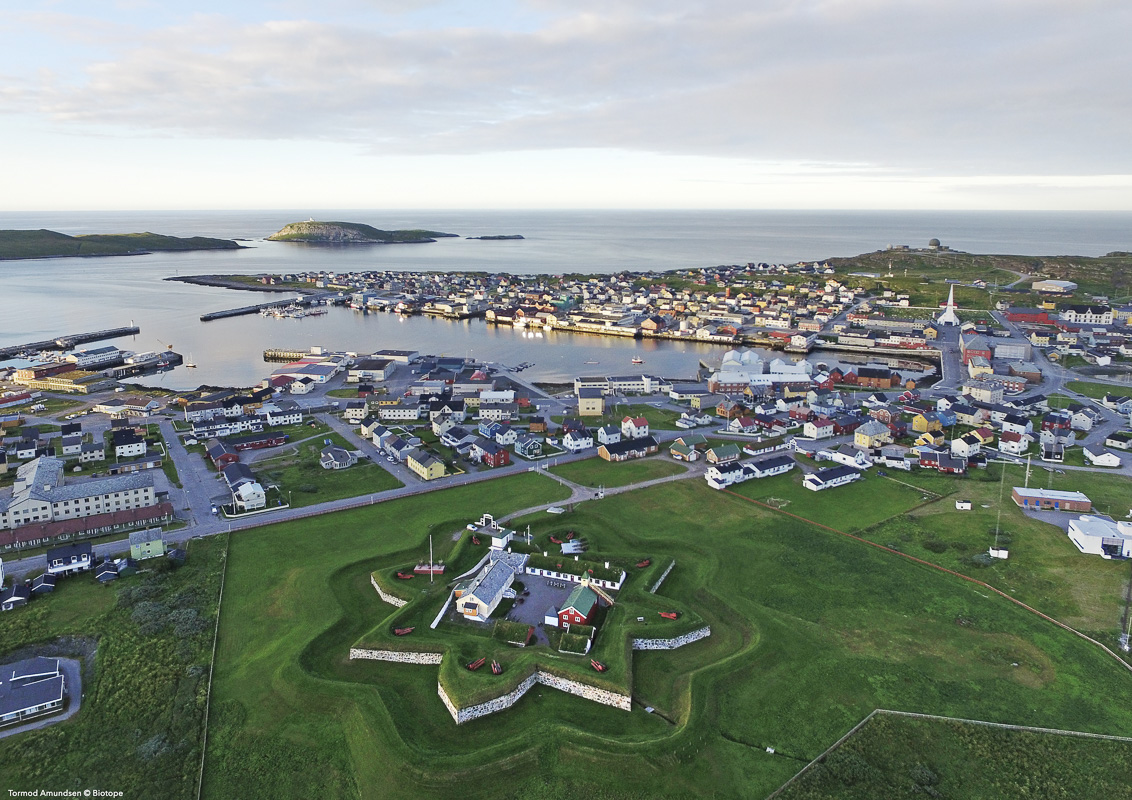
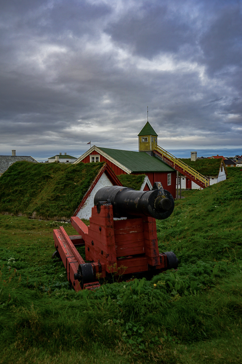
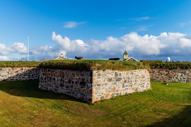
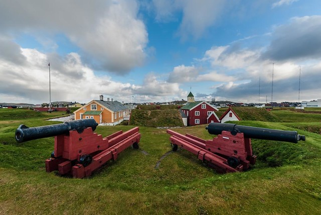
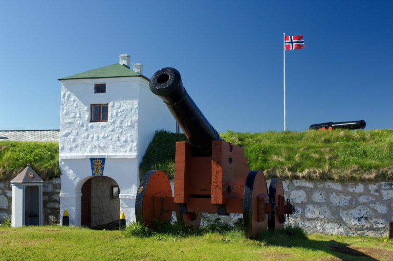
Vardøhus Fortress guards the eastern border
Vardøhus Fortress is the third fortress on Vardøya, and was completed in 1738. The remains of fortress number two can be seen in Østvågen, but today’s fortress is a star-shaped fortification of bastions with cannons on top. Inside the courtyard are several old houses, including the commander’s residence with a small rowan tree just outside. Previously, the roe at Vardøhus was the only tree in the town.
On the Royal Beam are the royal names
Christian IV’s journey to the far north in 1599 ended at the kingdom’s border in Vardø. The young king cut his monogram into the rafters of a house. Since then, the beam has found its way to slaveriet, which once housed the convicts. All later royal visitors had their monogram carved onto the royal staff. Today, Slaveriet is a small museum that puts the history of the fortress and Vardø in context.
The witch monument fills you with horror
The darkest chapter in Vardø’s history is the witch trials of the 17th century. For reasons we have not fully clarified, relatively more witch trials took place in Vardø than anywhere else in Norway. Between 1598 and 1692, 91 people, mostly women, were convicted of witchcraft and burned at the stake. In 2011, Queen Sonja Steilneset inaugurated a memorial site, often called the Witch Monument, in memory of the victims. Both Louise Bourgeois’ sculpture and Peter Zumtor’s memorial hall with a simple description of each of the nineties trial process add horror and evoke reflection.
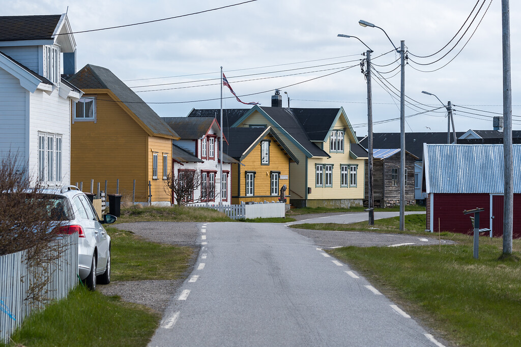
Remember to bring your camera to Vardø
The city centre itself is a delight for the photographer. Quite a few houses survived the bombing during the war, such as Brodtkorbsjåene. The colourful houses of the reconstruction, crumbling concrete from the post-war fishing industry, street art which adorn walls that would otherwise be empty and the seagulls that build nests everywhere; the city is characterized by history, decay and new optimism.
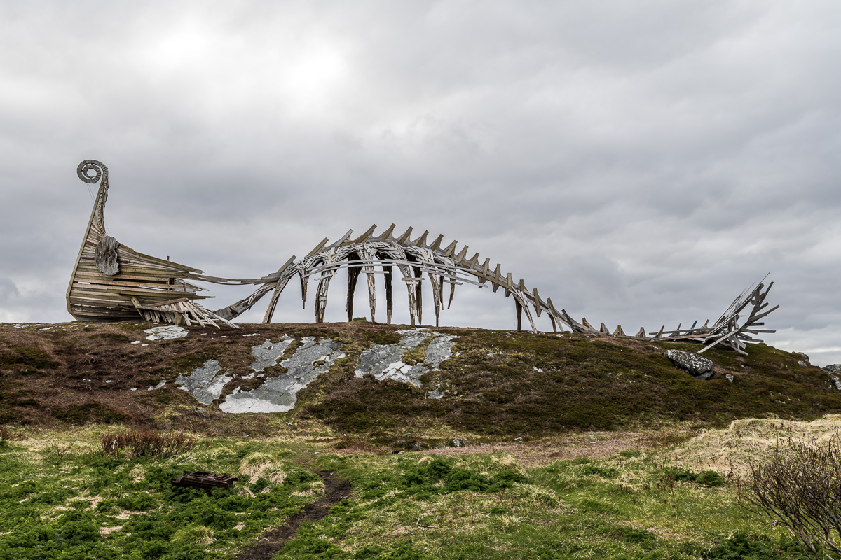
Drakkar is the strange sculpture
Humor and history are expressed in the sculpture Drakkar on the north side of the centre. A staff with a dragon’s head is reminiscent of a Viking ship. The rest of the sculpture is reminiscent of the body of a dinosaur skeleton, and of course you have to come here to take a picture.
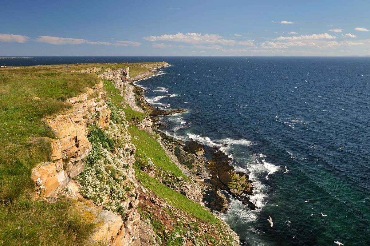
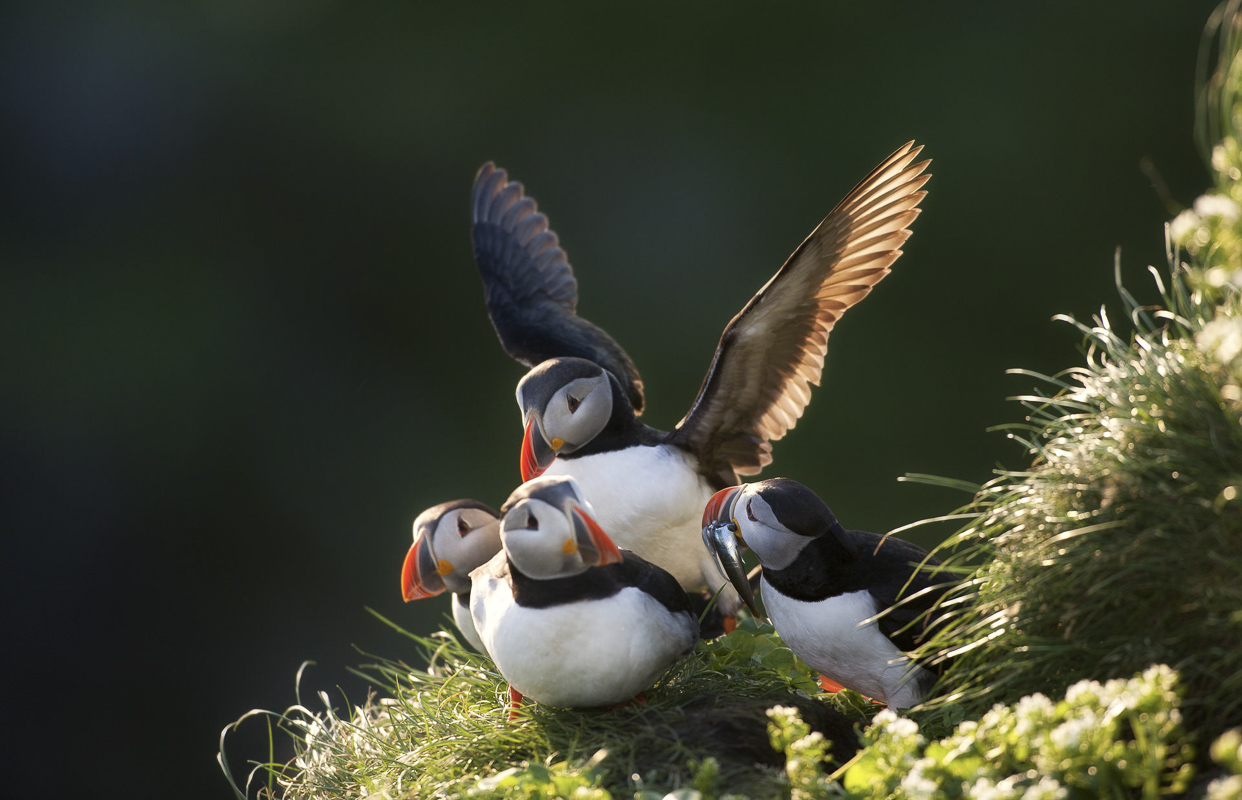
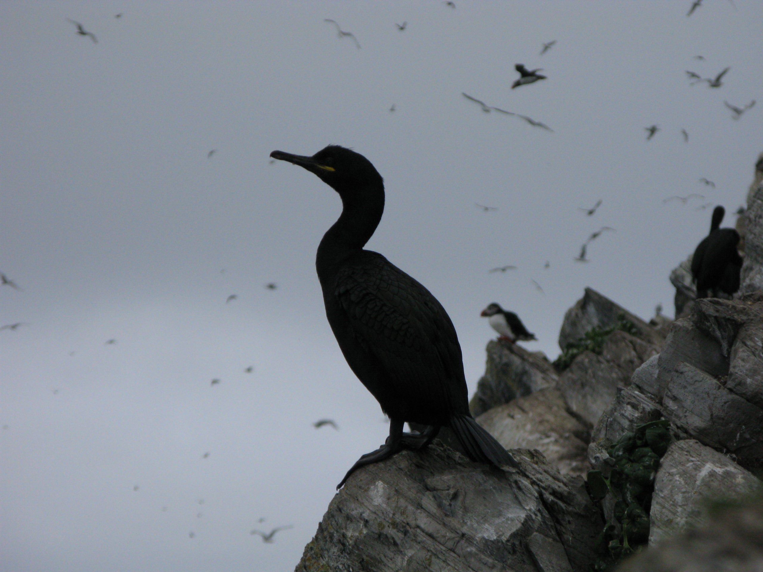
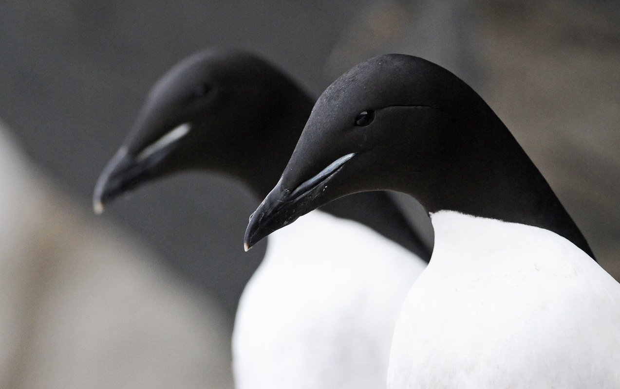
Hornøya is as far east as Istanbul
Even further east than Kibergneset is Hornøya, a ten minute boat ride from the harbour in Vardø. Tens of thousands of birds live here, and in early summer you are welcomed by diving guillemots. Angry seagulls, cormorants plunging from the rocks, polar guillemots in the steep slopes and the puffins in the lawn at the top; it is a classic breeding site over the summer months. Here you get closer to the birds than on any other bird cliff. Also take a turn up the hill to Vardø lighthouse and look over the Varangerfjord to Fiskarhalvøya. Such extremes make one think a little.

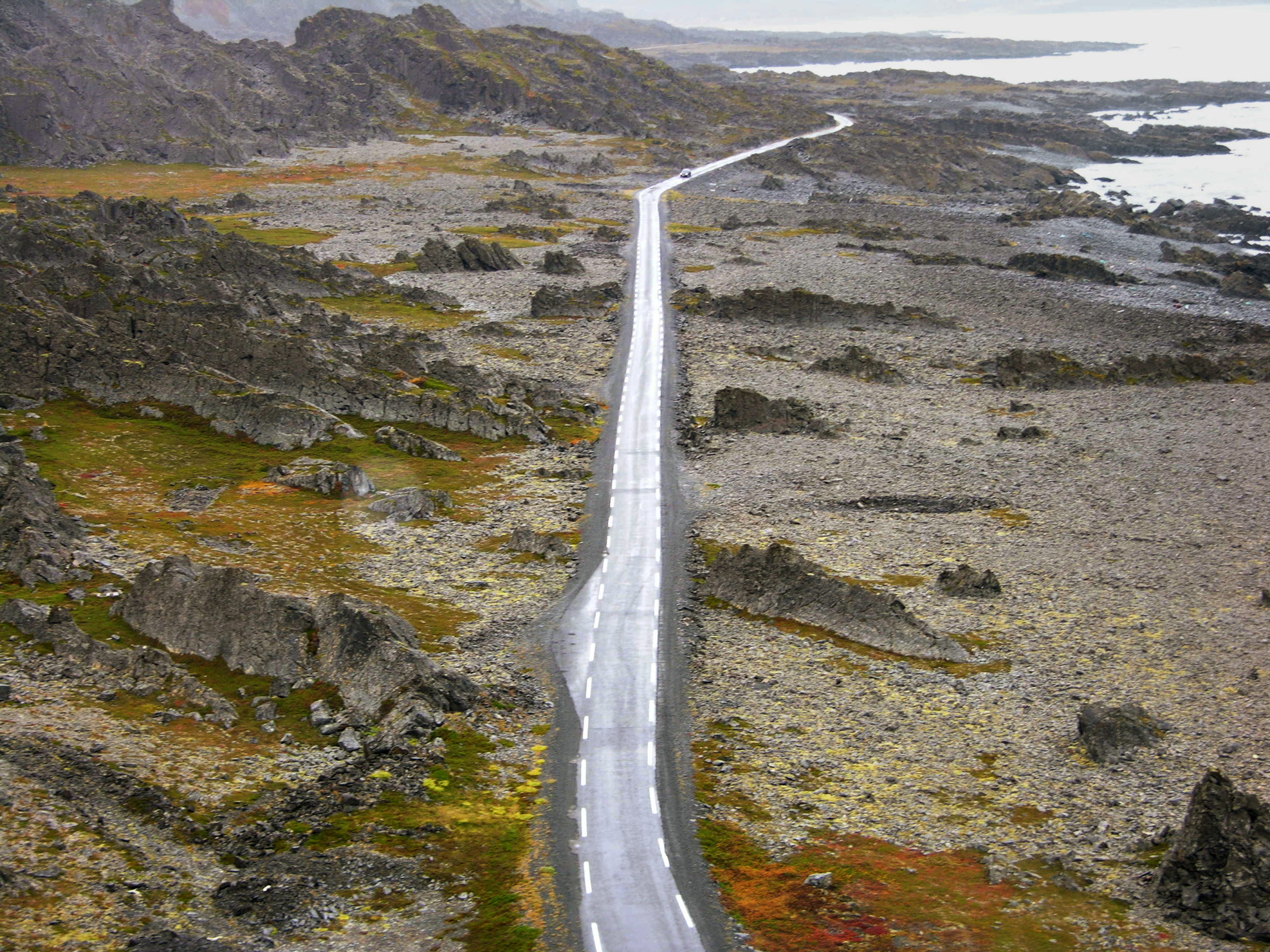
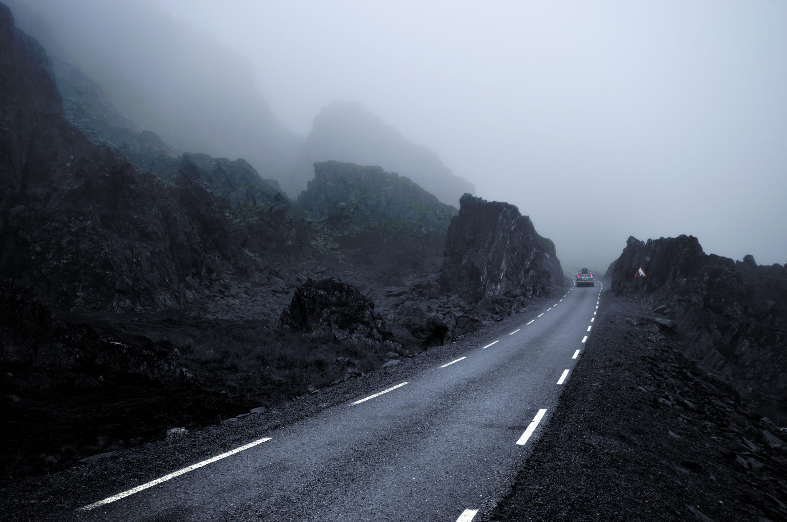
Drive the narrow, winding road through the lunar landscape
From Vardø, a narrow and winding, but absolutely drivable road continues towards Hamningberg. Since there is hardly any vegetation here, the geology gets to show itself in all shapes. The slate is thrown up by old geological drama, and stands as a point in the landscape. The lunar landscape was also used in the James Bond film Moonraker.
Hamningberg is located at the end of the road
Before World War II, there were 2-300 people living in Hamningberg. As in several places in eastern Finnmark, the fishing village escaped the devastation of war in 1944, and when the inhabitants returned in 1945, they were able to continue their lives. However, Hamningberg had an exposed harbour, and as the boats got bigger, Hamningberg lost in the competition with the other fishing villages. People began to move, and in 1970 the last ones left. In the summer, however, life returns to Hamningberg, and the descendants move into what are now used as summer holiday homes. The small café opens, and tourists sniff around the shore and take pictures of houses and weather-beaten nature. For a while, Hamningberg is reminiscent of the old days.
Take the detour to Berlevåg, Båtsfjord and Tana
From Varangerbotn, the E6 leads west over the landscape to Tana. The mighty river, called Deatnu in Sami and Tenojoki in Finnish, has its sources deep in the forests of Lapland and on the Finnmark plateau. In the summer, there is one thing that counts here, and that is salmon. The traditional river boats with modern engines have been pulled up on the river bank, and you see people standing in waders out in the river. This all takes place according to inherited rights and licences.
The Tana estuary is the country’s largest untouched delta
Where Tana meets Tanafjorden, large quantities of loose material come with the spring melt every year. This is located in what is Norway’s largest river delta, a flat area nature lovers can walk in as long as you pay attention. Ducks, sandpipers, sparrows, geese and a number of other birds are seen here regularly, the area has a distinctive flora and there is a separate seal community.


Tana is a Sami village by the river
Tana has deep Sami roots, with Finnish elements. Tana museum in Polmak is about the so-called ‘river Sami’, Sami who lived along the large rivers and lived off of river fishing, hunting and simple farming. Here you find both exhibitions, old houses that survived the war and traditional boats.
13 magic summer spots
The fishing villages north of the Varanger Peninsula are rarely visited
Nowhere in east Finnmark are tourists absent. If you take the road over the mountain from Tana to Berlevåg and Båtsfjord, however, you will be completely off the beaten track. Here you will find two active fishing villages and some small communities that are well worth seeing. Cross the mountain from Tana, and start in Syltefjord furthest to the southeast, and move to the end of the road in Store Molvik past Berlevåg in the northwest.
Syltefjordstauran is an elongated bird mountain
Syltefjord cuts deep into the Varanger Peninsula from the Barents Sea, and provides shelter for humans and animals. Syltefjordstauran is a mountainside here a couple of kilometres along the fjord. Seagulls, puffins, guillemots and many other bird species nest here between April and August. Although some of the bird communities have declined in recent decades, a boat trip out here is a great experience.
Syltefjord comes to life in the summer
Once upon a time life was bustling in several small places along Syltefjord. In Nordfjord, the houses from before the war are still here, and people from Båtsfjord use them as cabins. In the summer there is a festival, summer cafe and shop here, and the atmosphere is relaxed and summery. Ytre Syltefjord is nothing but tufts, but if you follow the small path from Nordfjord, you can walk between the walls and imagine what it might have looked like before the war.
Båtsfjord is the modern fishing village
If Syltefjord represents a beautiful past, Båtsfjord is very much representing the present. This fishing village has grown greatly after the war, and has all the amenities. Visitors enjoy the modern church with its colourful stained glass windows. Båtsfjord also has nice hiking trails that do not require too much effort, and which provide great views.
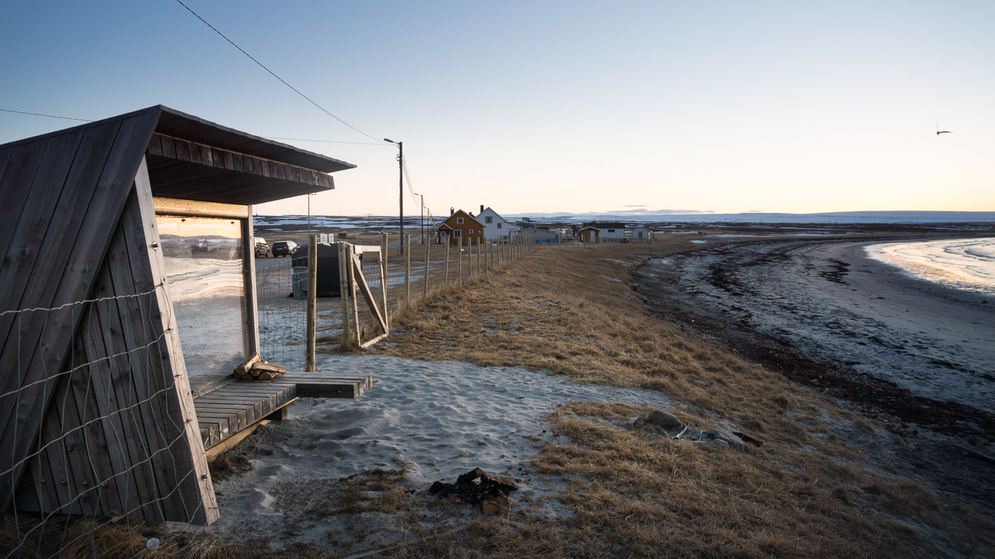
Veidnes is a small idyll by the Arctic Ocean
A small lump of mountain protects the small town of Veidnes against the Barents Sea, with Kongsfjord lying just beyond. These tiny idylls of colourful pre-war houses offer both a fun little shop with a café and accommodation in old houses, such as “Månedskarbua” – where “måneskaran” – the seasonal fishermen – lived. What do you do here? You walk to ancient monuments, war memorials and up to the bird sanctuary on a mountain top.
The Arctic Ocean Road runs along rugged Barents Sea coast
The road between Kongsfjord and Berlevåg is called Ishavsveien. Here, the Barents Sea, the Austhavet as it is said locally, meets a rugged rocky coast with strange rock formations, roll stone beaches and sandy beaches. Here you can stop in beautiful places, and there are even a couple of nice hiking trails where you can stretch your legs. One stop no one misses, however, is Kjølnes lighthouse. A square concrete tower from 1947 lighting up the rocky landscape.
Berlevåg is located at the far end of the Arctic Ocean
One of Finnmark’s historic fishing villages is Berlevåg, which is located at the far end of the Barents Sea. Nothing was left here after the burning in 1944, instead it is the colourful reconstruction era houses that stand close together around the small harbour, often with some roe trees sheltered by the south wall. The small town centre can offer shopping at the small art galleries, and is an urban little surprise in the raw landscape.

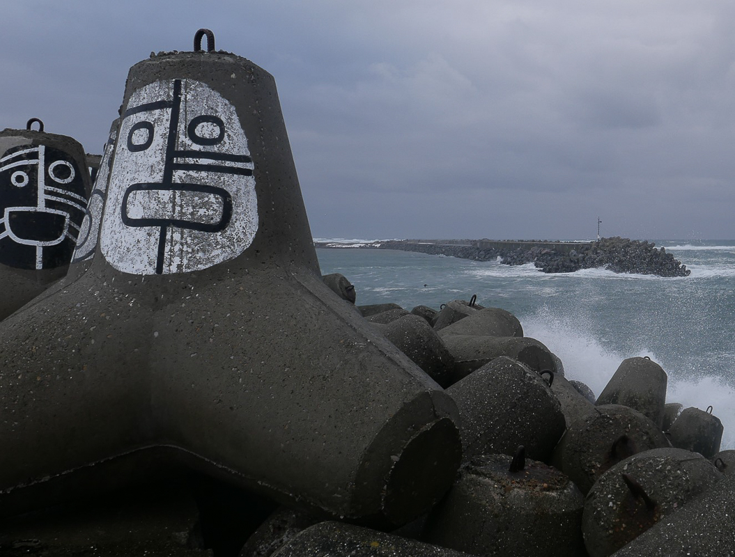
The pier is the battle for Berlevåg
Time and time again, the storms entered the small harbour and sent the fishing boats up into the quays. Jetties were built, but the winter storms washed them out to sea. With the modernization of the fishing fleet, Berlevåg’s existence was at stake. The answer to the many challenges was the impressive pier made of tetrapods, four-armed concrete elements that hook together when the storms rage. The whole story is told at Berlevåg Harbor Museum, which also exhibits “barges”, the boat that was used to help the Hurtigruten before the harbour was secured.
Store Molvik is the last chapter in this story
Once you have reached Berlevåg, you take the drive to Store Molvik. This is an abandoned place, where today there are only a few cottages and old houses used as summer houses. Along the way, it is possible to take the trip up to Tanahorn, which from a height of 270 meters offers a wide viewpoint of the Barents Sea, the Tanafjord, the North Kyn coast in the distance and the Varanger Peninsula.
The midnight sun first comes to East Finnmark
Time plays a small part when it comes to the midnight sun. Since we are still setting the clock for summer, midnight is one o’clock in the morning in western Troms-Finnmark. In Eastern Finnmark, however, Finnish time is more apt due to the areas longitude, here the sun is at its lowest around midnight. By the Varangerfjord, the midnight sun lasts for over two months, but the duration depends on how far north you are. In Noatun, the southernmost part of Pasvikdalen, the midnight sun lasts from 21 May to 22 July, while Berlevåg bathes in midnight sun from 13 May to 29 July, ie two weeks longer.
King crab is a delicacy
In the sixties, the Russians released a giant crab from the area around the Bering Straits in the Murmansk fjord, apparently it happened by accident. Now the crabs have spread over most of the Barents Sea, and in Eastern Finnmark you can go king crab fishing from Kirkenes, Vadsø and Ekkerøy. Fishing trips always include a good and plentiful meal of king crab, and delicious crab meat is also served in restaurants along the entire coast.
The birds meet in Varanger
You notice them in some hotels; people in puffa jackets and with small binoculars around their necks. It’s the birdwatchers. They look for rare birds, both small blue tits in the forest and on the plateau, waders and the large seabirds. If purple sandpipers and white winged Scoter are not immediately clear concepts for you, you will still enjoy the experience. To the delight of the birdwatchers, architecturally designed bird shelters have been set up. They provide shelter on hot summer days, and then you can watch the bird life without being seen by our feathered friends. Varanger Bird Park is an area by Vadsø where there is a particularly rich bird life, and where it is possible to various species, even for non-experts. The bird cliffs on Ekkerøy, Hornøya and in Syltefjord also delight more than the passionate birdwatchers.
East Finnmark has a visible history
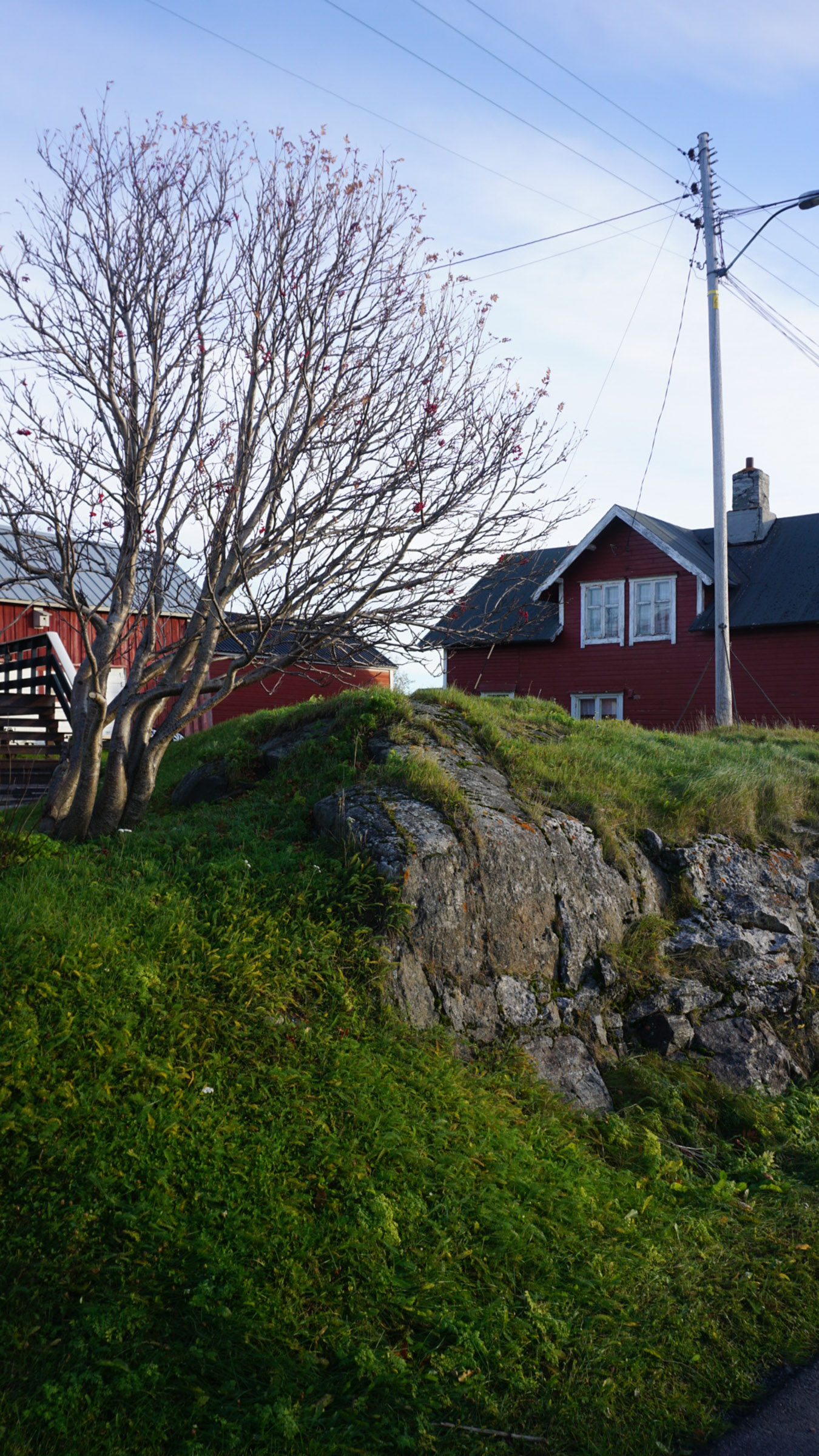
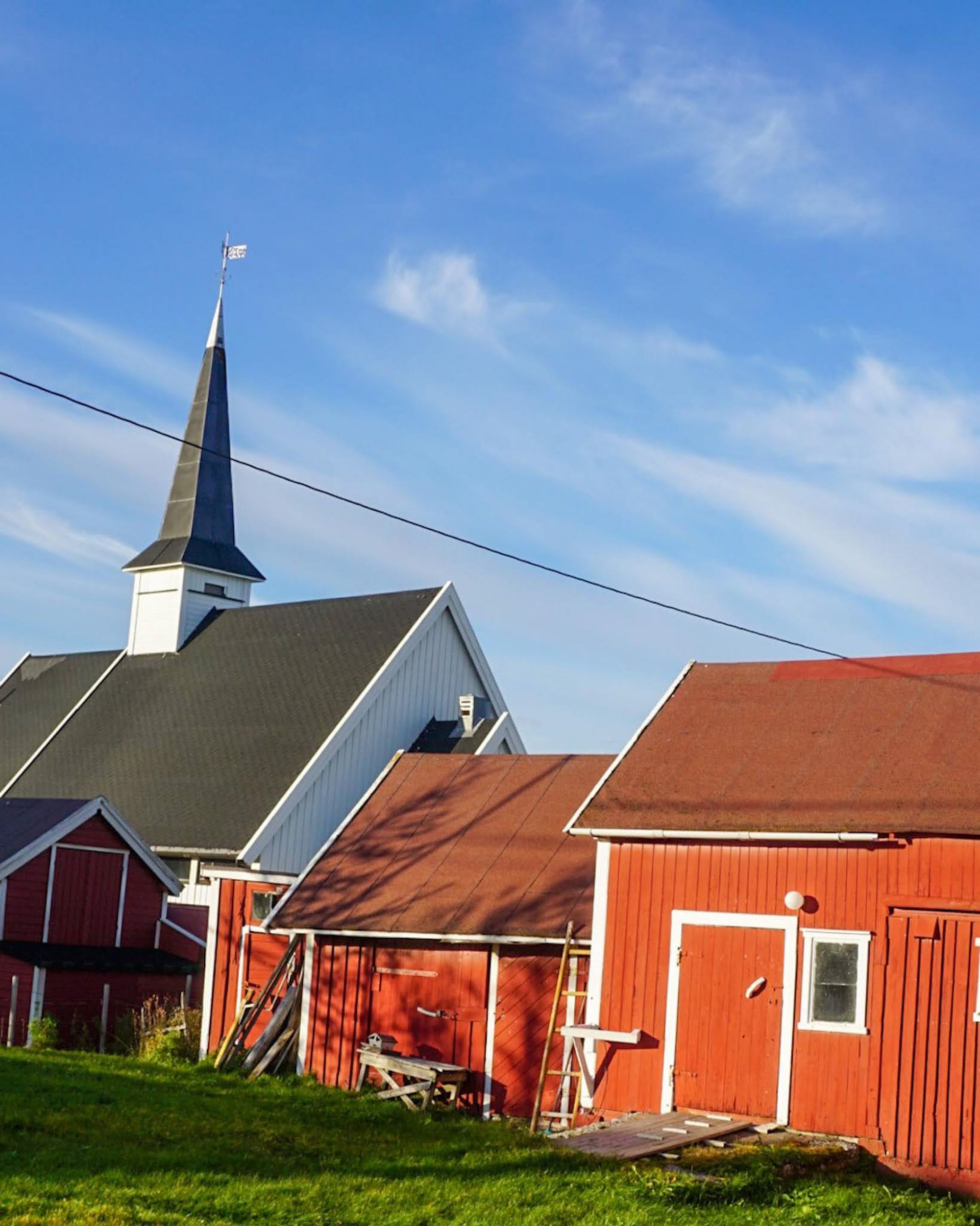
One of the most characteristic things about Finnmark is the reconstruction architectural style. At the end of 1944, the Soviets gained the upper hand in the war that had raged just east of the border. They moved in, and the Germans withdrew to the Lyngenfjord. On the way, they forcibly evacuated the entire population, and everything was burned down. However, they did not manage to burn everything in East Finnmark. Therefore, in many places you can see pre-war Finnmark in the form of old houses in the fishing villages, the varanger houses which are a Kven house type, farms of the southern Norwegian type in Sør-Varanger and churches from the 19th century. They often stand side by side with the typical simple, modernist and colourful rebuilding style, and form an eastern character of towns, fishing villages and settlements.

Three cultures meet in Eastern Finnmark
A typical feature of Eastern Finnmark is the multicultural community. Sami culture dates back at least 2000 years, and is the original culture in the area. The Eastern Sami in Sør-Varanger, who were Christianized by the Russian Orthodox monk Trifon in the 16th century, have a traditional connection to Russia. The others were Christianised from the west in a long process until the 18th century. Sami culture is particularly strong today in Unjarga / Nesseby and Deatnu / Tana.
Immigrants came in several waves
Norwegians settled in eastern Finnmark from the 14th century, and then lived in fishing villages along the coastline. A new wave of immigrants from the south came to south Varanger in the 19th century to set up farms. In the 19th century, there was also a new supply in the Norwegian fishing villages on the outer coast. Today, the vast majority speak Norwegian at home, and it is impressive to find someone you can not speak Norwegian with. Connections to Finland have always been strong, but during the famine in Finland in the 1860s, there was a large influx of immigrants to the whole of Eastern Finnmark. Kven (as the language and culture are often called today) today characterizes areas along the Varangerfjord, such as Vadsø, Vestre Jakobselv and Skallelv, and especially Bugøynes, where the Finnish language is strongest.
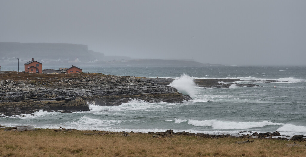
The weather is a lottery in Eastern Finnmark
Occasionally the highest temperatures in the country are measured in Nyrud up in Pasvikdalen, and the measuring stations in Tana follow. During these times Eastern Finnmark bathes in the Russian heat, and life is wonderful. Other times, the northwest wind is freezing with icy, horizontal rain. A few years ago, the snow settled on Båtsfjordfjellet in July. Typical summer weather in the far east can also be cool winds from the northeast, with clear, sharp days. Then it’s nice to be out, as long as you have a good jacket on. Put thermals, hat and mittens at the bottom of the suitcase just in case, and do not forget the swimming trunks. A windproof jacket and jeans are easily worn everywhere, with hiking trousers easy to slip over the top to add more protection.
Fly to Kirkenes and start there
It is natural to start in Kirkenes. Here is a main airport, a major airport as they say in the north, with 737s from both Norwegian and SAS. Since there is competition on the route Oslo-Kirkenes, it is easy to get discount tickets. Rental cars, hotels, etc. are also easily accessible here.
It is convenient to rent a car
There is no bus every 15 minutes in Eastern Finnmark, so nothing gives the freedom that a rental car gives. For example, two to four people can rent a car at the airport in Kirkenes (advance booking is a good idea, especially during the holidays) and have it during the entire stay. Alternatively, you can rent a car in Kirkenes during the day, and then use public transport to, for example, Vadsø, and then rent a car there for a day or two. A combination of public transport and car rental requires some planning, but you can save money and relax more.
Public transport between the cities and the large towns goes well with a little planning
Bus travel must be planned carefully, as there are not many departures. There is a bus from Kirkenes to Varangerbotn and around the fjord to Vadsø and Vardø a couple of times a day. The same applies westwards from Varangerbotn to Tana bridge. Please note that there are no departures on Saturdays. Finnmark is large, and the distances are long. Within the area covered by this article, however, the distances are not extreme, it takes a little over four hours by bus from Kirkenes to Vardø or Berlevåg, i.e. the end points.
Widerøe’s summer tickets open up cheaper opportunities
One way to save yourself time and money is to check Widerøe’s website during the run up to Summer. At this time, Widerøe tends to put out cheap tickets as there is little demand. One idea might be to take a flight from Kirkenes to Berlevåg, and then use public transport back again.
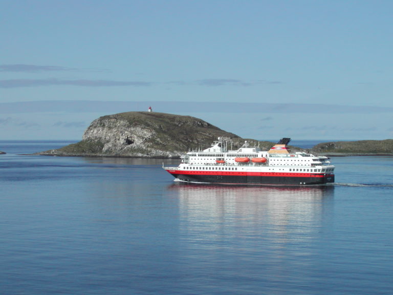
The Hurtigruten always runs
One of the most traditional ways to travel is to take the Hurtigruten boat. The calls in Eastern Finnmark are Berlevåg, Båtsfjord, Vardø and Vadsø, as well as Kirkenes where Hurtigruta turns. The sailing time between calls is a couple of hours, and you do not need to book a cabin if staying on board less than 24 hours. The ships are modern and comfortable, and you can eat well on board.
The accommodation opportunities are varied
The accommodation possibilities in Eastern Finnmark are varied, and flexible travellers like to stay in a chain hotel with a breakfast buffet one day, and then in a historic fisherman’s cabin with self-catering the next. It’s a matter of attitude. The comfortable chain hotels are located in Kirkenes and Vadsø, while Båtsfjord and Tana bridge have locally owned hotels. At Svanhovd in Pasvikdalen there is a comfortable hotel and conference centre. There are also campsites and various private accommodations.


Look for accommodation with character
Do you think the accommodation should smell a little of the sea to be real? Then you should look for distinctive accommodation. East Finnmark with its rich history has some real gems. Jakobselvkaia in Jakobselv by Vadsø is furnished within a fish farm from the seventies. Ekkerøy holiday home and Havhesten offer simple accommodation on Ekkerøy by Vadsø, both in old houses. Here you can enjoy beach life, with a sea bath, followed by a sauna and kayak trip. Kongsfjord Guesthouse at Veidnes is historic and beautiful. Berlevåg Pensjonat is the address to know about in the fishing village in the far north. In the forest in Pasvikdalen, the cabins of Birk Gjestehus are atmospheric by the river.
Design and modern lines
Maybe you sleep best when you are surrounded by modern and dynamic architecture. “The Icehouse” is an old ice factory in Vardø which today have been turned into apartments with modern lines. Varanger Lodge in Nesseby is uncompromisingly modern and luxurious located by the quayside. The new Ekkerøy Lodge at Ekkerøy offers comfort with a wide fjord view.
Practical information about Eastern Finnmark
Eastern Finnmark borders northeastern Finland and northwestern Russia, and constitutes Norway’s easternmost point. The municipalities that are part of Eastern Finnmark are Sør-Varanger (with Kirkenes as the center), Nesseby (which is officially called Unjarga in Sami), Vadsø, Vardø, Tana (which is called Deatnu in Sami), Berlevåg and Båtsfjord.
You can drive the E6 all the way from Svinesund through all of Norway to Kirkenes, a stretch of 2600 kilometers. It is a little faster to drive through Sweden and Finland (in the corona year 2021, one must be aware of restrictions). The Hurtigruten spends five and a half days on the trip from Bergen to Kirkenes. If you want a long weekend or a week’s holiday, however, flying is very convenient. There are several departures with several companies daily travelling Oslo-Kirkenes. Travelers who also go to places like Tromsø or Alta, can fly on with Widerøe to Berlevåg, Båtsfjord, Vardø, Vadsø and Kirkenes. The morning departure from Tromsø eastwards along the entire Finnmark coast, popularly called the milk route, is pure air sightseeing for everyone who enjoys flying.
The small towns and settlements in Eastern Finnmark are small with limited offers. That means you do not get everything everywhere. However; if you see the whole region as one, the accommodation opportunities are very varied. Chain hotels, locally owned hotels, simpler guest houses, historic accommodation and holiday homes are on offer, occasionally with large doses of character.
There are a couple of buses a day between Kirkenes, Nesseby, Vadsø and Vardø, as well as to Tana. Berlevåg and Båtsfjord do not have daily bus connections, but can be reached with good planning. Please note that the bus service is very limited on Saturdays. Hurtigruta has daily calls at Berlevåg, Båtsfjord, Vardø, Vadsø and Kirkenes. Finally, Widerøe flies between Berlevåg, Båtsfjord, Vardø, Vadsø and Kirkenes. In summer there is access to affordable summer tickets.
Occasionally, some of the warmest temperatures in the country are measured in places like Nyrud at the top of Pasvikdalen. Even at the coastline you can measure up to 30 degrees when the wind from Russia is blowing. Maximum temperatures of 6-7 degrees and icy rain are also an option. In a week in East Finnmark, one must be prepared for the entire temperature scale, as well as varied cloud cover.
Bring a hat, mittens and long woolen underwear at the bottom of the backpack. A normal summer outfit is an all-weather jacket and casual pants. Feel free to wear hiking trousers too. There is hardly any opportunity to dress up, so the suit and ball gown are often left at home.
Visit Kirkenes provides information about Kirkenes and Sør-Varanger. They also have an open tourist information centre in the centre of Kirkenes in the summer where city maps are handed out and tips are given. For Vadsø, Vardø, Nesseby, Tana, Berlevåg and Båtfjord, there is plenty of information on Visit Varanger’s website.