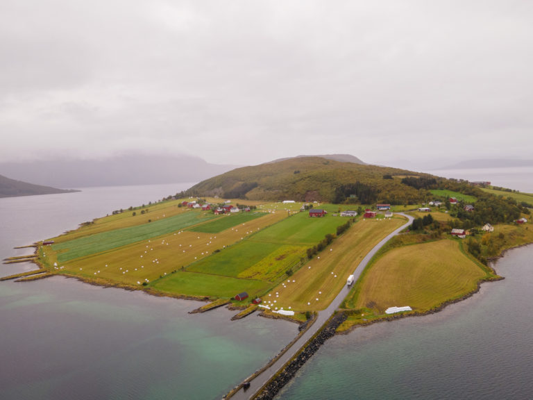
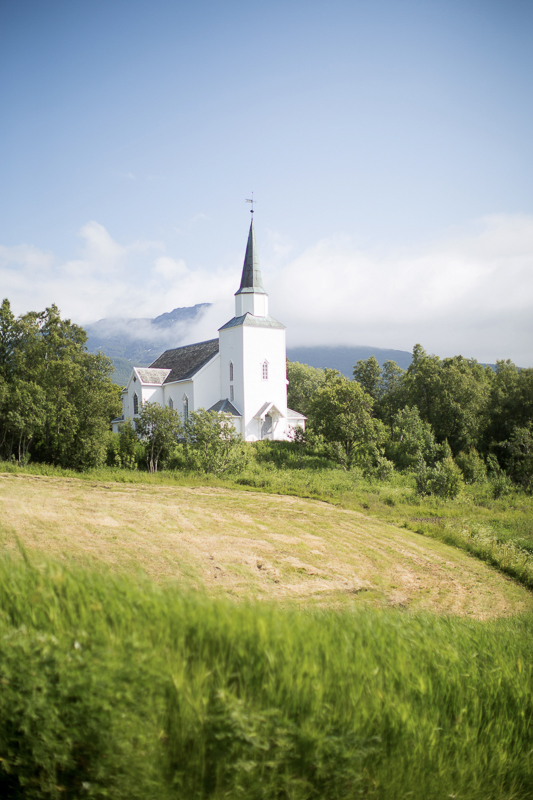
Inside the Arctic Circle, about 300 kilometres away, lies the island of Dyrøy. It’s protected from the Atlantic’s roughness by the big island of Senja. Dyrøy has lush forests that stretch almost to the top of the island—a rare sight in the Arctic. There’s a small bridge connecting it to Brøstadbotn, the little center of the area. On both sides of the Dyrøysundet waterway, you’ll find peaceful farmland and green fields. It’s simply beautiful.

Few tourists make it to Dyrøy
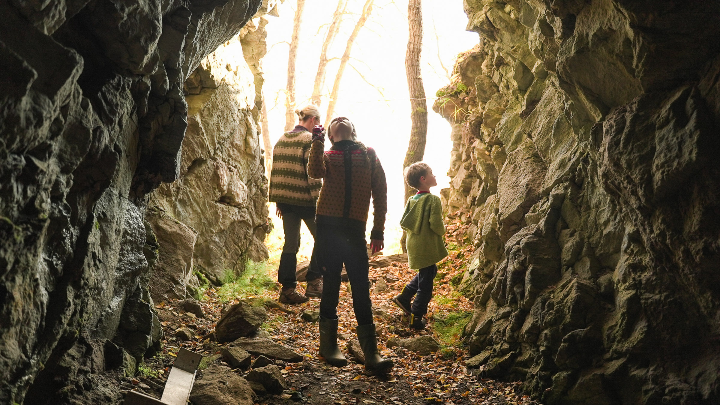
Dyrøy is off the beaten track, with only a few small places to stay and eat. There aren’t many attractions, but if you visit during summer or autumn, you’ll experience the welcoming nature of the local community. The best thing to do here is to go hiking on the easy to medium trails. The views are fantastic, and you’ll enjoy the tranquillity.
Go hiking on easy trails in Dyrøy
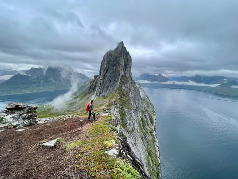
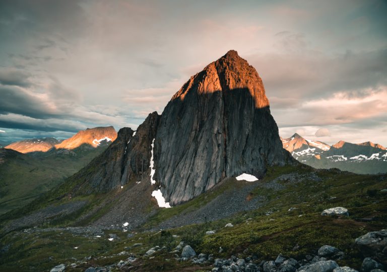
We asked the Dyrøy municipality to recommend some hiking trails. These trails have varying levels of markings, as part of an effort to make nature more accessible to locals. So, don’t be surprised if you come across friendly locals, especially on weekends. There are seven trails to choose from, ranging from easy hikes to reaching the peak of Sørtinden at 997 meters. None of them are too challenging, and all offer breathtaking views of mountains, islands, and waterways. Plus, most of the trails have connections to the area’s history and traditions.
Know your way around Dyrøy
Here are some of the hikes and tours you can make in Dyrøy. The markers are place approximately, ask around locally and respect signage.
Brøstadbotn
Municipal centre on Dyrøy’s mainland side
Sørfjorden – for Kvalnes and Hållaksla
Easy hike to Kvalnes where the landslide killed two people in ’59, and on to Hållaksla for those great views.
Mikkelbostad – for Hagenes
Easy hike to WII bunkers
Vinjevegen – for Dyrøygommen
Medium hike for great views – marker slightly misplaced.
Vinje – for Berg and Bergaksla
Hike along the shore to abandoned houses – and maybe make it up to a viewpoint
Finnefjellet – for Femvatnan and Sørtinden
Medium hike to Femvatnan (“Five Lakes”) – or go up to the roof of Dyrøy at a 1000 metres
Camp Solbergfjord
Accommodation and Activities
Attme Have
Accommodation and Activities
Jæger Adventure
Accommodation and Activities
The trail to Kvalnes takes you to an old tragedy.
In 1959, heavy rainfall caused a landslide at Kvalnes that dragged a house into the fjord, resulting in the unfortunate deaths of two women. Luckily, the local postman managed to survive. The nearby farms were evacuated, and the settlement was abandoned due to safety concerns. Today, you can easily walk along the beach from Sørfjorden, the southernmost point on Dyrøy’s mainland side. It’s a short round trip of under two hours, and you’ll find benches and information boards recounting the tragic event along the way.
Hållaksla offers a magnificent view with minimal effort.
For those adventurous hikers who find the Kvalnes hike a bit short, adding a tour to the Hållaksla viewpoint is a great option. The trail takes you around Kvalnes point and uphill. Along the way, you’ll find boardwalks across bogs, and at an altitude of 320 meters, you’ll reach distinctive cliffs. From this vantage point, you can enjoy a splendid southwest view of the majestic peaks of Andørja, Norway’s most mountainous island.

The Hagenes hike takes you through war history.
Another easy trail leads to the southernmost tip of Dyrøya Island, Hagenes. The terrain is so gentle that you can bring a pram for most of the hike, which follows the shoreline from the hamlet of Mikkelbostad. Here, you’ll discover two gun emplacements and two bunkers from World War II, built by the German occupying forces to secure their hold on Northern Norway. The view is exceptional, and you can sit on benches and light a fire at designated fireplaces.
The Berg path guides you to abandoned settlements.
Facing the open Tranøyfjord on the island’s western side, with expansive views of Senja and mountainous Andørja Island, lies the old Berg area where more people once resided. A tractor path traces the shoreline from Vinje on the southwestern side. In less than an hour, you can reach the well-maintained old houses of Berg, which now serve as summer homes. If you’re up for a longer hike, you can venture towards the 559-meter-high Bergsheia hillside along a ridge just northeast of the old settlement, extending the duration to nearly five hours.
Dyrøygommen rewards you with a stunning view.
Standing at the summit of the 490-meter-high Dyrøygommen hill, you can overlook the impressive mountains of Andørja to the southwest, along with the island of Senja. On clear days, you might even catch a glimpse of Harstad. The tour commences in a forested hillside, gradually ascending through wooded areas on easy paths. The terrain becomes a bit steeper and rocky towards the end, but the effort is soon forgotten. The round trip typically takes around 2-3 hours.

Choose between a medium hike or a tough one at Sørtinden
Mount Sørtinden, located east of Brøstadbotn, rises to an impressive height of 997 meters, providing breathtaking views of the surrounding area. While the climb is challenging, taking less than five hours for a round trip, an alternative option is to stop at the Femvatnan (“the five lakes”) on the way up, situated in a southwest-facing valley at 500-600 meters above sea level. The lakes offer a beautiful view and are more suitable for those in average shape.
When is the best time for hiking in Dyrøy?
The trails along the shore are accessible from May, and by mid-June, most areas are free of snow, although you may encounter patches along the way. The Sørtinden hike is best reserved for July. In this prime holiday month, you might be fortunate enough to hike in shorts and a t-shirt, surrounded by nature in full bloom. Bugs can be active, but bug spray will keep them at bay. However, the locals prefer August and September. August offers pleasant temperatures and abundant blueberries, while September showcases tart lingonberries and stunning autumn colors. The clear, crisp air allows for long-distance visibility. Although October days are shorter, the low sunlight creates a wonderful atmosphere.
What else can you do in Dyrøy?
Attme Have provides rentals of SUP boards, bikes, cars, and fishing gear for shore fishing. They also organize farm visits and informal guided tours, with a specialization in yoga. Jæger Adventure camp offers rentals of SUP boards and kayaks, as well as diving excursions. Camp Solbergsfjord conducts guided cultural tours and hikes to nearby peaks, and they also rent out fishing boats. The local motor club offers go-kart rentals every Sunday. Additionally, there is an 18-hole disc golf course in central Brøstadbotn for some outdoor fun.
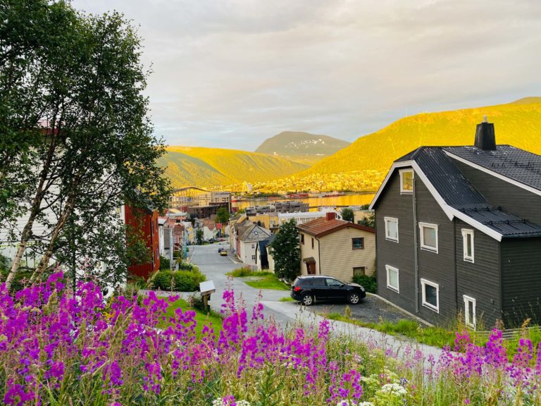
The midnight sun shines for two months
A good 300 km north of the Arctic Circle, Dyrøy enjoys the midnight sun for a whole two months. The first night when the sun remains above the horizon at midnight, is at the 22nd of May. It sets again a little past midnight on the 24th of July. This is measured at Brøstadbotn, providing a free view to the north. It is of course perfect timing to climb one of the hills or mountains mentioned above at midnight.

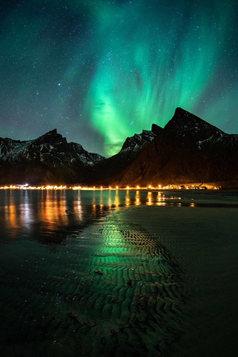
In autumn, the northern lights dance over Dyrøy
Dyrøy is found directly under the Northern Lights belt of the planet. This means there is no better place to watch the Northern Lights than here. Admittedly, the same goes for most of Northern Norway. Around mid-August, the nights are dark for a few hours and the Northern Lights have a little window. By early September, chances have increased a lot. In the latter half of September and first half of October, there is often a boost in the Northern Lights activity, and we can watch some of the best Northern Lights for the whole season. Go for a long walk or bring a headlamp and walk one of trails we have listed.
Eating out is limited, but sociable
Often, the only place serving food in Dyrøy is the petrol station Yx, which has a snack bar serving burger and pizza. However, with a bit of planning, one could visit the “Nordavindshagen” in the small cultural centre dedicated to the local poet Arvid Hanssen, where there is often a café. On summer Sundays, one also meets in the premises of the boating association at Finnlandsnes. Be assured that this is much less posh and much more welcoming than a posh yacht club.
Finding your way around Dyrøy
Dyrøy is a small municipality between the cities of Harstad and Tromsø. The town of Finnsnes is some 50 km and 50 minutes to the north.
Dyrøy has a good 1000 inhabitants, and an area of 289 square kilometres. Most people live in the municipal centre of Brøstadbotn on the mainland side, and less than 200 live on the island of Dyrøy, which has given name to the municipality.
The catamaran between Tromsø and Harstad stops several times a day in Brøstadbotn. There are also buses from Finnsnes. However, to reach most of the hiking options we have listed, you need a car. Or at least a bike.
Simply because there is no English-language site informing about tours in Dyrøy. The Telltur.no site has excellent maps, information about parking etc. Use google translate, and ask around a little. This is the price of going off the beaten track.
Where do you stay in Dyrøy?
Attme Have (Local spelling of “ved Havet” – by the sea) is a comfortable guesthouse just outside Brøstadbotn, specialising in yoga sessions, digital detox and relaxation. Jæger Adventure Camp has modern, spacious holiday homes suited for groups of friends. Camp Solbergfjord offers accommodation in modern holiday homes, and is also suited for small groups or families.
Combine Dyrøy with other destinations
Dyrøy has friendly landscapes and a relaxed atmosphere. Equally relaxed is the island of Senja, visible from most of Dyrøy, but the oceanside of this island is stormy and dramatic. Sophisticated Harstad in the south has some important historic sights and some first-class dining. Glitzy colourful Tromsø in the north has none of Dyrøy’s sleepy charm, instead it’s busy and loud well into the night. Every destination in the north has its own personality, waiting to be discovered.