The trail from Skallan to Rå follows the borderline between cultivated farmland and the forest. In the days of traditional farming, people relied on this trail for their everyday tasks. Dairy maids would come here to milk cows in the summer, men would stay up here to cut peat, boys would guard the livestock, and people were even buried here many centuries ago. Today, this area is a heritage landscape full of memories of traditional life. The best part, however, is the frame of lush forest, green fields, and wide panoramas. On a rainy day in late August, I shook hands with my local guide, Bjørn Welde, from Kvæfjord. We then set out to explore this trail that he knows so well
Smallholdings welcomed us to the trail
Where the path starts—or ends—there is a cluster of four smallholder cottages. These small farms were cleared in the late 19th century, allowing families to keep a cow or two and a few sheep. Depending on the season, they would take paid work in the village or, in some cases, work as shoemakers. A few years after the war, these places transformed from active farms into holiday homes, which people still use today.
WWII was felt even in Kvæfjord
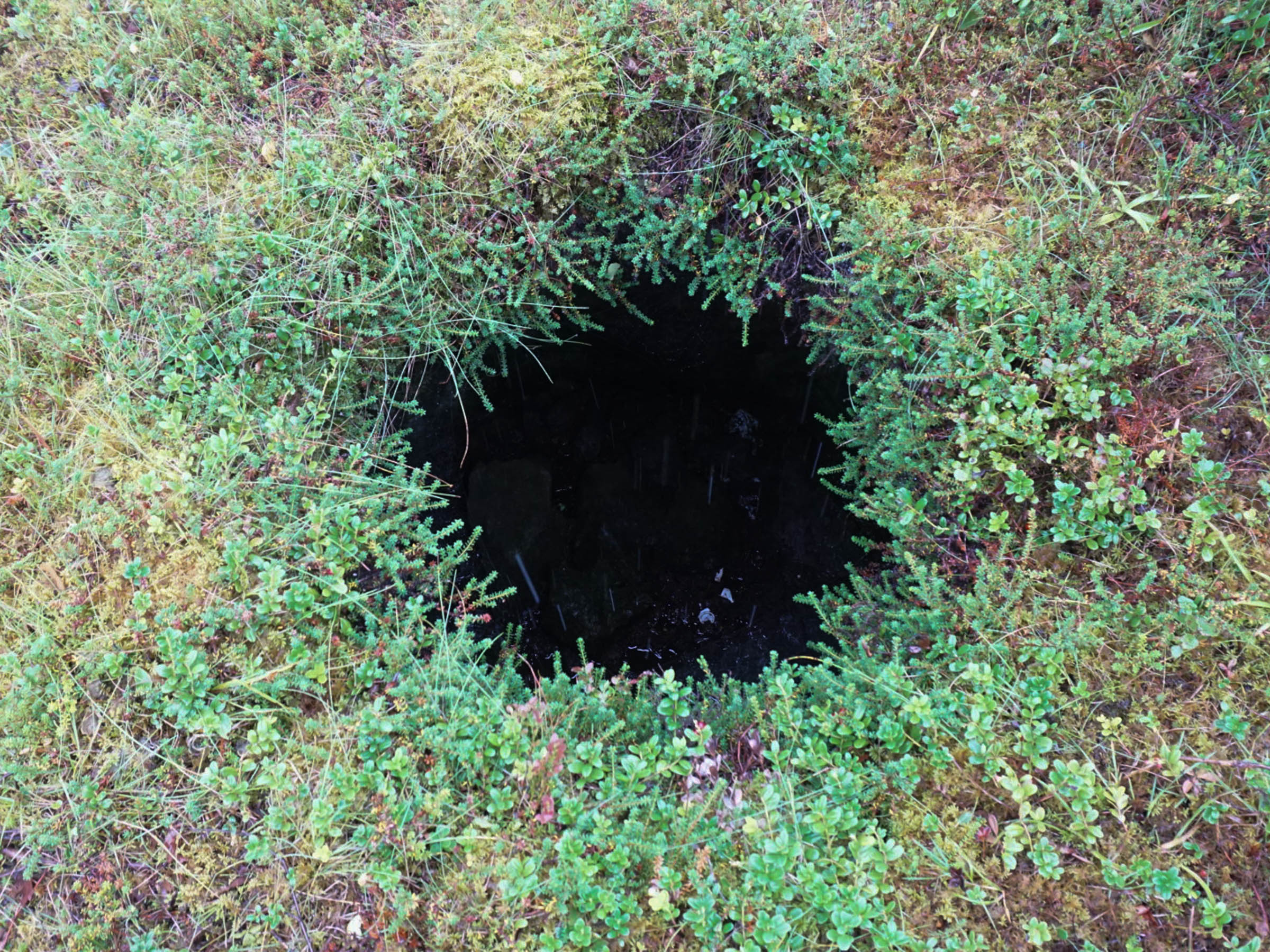
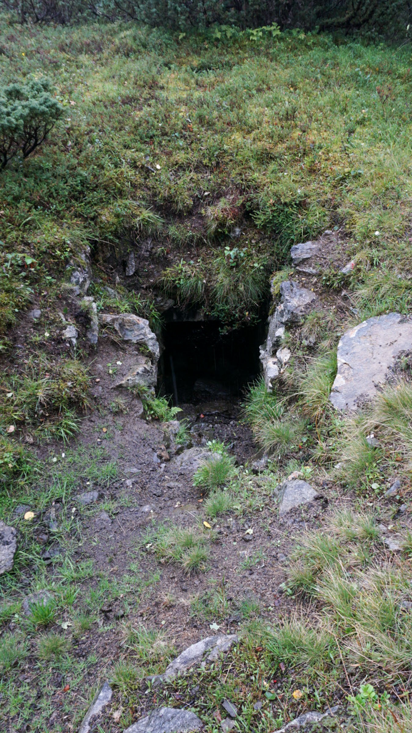
The first German soldiers of WWII arrived in Kvæfjord in late June 1940, only 2-3 weeks after the Nazi takeover of Northern Norway. This area was sensitive, being close to the waterways leading to the important iron ore port of Narvik. In the area below the path, a company of 150 German soldiers stayed for most of the war. Along the path, there is crumbling concrete from the bunkers dug into the ground; however, they are easy to miss. With Bjørn’s help, I spotted an entrance to a bunker: a circular hole in the dense ground vegetation that allowed us to see into a rather large room.
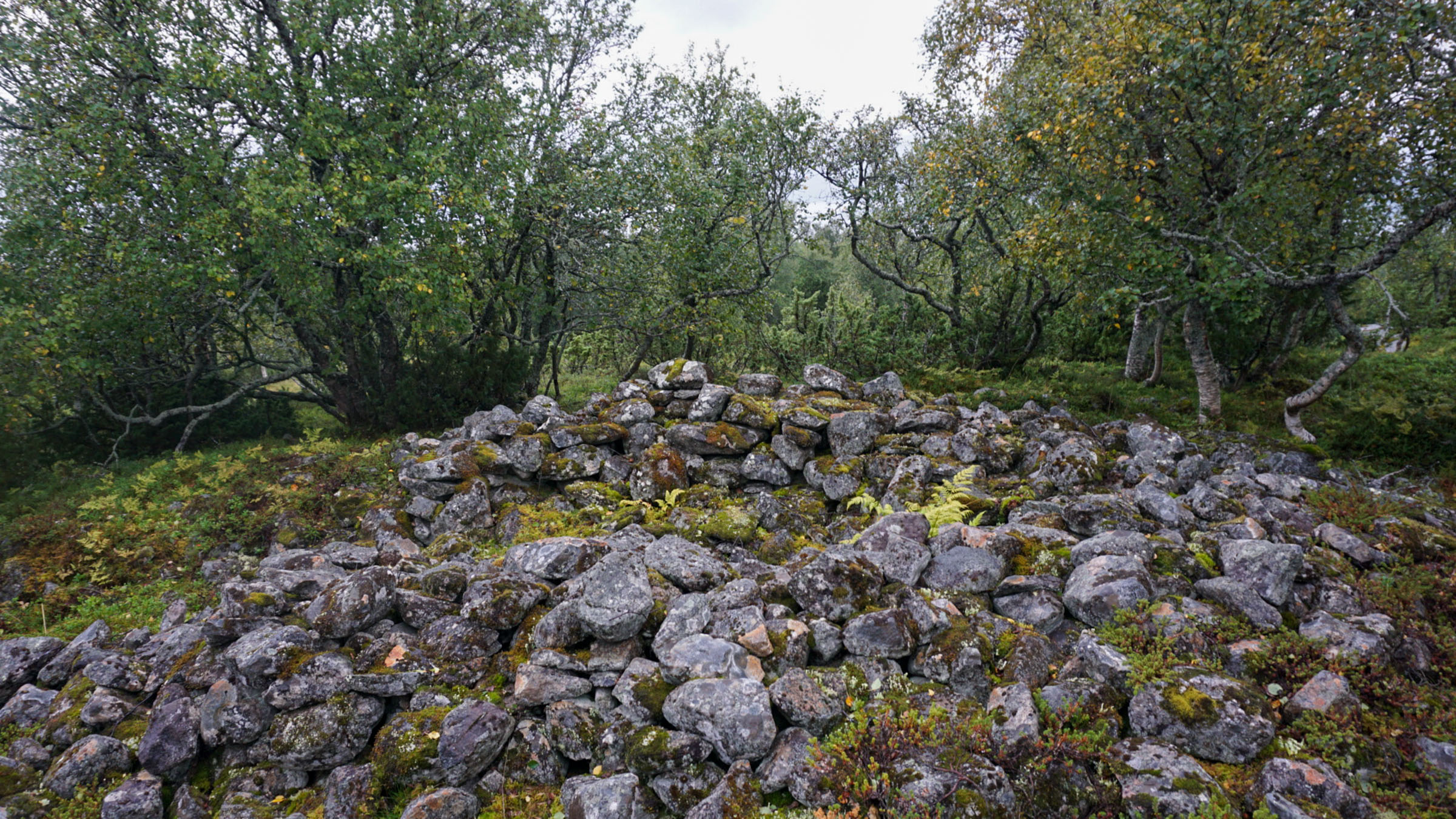
The grave mound at Klemhågen is haunted
In the Iron Age, a good location for a grave mound was somewhere with a view, allowing the deceased to keep an eye on what the living were up to. Since not everyone received a grave mound, we must imagine that visible mounds indicate the grave of someone important. One of the most prominent graves is found at Klemhågen, a little detour from the path. It looks like a rock pile but remains unopened. The grave at Klemhågen is said to be haunted, and cows have been reported to stay away from the site. Old ghosts left us alone, however, as we studied the rock pile from all angles.
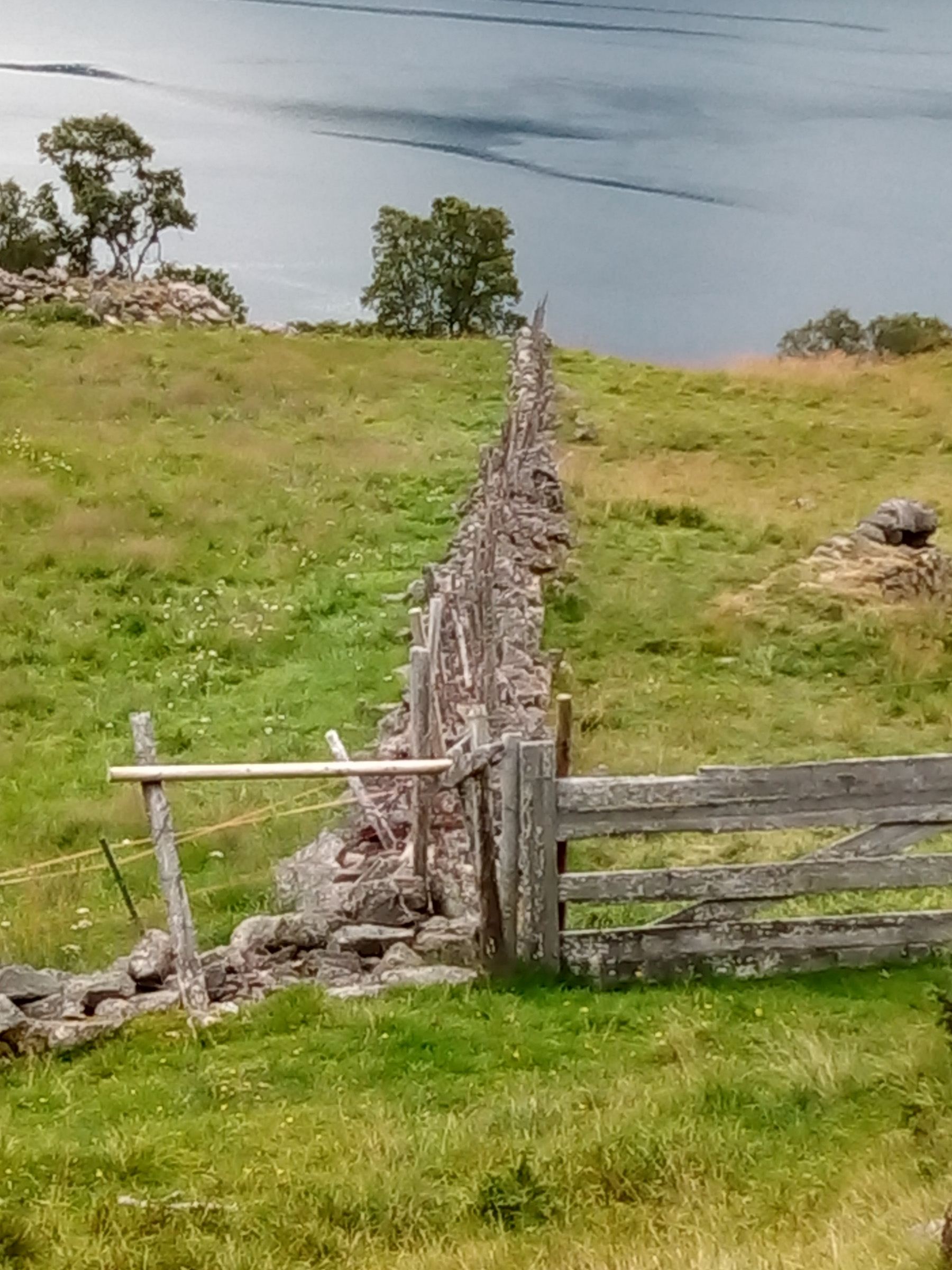
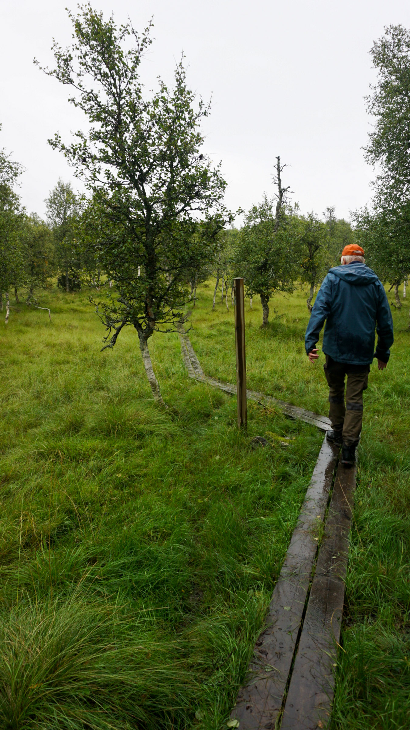
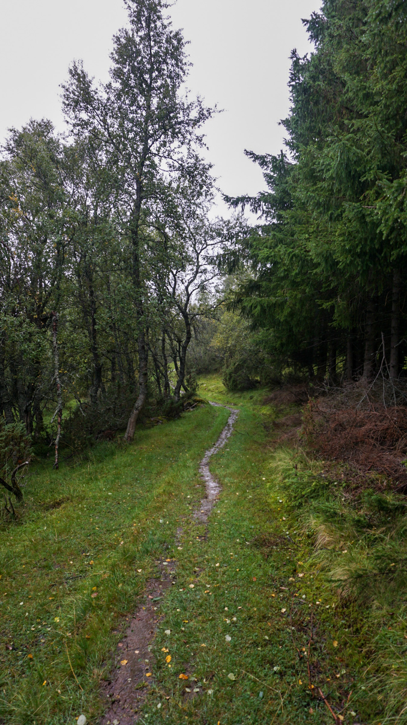
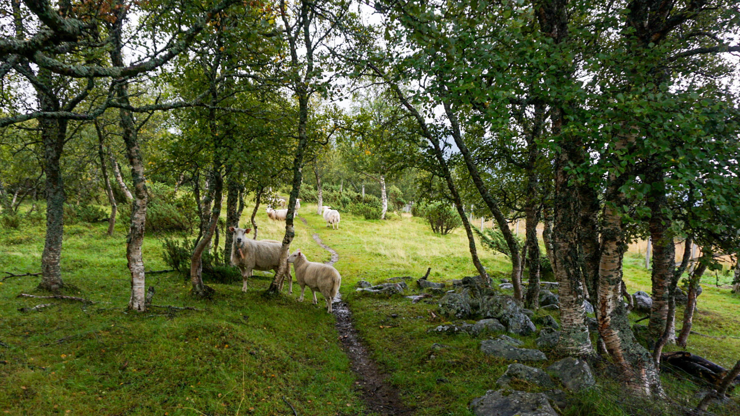
The trail is varied and easy
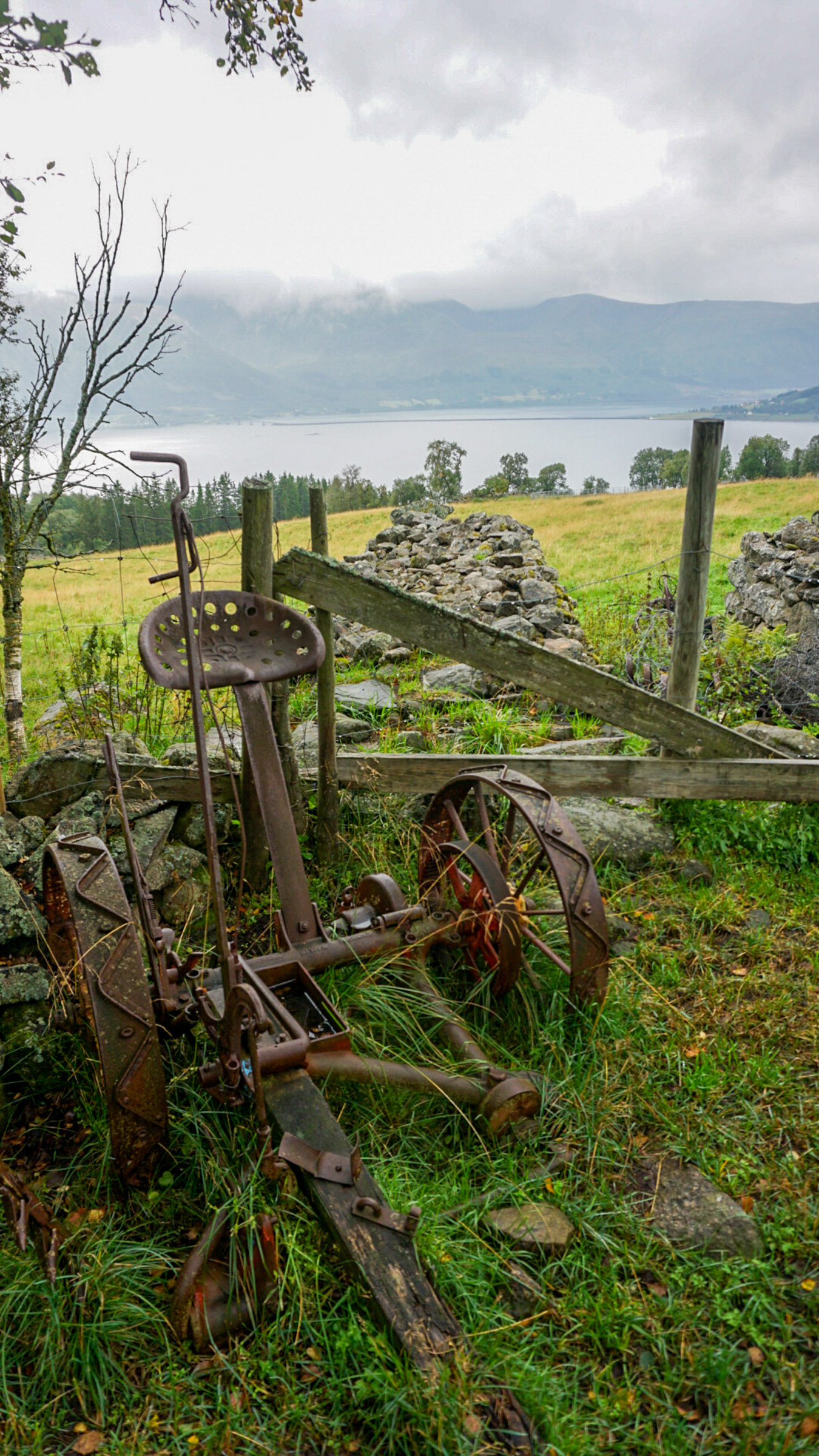
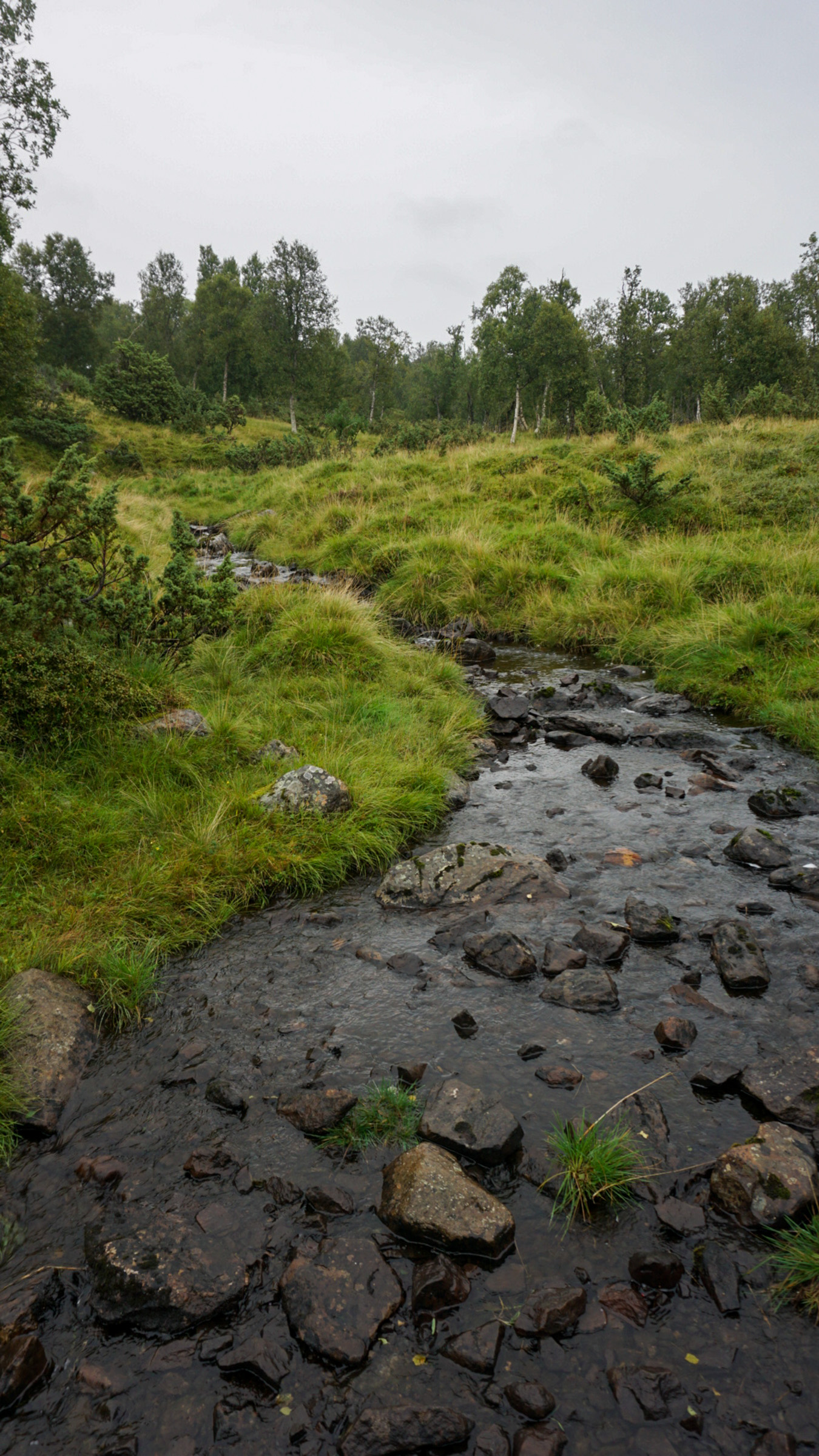
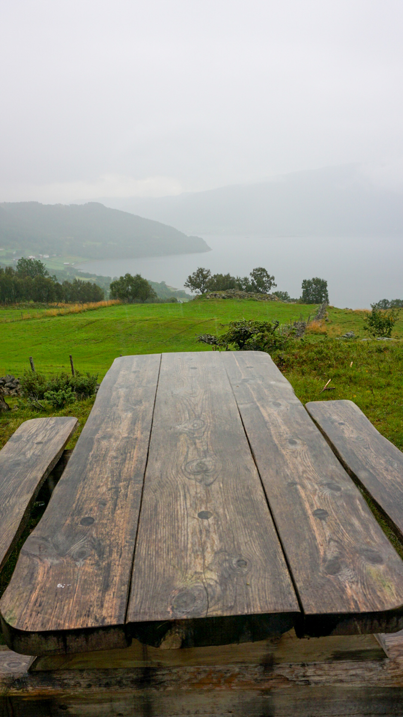
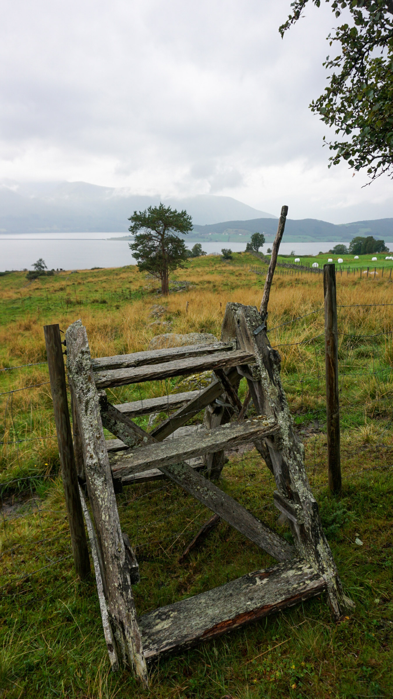
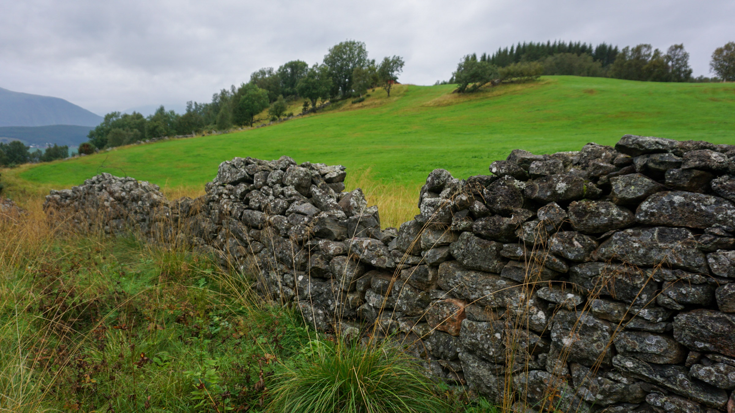
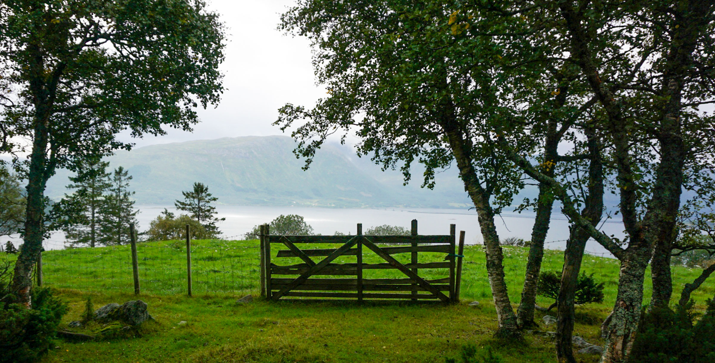
The walk is not a difficult one. We followed a succession of fences made of stone or wire mesh. The occasional wooden gate provides access to the tended fields below, but they are closed. There are also stiles, and at one location, we saw an old hay mower. A sturdy sheep pen, a picnic bench, and even a wooden lavvu shelter—this is not untouched nature but part of everyday life in the area. We walked on planks across bogs and stepped from one stone to another across streams. Nothing felt strenuous or difficult, though. We also had company; sheep watched us from beneath the trees, where they had sought refuge from the rain.

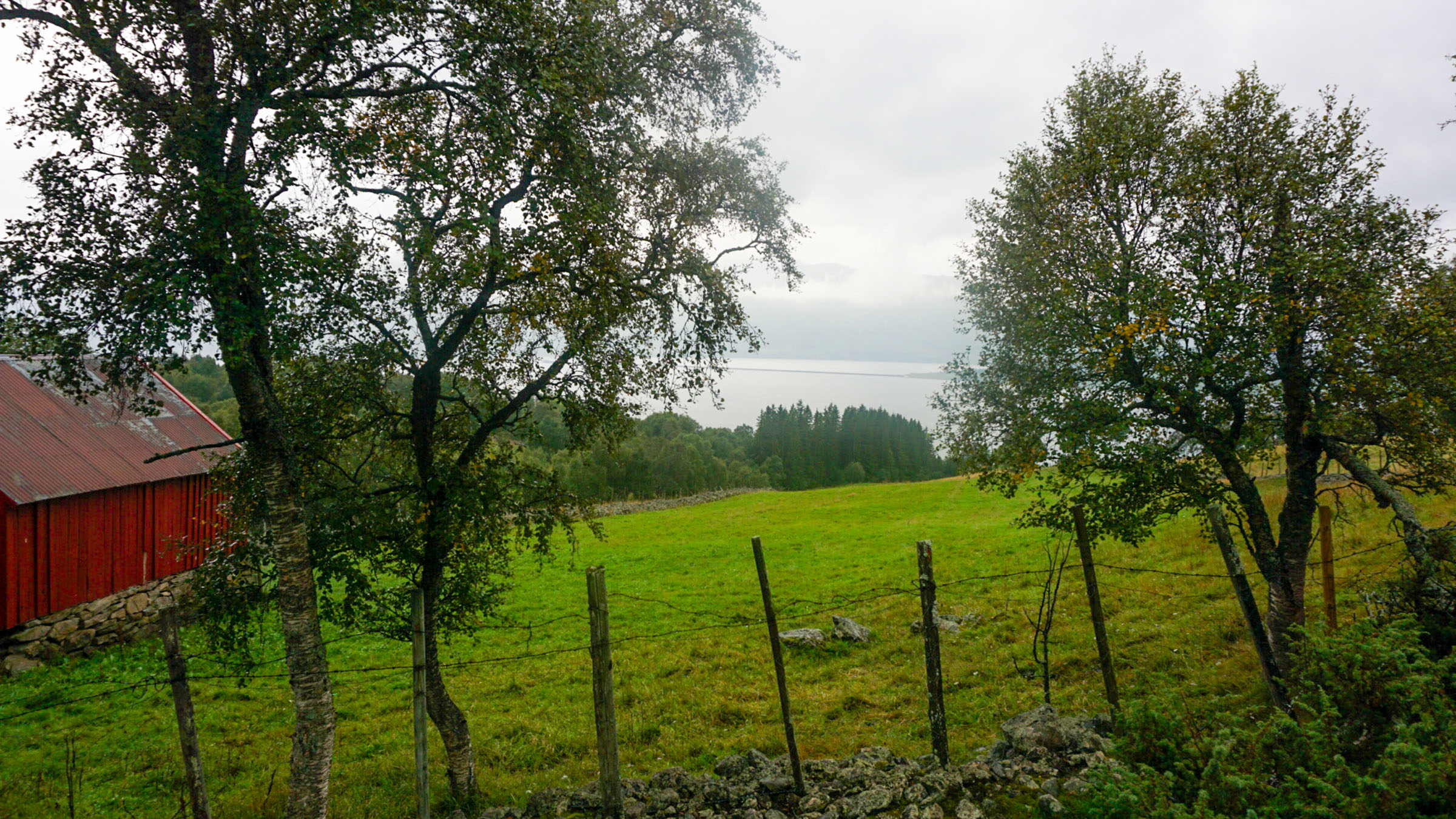
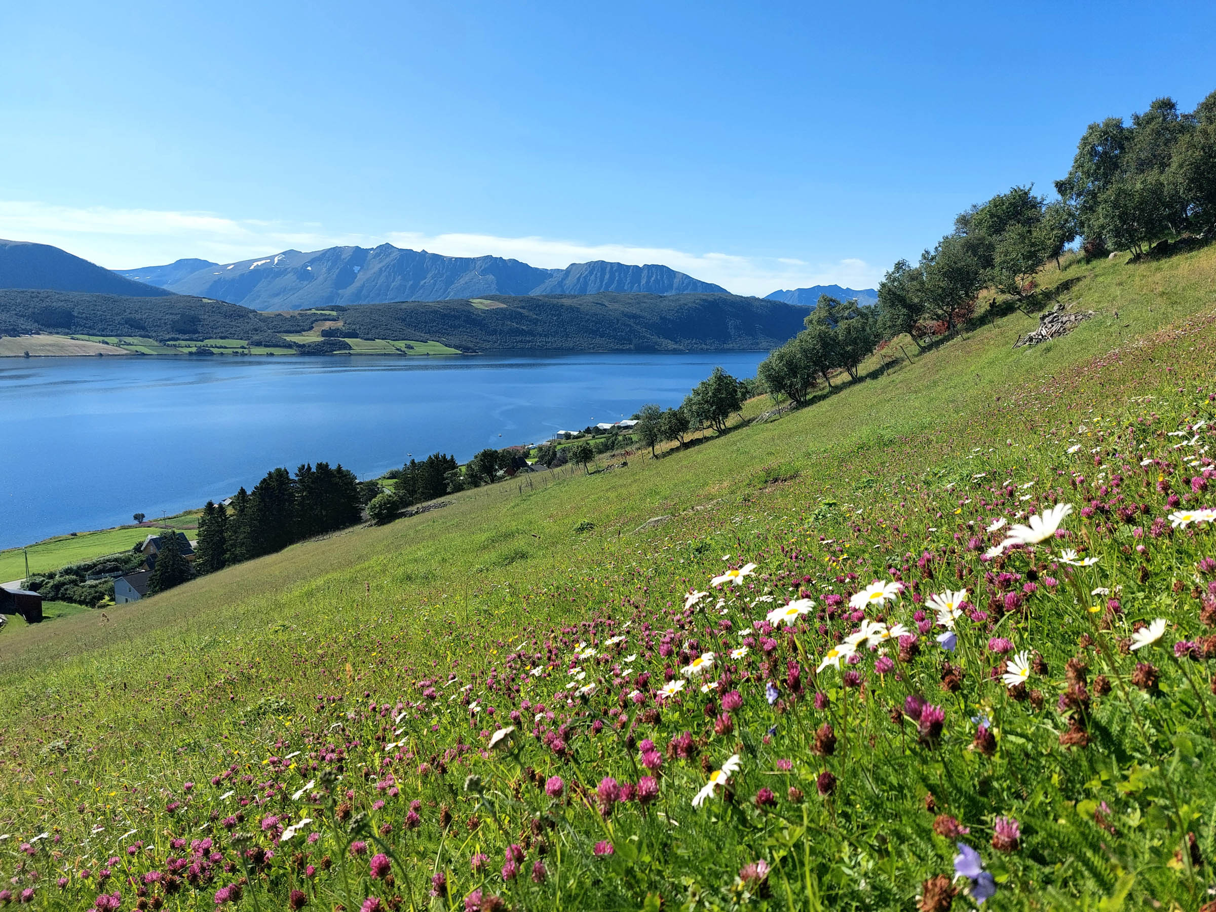
The view could be from a painting
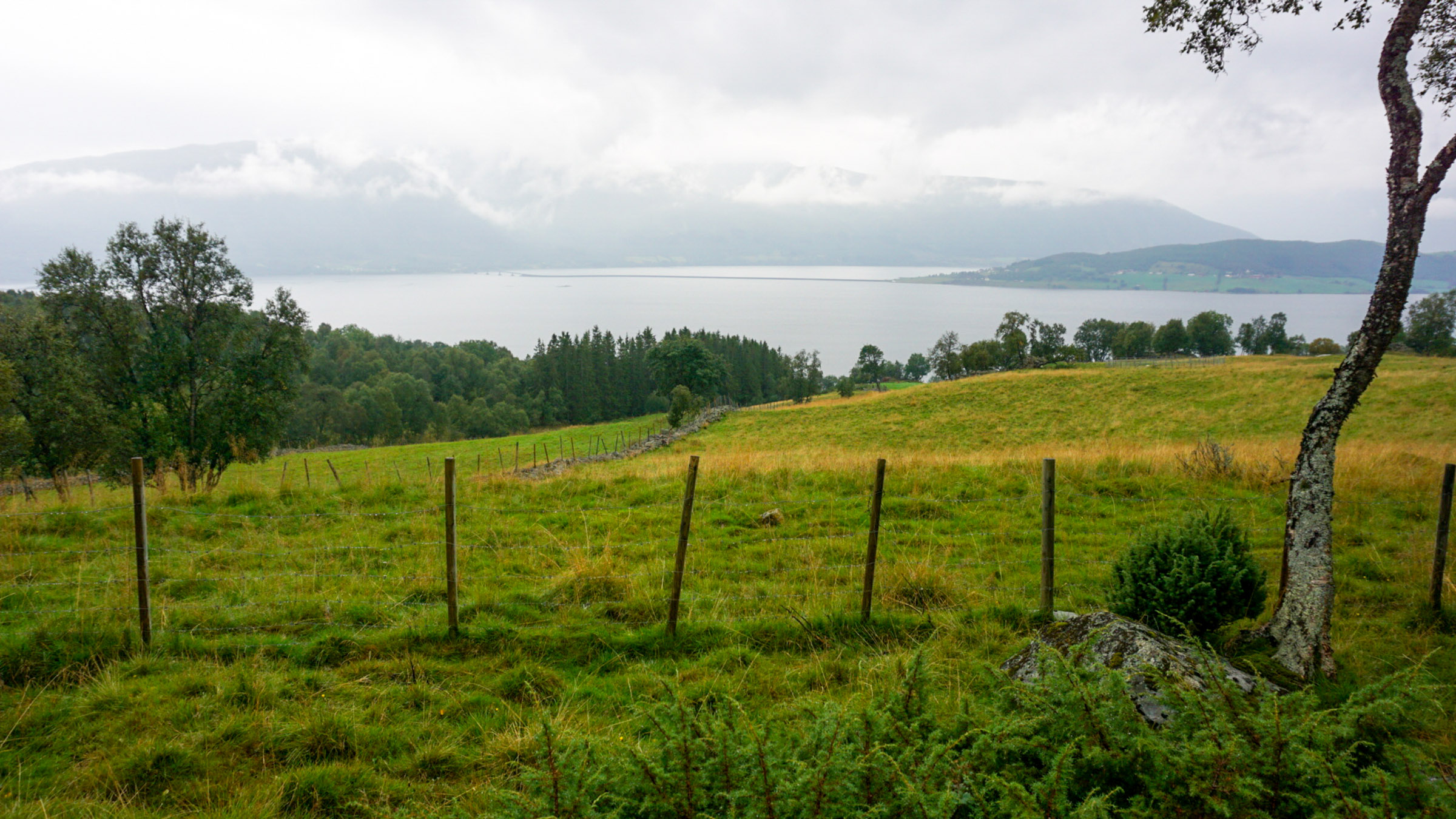
At times, dense forests closed in around us. Every so often, though, the foliage on our left opened up, allowing us to see far and wide across a gate or fence. Down below, the island of Kvæøya, connected to the mainland by a causeway, was easily recognised. Further back, the mountains on the western side rose vertically. In the south, majestic peaks played hide and seek with the clouds. Sculptural trees framed the view, which reminded me of those kitschy paintings in Grandma’s living room—except this was real.
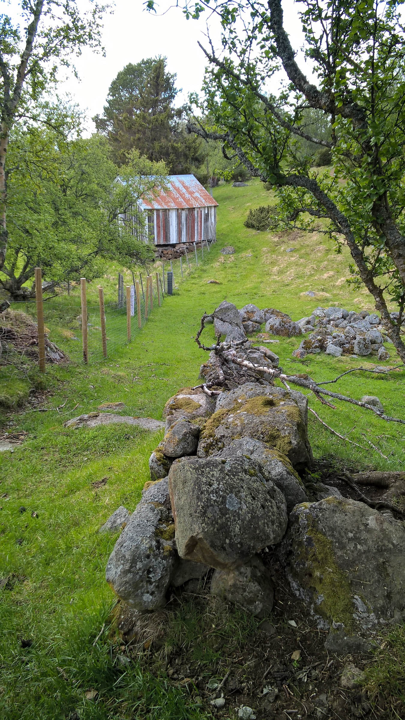
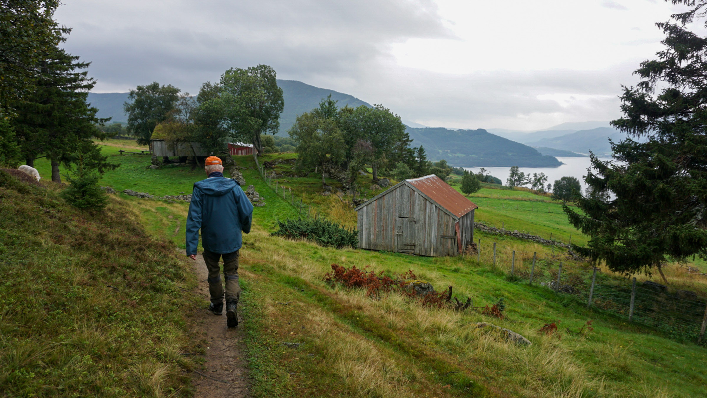
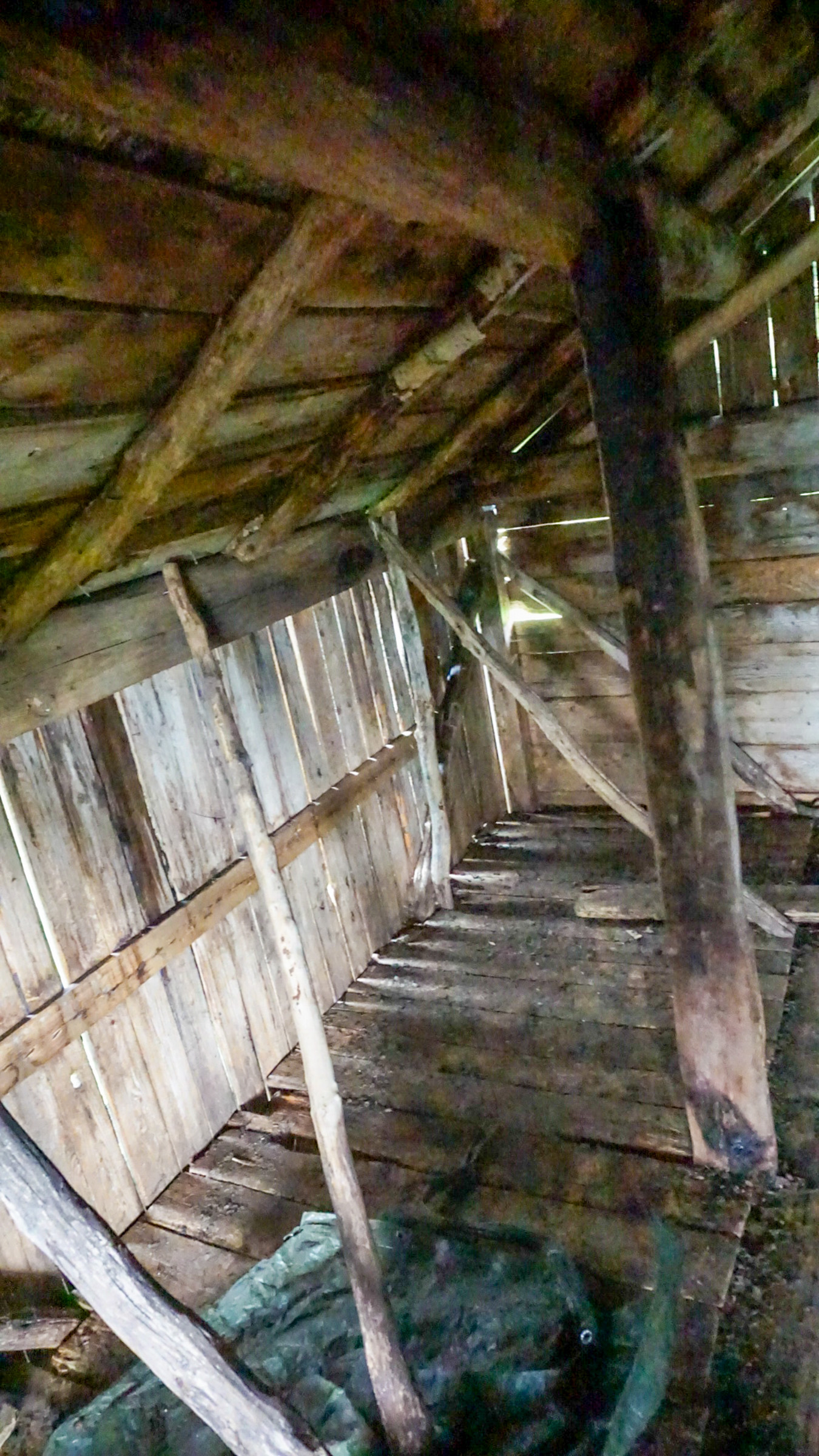
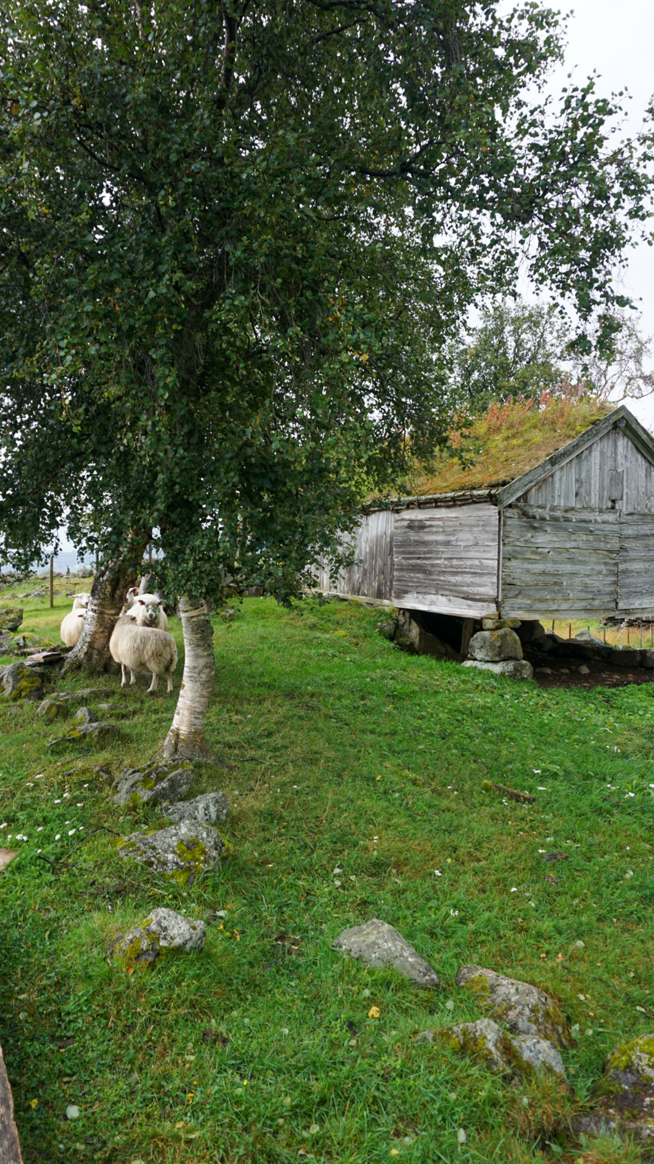
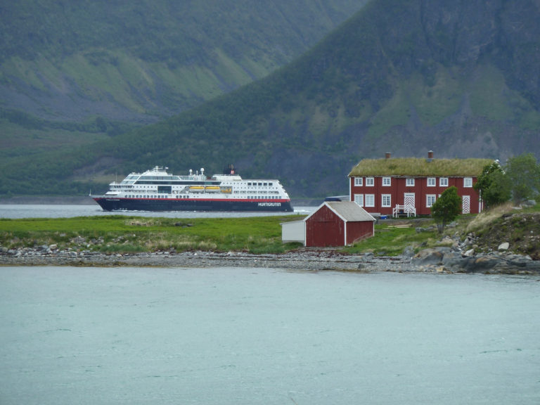
A village of summer barns overlooks the fjord
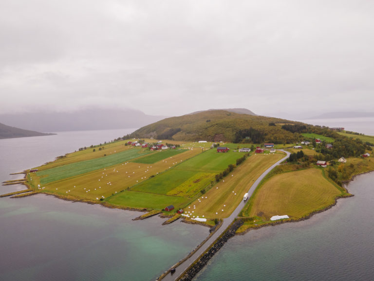
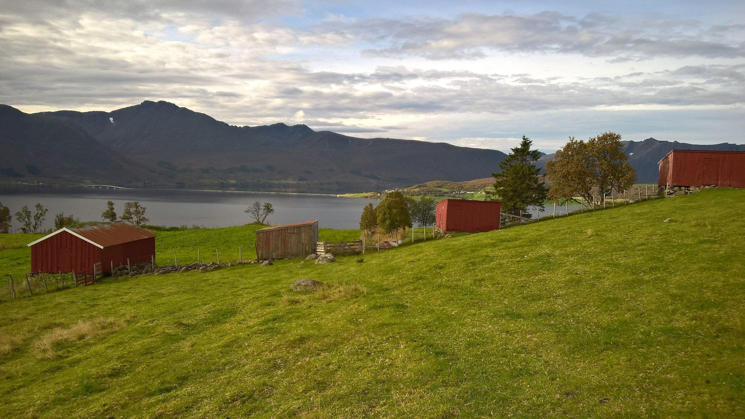
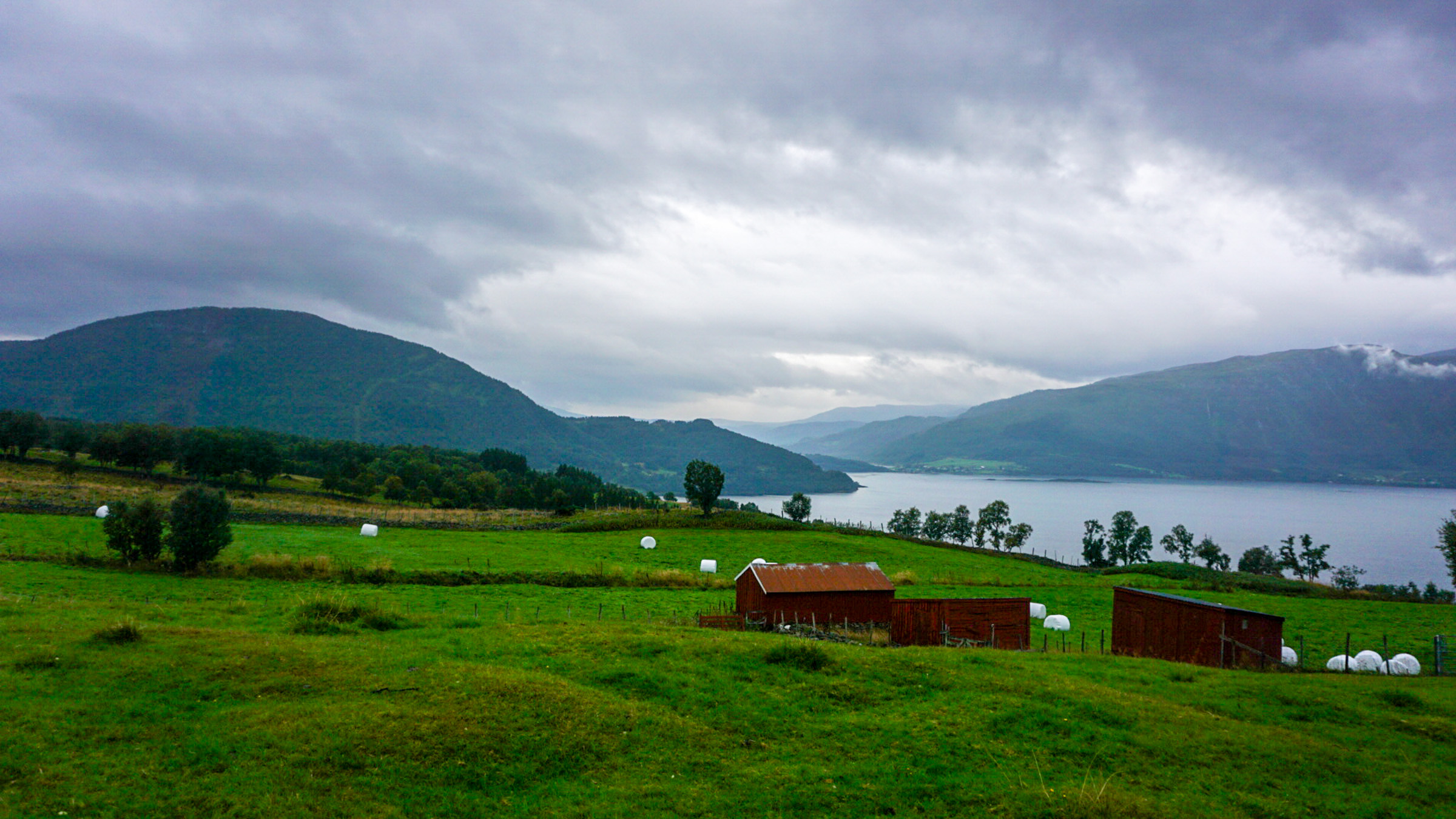
All of a sudden, the landscape opened up, revealing a lawn manicured by intense sheep grazing. The view toward the fjord and the island of Kvæøya was fantastic; three red-painted summer barns in a row punctuated the panorama. We walked past a maze of fences toward a grey, picturesque summer barn and looked inside. Summer barns—sommarfjøs—are simple shacks used to provide shelter for sheep and cattle on summer pastures. Located within walking distance from the farm, women would come up every evening to milk the cows and lock in the livestock for the night. From here, the path descends to Rå, the northernmost of the farms. However, we had parked at the beginning of the tour and started our return.
Kvæfjord is a lush garden
Kvæfjord, which almost splits the large island of Hinnøya in two, is known as the garden of Northern Norway. The microclimate here is surprisingly mild; it faces southwest and is open to the mild air brought in by the Gulf Stream. The mountains and islands to the west protect the area from the fury of the Atlantic. The fields along the fjord were submerged for millennia after the Ice Age and are rich in nutrients. Even in the centuries before the birth of Christ, this was a prosperous agricultural landscape.
Four farms line the fjord
Four old farms—Indre (Inner) Gåra, Ytre (Outer) Gåra, Strand, and Rå—line the fjord. Several families lived together here, with each family’s land spread out in fragmented plots. However, in the 19th century, arable land was consolidated into contiguous farms. Each individual farmer then moved his house to the center of his land, which means that the cultural landscape took on its present appearance during the 19th century.
The old ways preserve flora and fauna
If you hike on a sunny summer day, you will see a rich flora. Most modern forage fields in Norway are characterised by monocultures designed for easy machine harvesting. In the Klemma area, however, farmers hardly use harvesting machines. Instead, sheep graze the land intensely during the summer. A total of 57 different species have been counted here. Most are part of the wild flora, but some include cultivated plants, escaped plants, and common weeds found in traditional agriculture. The flora thus resembles what you would have found in agricultural lands before monocultures and harvesting machines were introduced, much to the delight of both visitors and wildlife, particularly insects.
The forest strikes back
If we had been here 100 years ago, the forest would have been much less dense. Back then, goats roamed freely through the area all summer, feeding on a wide range of herbs and shrubbery. The sturdy little Nordland cow would also be let loose in the forest, saving the tended meadows for winter fodder. In spring, if hay was in short supply, farmers would cut branches from the trees to feed the livestock. The forest was also a source of firewood, and peat was cut from the bogs. Old photos show an open landscape reminiscent of a park. Today, the forest is reclaiming the land, becoming taller, denser, and more impenetrable. In the years after World War II, there was extensive planting of Norway spruce (Picea abies) and Pacific North American Sitka spruce (Picea sitchensis). Spruce has also been planted along the trail, creating groves of tall trees.
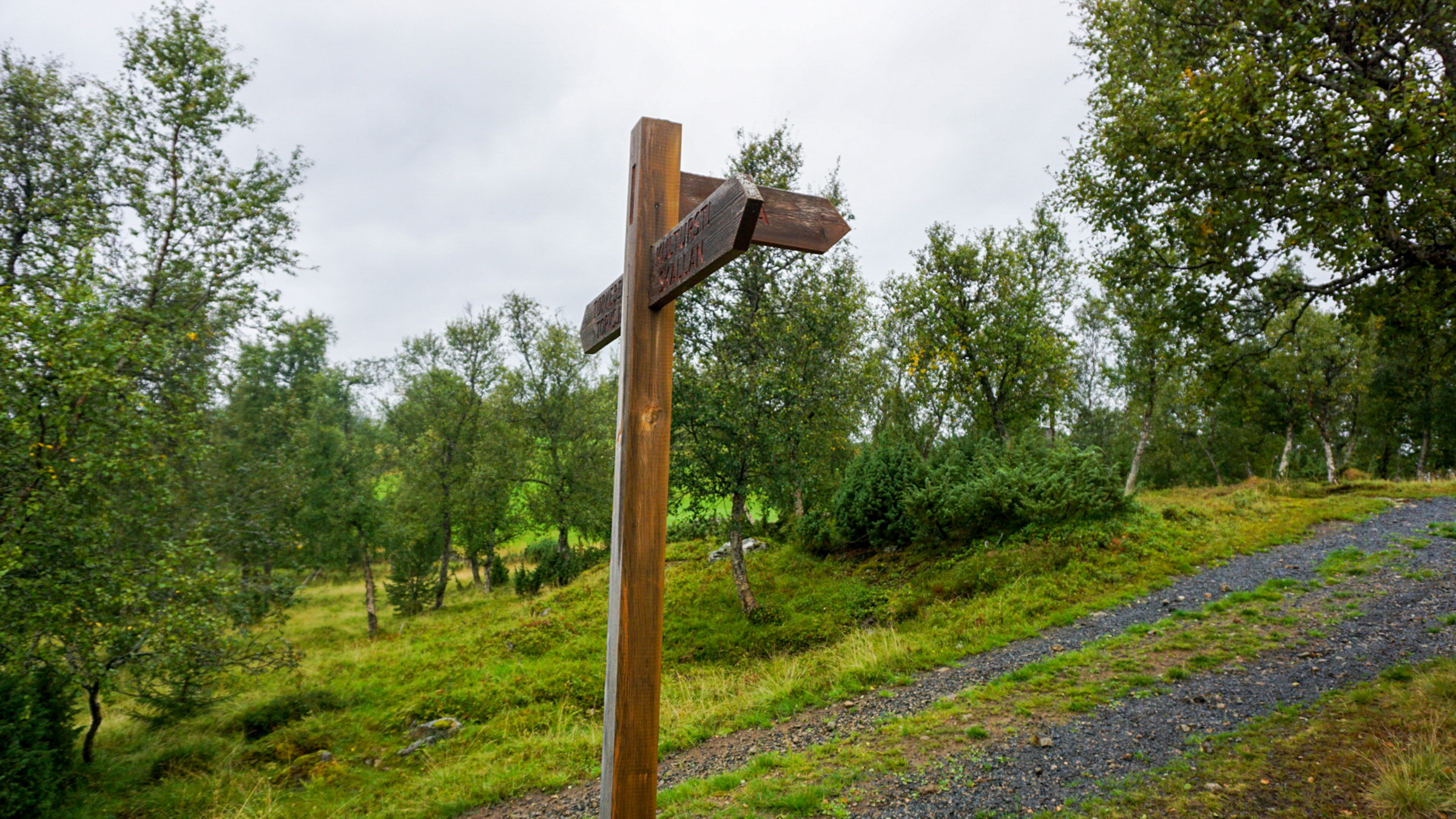
Culture Path Skallan – Rå
This is an approximate map of the area. Skallan is the southern end, and the Rå area of Borkenes the end. If you come by bus, get off at Skallan, do the hike and end up in Borkenes, where there is coffee, food and accommodation. If you have your own wheels, park in Skallan, do the hike, but turn around about where it says u0022Rånakkenu0022 on the map and hike back.
Skallan
Bus stop and parking at the path’s southern end. If you come by bus from Harstad, ask for the bus stop “Skallan”. The best starting point if you have a car.
Steinkrysshågen
Detour to the Iron Age grave mound.
Rå
Exit to or access from the Borkenes side. Bus connection to Harstad from the centre of Borkenes village.
Practical about the Skallan – Rå cultural path
Kvæfjord is the city of Harstad’s neighbour in the west, a rural farming municipality centered around the village of Borkenes. The trail runs from Skallan, situated along the
Along the Riksvei (highway) 83, there is designated parking, see our map.
You can indeed take the bus from Harstad, they are frequent Monday to Saturday, but a bit rarer on Sunday. Check the website Swipper (for Troms County) – maybe a good idea to double check with your hotel reception or the Tourist Information. You can then get off the bus at Skallan (bus stop), do the hike, come down to Rå and Borkenes. Here you can eat and have coffee, and then take the bus back to Harstad.
Rå gårdsbutikk is run by students at the high school cooking programme. They serve coffee and lunch Monday to Friday. There is also a little cafe at the Red Cross in Borkenes. Both are open Monday to Friday, but closed over the week-end.
The writer of this article came in jeans and trainers, and it was raining cats and dogs. Based on this, we recommend light outdoor gear and solid shoes.
For information on the City of Harstad and the neighbouring communities, look no furthern than Visit Harstad.