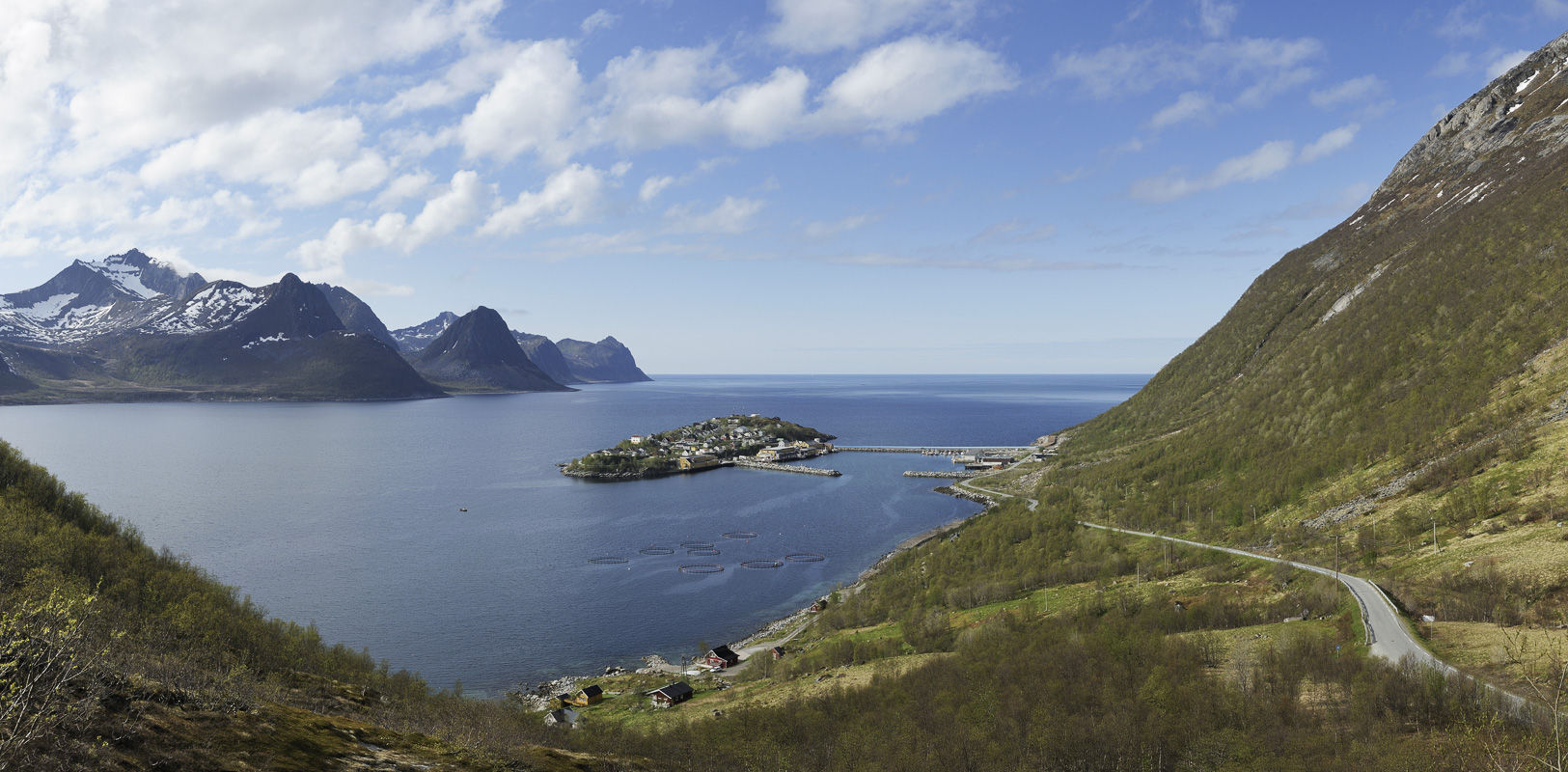
Senja Island resembles a micro-continent, showcasing a mountainous spine, a hospitable southern coast, light birch forests, farmland, and a wild, stormy, and precipitous ocean side. Head to the ocean side for a bit of drama, and travel east for serene relaxation and calm. The friendly southern coast hosts numerous beauty spots, and the nearby island of Dyrøy is lush, green, and off the beaten track.

The west coast is the meeting with the Atlantic
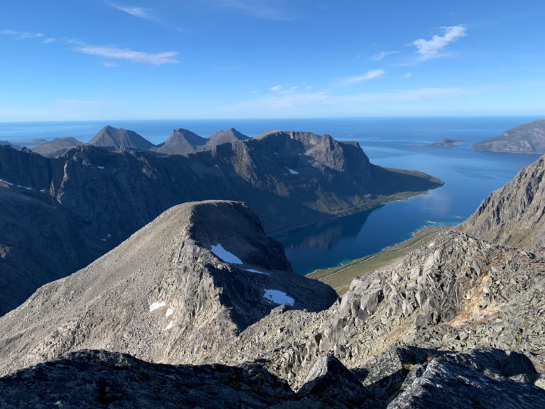
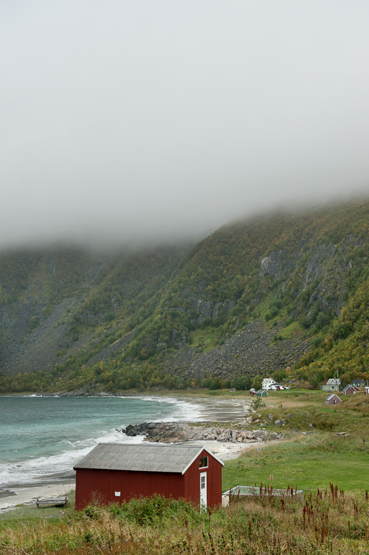
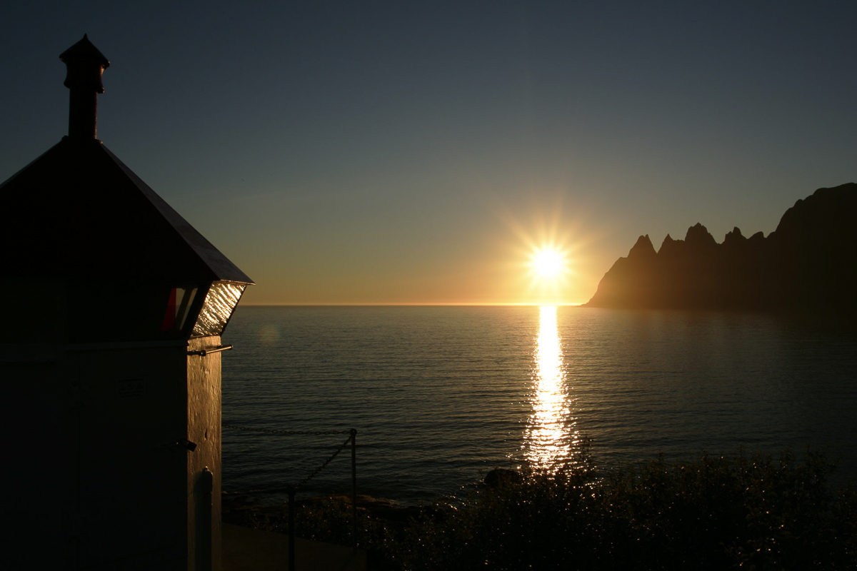
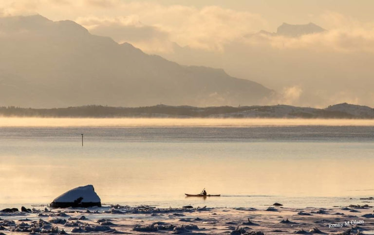
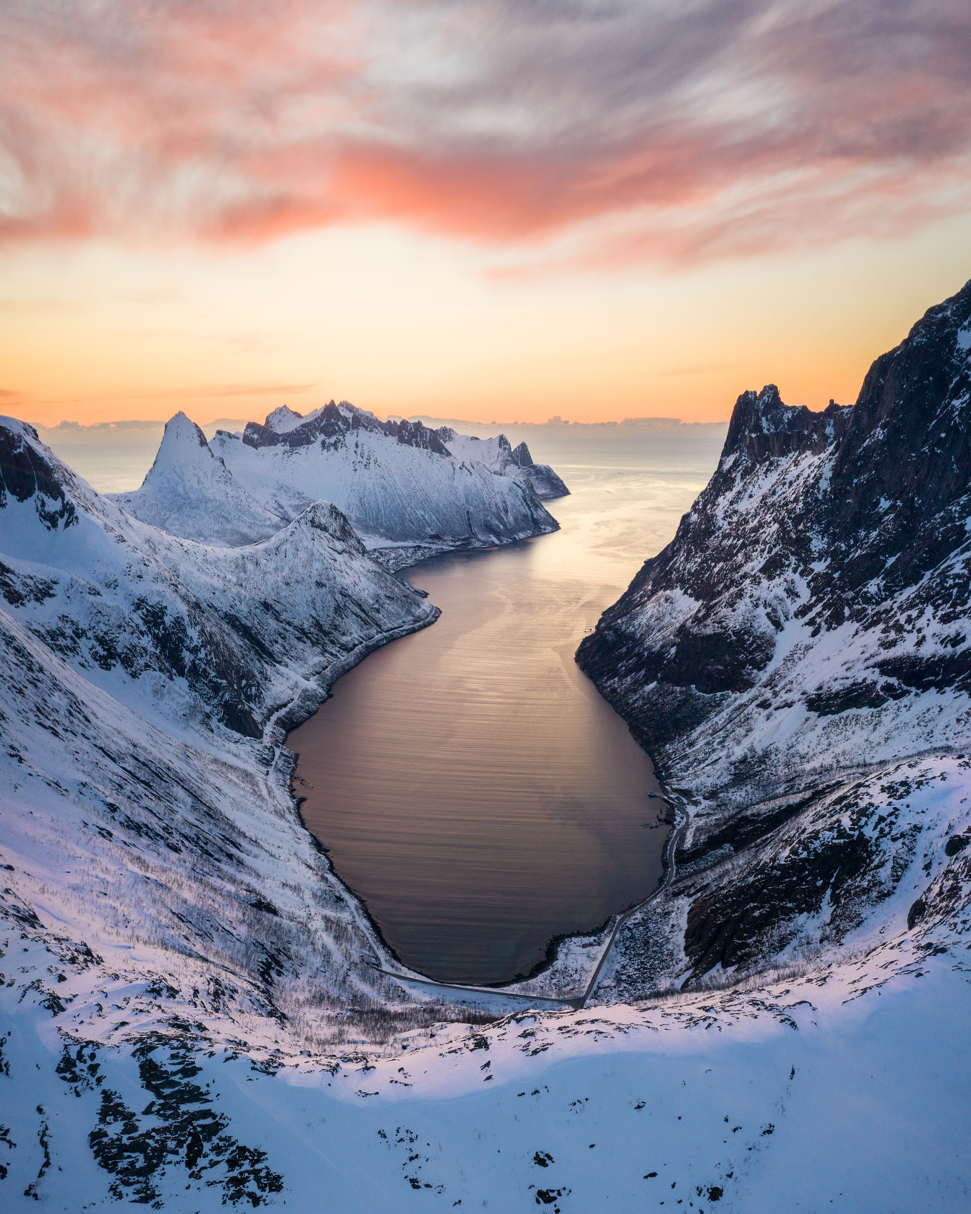
There is nothing to hinder the fury of the Atlantic from pounding the outer coast of Senja. The coast plunges 7-800 meters from the mountain tops directly into the ocean. The terrain is solid rock, featuring barren cliffsides and rocky promontories. There are also coves and bays with fishing villages, and some of the sandy beaches boast a South Sea quality.
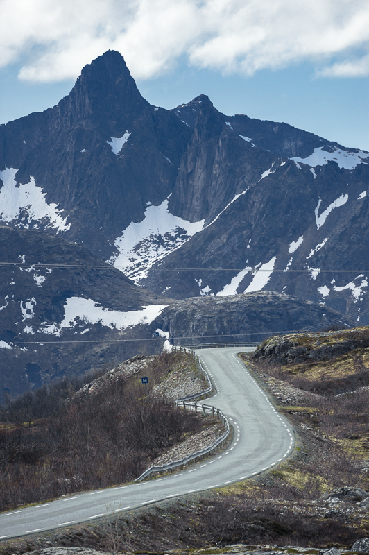
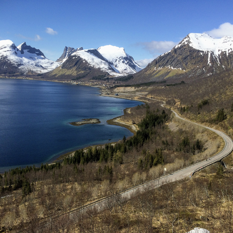
The Norwegian Scenic route follows the outer coast
The easiest way to explore this dramatic outer coast is to follow the Norwegian Scenic Route of Senja as it winds its way along the coastline. This route features charming, architecturally designed rest stops, viewpoints, and toilets, all seamlessly blending with and adding to the scenic landscape
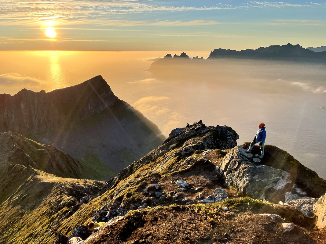
16 hikes in Senja…
Husøy is an island of its own
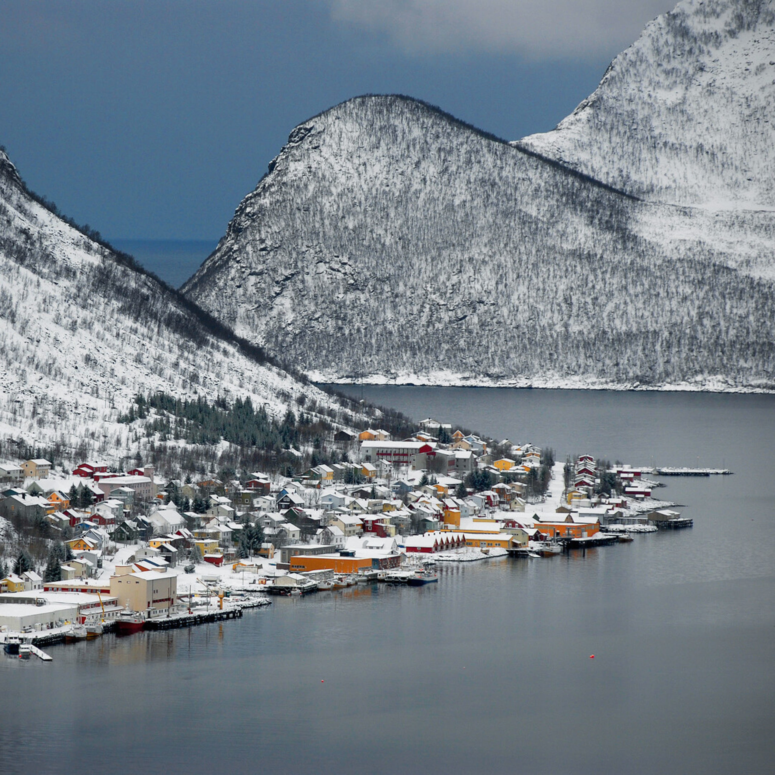
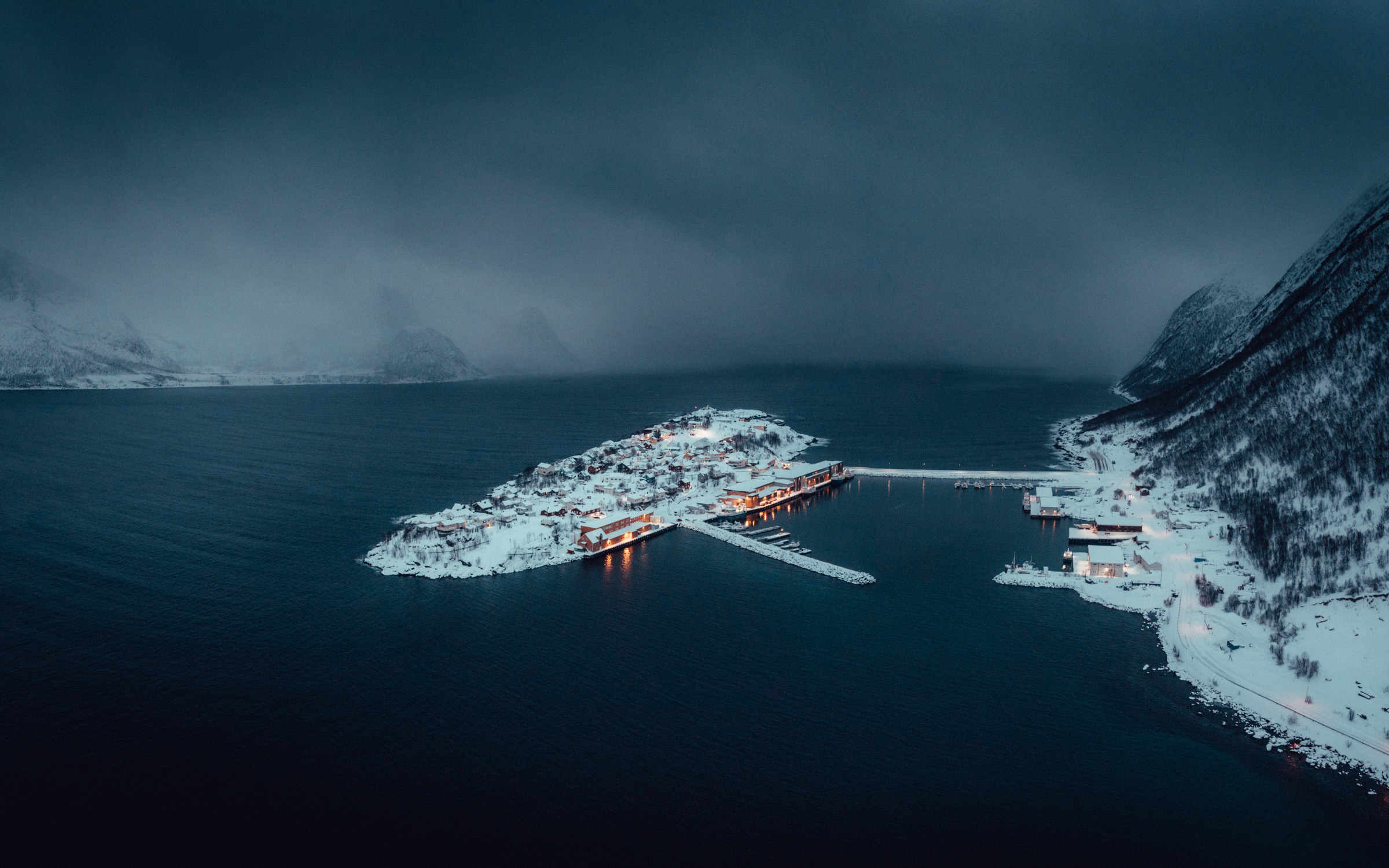
The liveliest among the numerous fishing villages is Husøy. A narrow, winding road takes you over the mountain to the jetty connecting Husøy Island (The “House Island”) with Senja itself. The village, so exposed to the elements, has some houses wired to the ground to withstand the storms. It’s a bustling spot, with winter cod fishing and year-round salmon processing. Despite the hardworking folks, the local shop closes for an hour at midday for lunch. This is quite unusual in Norway and is rumored to trace back to a ship off course from the Spanish Armada in 1588.

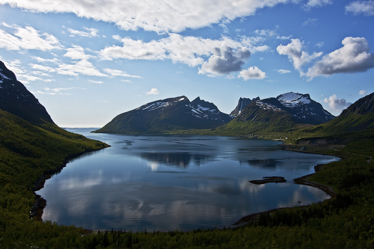
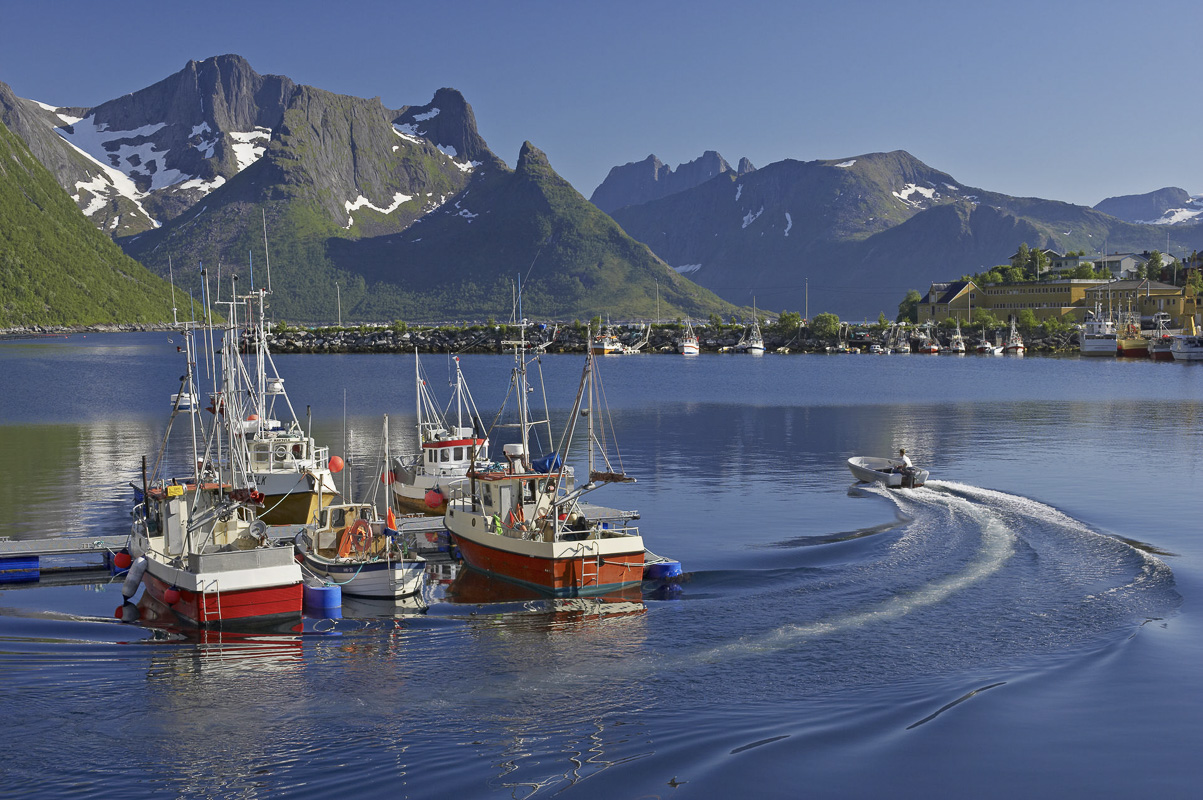
Mefjordvær and Senjahopen are non-identical twins
Senjahopen is yet another bustling fishing village. However, just a mile further out lies Mefjordvær, a much sleepier and traditional counterpart. Old houses gather around a charming harbour, providing a picturesque scene with breathtaking views of the surrounding mountains and the open sea. A lovely sea view can also be enjoyed from the nearby Knuten.
Bøvær has the lovliest beach
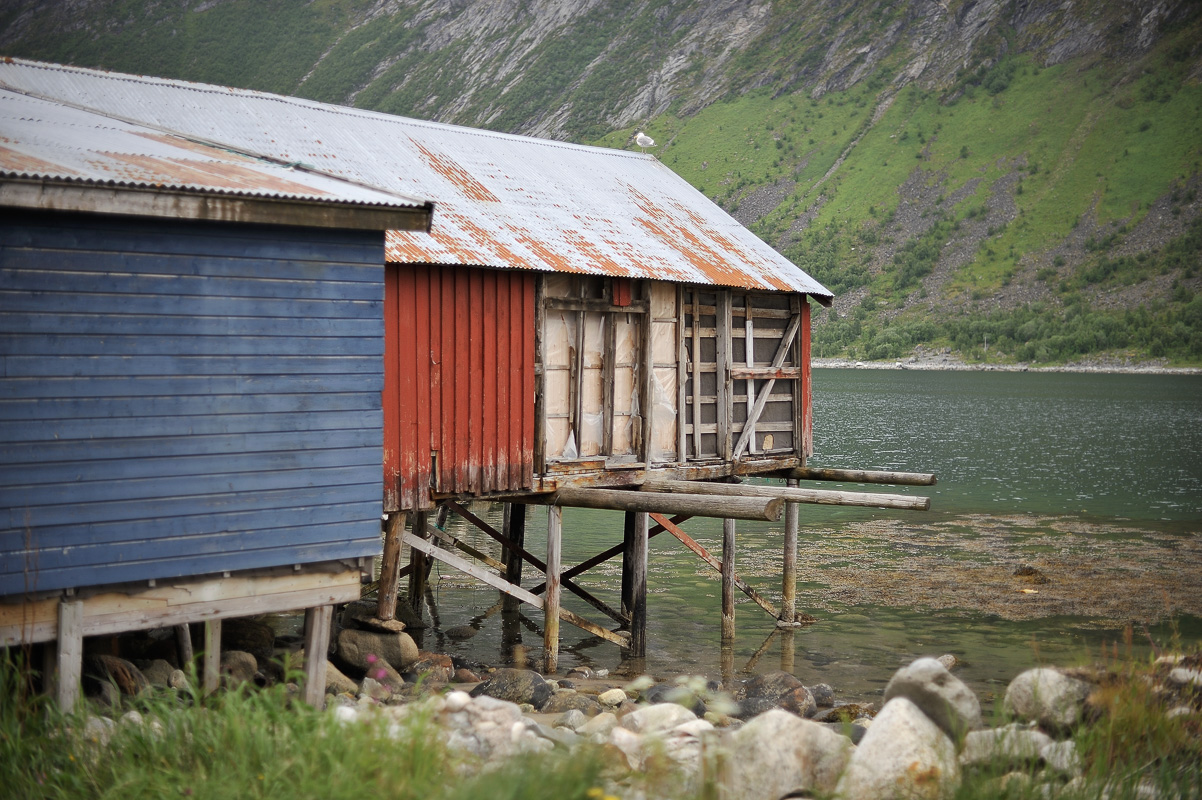
A detour from the small centre of Skaland leads out to Bøvær. Most folks simply visit for the expansive, sandy beach where they walk barefoot in summer, skip stones in the water, and admire the archipelago of 98 islands in the Bergsfjord. The old fish factory “Kråkeslottet” (The Crow’s Nest), built on stilts into the fjord, is a popular backdrop when taking photos at the beach.
From The Golden Loo you overlook the Ersfjord peaks
Another photo op along the National Scenic Route is the so-called “Golden Loo” (Gulldassen), named after its golden-coloured wall cover. From here, take a stroll to the fine, white-sand beach and relish the view of the impressive mountains on the right side of the fjord.
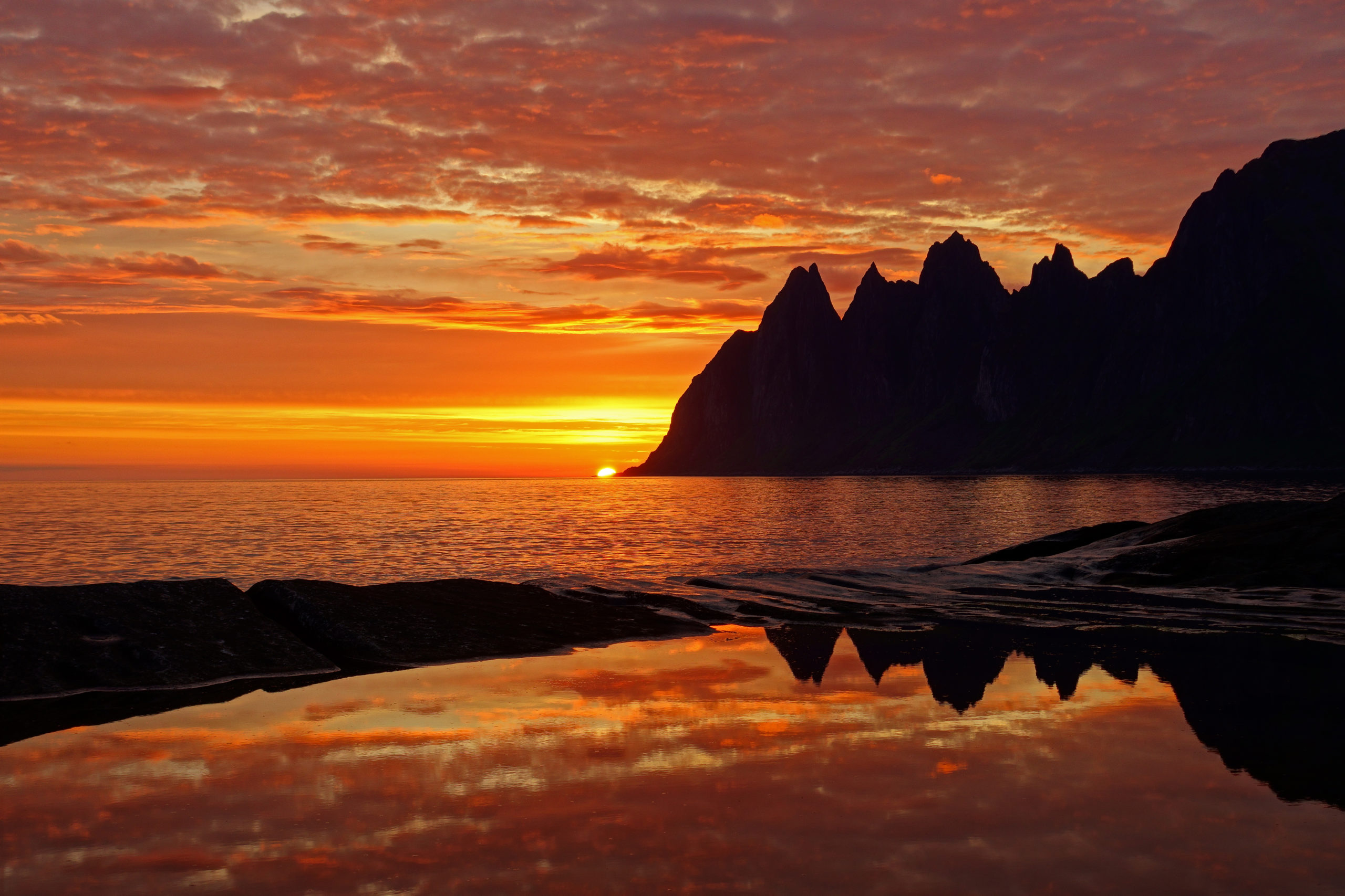
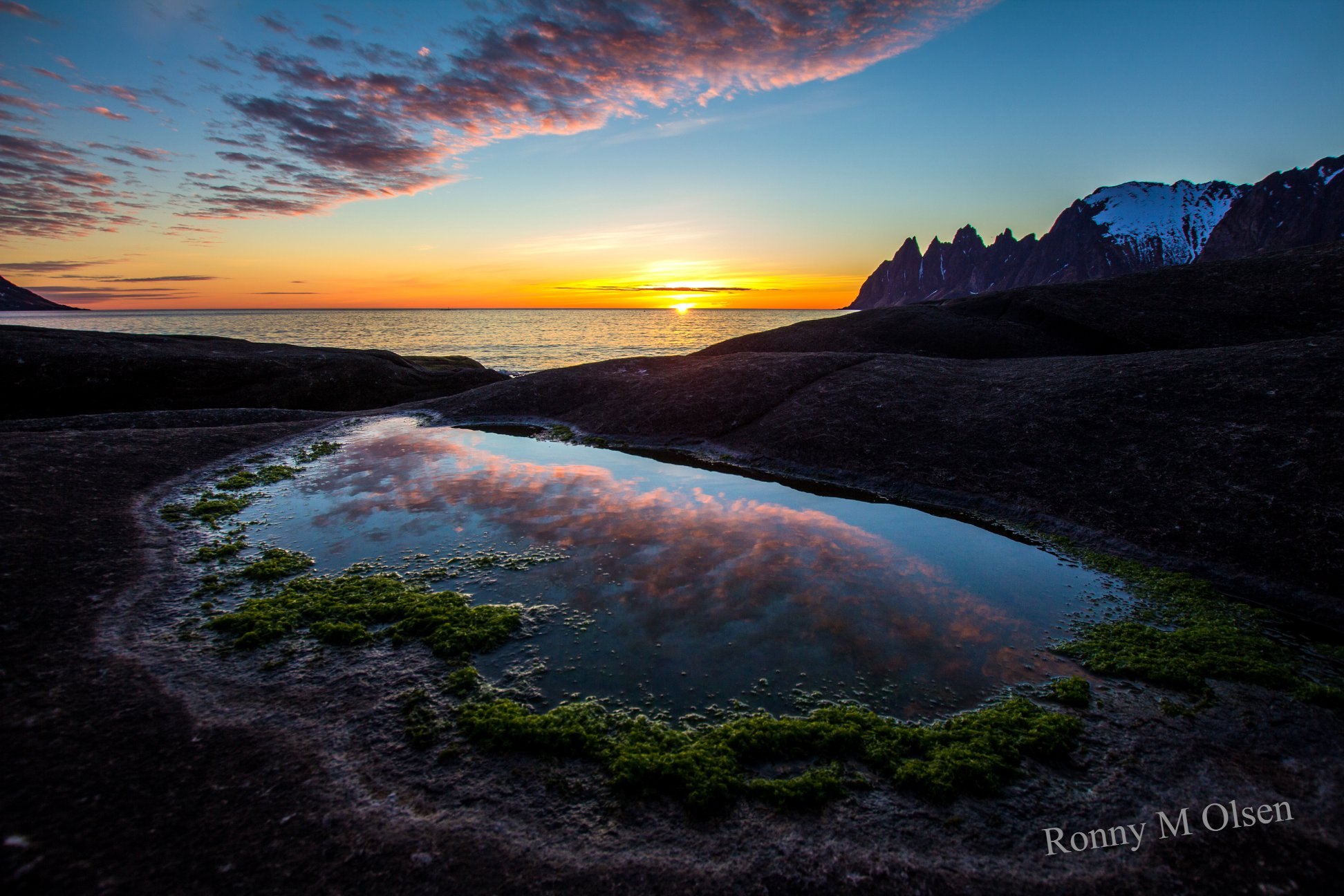
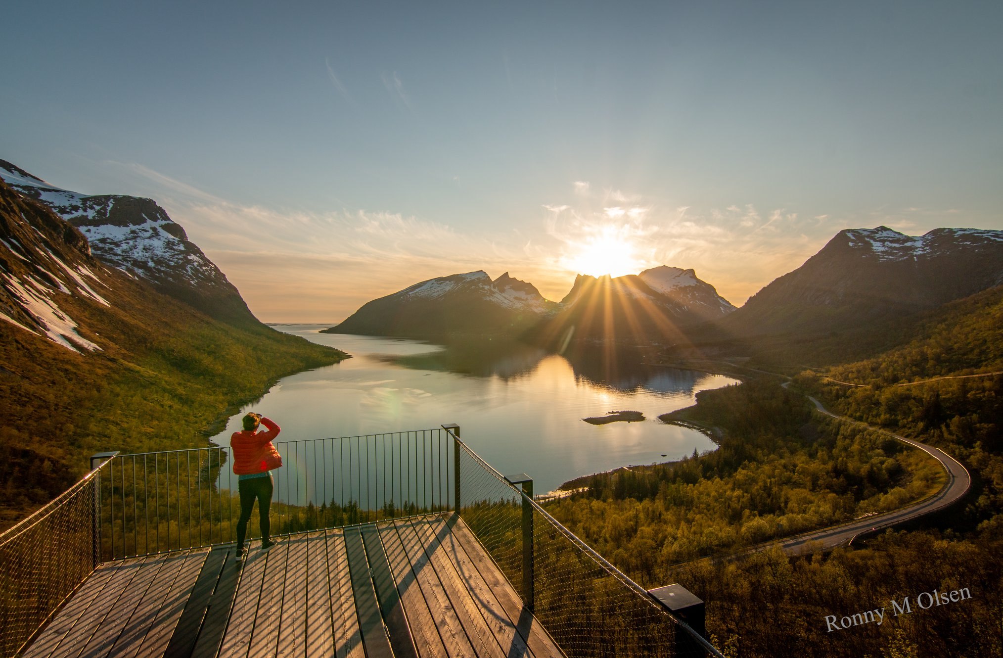
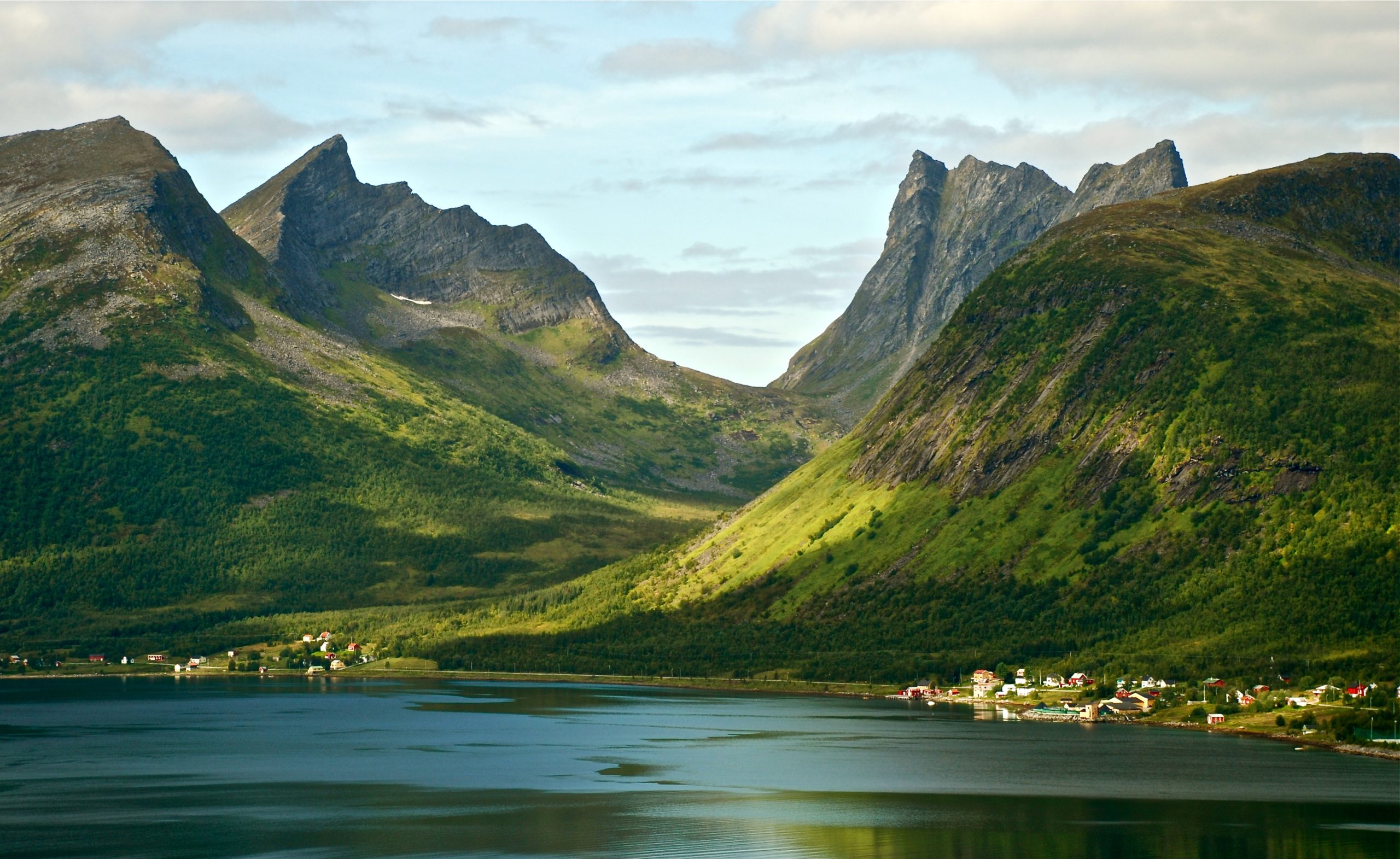
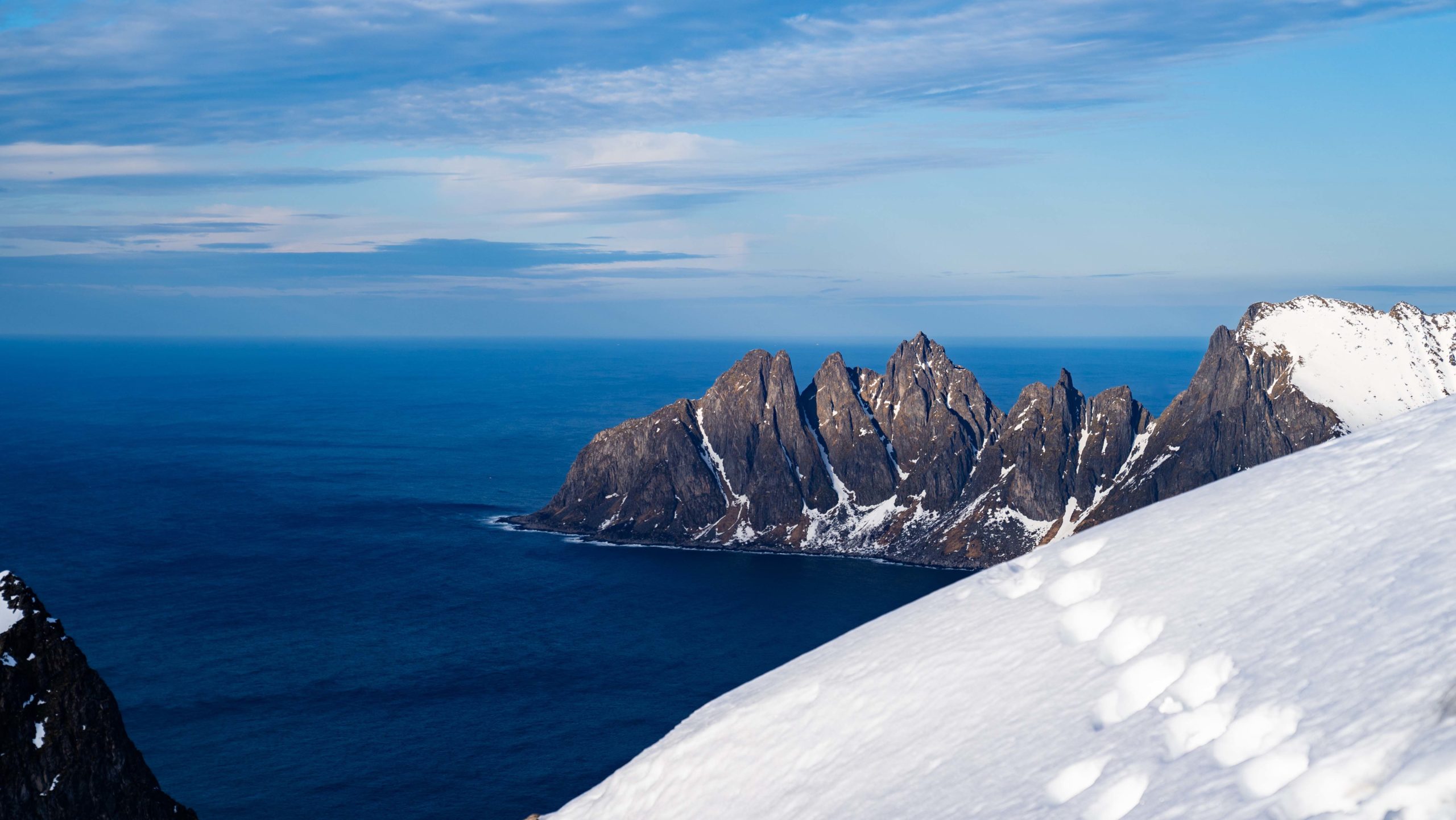
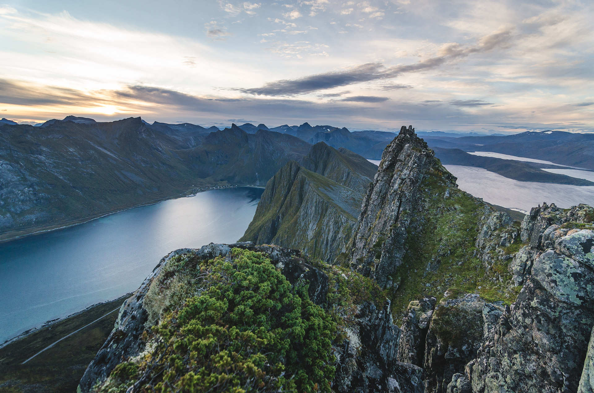
Tungeneset has the iconic view
The most photographed spot, and for good reason, is Tungeneset. From here, you’ll see the Okshornan cliffs dramatically rising from the ocean. A ramp takes you to some flat rocks that are easy to walk on. Snap pictures of the cliffs reflecting in the small pools on the rock surface, or just sit back and enjoy the view. Just be careful not to get too close to the waves.


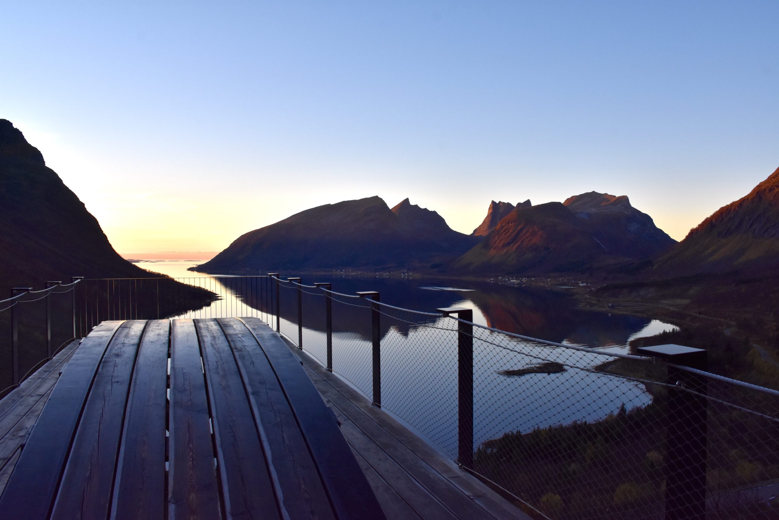
See the fjord and ocean from the “Stomach churner”
Once you’ve driven up the winding road from the end of Bergsfjord, you’ll reach a pretty special viewpoint. The platform is a bit wobbly, and if you’re not a fan of heights, it might be a tad scary. But trust me, it’s definitely worth facing those fears because the views of Bergsfjorden, the open sea, and the majestic peaks will stay with you forever.
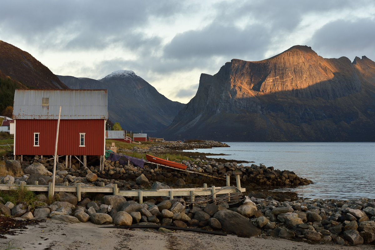
Hamn i Senja is a sheltered port facing the ocean
Hamn means port, and a cluster of islets creates a sheltered harbor for this ancient settlement. The old nickel mine and trading post in Hamn i Senja couldn’t be more dramatically situated, with the Sugarloaf mountain directly south, the 98 islands of Bergsfjord to the north, and the endless Atlantic to the west

Torsken village is a small detour
A quick detour from the main road leads you to the old centre of Torsken, now a quiet village with around 150 people. The fjord view is fantastic. The small Torsken church, built in 1785, holds treasures dating back to earlier churches from as far back as the late Middle Ages. It was also the ministry of Ingrid Bjerkås, the first woman minister in the Church of Norway, who started her service here in 1961, stirring quite a bit of controversy at the time. Nevertheless, she is warmly remembered by the parishioners.
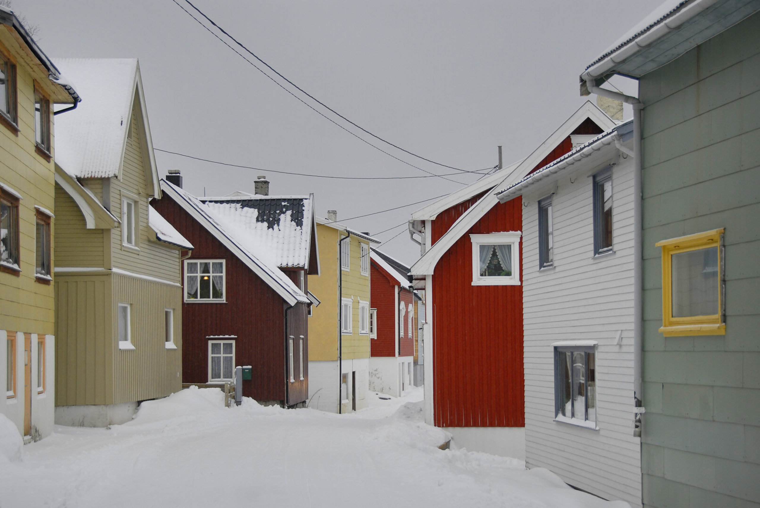
Gryllefjord is a colourful village
The village of Gryllefjord enjoys a dramatic setting between the fjord and the open ocean. Highly dependent on fishing, the village is compact and colourful, with houses painted in a myriad of hues. Come here for a bit of urbanity amidst all the scenery, and to take the summer ferry to the whale town of Andenes.
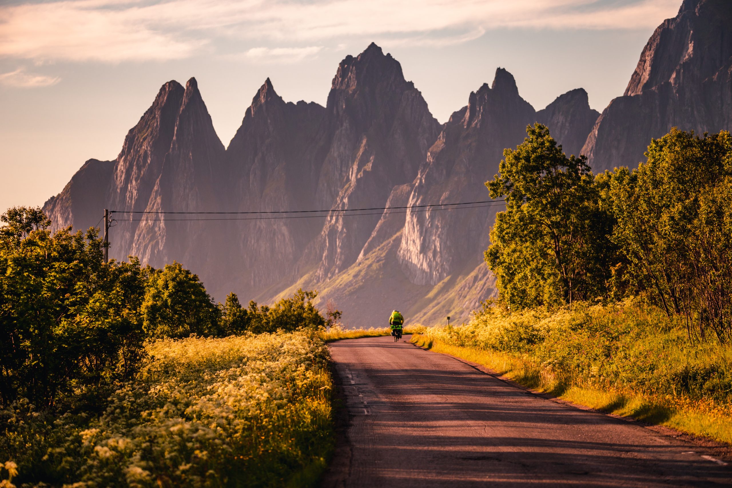
Senja is bike heaven
The Norwegian Scenic Route is a fantastic cycling route. Although you’re on the road, traffic is minimal. Following the shoreline, it’s not too strenuous, except for the Bergsfjorden hairpin bends. Stop at viewpoints, check out local cafes, and park your bike for a beach walk. The route can be tackled in a day for the experienced, two for the rest of us. Add extra days for exploring the inland forest.
The Sifjord detour leads to nowhere but picturesque rural communities
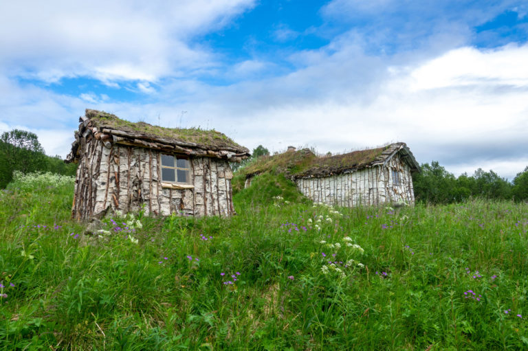
For the adventurous souls, the sidetrack to the communities along the Sifjord is a real gem. The winding road descending the scree of Sifjordura towards the fjord is simply picturesque. Continue driving along the fjord, passing quaint settlements, until you reach the road’s end at Grunnfarnes, surrounded by small farms beneath majestic peaks. En route across the mountains, make a pit stop at the Kaperdalen museum, a collection of turf huts constructed by the Sami who settled here 2-300 years ago.
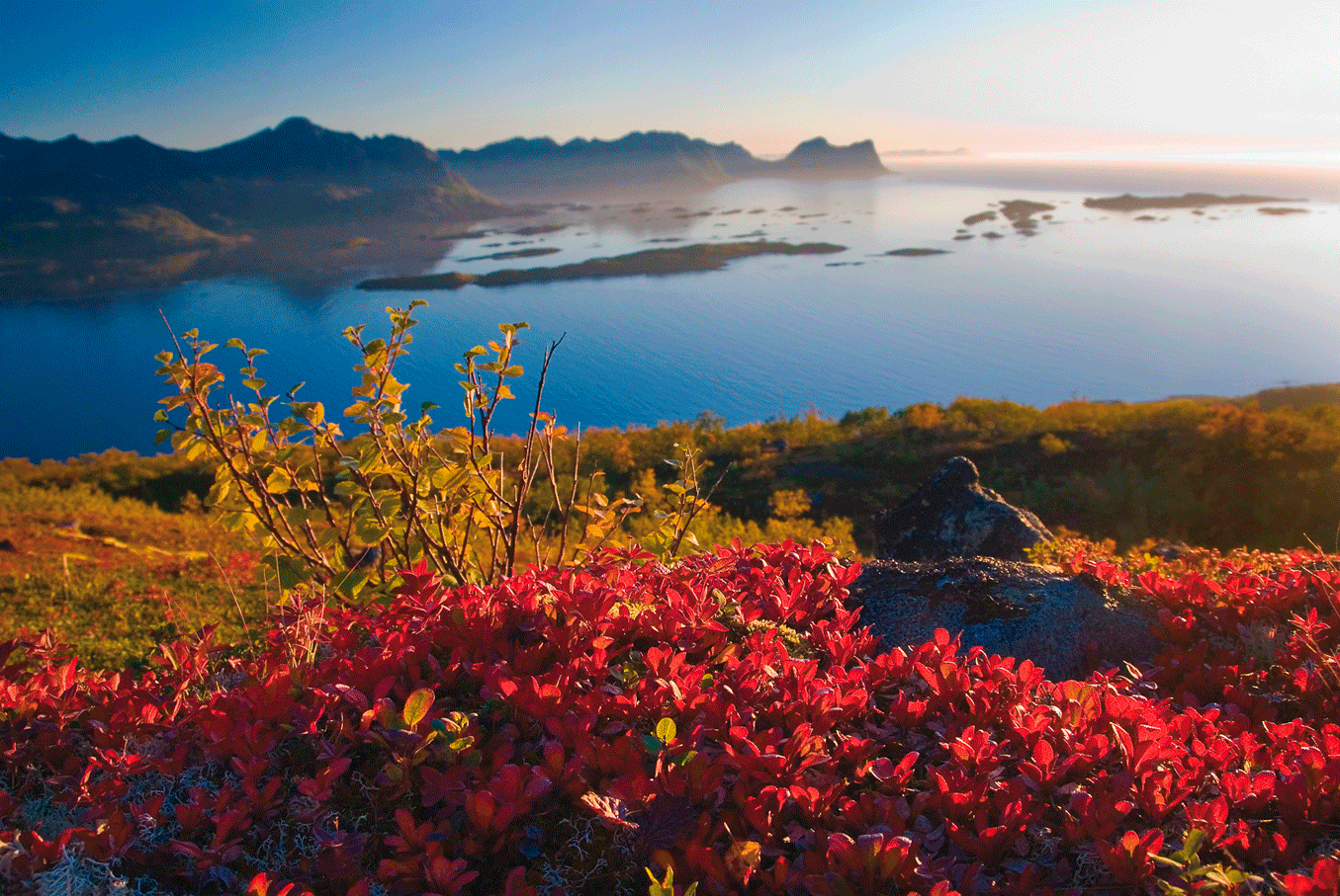
The Senja autumn…
Highlights Senja
Some points of orientation on the u0022Fairy Tale Islandu0022 of Senja
Finnsnes
Town, centre of communication
Botnhamn
Northern end of the Norwegian Scenic Route of Senja
Husøy
Dense, active fishing village
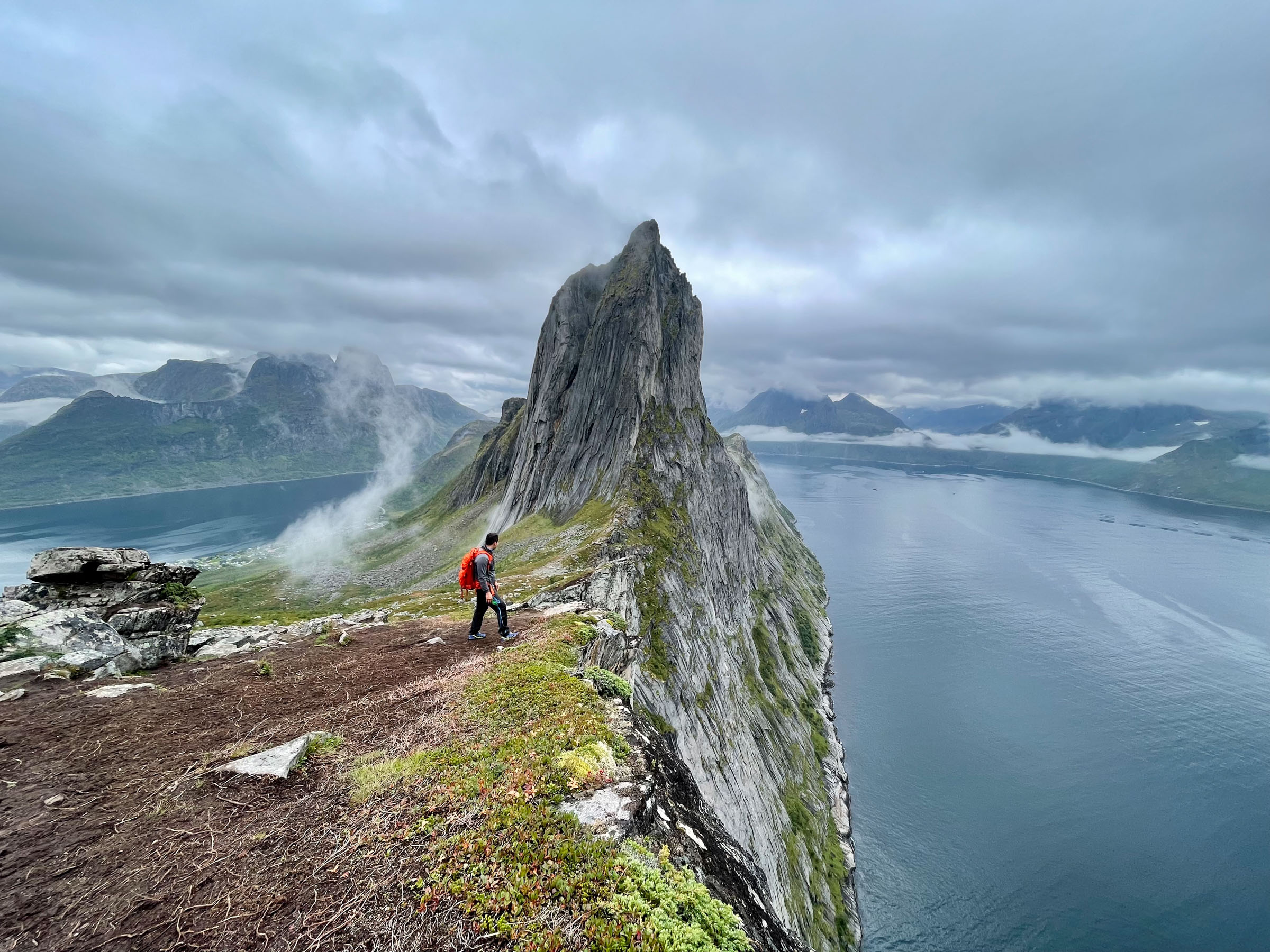
Tungeneset
Iconic viewpoint
Mefjordvær
Tungeneset
Torsken
Gryllefjord
Sifjord
Drive past the Sami museum down the switchback road of Sifjordura to the remote villages along the Sifjord
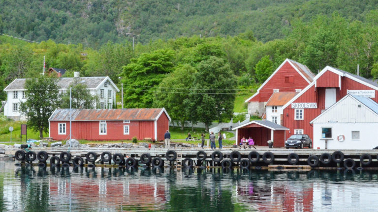
Skrolsvik
Fishing port facing the open sea, and the end of the road. Stop for the halibut museum.
Tranøybotn
Calm cove filled with islands, suited for kayaking. The National Park of Ånderdalen invites to easy forest hikes
Tranøya Island
The church from 1775, the vicarage and the calm atmosphere of days gone by
Gibostad
A colourful old trading centre on the main shipping lane.
Discover the unknown Senja
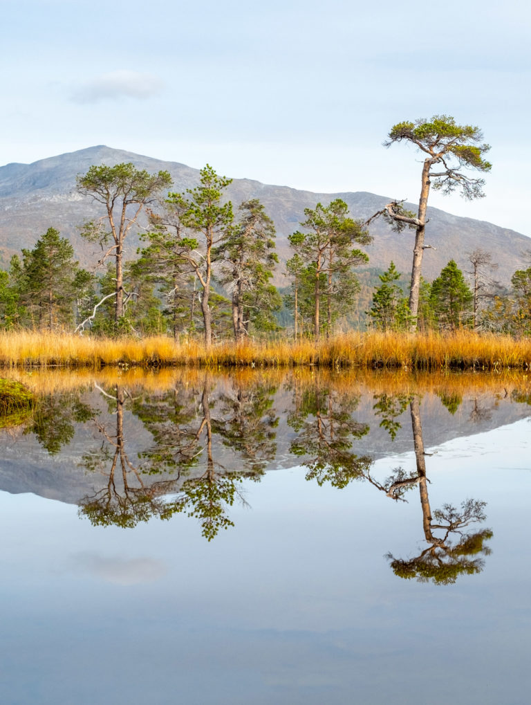
The eastern side of Senja has a different face
The eastern slopes of Senja Island present a completely different landscape. Dense birch forests, intertwined with aspen and rowan, cover the area. Tiny lakes glisten, and rivers and streams weave through the scenery. In the valleys, you’ll come across small farms, while along the inner waterways facing the mainland, there’s fertile farmland and a welcoming, green panorama. Gibostad, an old trading post, boasts charming old houses and hosts a popular market in August.
Senja has a friendly southern coast
The diversion from Finnsnes through Vangsvik to Tranøybotn, Stonglandseidet, and Skrolsvik is a seldom-taken route. However, it unveils yet another facet of Senja. The sheltered bay of Tranøybotn is perfect for year-round kayaking. The Stonglandseidet peninsula offers easy hikes to viewpoints or a shoreline path to the southern tip. The Ånderdalen National Park is among the most accessible, featuring gentle forest hikes. Skrolsvik, at the road’s end, is a sheltered port on the open ocean.

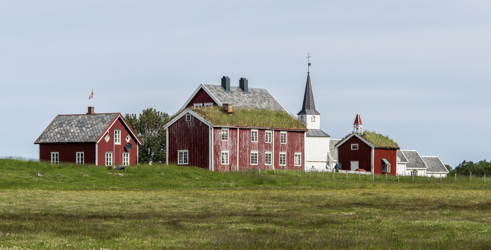
Tranøy is the old centre
Before cars and roads, communication relied on the sea. In those times, the small island of Tranøy was at the heart of trade and communication. This is why we find the old church, dating from 1775, here, surrounded by the buildings of the vicarage. Today, the island is car-free and remarkably tranquil, offering a haven for anyone seeking to get away from it all.
The trees in Ånderdalen National Park are 600 years old
The compact Ånderdalen National Park, located near Senja’s southern coast, stands as a guardian of the distinctive coastal pine forests that have managed to escape logging. The park also boasts various types of deciduous forests, offering easy access for hikes and fishing in summer, as well as dog sledding, snowshoeing, and skiing in winter.
Finnsnes is the new centre, Bjorelvnes the old
Today, most people get to Senja through the town of Finnsnes, near the bridge to Senja. You’ll find plenty of shops, restaurants, and places to stay in Finnsnes. But for a dose of history, head to nearby Bjorelvnes. There, you’ll discover the old Lenvik church, originally built in 1130, and an ancient vicarage that now houses a small museum.
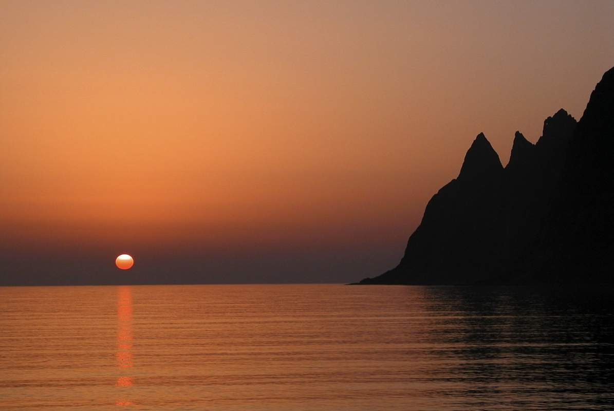


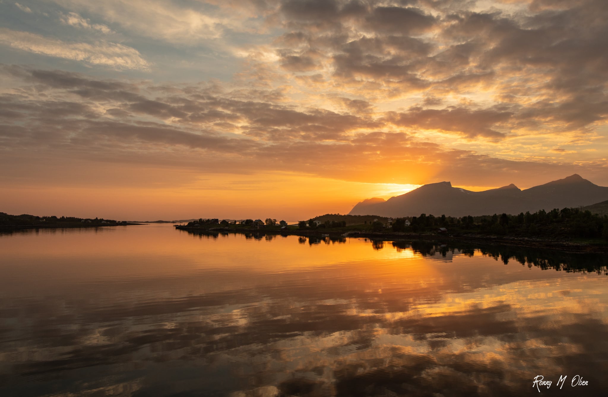
The Midnight Sun shines for two months at Senja
Senja, located a good 300 km north of the Arctic Circle, experiences the midnight sun for over 2 months. In Finnsnes, the sun graces the sky at midnight from the 20th of May to the 23rd of July. However, be aware that the Midnight Sun might be concealed behind a mountain, especially along the rugged outer coast of Senja. Some catch the Midnight Sun at Knuten hill near Mefjordvær, while others prefer the view from Tungeneset overlooking Okshornan. Ask around for the best vantage points wherever you are at night.
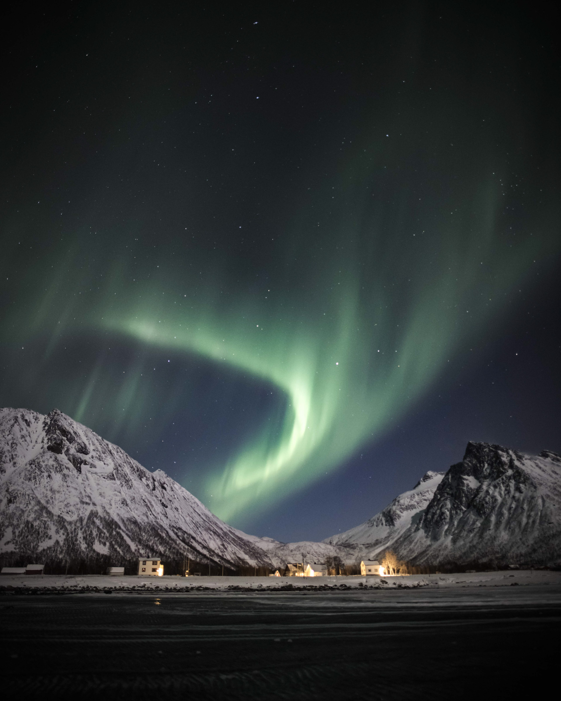
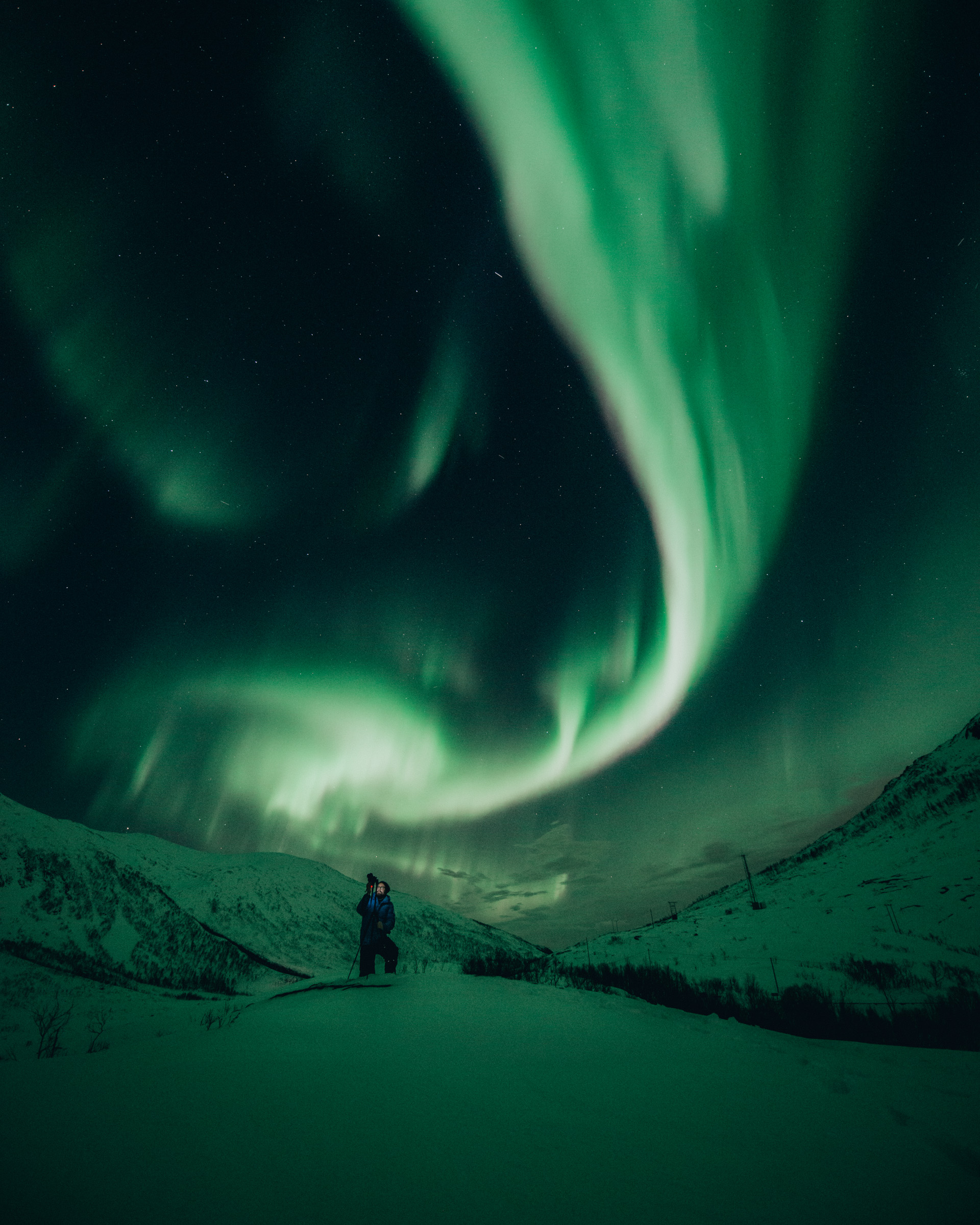
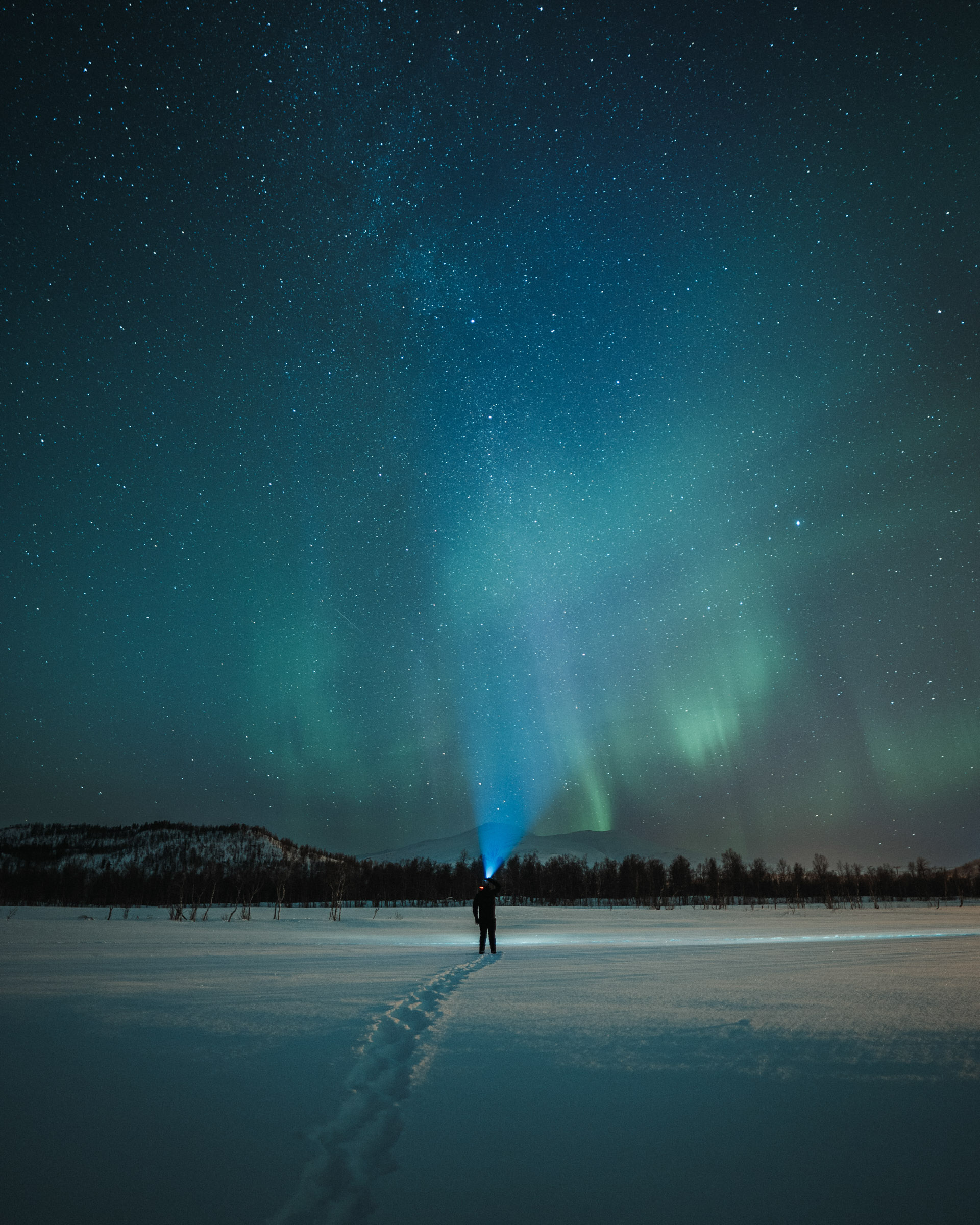
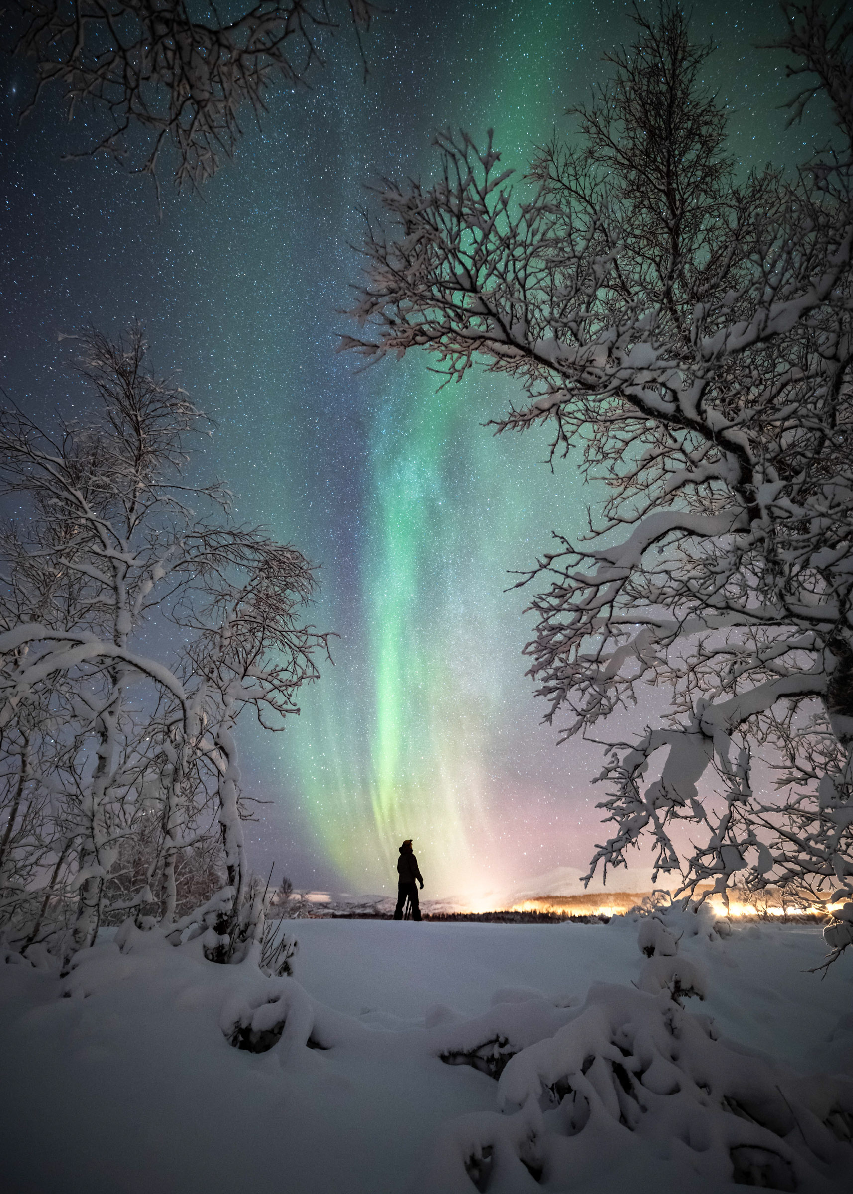
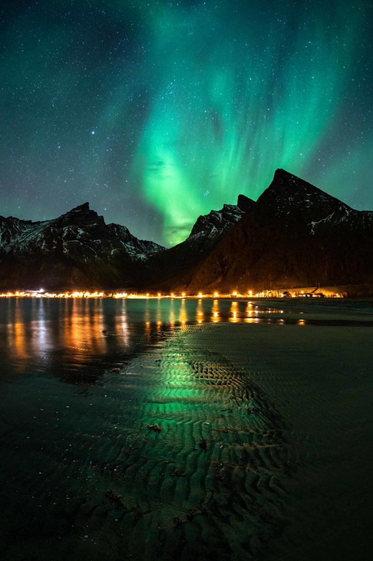
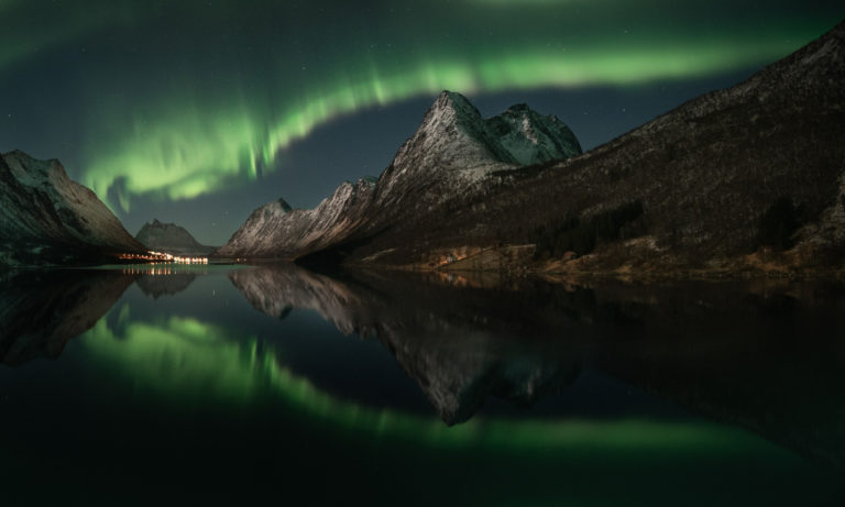
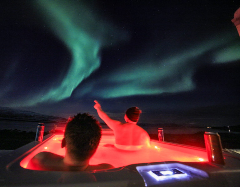
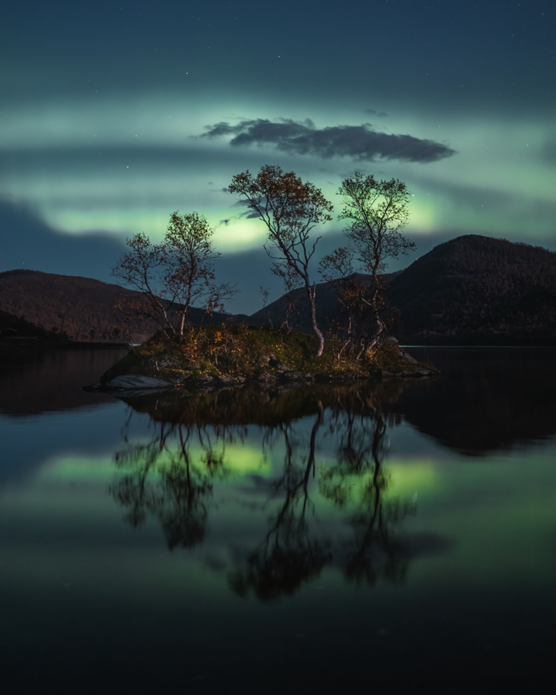
Senja is right under the Northern Lights oval
The Northern Lights oval, the prime zone for witnessing the Northern Lights, is positioned about 100 km above Senja. This makes the island one of the best places globally for catching the Northern Lights. Venture around the island for Northern Lights hunting or join a professional guide to explore the island for clear skies, a must to spot them. During the winter, many visitors opt to rent a cabin for a tranquil holiday, keeping an eye out for the lights each night.
Hike for ocean views, or head into the pine forest
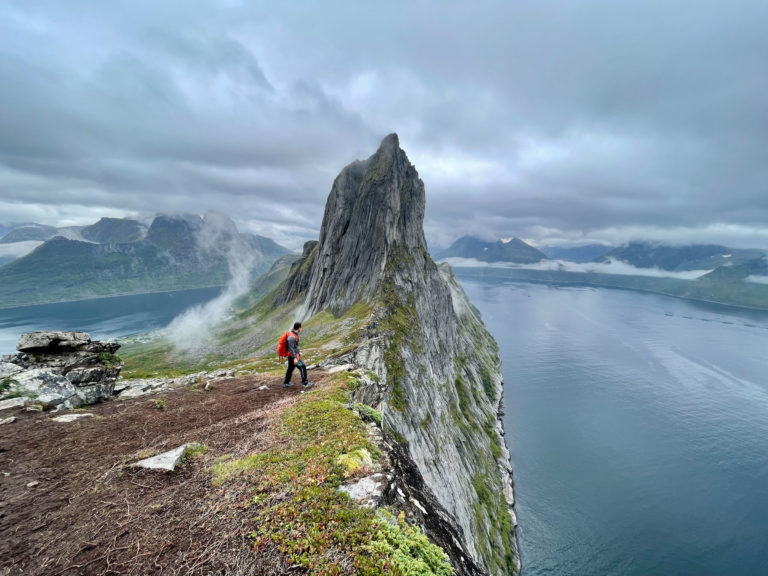
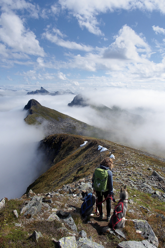
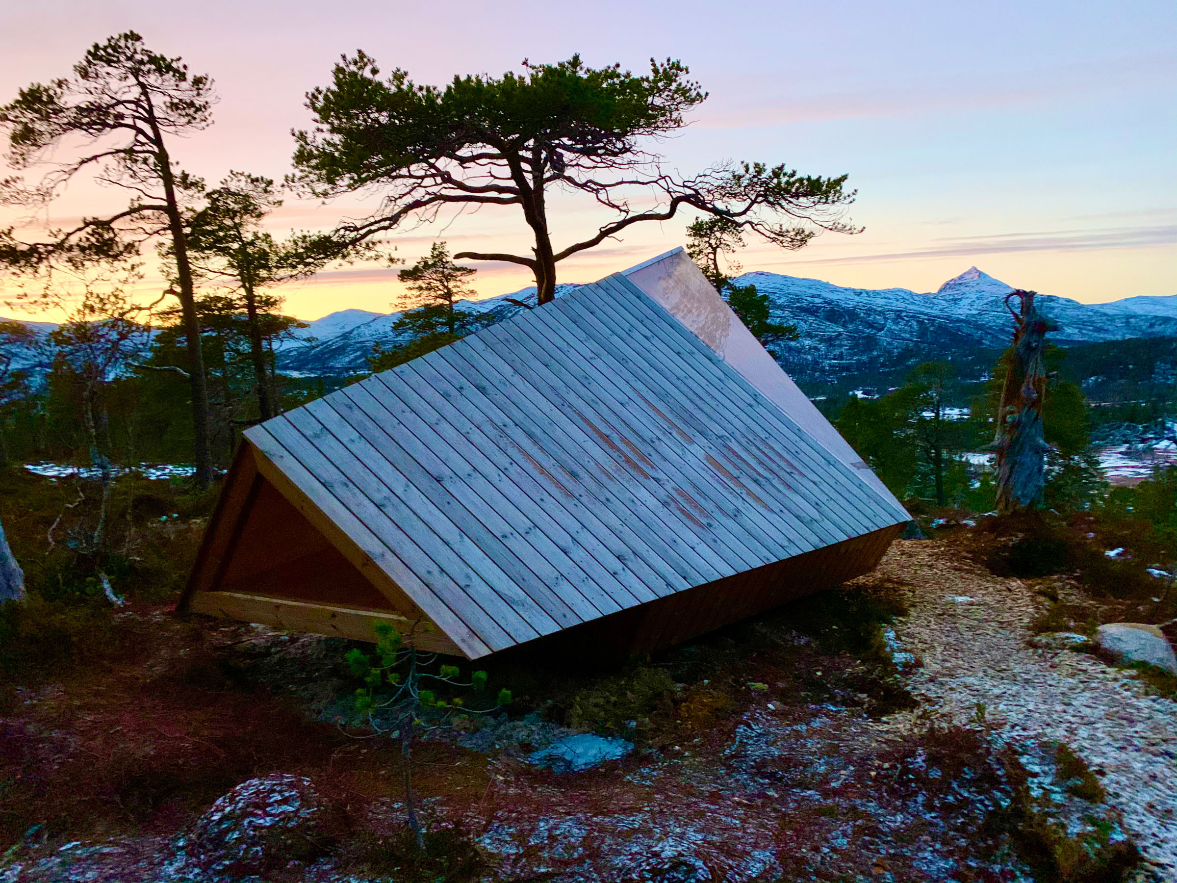
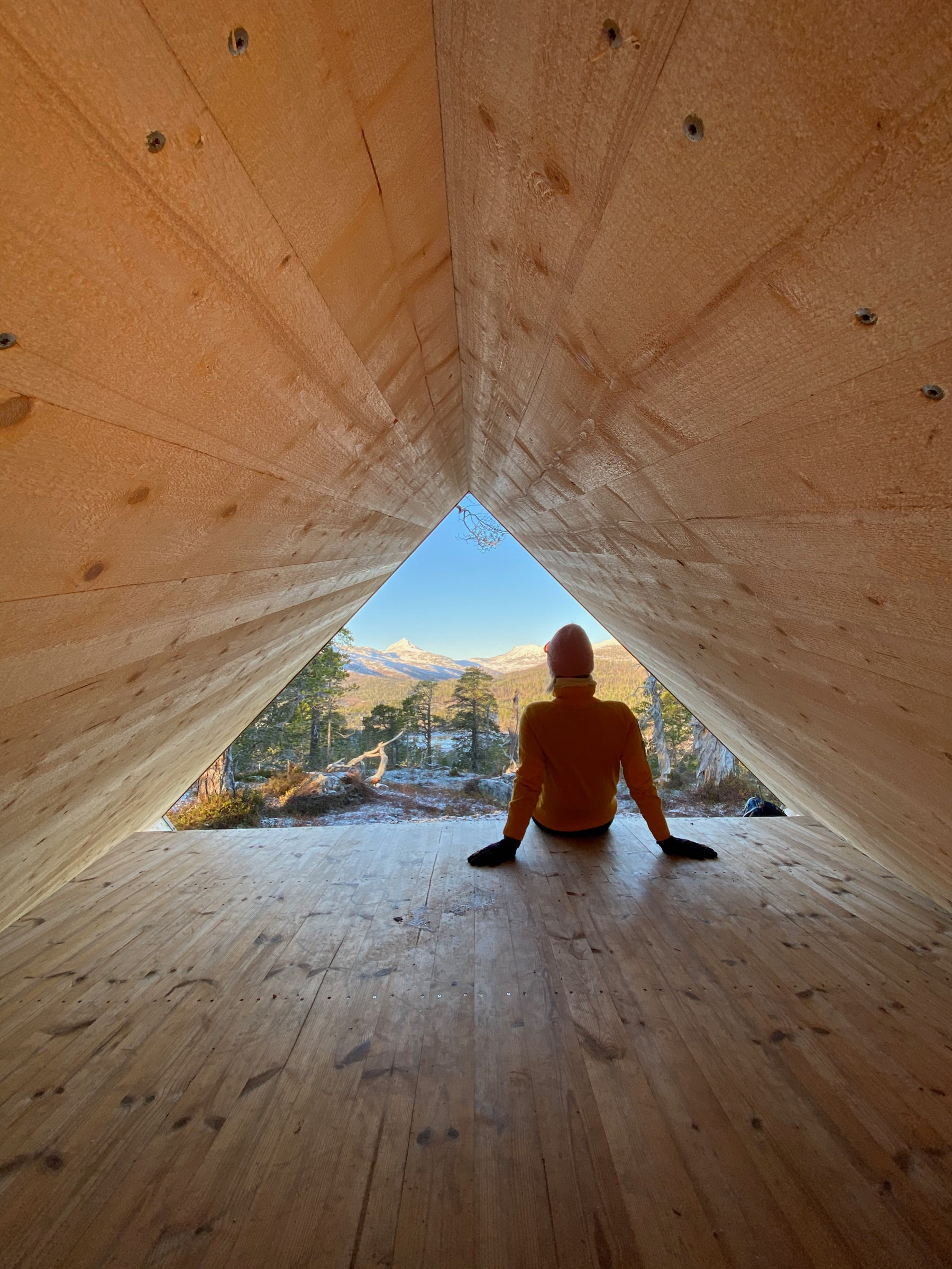
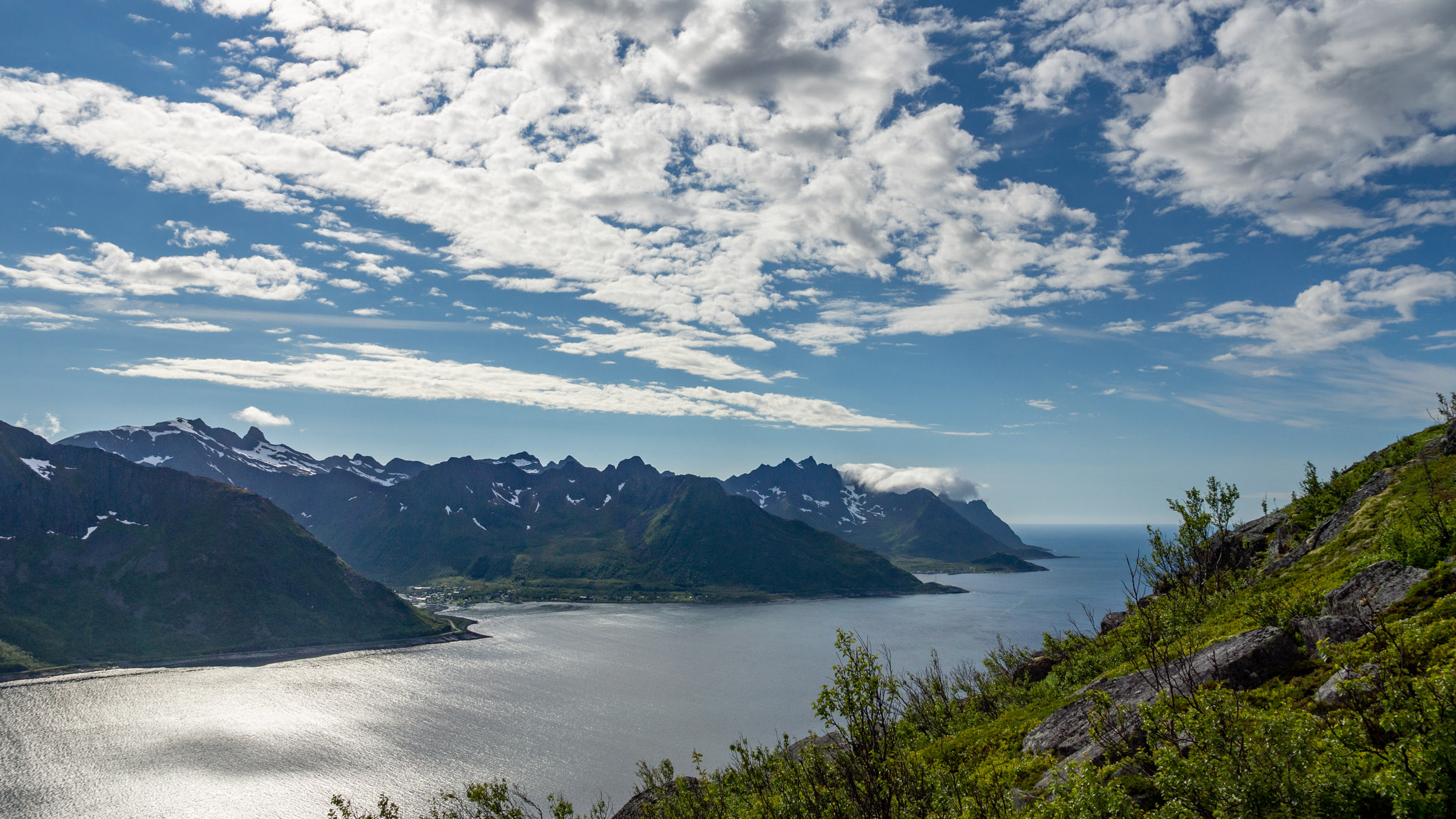
One of Senja’s highlights is the abundance of scenic hikes. The outer coast offers steep yet short trails to iconic sea viewpoints. Smaller shoreline hikes are also available. On the eastern and southern shores, easier hikes traverse gentle landscapes with forests and farmland. The stroll around Lake Åndervatn in the south delivers instant wilderness. At the other extreme, the five-day hike along Senja’s mountainous spine (“Senja på langs”) is a civilization-free adventure.
Practical on Senja
Senja is a big island situated south of Tromsø, north of Harstad, with the Vesterålen and Lofoten islands in the south west. From Finnsnes, on the mainland, there is a bridge to Senja.
Visit Senja is the local tourist board, with lots of useful info on their website visitsenja.no
There is a wide range of accommodation, mostly locally owned places with character. Have a look at Visit Senja’s overview
Yes. There are several ways of doing it. In Summer, you drive from Lofoten through the Vesterålen Islands past Sortland and Andenes, and then take the summer ferry to Gryllefjord. The rest of the year, you have to drive the E10 to Bjerkvik, and then the E6 to Buktamoen near Bardufoss. From here, the 86 takes you to Finnsnes.
From Lofoten, there are buses to Harstad. From Harstad, there are catamarans several times a day to Finnsnes. From there, you can take buses around Senja. From Harstad, there are also catamarans going to communities along the southern coast, notably Skrolsvik. You can also go by bus from Lofoten through Sortland and Andenes in the Vesterålen Islands. In Summer, there is a ferry from Andenes to Gryllefjord on Senja. This is not an option outside the Summer tourist season. Timetables should be found at EnTur.
Yes. The easiest is to drive from Tromsø to Brensholmen, near the fishing village of Sommarøy 1 hour southwest of Tromsø. Then on you take the ferry Brensholmen-Botnhamn. Botnhamn is on the northern end of the Senja scenic route. You can also drive overland from Tromsø to Nordkjosbotn and on to Buktamoen, then turn right and go to Finnsnes. From Finnsnes, you cross the bridge to Senja.

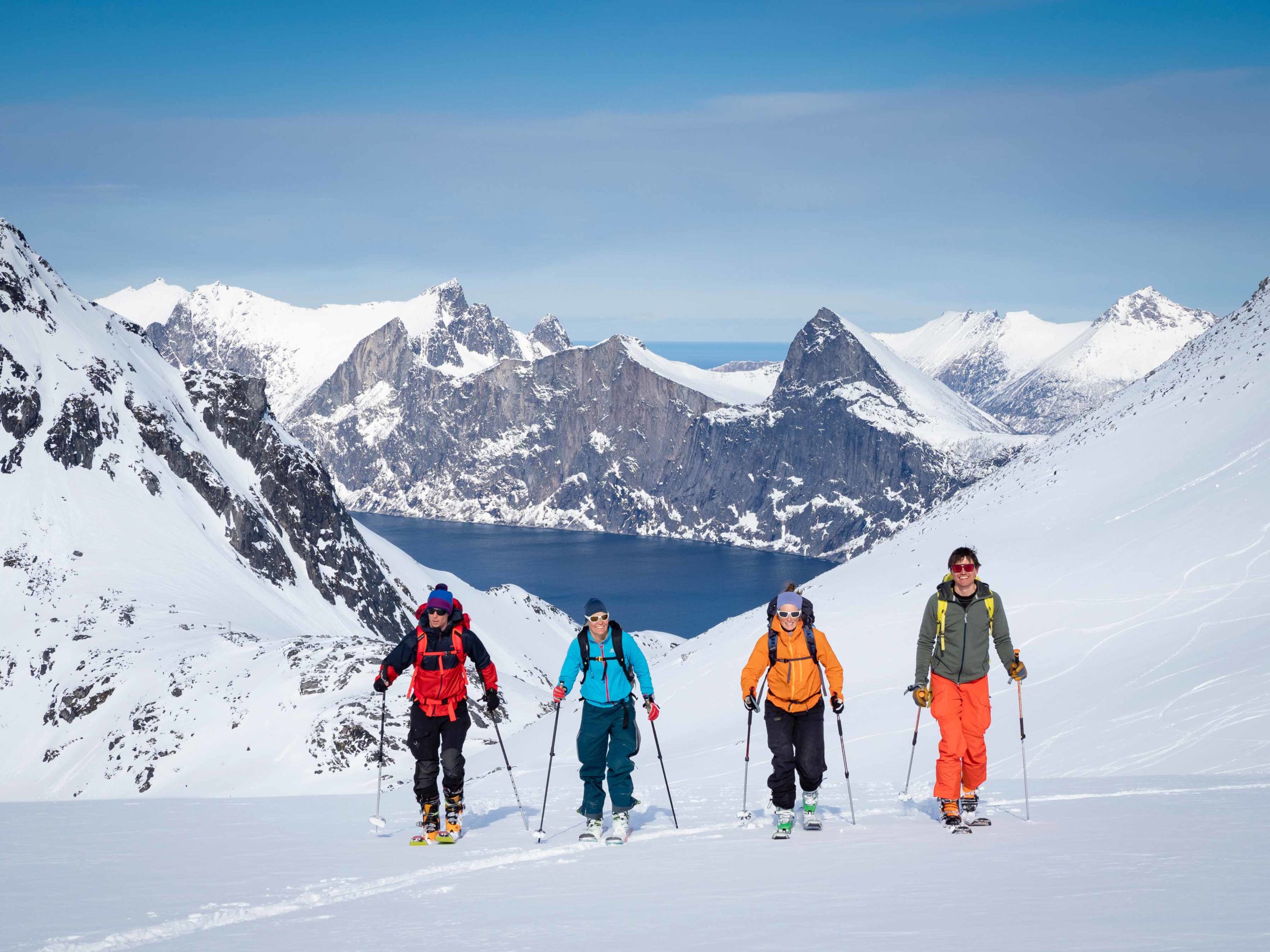
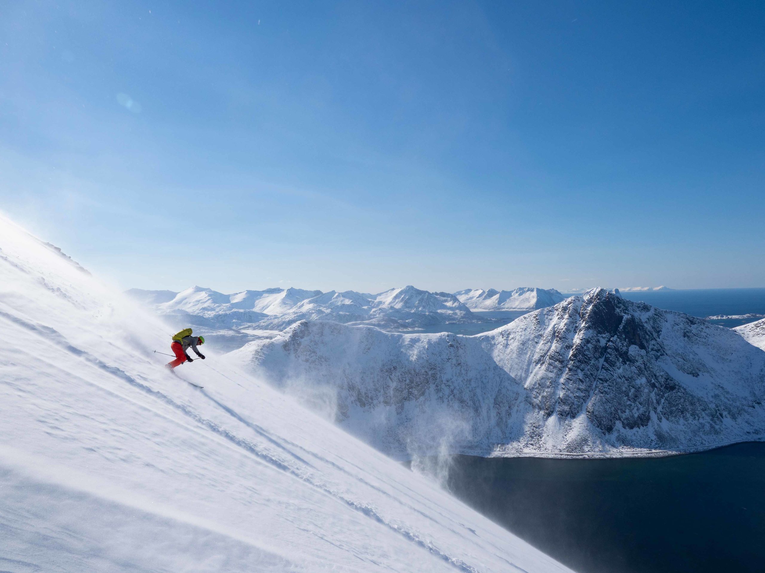
Ski touring is the spring adventure
In March, April, and early May, when the weather is steady and the hillsides boast waist-deep snow, it’s prime time for ski touring in the Senja mountains. Skiing enthusiasts can stay in cabins and resorts along the outer coast or rent a holiday home, spending the entire day skiing. After all, who can resist the allure of skiing from a summit straight down to the Atlantic?


Visit Senja
Your assistant to explore the big island of Senja is Visit Senja