2021 could be the year you will finally get to the North Cape. As the pandemic hopefully ebbs away, the locals are a bit more social and there is plenty of space to explore the North Cape, now is the time to strike! Here are some ideas for what to see and experience at the North Cape and in the surrounding area.
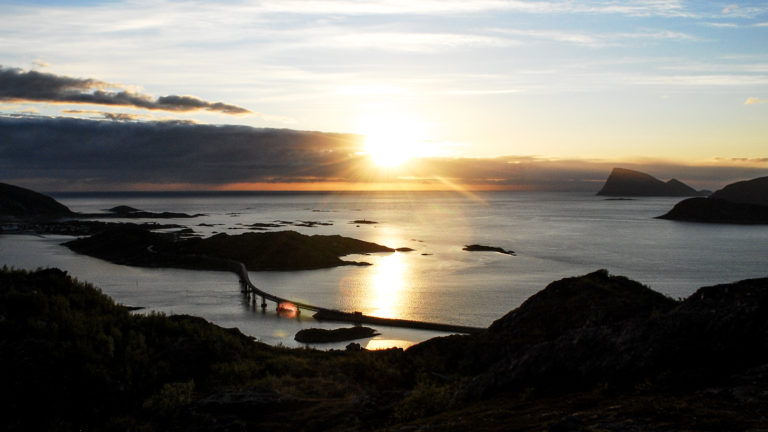
The North Cape is one of the world’s largest capes
Columbus, Vasco da Gama, Magellan and all the other explorers from the end of the 15th century onwards discovered new lands and new sea routes, making the world appear smaller. Then the great capes, point markers for long and dangerous voyages, such as the Cape of Good Hope and Cape Horn, became a topic of high interest in sailors’ inns, among cartographers and in the emerging natural sciences. In 1553, the “North Cape” was christened for the first time by the English seafarer Richard Chancellor. He made an attempt to find the Northeast Passage, a more direct route to Asia, and noticed that the Finnmark coast from the North Cape sloped southwards. Soon more explorers, merchants and whalers arrived, and the North Cape became a distant, difficult-to-access and legendary point reserved for the bravest.
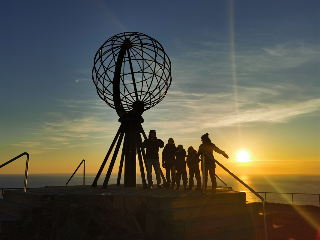
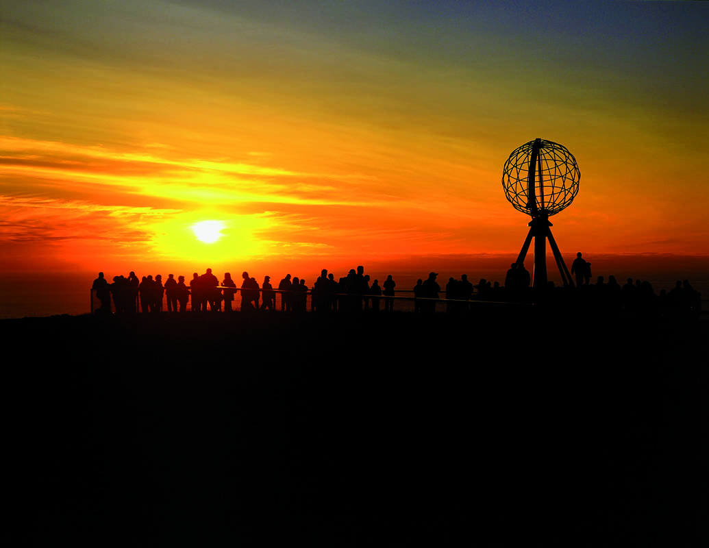
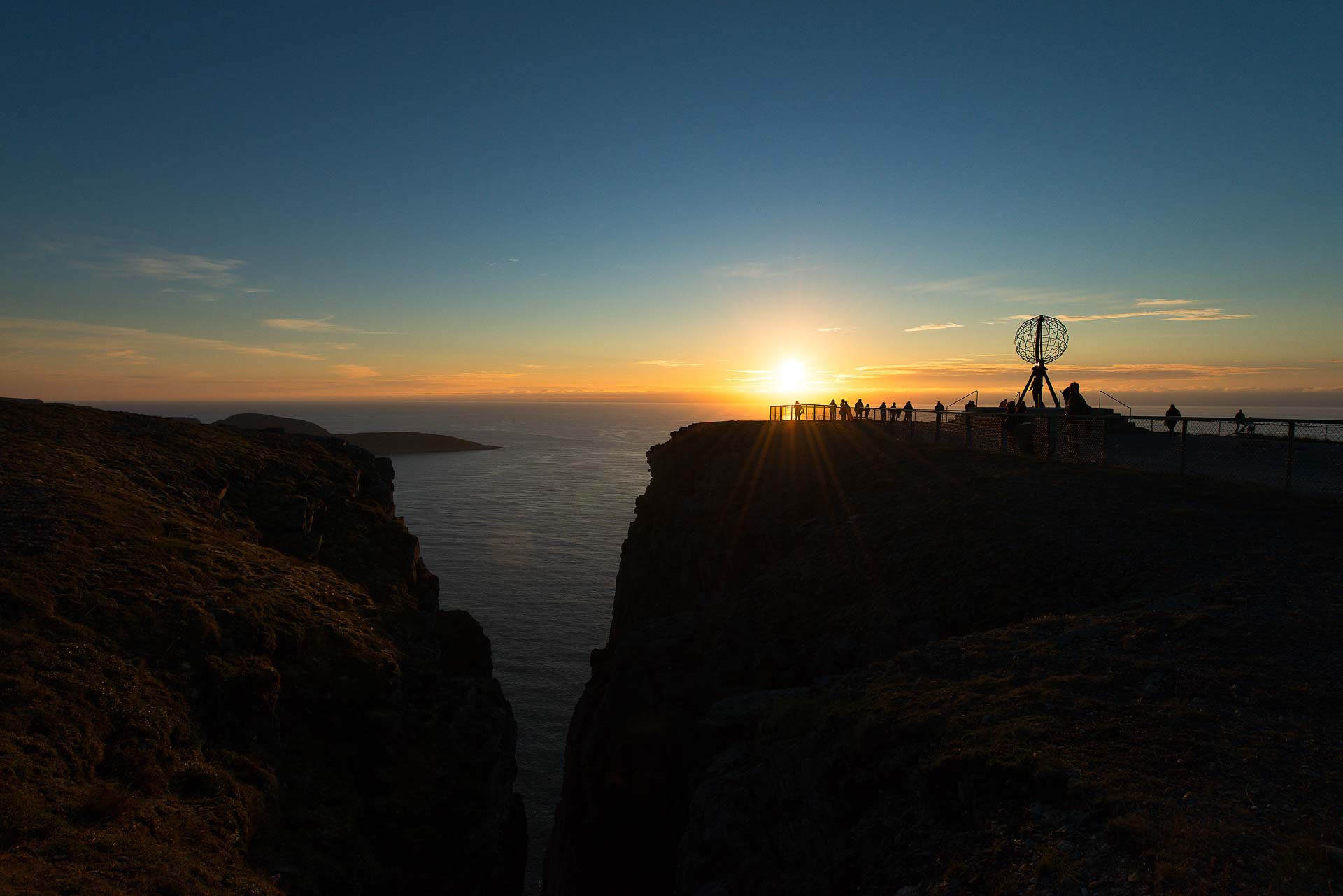
Europe ends at the North Cape
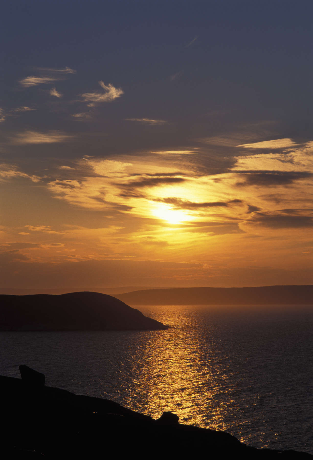
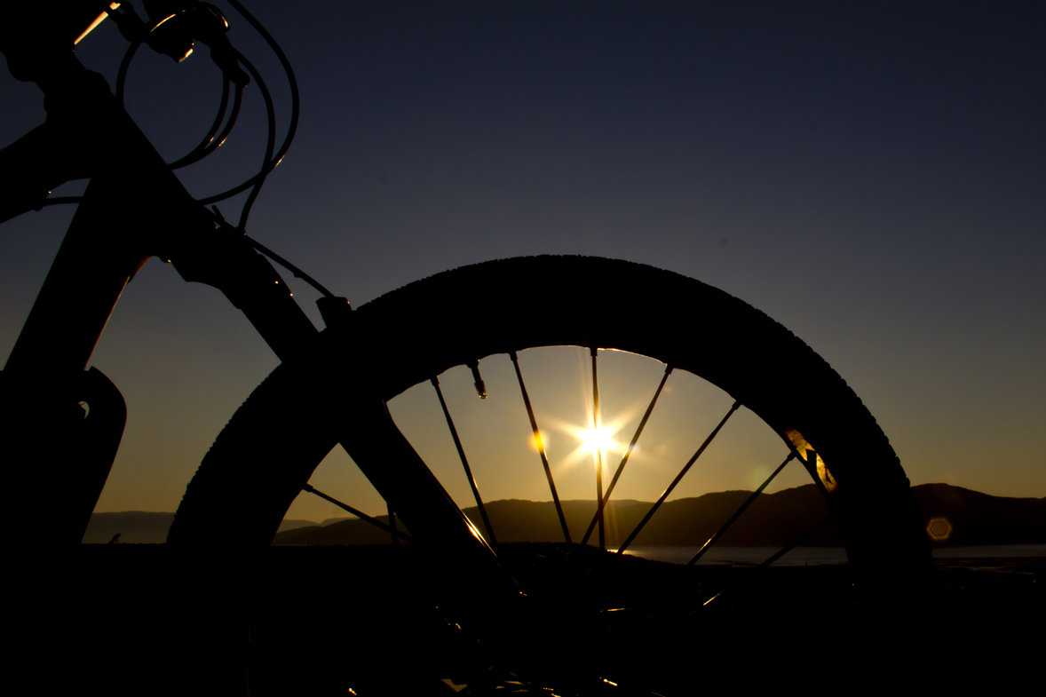
The cliff rises 307 metres from the North Sea, and from here you look north to an empty horizon. The first real North Cape tourist, who travelled here just to say he had been here, was the Jesuit father Francesco Negri, who spent three years travelling up to the North Cape. In 1664 he concluded that he had now seen enough, and could go home and die peacefully. We do not think you should take it so seriously, but a visit to the North Cape is definitely about having reached a milestone. If you are lucky, you will see the midnight sun shimmer in a calm North Sea, with a fishing boat in a black silhouette in the middle. However westerly-northwest winds mean drizzle in the face and seven degrees Celsius. Regardless, it’s not about the weather, the midnight sun, the selfie or the North Cape certificate. This is a point for reflection.
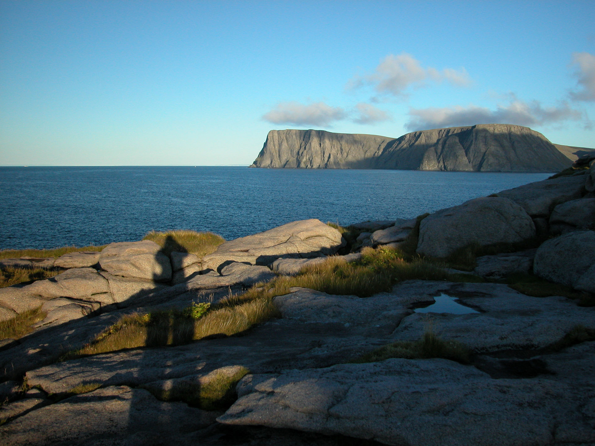
See Nordkapp from the north
There is in fact a geographical point that is further north than the North Cape; namely Knivskjelodden. 1400 meters further north, this is a decent trip for all ordinary walkers who can walk in rough terrain, but it takes 3-4 hours. Out here you see the North Cape to the southeast, while you hardly see anything straight to the north. It sets your mind in motion, so put on your extra jacket, sit on the rocks and take in the atmosphere.
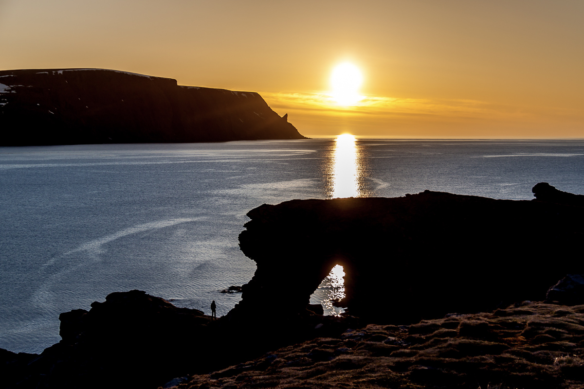
Through Kirkeporten you see the North Cape
Another iconic place to see the North Cape from is Kirkeporten. It is a rock formation shaped like a natural arch like you would see in a church. From here you see the North Cape with its characteristic horn, which is a classic photo motif. Take the trip here during the day, or come here in the evening and see the midnight sun – or midnight clouds – through the arch. The trip is done in a one hour round trip, and is easy for most people.

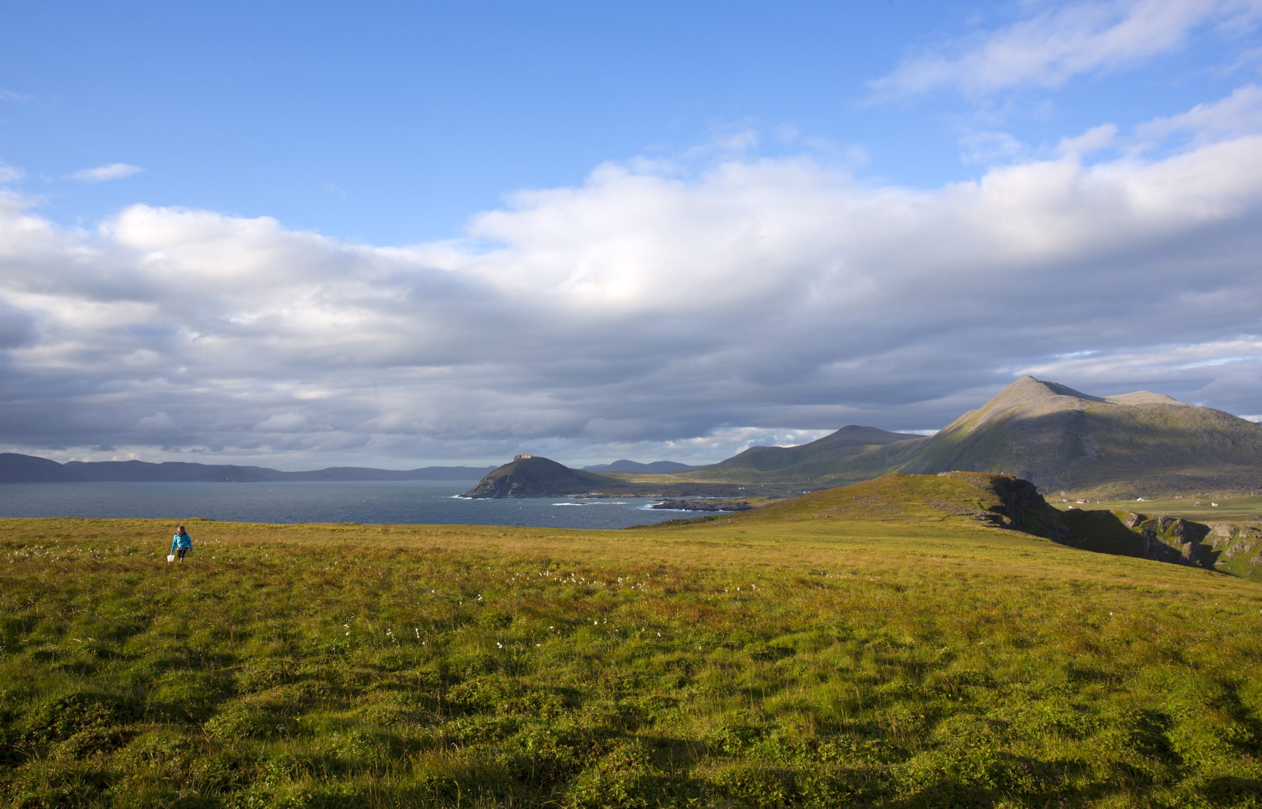
Gjesværstappan is Norway’s largest set of bird cliffs
On the western side of Magerøya is the fishing village of Gjesvær. Just outside the village there is a chain of mountainous islands collectively known as Gjesværstappan. Hundreds of thousands of auks, guillemots, puffins, crutches, cormorants, ospreys and several other species nest here. On a bird safari, you see the frantically fluttering puffins that fly down into the wave like valley, diving guillemots and the huge gannets that struggle to take off when they have eaten. Wherever you turn you see flocks of birds, and the sound is something you won’t soon forget.
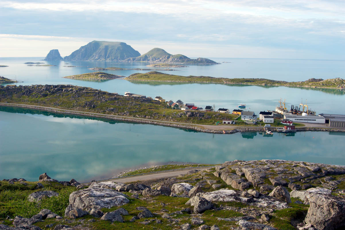
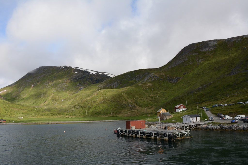
The fishing villages are small islands of civilization among mighty nature
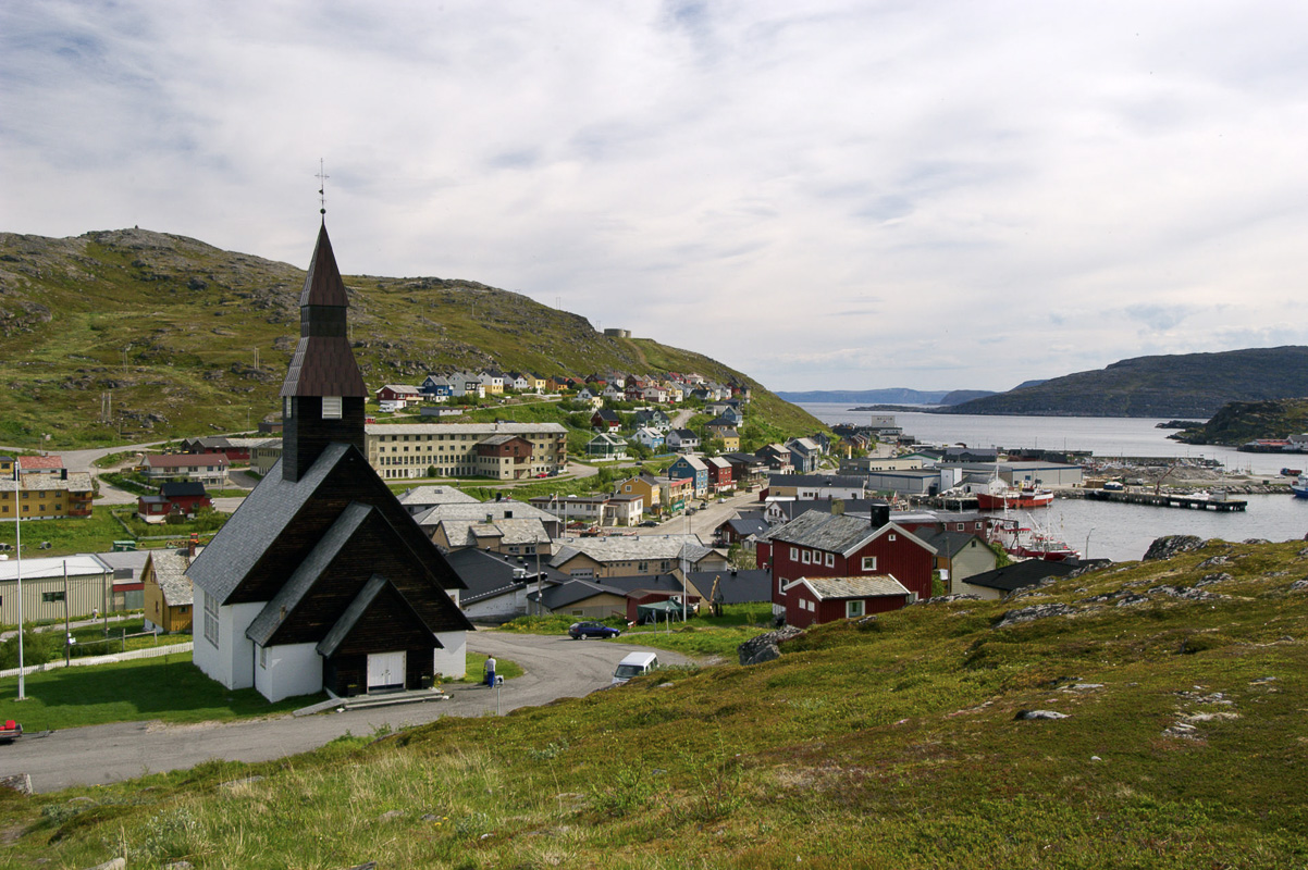
On Magerøya you drive around in deserted nature, there are no houses in the landscape. All residents live in four dense fishing villages: Honningsvåg with 2800 inhabitants, as well as the small villages Kamøyvær, Gjesvær and Skarsvåg. We recommend visiting all of them. Gjesvær is located on the western side, and is idyllic with all the small islands outside. Take a stop in the bend above the village and take in the weather and Gjesværstappan out to sea. Skarsvåg calls itself the world’s northernmost fishing village, and here it’s nice to take a trip around the harbour and hike to Kirkeporten. Kamøyvær is a small sheltered harbor surrounded by rocky cliffs and colourful houses, a great spot for photographers.
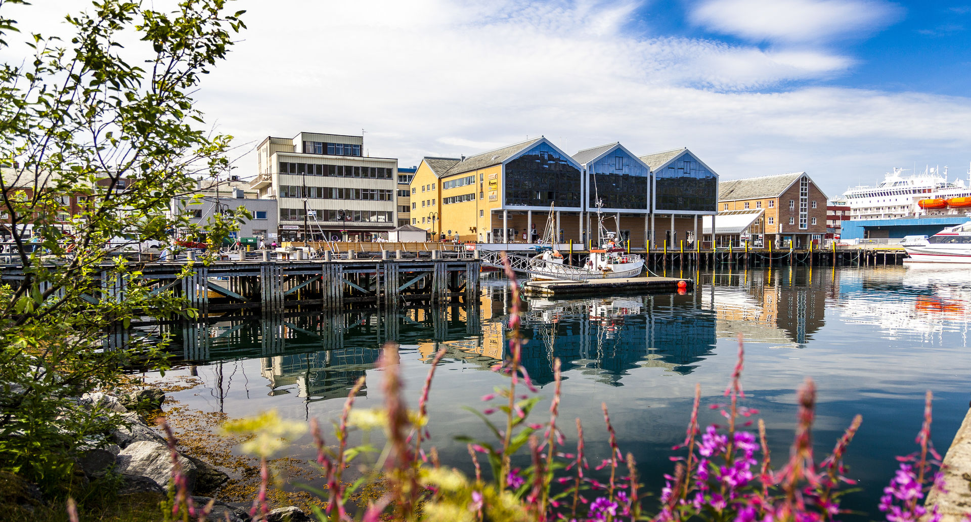
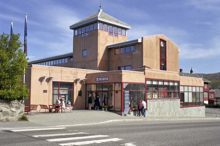
Honningsvåg was once known as little Chicago
The small town of Honningsvåg is sheltered on the south side of Magerøya. Here you can visit the North Cape Museum, take a short tour along the quay promenade, and look at the boats before going up to the bust of the filmmaker Knut Erik Jensen (“Fierce and excited”) for a little view of Magerøysundet to the mainland. It is even nicer to sit at the ‘Corner’, which is the meeting place in Honningsvåg. The nickname “Little Chicago” came from the hectic, humid, hormonal and blue-water nightlife from the time the trawler crews went ashore after weeks at sea. This mood is probably gone forever, but the Honningsvåg locals are still very talkative and like to meet people over a small glass or two.
Alta is the gateway to Western Finnmark
Alta is often called “Finnmark’s Italy”, and at seventy degrees north it is surprisingly green and lush here. At the bottom of the valley are deep pine forests, the slopes are covered with rustling aspen, and along the river there are green hayfields. Summer temperatures can be tropical when the Russian air hits, and when the northwest winds make summer temperatures single digits in Finnmark, Alta is the warmest place to be.
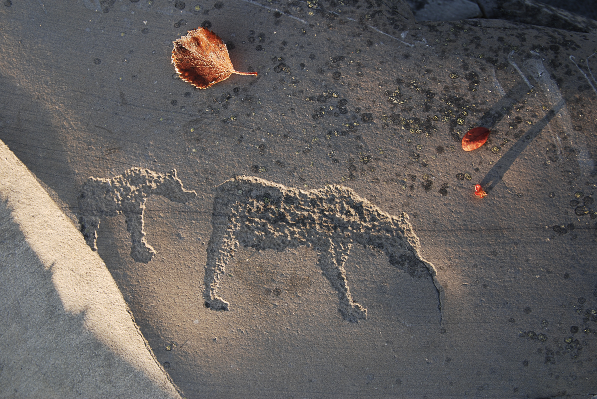
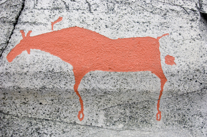
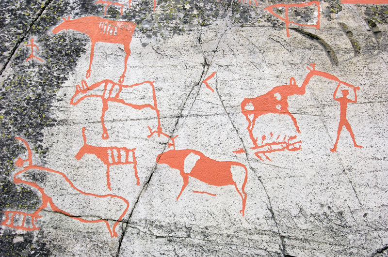
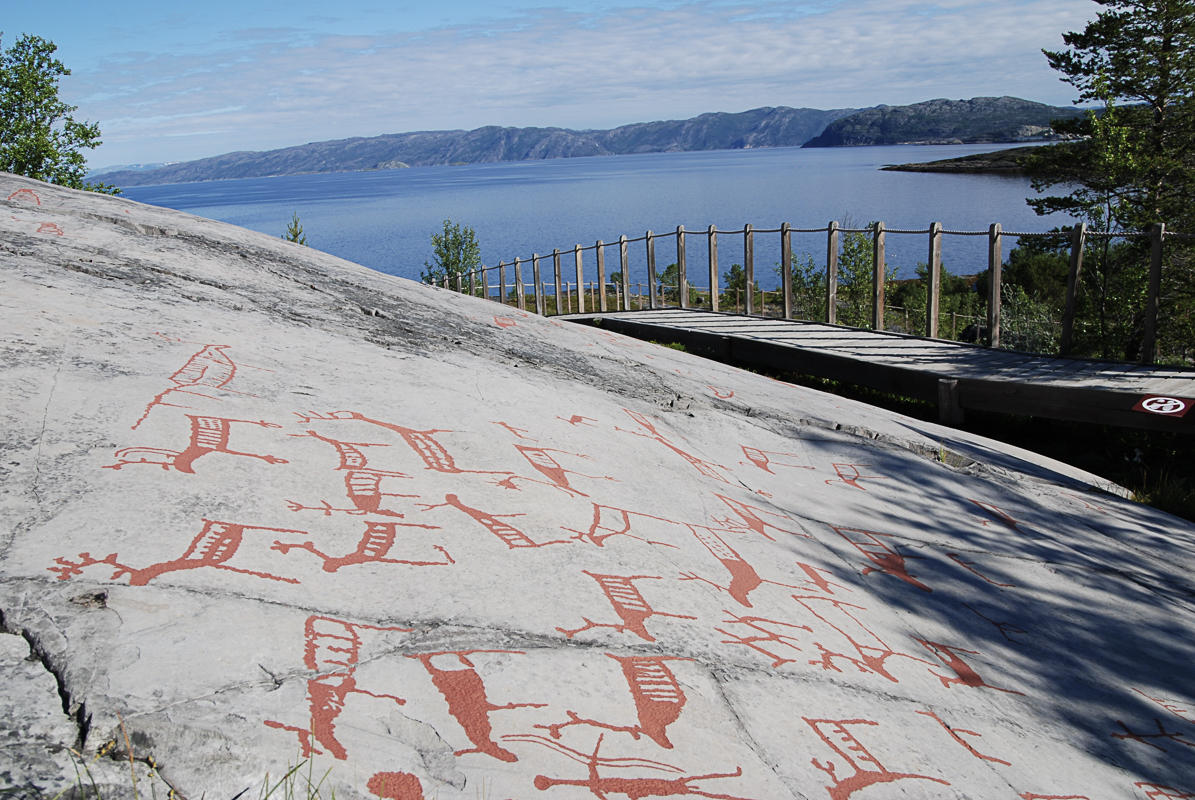
The absolute highlight of Alta is the rock carvings
Reindeer heads sticking out of the water, strange geometric shapes, boats with matchstick men on board and large halibut at the end of a long fishing line; the rock carvings in Alta speak to us from up to 5000 BC. It is easy to see what many of the carvings are supposed to represent, but we know little about the significance of them for the people at that time. 6,000 petroglyphs are located around the fjord, 3,000 of them in Hjemmeluft, where you can walk around ramps and study them more closely. You can get more explanation inside the Alta Museum, where everything is put into context and they also offer guided tours which we highly recommend. The petroglyphs are on the UNESCO World Heritage List.
What is it like to jump after Wirkola?
“Jumping for Wirkola” we say (Wirkola being a famous ski jumper from Alta). The long-jumping Alta residents have their own little exhibition at Alta Museum. Other local themes are fishing in the Alta River, which is a deadly serious issue locally, the historic market in Alta and the Kven people’s roots in the area. Alta’s central role in Northern Lights research is also given a lot of space. In the “Faith and Religion” exhibition, Catholic images of saints and Sami rune covered drums are put together, as they coexisted over centuries in Finnmark. You simply have to set aside plenty of time at the Alta Museum.
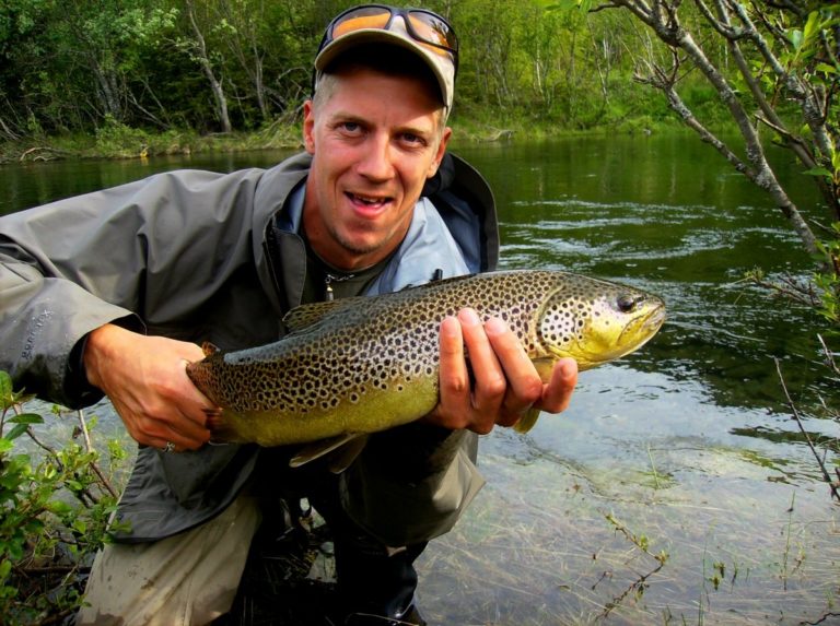
Taste the nature in Alta
One of Alta’s greatest joys is the cuisine. Trasti and Trine live in the pine forest, and here Jonny Trasti serves whatever he has received from local raw materials, be it redfish from the Lopphavet, reindeer from summer grazing or grouse from the plateau. Everything is spiced locally, and you can inspect the herb garden before entering. Equally festive is the kitchen at Laksestua, where the ingredients are sourced from the Alta River a few meters away and from the forest and mountain range. The Hoftepluss restaurant inside the shopping center in Alta, where Kokkejævelen reigns, serves bolder flavours with a twinkle in the eye, such as the reindeer kebab called Ole Mattis Hætta.
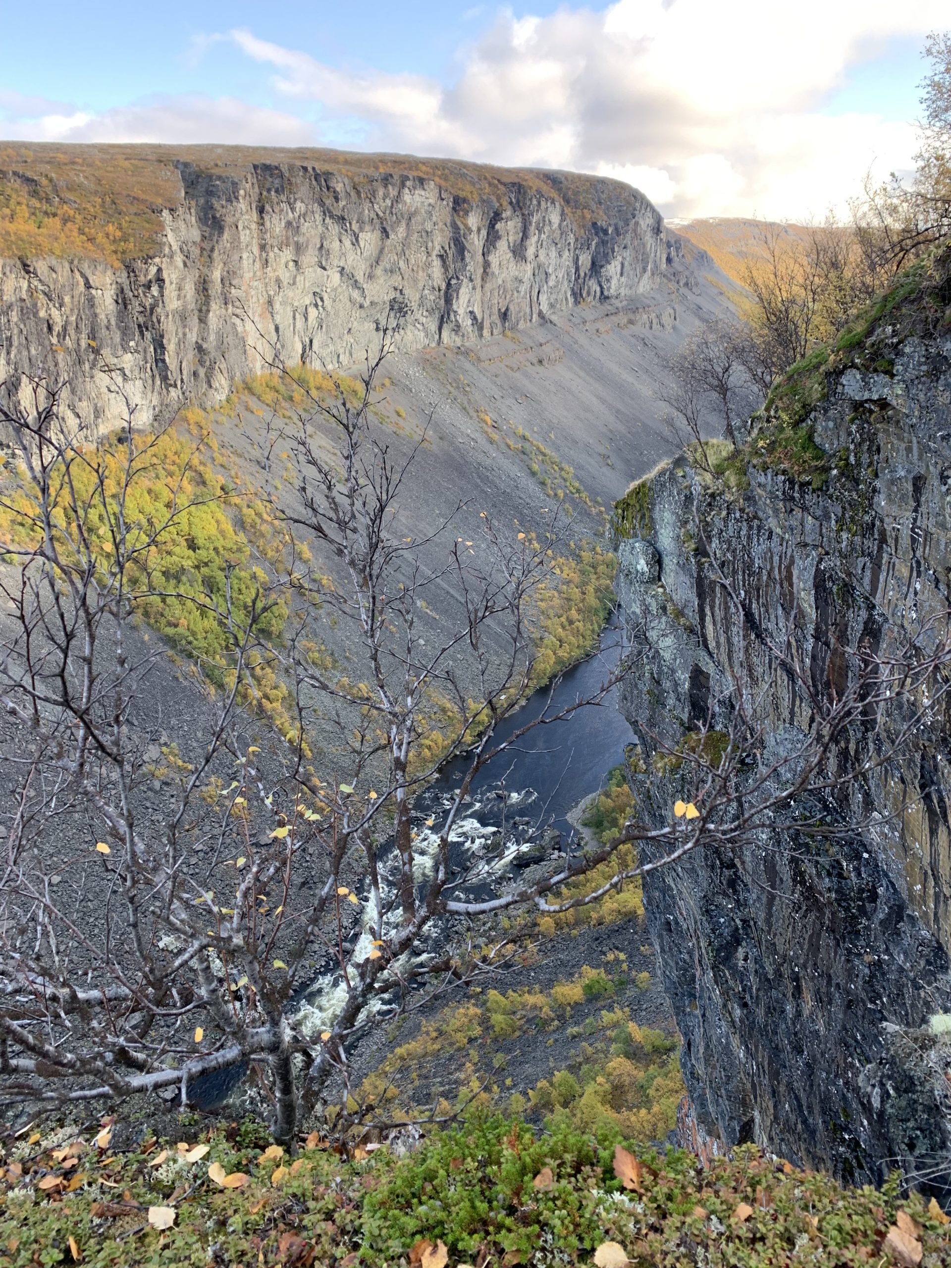
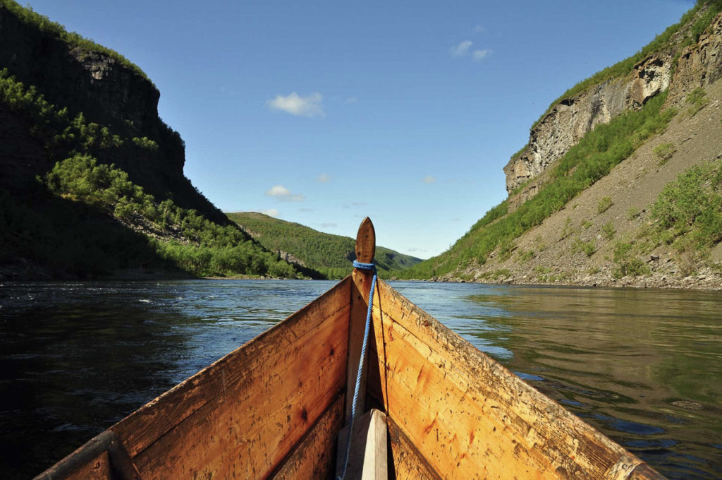
The gorge in the Alta River is reached by river boat
The gorge in the Alta River, “Alta Canyon”, is a deep gorge dug out by the Alta-Kautokeino River. The magnificent nature is best reached on long, narrow river boats. The trip starts in a gentle forest landscape and ends under dark, threatening mountain sides and cascading river rapids. Sautso, often called the Alta Canyon, is 10 kilometers long and 3-400 meters deep.
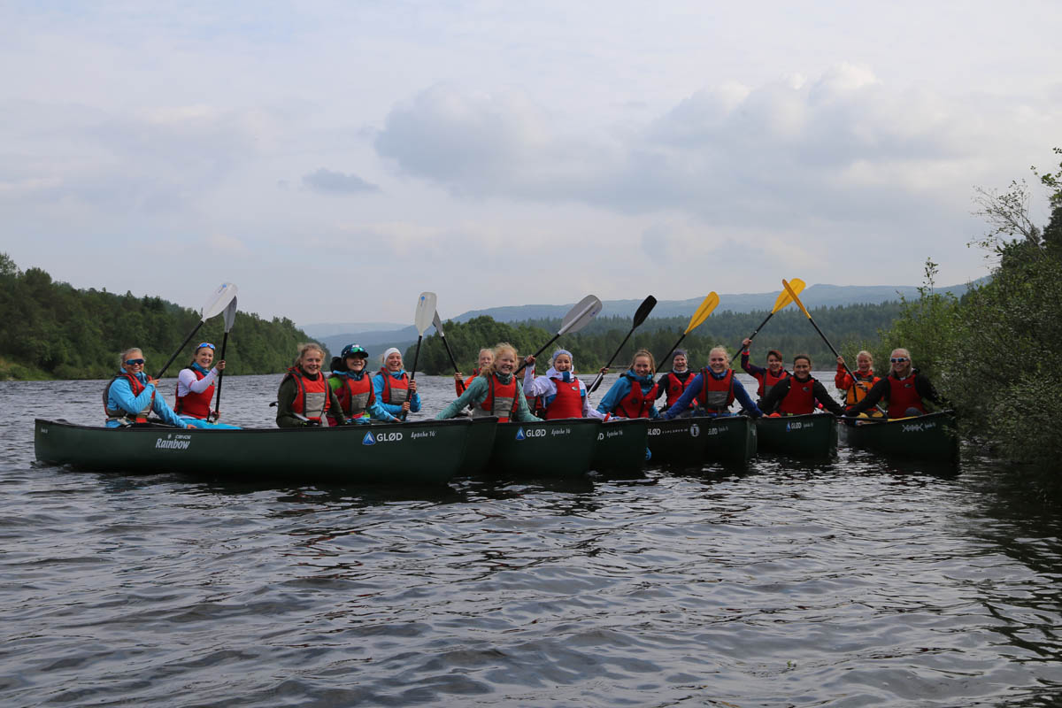
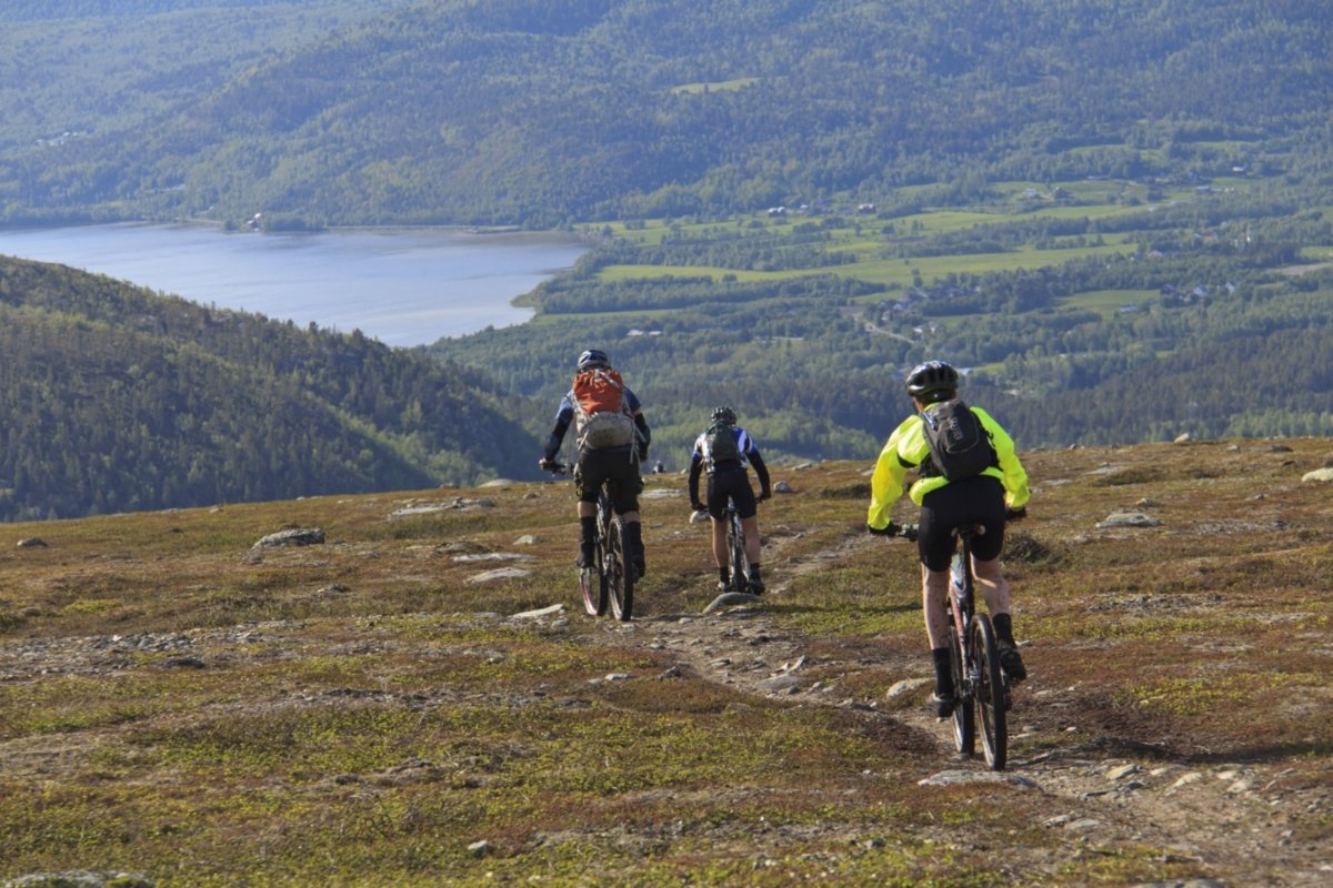
…On foot or by bike…
You can also go along the canyon by bike ride, if you have some experience mountain biking. Here there are both organized tours and the opportunity to rent a bike. You can also walk along marked trails, and although it is long, it is not particularly heavy.
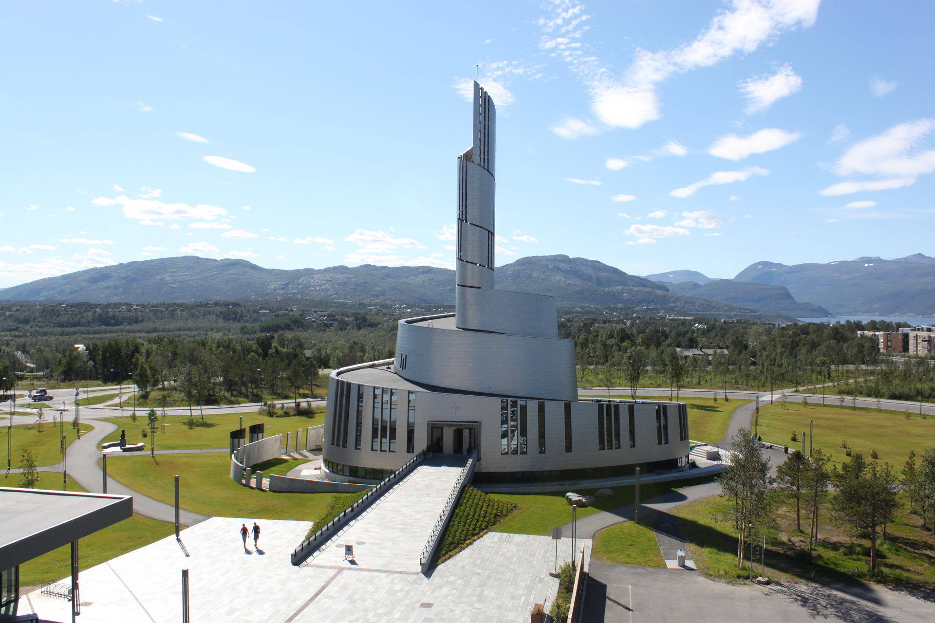
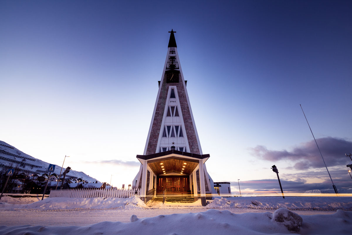
Alta city center is dominated by the Northern Lights Cathedral
Alta has a brand new center with shops, Nordlysbadet (swimming pool) and some nice places to eat and drink along tree-lined walkways. The eye-catcher, however, is the curved lines of the new, modern church, called the Northern Lights Cathedral. The inspiration is of course the northern lights, which dance more over Alta than most places in the north, due to the dry climate. In the basement of the church you can learn more about the northern lights in a well-explained exhibition.
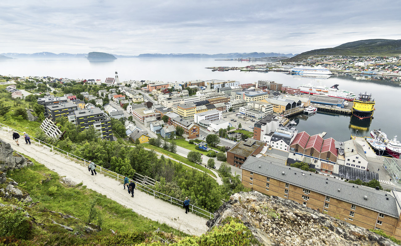
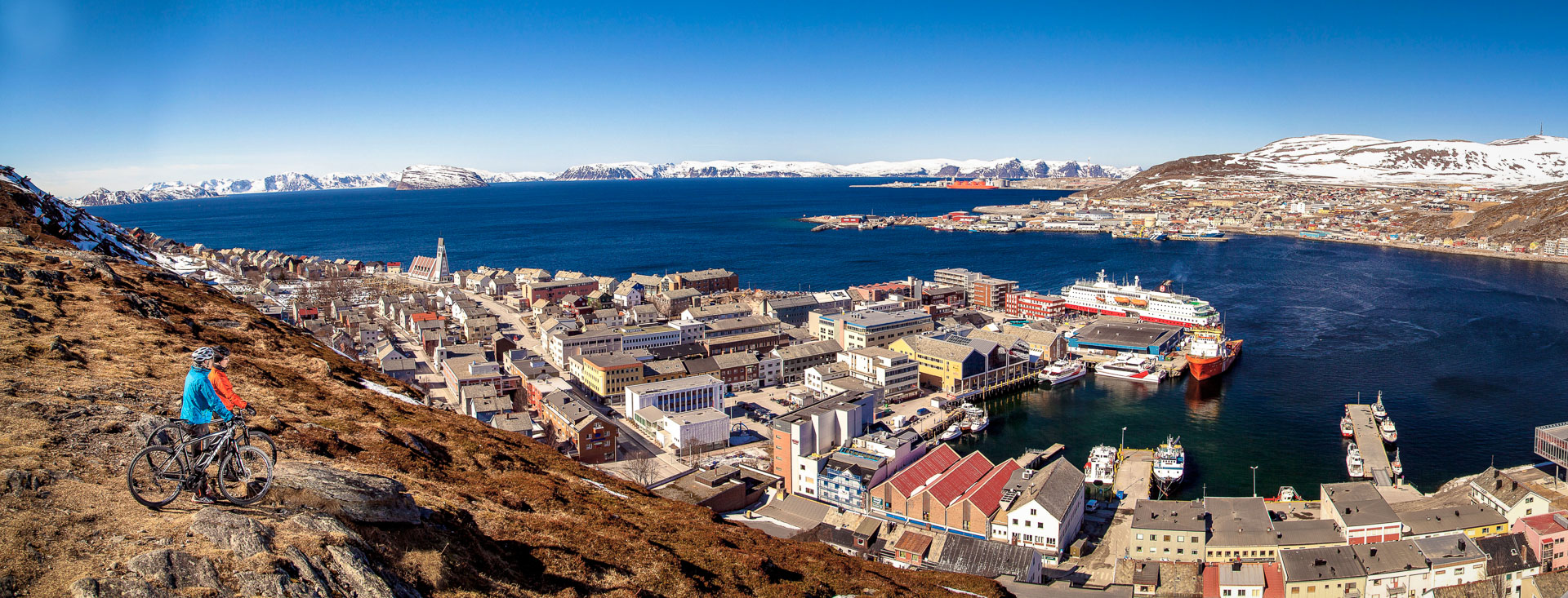
Hammerfest is a micro-metropolis on the Arctic coastline
One of the most surprising things when coming by air or by sea is Hammerfest; in the middle of an almost deserted, desolate and windswept coastal landscape, there is a dense, compact city with 10,000 inhabitants. As early as 1789, Hammerfest received market town status, and is thus Northern Norway’s oldest city. Visitors in the 19th century were probably even more surprised than we are, because we get big-eyed descriptions from the merchant class and at the cultural level from that time. Expectations were probably low up here near the North Pole. Hammerfest’s urban history ranges from Europe’s first street lighting to the absolute destruction in the autumn of 1944.
Take a wander around the cube-shaped, colourful architecture
Hammerfest has a compact and easy-going centre built in the colourful post war rebuilding style after the city’s destruction in 1944. The simple lines, the cubic shapes and the strong colours have now come to bring back life to the city, and are studied with interest by today’s architects. The town hall and Hammerfest church with its striking tower are the orientation points of how you get around. Bring your camera and capture the contrast between architecture and nude coastal nature. It takes ten minutes to walk up the zigzag road to the city mountain Salen, and from here you see the city lying beautifully around the bay with Sørøya island in the distance and the gas terminal on Melkøya far out to the right. Feel free to stop by Niri to eat sushi made from fresh, local fish.
The Museum of Reconstruction brings a tear to the eye
If you are going to spend a lot of time on one thing in Hammerfest, it is the Reconstruction Museum for North Troms and Finnmark. Here the story is told about the old Finnmark that burned down in 1944, about cave dwellers who ran away, about the forced evacuation and about how Finnmark was rebuilt after the war according to modern ideals. The war is key to understanding why all human settlement looks like they do in Finnmark, since everything had to be rebuilt. The experience will be even more interesting if you join one of the guided tours.
The sightseeing boat goes to Sørøya island
Okay, there is no sightseeing boat, because Hammerfest is pretty much out of the tourist area. However, there are tiny, roadless settlements around the entire Sørøysundet which are served by Bygderuta (the local ferry). A tour takes a couple of hours, and is a great opportunity to see naked, desolate nature and the tiny settlements. You can get ashore for a few minutes while goods are being unloaded, but in Akkarfjord you can actually be there during the day, since there are nice walking routes and a small shop where you can drink coffee.
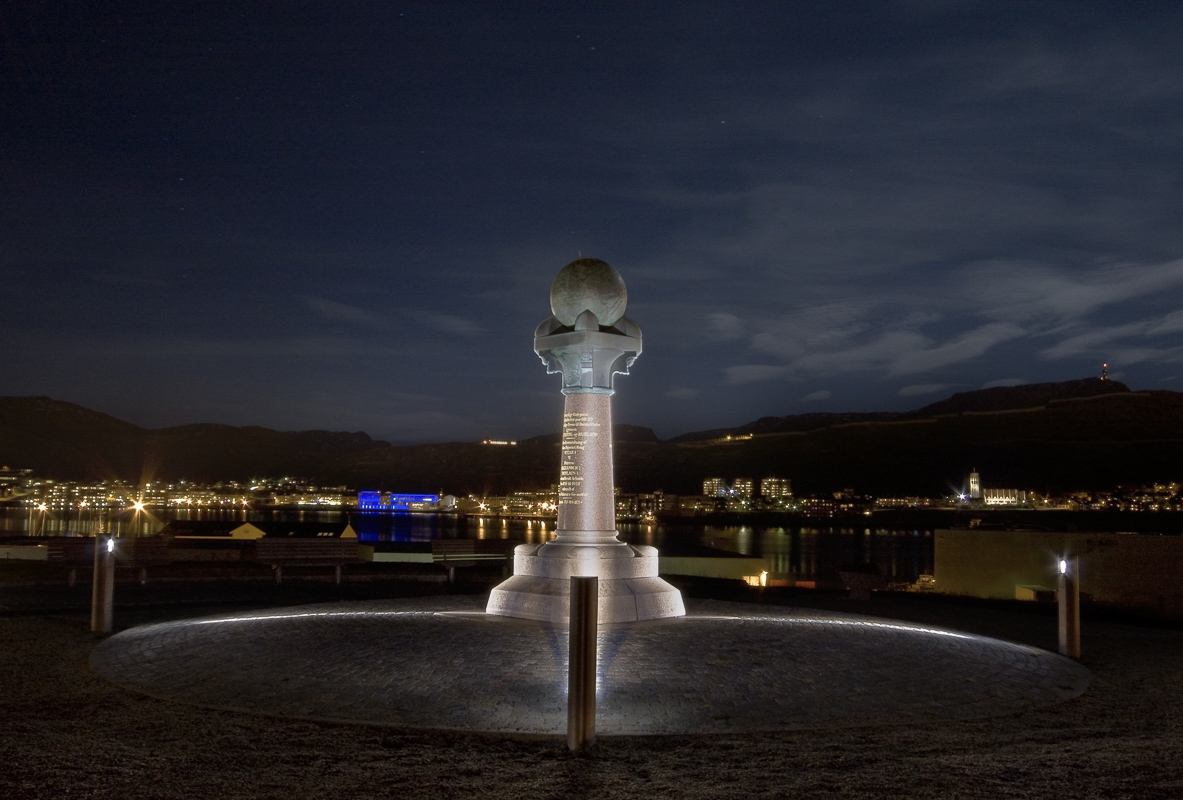
How big is our planet?
It’s been a while since we thought the earth was flat. But until the 19th century, it was not known exactly how big the planet was, until the German-Estonian-Russian scientist von Struve led a large survey project using triangulation points (they measured the curvature of the planet) along a 2800 km long line from Hammerfest to the Danube Delta. The northernmost point is on Fugleneset in Hammerfest, where there is today a meridian marker. The entire arch with nearly 300 triangulation points is now on the UNESCO World Heritage List, and the meridian marker in Hammerfest is the most visible of all.
Join a boat trip to historic sites around Hammerfest
In weather battered, bare, coastal nature, there are traces of a dramatic history. In Jøfjorden on the island of Seiland, a family of nine hid to avoid the forced evacuation during the last winter of the war. The trip out here is by boat, and you should be able to walk on land. Along the way you get the whole story. Another trip goes to the island Store Vinna, which was an active fishing village and gathering point during the seasonal fisheries until the war. After the war, the area was rebuilt and then abandoned. A trip out here is a trip to overgrown paths and fishing history in Finnmark.
The walks in Hammerfest are on easy terrain
One would think that hiking on the Arctic coast would be an extreme experience. In fact, the trips in Hammerfest are much easier than they are often further south, where the mountains are higher. Yes, there are some steep slopes that are felt in the thighs, but it is not very steep. The trip to Storfjellet is short and easy, while the one to Tyven is a bit longer. Both have fun, architecturally designed lookout cabins where you can eat your snacks. Slightly more demanding trips can be found, for example, on Sørøya, where a 20-kilometer trip takes you to the viewpoint Kjøttvikvarden, or on Seiland, a ten-minute ferry ride from just south of Hammerfest.
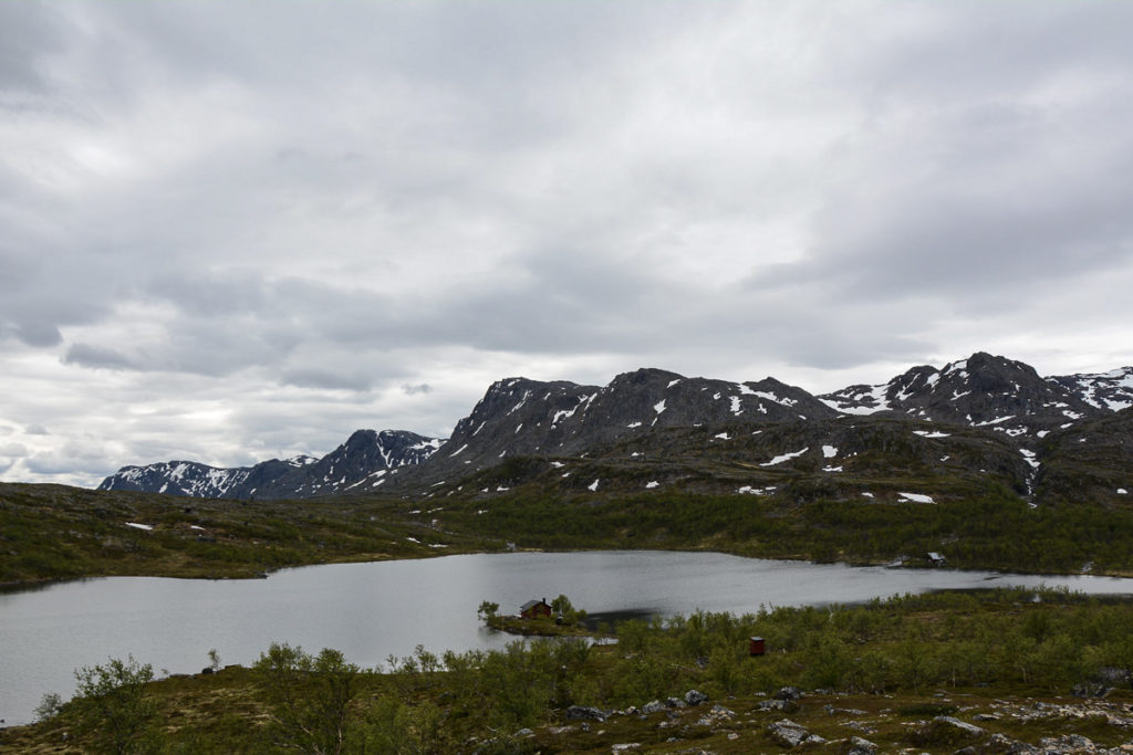
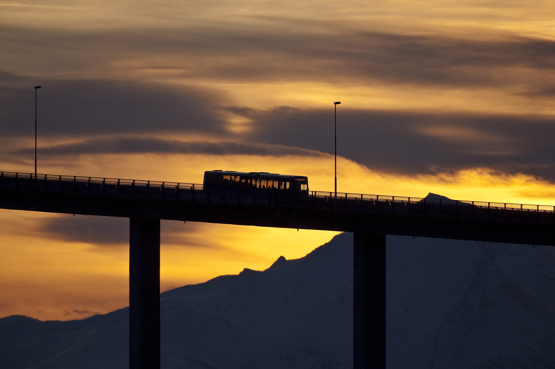
The journey between the cities goes over a treeless plateau
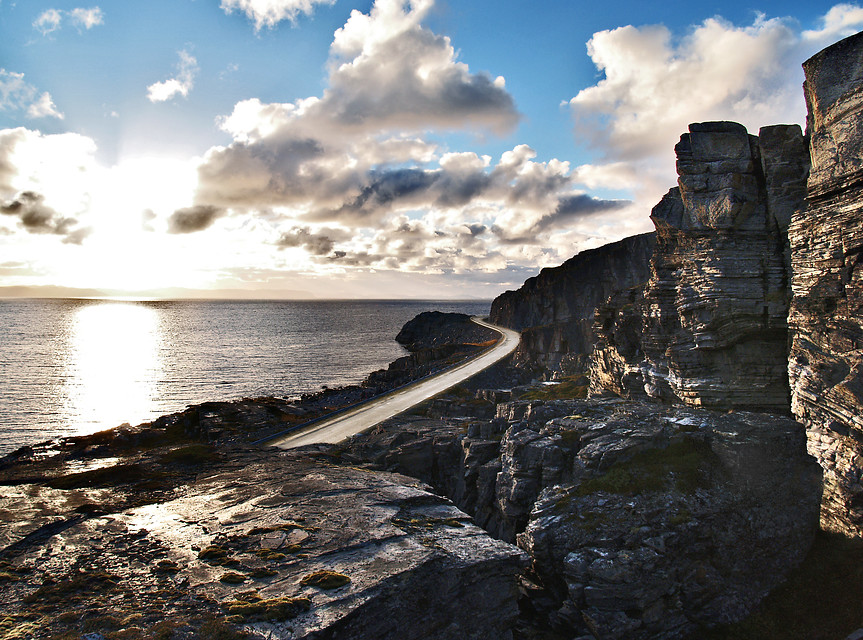
If there is one geographical name we must learn, it is ‘Sennalandet’. It is the mountain pass between Alta and Skaidi, and is a rolling plateau landscape with willow scrub and small birch that the E6 highway winds its way through. The only thing that really breaks the horizon is the chapel in Áisaroaivi, “Vion of Zion”, built for the reindeer herders who live in cabins in the surrounding area. Skaidi (Sami for where the rivers meet) is crossed in the middle of the mountain, here you choose whether you are going to the North Cape or Hammerfest. The road to Hammerfest goes through the small forest in Repparfjorddalen to Kvalsundbrua and over to Hammerfest island, Kvaløy. Here you will find the rock formation Áhkánjárstábba, locally known as Stalloen, which is a Sami sacrificial stone. The road to Honningsvåg runs along the Porsangerfjord with its layered slate mountains and small fjord settlements.
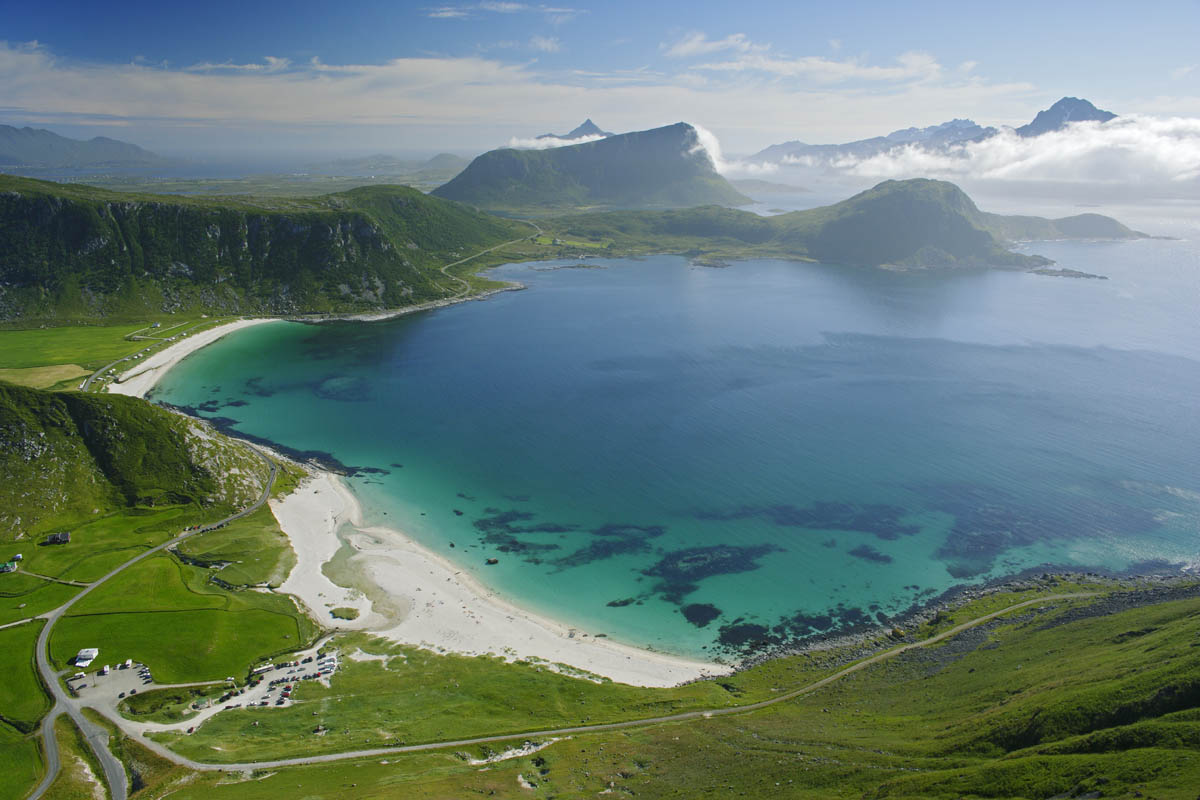
The national tourist road to Havøysund runs from forest to sea
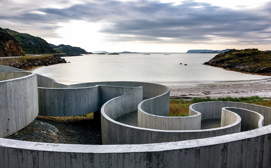
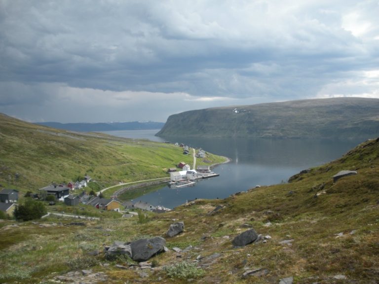
In northern Norway, you should always drive the side roads and see where you end up. In Western Finnmark, there are not many of them, but the National Tourist Road to Havøysund runs from the small forest and fjord settlements in Kokelv via Snefjord, and the special picnic area in Selvika to the fishing village Havøysund. This is a typical fishing village with a dense settlement, and from the viewpoint ‘Arctic View’ you have sweeping views of the sea and coastline. Then you can end with a boat trip out to the small communities, such as Ingøy, Måsøy and Rolfsøy. Depending on the day of the week and weather conditions, you can join a trip with the local boat to the islands.
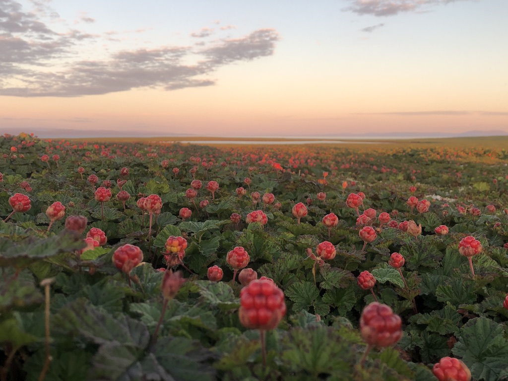
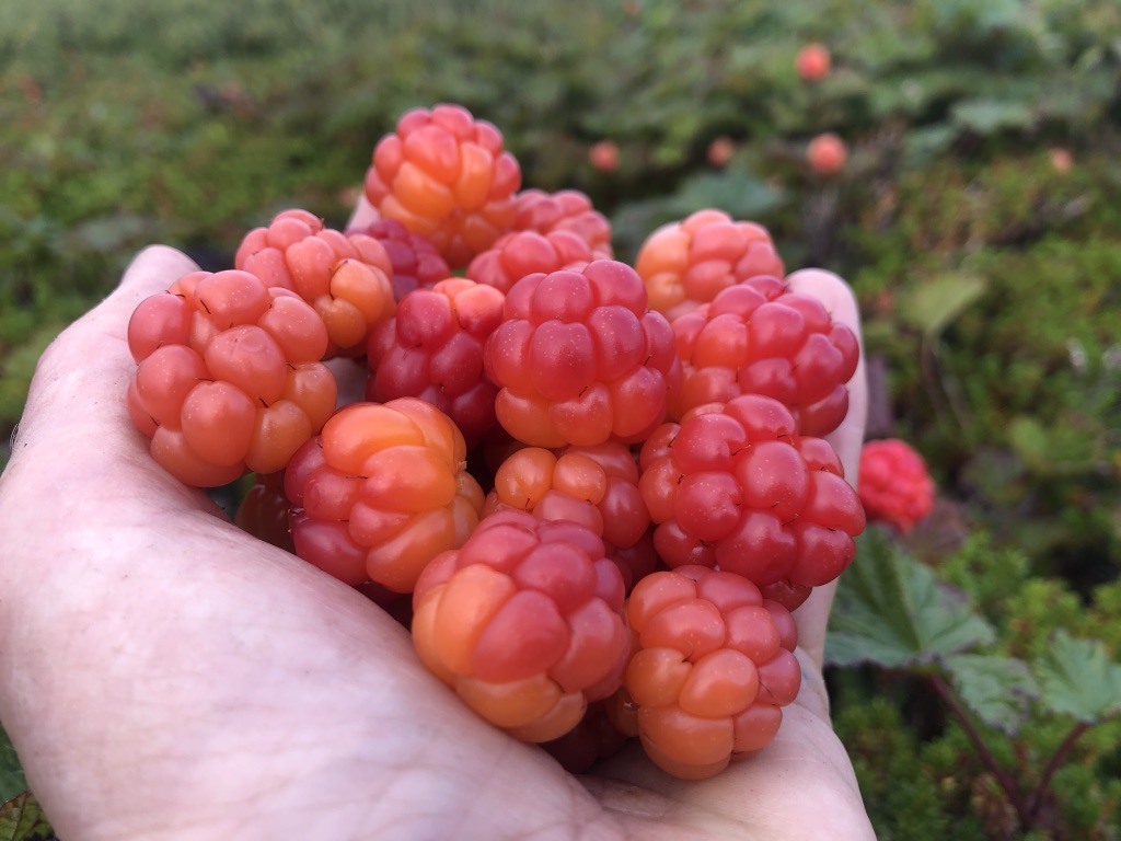
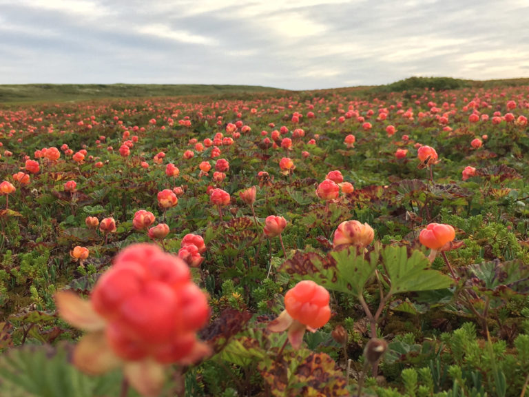
Tamsøya is cloudberry island in Porsangerfjord
I had heard about Tamsøy multe (cloudberries) before I had any idea where Tamsøy was. This large, flat and privately owned island at the far end of the Porsangerfjord is widely known for the large quantities and the exquisite taste of the plateau’s gold. The new thing is that you can actually come here. Now you can live in a square reconstruction house that has not been modernized to the unrecognizable, so here the atmosphere from around 1950 is intact. The day is used to explore the distinctive plateau landscape with eider and waders in absolute tranquillity. The cloudberries arrive in early August.
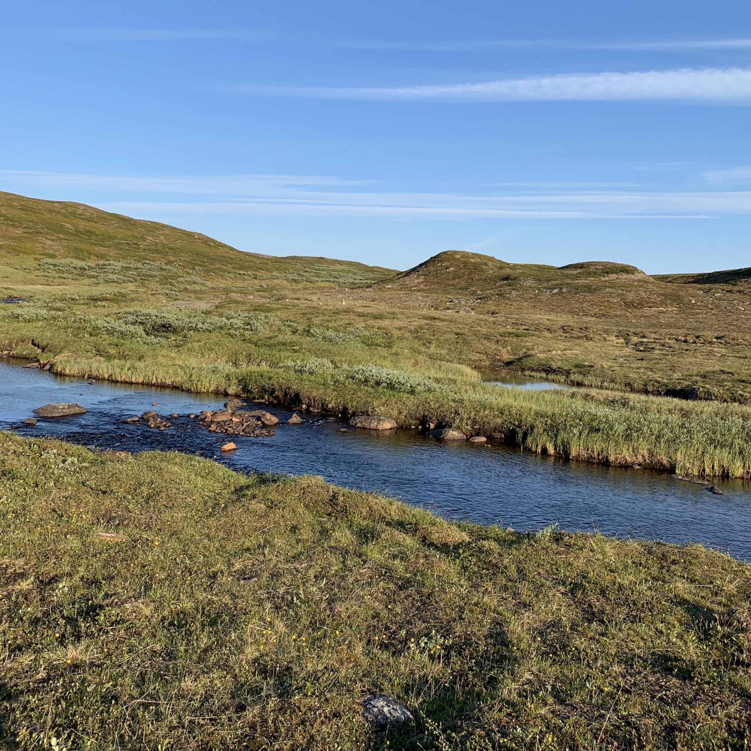
The plateau’s landscape is an enormous reindeer pasture
The plains and small forest between Alta, Nordkapp and Hammerfest can look like deserted wilderness. In reality, it is a centuries-old cultural landscape so to speak, the entire area is historically for reindeer grazing. The reindeer herding Sami from Karasjok live on Magerøya island where you’ll find the North Cape, while those from Kautokeino are out on the large islands in western Finnmark, such as Seiland and Kvaløya. In summer, the reindeer can be seen everywhere, a little shaggy while changing fur in early summer and dense and fine in August.
The Sea Sámi culture is a more unknown Sámi culture
Most Sami do not engage in reindeer herding at all. Traditional reindeer herding is a combination of simple farming, fjord fishing and “field industry” – freshwater fishing, berry picking and hunting. Most small communities along the fjords in western Finnmark have Sami roots, often with Finnish elements. In some places the Sami language is still spoken, in many more places old traditions live side by side with modern technology. The Sea Sámi Museum in Kokelv on the national tourist route to Havøysund provides an in-depth introduction.
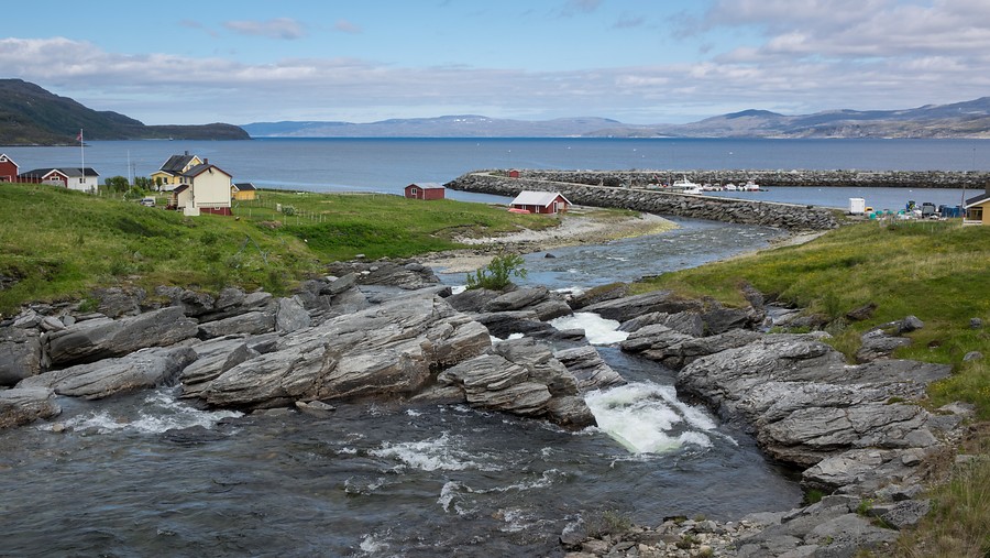
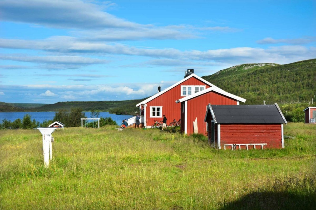
The fishing villages characterize the coast
A striking feature of Western Finnmark is the fishing villages. When you drive along the road or sail with Hurtigruta, you hardly see a house in the coastal landscape. Then you round a bend, and there is suddenly a dense village with residential houses built close together around a harbour. Jetties and fish production facilities are located along the quays, and people live on the slope behind. Since both fishing and processing are mechanized, even robotized, fewer people live and work in the villages than before. On the other hand, many of the inhabitants are now immigrants from many different countries.
Western Finnmark was rebuilt after World War II
Three-quarters of a century ago, at the end of World War II, Western Finnmark was emptied of people. People packed a suitcase or backpack with the necessities, were put on a fishing boat and sent south. Then all the houses were burned. All the quays were torn up, the boats were sunk and the telegraph poles cut. The old Finnmark disappeared, and from 1945 people came back and started a new life. Colourful houses in a modern style, contemporary fishing industry and public buildings rose in what was a national boost. When you travel around Western Finnmark, the architecture is one of the most striking. While we previously thought this was a bit sad, the reconstruction architecture has been revalued and recognized in recent years.

Farthest north is where the midnight sun shines longest
A summer visit to the high north turns the clock upside down. The midnight sun shines on the North Cape from around 13 May to 30 July, and sets only a few days before in Hammerfest and Alta. The summer day thus lasts for 24 hours. Then there is usually little sleep, not because you are not allowed to sleep, but because you are so full of energy. When the good weather is over Finnmark, you do as the locals do and stay up until late at night. You return to sleep in the winter, possibly a little nap in the afternoon. Now the midnight sun is not something that can be guaranteed, but you increase the chance by being up until midnight every single night. It can be nice to be an early riser and night owl while you are in Finnmark.
The triangle Alta-Nordkapp-Hammerfest is easy to visit
Finnmark is known for great distances, and traveling here requires patience. However; Alta, Hammerfest and Honningsvåg are 3-4 hours by car apart. This means that during a busy long weekend or a relaxed week, you can visit all three. The three each have their own personalities, the atmosphere is different and they offer completely different things to look at, so together there is a lot of variety.
How to get to Alta, Hammerfest and Nordkapp?
Some people choose to drive a rental car from elsewhere. Everyone who enjoys driving will love the varied nature along the E6, the settlements along the road and all the detours to beautiful places. It is quite common to drive through Sweden one way, which has been difficult during the corona pandemic. Here you must stay informed about current rules.

Large aircraft go to Alta, and small aircraft to Honningsvåg and Hammerfest
If you want to jump over most of Norway, a flight to Alta is fine. You get here with direct flights from Oslo, and indirectly from all over the country, and then preferably with a good offer of discount tickets from several airlines. Alta is thus a natural gateway. Hammerfest and Honningsvåg can be reached from Tromsø with Widerøe’s propeller aircraft, and in the summer you can quickly get affordable summer tickets. If you take West Finnmark as a detour from a visit to Tromsø, you can, for example, fly into Hammerfest, take the Hurtigruten to Honningsvåg and the bus across Sennalandet to Alta, and then fly home from there. An evening class in front of the PC will get most things in place.
How to travel between the three cities by public transport
If you travel by public transport, a little planning is required. But if you make the right choices, you can actually see a lot of beautiful nature without troublesome travel distances. There are busses between the three cities a couple of times a day. The buses are fast, and everyone passes Skaidi, where you sometimes change buses. Alta-Hammerfest runs in 2 hours and 20 minutes, while the section Alta-Honningsvåg runs in just under four hours. From Honningsvåg to Hammerfest it takes just under three and a half hours. Although there are both boats and planes, we would strongly recommend taking the bus Alta-Honningsvåg at least one of the roads, as this stretch is very varied and beautiful.
Feel free to take to the water and the air
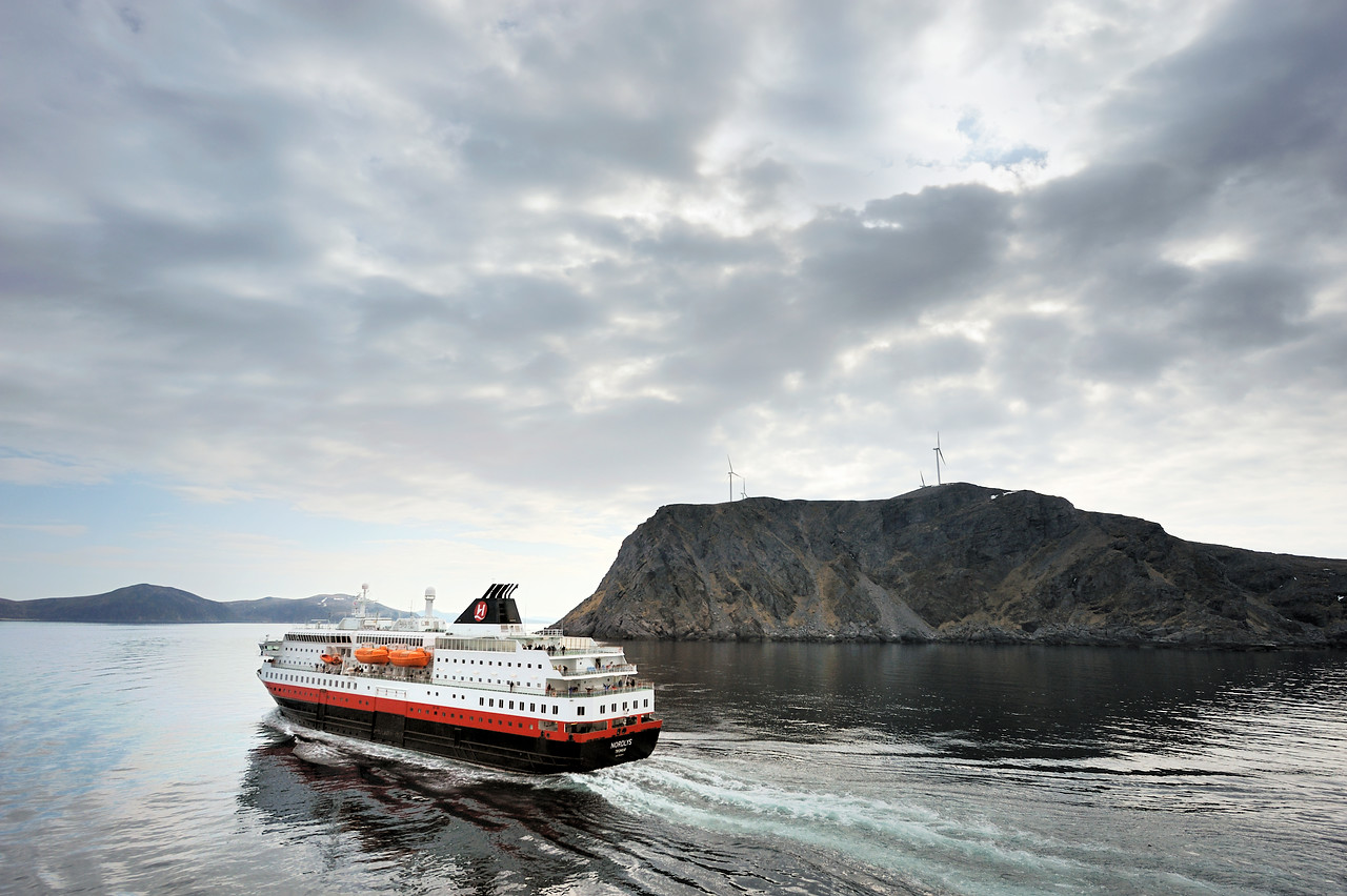
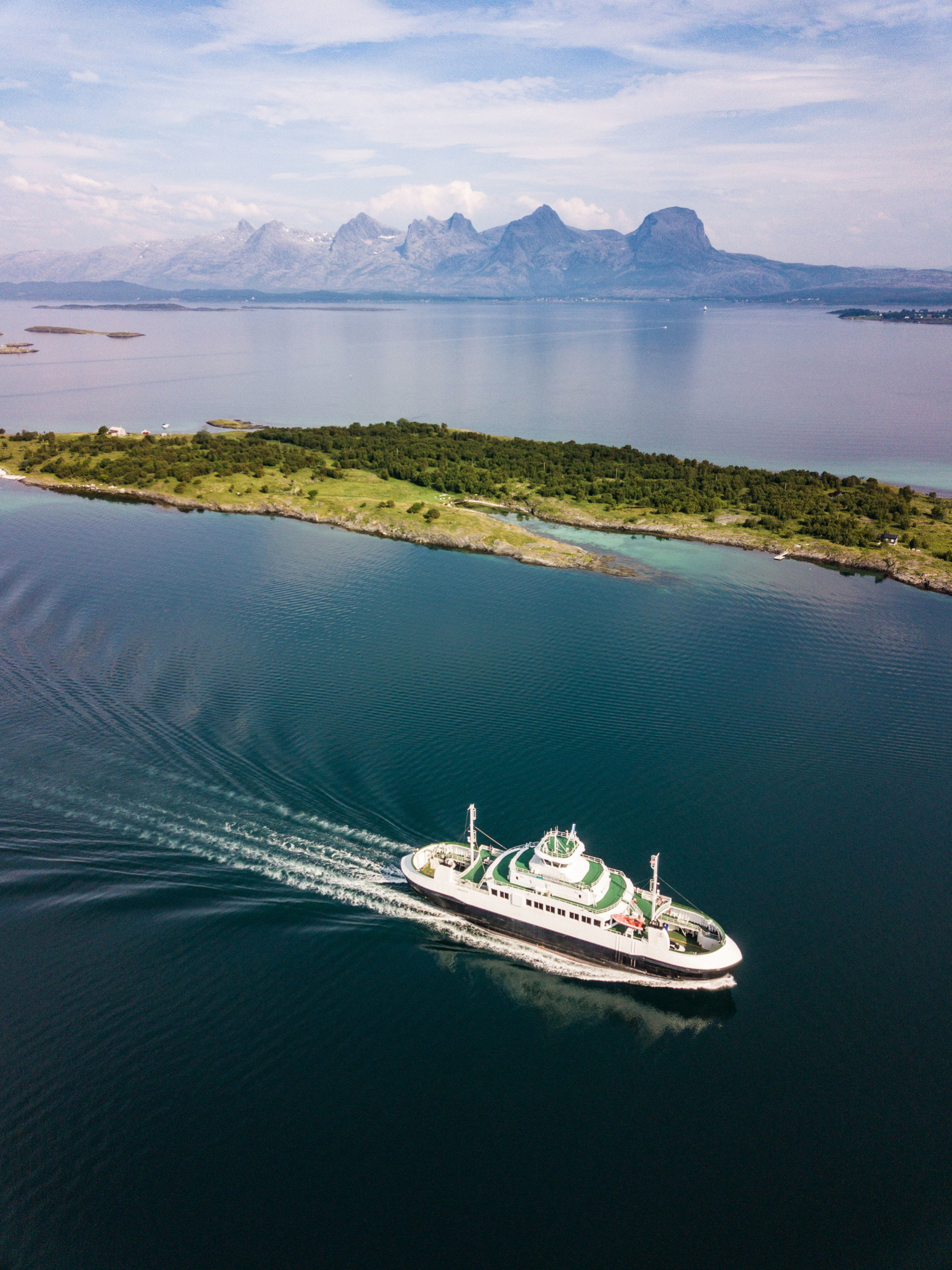
The most stylish way to travel is of course the Hurtigruten, which sails from Hammerfest to Honningsvåg and Honningsvåg-Hammerfest early in the morning. In five and a half hours you then sail along the outer coast on a wild, deserted and infinitely beautiful coastal landscape. Another sea option is the speedboat between Alta and Hammerfest, which connects the two cities in less than two hours daily. The nature on the stretch is more mountainous, and the route calls on tiny communities inside the fjords. A last option for those with less time is flights: Widerøe puts out affordable summer tickets that allow a small jump of 20 minutes to take you to the next town. We have had plane sightseeing around the North Cape, but it probably only happens when the weather is good and everything is on schedule.
The dress code is woolly and casual
You do not travel to Finnmark for the summer heat. But look, you can quickly be surprised! When the low pressures are over the south in the summer, Finnmark can swim in sun and temperatures around 30 when the hot air flows from Russia. That’s when people are interviewed in the newspapers and say “if it gets warmer now, then we will move south”. However, this is not guaranteed (.. far from ..), the northwest wind can be on with horizontal, icy rain right in the face. Far more frequent is the cool, dry northeast. Then the temperatures are fresh, but there is a lot of clear weather. You must therefore bring swimming trunks and a bikini, but also longs, mittens, a hat and a scarf. A good pair of hiking trousers and a windproof jacket are good outfits almost everywhere. If you want to save space in your luggage, there is no need for a dress or suit, there is little use for them in Finnmark.
How do I get affordable airline tickets?
Alta is an airport hub, a major airport as we say, where 737s from different airlines fly to from Oslo, sometimes via Tromsø. Here, the offer of discount tickets is good, and thus Alta is a good starting point to start and end the trip. Widerøe flies from Tromsø and Alta to a number of short-haul airports, such as Hammerfest and Honningsvåg, and since they fly lower, the trips can degenerate into pure air sightseeing. Here you usually have to wait longer between the discount tickets, but in the summer there are the so-called ‘summer tickets’. One can therefore consider flying north via Tromsø and landing in Hammerfest or Honningsvåg. Examine the airlines’ websites.
Accommodation is easy to find
Alta, Hammerfest and Honningsvåg all have good accommodation during the summer season. The large hotel chains with their summer passes and summer prices are represented, with modern, comfortable rooms. At the campsites there are both simple, cheap and modern cabins with kitchens and bathrooms, and in the cities there are also cheaper guest houses. You can also rent a holiday home, especially in smaller places. A small group can, for example, rent a house with several bedrooms, a bathroom and a kitchen, and have plenty of space and a high standard at a good price.

Frequently asked questions
There is a bus 1-2 times a day Alta-Honningsvåg, it takes about four hours. Then there is a local bus from Honningsvåg to Nordkapp. Check with EnTur.
There is a bus 1-2 times a day from Alta to Hammerfest. You can also take a speedboat. Check with EnTur.
1-2 times a day there is a bus from Hammerfest via Skaidi to Honningsvåg. From here you can take the local bus to the North Cape. Check with EnTur. Hurtigruta also leaves early in the morning, in fact both ways, and calls at Havøysund on the way.
According to TimeAndDate, the midnight sun period on the North Cape is from 13 May to 30 July. For Hammerfest, 14 May to 28 July and for Alta 17 May to 25 July.
Most days capacity is good in Honningsvåg and in other locations around Magerøya. In 2021, most tour groups have been cancelled, so there is plenty of room for everyone who travels on their own.
The local tourism organization (the “tourist office” we mentioned before) is Visit Nordkapp. They have a comprehensive website.
Visit Hammerfest lists all you need to know about the city on its website.
Visit Alta has its own website under development, with many great ideas from the northern lights city.